The instrument's own words
page 1 · read by Gemma vision
511
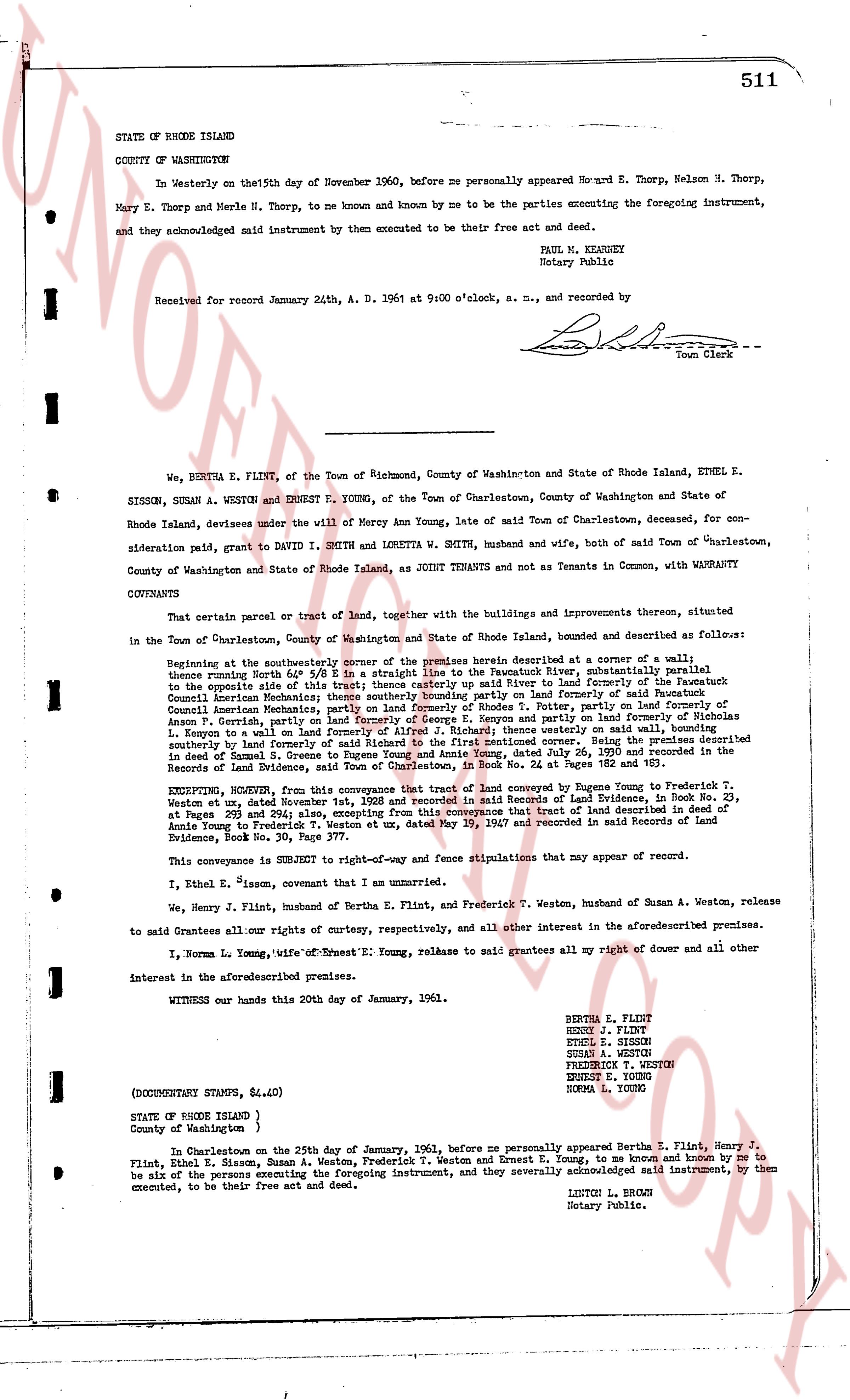
STATE OF RHODE ISLAND
COUNTY OF WASHINGTON
In Westerly on the 15th day of November 1960, before me personally appeared Howard E. Thorp, Nelson N. Thorp, Mary E. Thorp and Merle H. Thorp, to me known and known by me to be the parties executing the foregoing instrument, and they acknowledged said instrument by them executed to be their free act and deed.
PAUL M. KEANEY
Notary Public
Received for record January 24th, A. D. 1961 at 9:00 o'clock, a. m., and recorded by [signature] Town Clerk
----
We, BERTHA E. FLINT, of the Town of Richmond, County of Washington and State of Rhode Island, ETHEL E. SISSON, SUSAN A. WESTON and ERNEST E. YOUNG, of the Town of Charlestown, County of Washington and State of Rhode Island, devisees under the will of Mercy Ann Young, late of said Town of Charlestown, deceased, for consideration paid, grant to DAVID I. SMITH and LORETTA W. SMITH, husband and wife, both of said Town of Charlestown, County of Washington and State of Rhode Island, as JOINT TENANTS and not tenants in Common, with WARRANTY COVENANTS
That certain parcel or tract of land, together with the buildings and improvements thereon, situated in the Town of Charlestown, County of Washington and State of Rhode Island, bounded and described as follows:
Beginning at the southeasterly corner of the premises herein described at corner of a wall; thence running North 81° West 3/4 E in a straight line to the Pawcatuck River, subsequently identified as the opposite side of this river in the deed from Eugene Young to Frederick T. Weston and Susan A. Weston; thence southeasterly along the river to land formerly of the Pawcatuck Council American Mechanics; thence southeasterly bounding partly on land formerly of said Pawcatuck Council American Mechanics; thence southeasterly bounding partly on land formerly of Frederick T. Weston and Annson P. Gerrish, partly on land formerly of George E. Kenyon and partly on land formerly of Nicholas L. Kenyon to a wall; thence running North 15° East in a straight line practically on said wall to a corner; thence southeasterly bounding partly on land formerly of said Richard to the first mentioned corner. Being the premises described in deed to Ernest E. Young, Frederick T. Weston and Susan A. Weston dated July 24, 1939 and recorded in the Records of Land Evidence, said Town of Charlestown, in Book No 24 at Pages 182 and 183.
EXCEPTING, HOWEVER, from this conveyance that tract of land conveyed by Eugene Young to Frederick T. Weston et ux dated December 14, 1936 and recorded in the Records of Land Evidence in Book No 23, at Pages 251 and 254; also, excepting from this conveyance that tract of land described in deed of Annie Young to Frederick T. Weston et ux, dated May 29, 1947 and recorded in said Records of Land Evidence, Book No 28, Page 141.
This conveyance is SUBJECT to right-of-way and fence stipulations that may appear of record.
I, Ethel E. Sisson, covenant that I am an unmarried.
We, Henry J. Flint, husband of Bertha E. Flint, and Frederick T. Weston, husband of Susan A. Weston, release to said Grantees all their right of curtesy, respectively, and all other interest in the aforesaid premises.
I, Norma L. Young, wife of Ernest E. Young, release to said grantees all my right of dower and all other interest in the aforesaid premises.
WITNESS our hands this 20th day of January, 1961.
BERTHA E. FLINT
HENRY J. FLINT
ETHEL E. SISSON
SUSAN A. WESTON
FREDERICK T. WESTON
ERNEST E. YOUNG
NORMA L. YOUNG
(DOCUMENTARY STAMPS, $4.60)
STATE of RHODE ISLAND
County of Washington }
In Charlestown on the 25th day of January, 1961, before me personally appeared Bertha E. Flint, Henry J. Flint, Ethel E. Sisson, Susan A. Weston, Frederick T. Weston and Ernest E. Young, to me known and known by me to be the persons named in the foregoing instrument, and they severally acknowledged said instrument, by them executed, to be their free act and deed.
LESTON L. BROWN
Notary Public.
page 2 · read by Gemma vision
STATE OF VERMONT
County of Orange
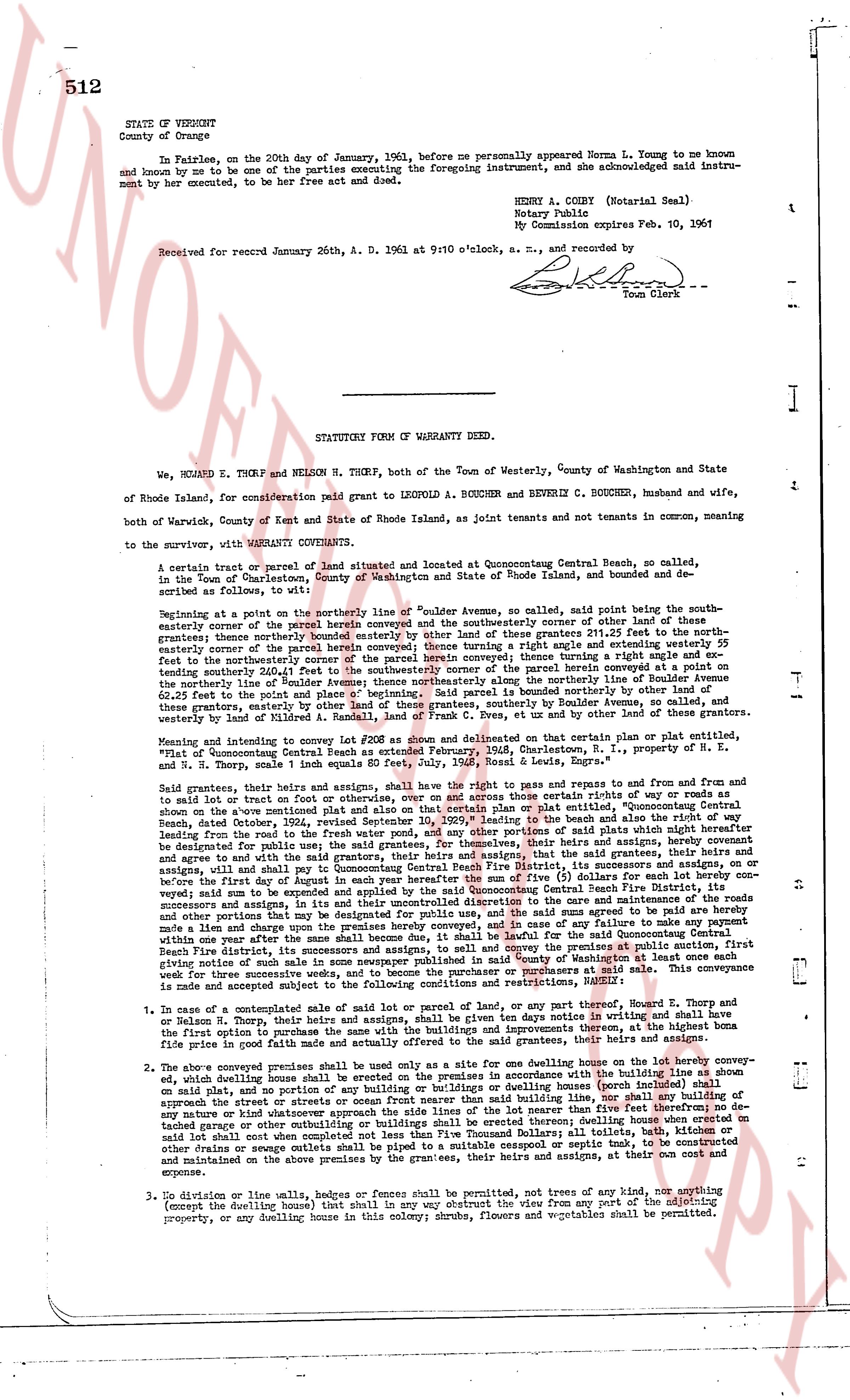
In Fairlee, on the 20th day of January, 1961, before me personally appeared Norma L. Young to me known and known by me to be one of the parties executing the foregoing instrument, and she acknowledged said instrument by her executed, to be her free act and deed.
Received for record January 26th, A. D. 1961 at 9:10 o'clock, e. recorded by [signature]
Town Clerk
HENRY A. CODY (Notary Seal)
Notary Public
My Commission expires Feb. 10, 1961
STATUTORY FORM OF WARRANTY DEED.
We, RICHARD E. THORP and NELSON H. THORP, both of the Town of Westerly, County of Washington and State of Rhode Island, for consideration paid grant to LEOPOLD A. BOUCHER and BEVERLY C. BOUCHER, husband and wife, both of Warwick, County of Kent and State of Rhode Island, as joint tenants and not tenants in common, meaning to survive the survivor, with WARRANTY COVENANTS,
A certain tract or parcel of land situated and located at Concentrating Central Beach, so called, in the Town of Charlestown, County of Washington and State of Rhode Island, bounded and described as follows, to wit:
Beginning at a point on the northerly line of "Coulter Avenue", so called, said point being the southeasterly corner of the public highway known as "Coulter Avenue" and the northeasterly corner of other land of these grantees; thence northerly bounded easterly by other land of these grantees 211.25 feet to the northeasterly corner of the parcel hereby conveyed; thence north 81 degrees 15 minutes east 151.87 feet to the northeasterly line of the northeasterly boundary of the parcel herein conveyed; thence running a straight line and or extending southerly 230.41 feet to the southeasterly corner of the parcel hereby conveyed; thence running substantially parallel and westerly along the northerly line of Boulder Avenue the distance of 151.87 feet to the point and place of beginning. Said parcel is bounded on the south by Boulder Avenue, so called, these grantees, easterly by other land of R. Smith, C. Cox et ux, and other by the land of these grantees, westerly by land of Mildred R. A. Randall, land of F. Cox et ux, and other by the land of these grantees.
Meaning and intending to convey Lot 20R as shown on "Coulter's" deeds and on that certain plat or plot entitled, "Plat of Concentrating Central Beach", recorded in the Charlestown, R.I. land evidence book 11, page 11, and we Richard E. and N. Thorp, sell one fourth equals 80 feet, July, 1936, Ross & Lewis, Engrs."
Said grantees, their heirs and assigns, shall have the right to pass and repass to and from said land and to said lot or lot of land or tract of land by the use of certain public rights of way or roads as are shown on the above mentioned plat and also on that certain plan or plot entitled, "Concentrating Central Beach, dated October, 1936", recorded in the Charlestown, R.I. land evidence book 11, page 11, including a way leading from the road to the fresh water pond, and any other portion of said plats which might hereafter be designated for such purpose, and said grantors, their heirs and assigns, do hereby grant, release and agree to and with the said grantees, their heirs and assigns, that the said grantees, their heirs and assigns, shall have the right to use the said ways and roads, and that the said grantors, their heirs and assigns, shall on or before the first day of August in each year hereafter the sum of five ($5) dollars for each lot hereby conveyed; said sum to be amassed and paid to the town selectmen in their unrestricted discretion to the care and maintenance of the roads and other portions that may be designated for such purpose in the town of Charlestown, R.I. and in case of any failure to make any payment a lien shall attach to said lot or lots of land, and the town selectmen, or the said grantors, or their heirs and assigns, within one year after the same shall become due, shall be entitled to foreclose said lien. The said conveyance is subject to the condition that the said grantees, their heirs and assigns, shall keep the premises at the current public auction, first sale which for three successive months shall be advertised in a newspaper published in said County of Washington at a time and place designated by the said grantors, or their heirs and assigns, for such sale. This conveyance is made and accepted subject to the following conditions and restrictions, namely:
1. In case of a contemplated sale of said lot or parcel of land, or any part thereof, Richard E. Thorp and or Nelson H. Thorp, their heirs and assigns, shall have the right of first refusal, in writing and shall have the first option to purchase the same with the buildings and improvements thereon, at the highest bona fide first offer in good faith, at a price to be agreed upon by the grantors, their heirs and assigns, and the purchaser.
2. The above conveyed premises shall be used only as a site for one dwelling house on the lot hereby conveyed, such dwelling house shall be erected on the premises in accordance with the building line as shown on said plat, and no part of any building, structure or dwelling house (except for porches) shall be erected so as to approach the street or streets or ocean front nearer than said building line, nor shall any building or structure be erected on said premises except for one dwelling house, one garage or car port, and detached garage or other outbuilding or buildings collateral to said erecting dwelling house erected on said lot shall not exceed one story in height, and no other building or structure shall be erected thereon; and all drainage, sewers, cesspools, privy vaults, etc. shall be piped to a mutable cesspool or septic tank, to be constructed and maintained on the above premises by the grantees, their heirs and assigns, at their own cost and expense.
3. No division on line walls, hedges or fences shall be permitted, nor trees of any kind, nor anything (except the dwelling house) that shall in any way obstruct the view from any part of the adjoining property, or any dwelling house in this colony; shrubs, flowers, and vegetables shall be permitted.
The page as recorded