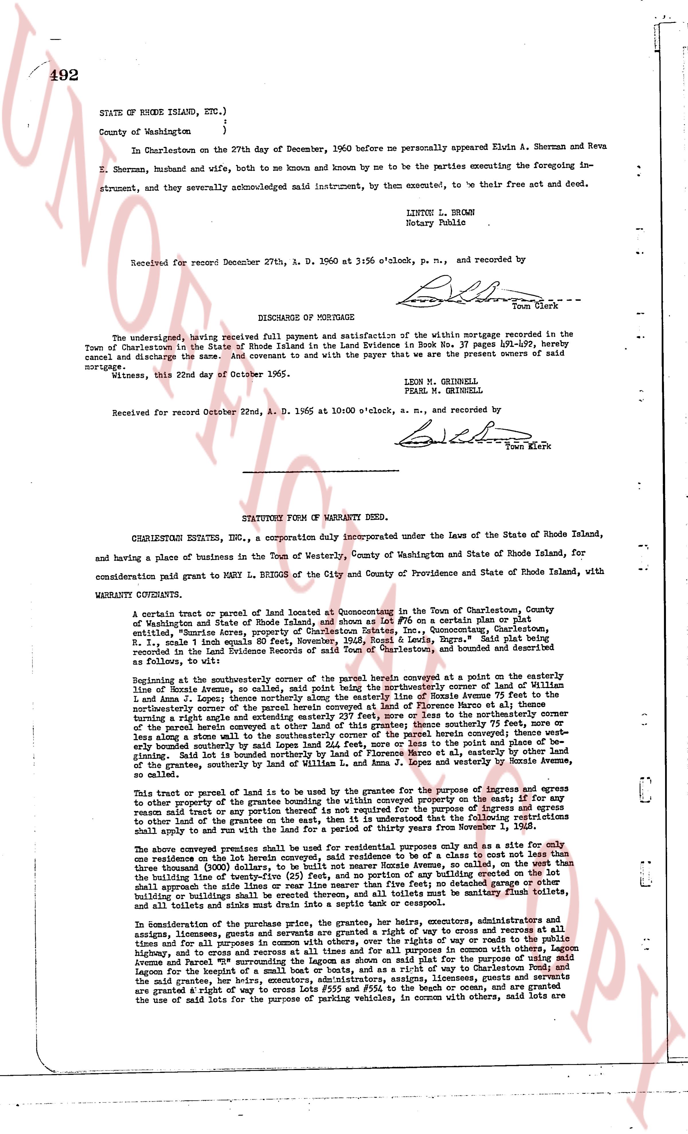
The instrument's own words
page 1 · read by Gemma vision
492
STATE OF RHODE ISLAND, ETC.)
)
County of Washington )
In Charlestown on the 27th day of December, 1960 before me personally appeared Elwin A. Sherman and Reva E. Sherman, husband and wife, both to me known and by me to be the parties executing the foregoing instrument, and severally acknowledged said instrument, by them executed, to be their free act and deed.
LINTON L. BROWN
Notary Public
Received for record December 27th, A. D. 1960 at 3:56 o'clock, p. m., and recorded by
[Signature]
Town Clerk
----
DISCHARGE OF MORTGAGE
The undersigned, having received full payment and satisfaction of the within mortgage recorded in the Town of Charlestown in the State of Rhode Island in the Land Evidence Book No. 37 page 491-492, hereby cancel and discharge the same, and do hereby quit claim to and with the payer that we are the present owners of said mortgage.
Witness, this 22nd day of October 1965.
LEON M. GRINNELL
PEARL M. GRINNELL
Received for record October 22nd, A. D. 1965 at 10:00 o'clock, a. m., and recorded by
[Signature]
Town Clerk
----
STATUTORY FORM OF WARRANTY DEED.
CHARLESTOWN ESTATES, INC., a corporation duly incorporated under the Laws of the State of Rhode Island, and having a place of business in the Town of Westerly, County of Washington and State of Rhode Island, for consideration paid grant to MARY L. BEIGH OF the City and County of Providence and State of Rhode Island, with WARRANTY CONVEYS QUITCLAIM:
A certain tract or parcel of land located at Quonsetum in the Town of Charlestown, County of Washington and State of Rhode Island and shown as Lot 15" on a certain plat or plan entitled, "Survey of Rhode Island, Town of Charlestown, State of Rhode Island, County of Washington, R.I., scale 1 inch equals 80 feet, November, 1965, Ronald R. Lewis, Engr." Said plat being recorded in the Land Evidence Records of said Town of Charlestown, and bounded and described as follows, to wit:
Beginning at the northeasterly corner of the parcel herein conveyed at a point on the easterly line of Noyes Avenue, the same called, said point being the northeasterly corner of said Lot 15" and Line 1 and Line 2; thence running southwesterly by said Line 1 along the center of Noyes Avenue 75 feet to the northeasterly corner of the parcel herein conveyed at other land of this grantor; thence southerly 75 feet, more or less along the east line of said Lot 15" to the northeasterly corner of the parcel herein conveyed at other land of this grantor; thence easterly 75 feet, more or less along the northerly boundary southerly by said Lot 15" land 24.5 feet, more or less to the point and place of beginning; said Lot 15" being a lot in the aforementioned plat; the said parcel herein conveyed is further bounded southerly by said Lot 15" land 24.5 feet, more or less to the point and place of beginning; the said parcel herein conveyed is further bounded easterly by the land of the grantor, southerly bounded by said land of the grantor, southerly bounded by said land of the grantor, southerly bounded by said land of William L. and Anna M. J. Lopes and westerly by Noyes Avenue 80 feet, more or less.
This tract or parcel of land is to be used by the grantee for the purpose of ingress and egress to other property of the grantee within the body conveyed within the property open to the east; for the purpose of said land or any part thereof to be used for the purpose of ingress and egress to other land of the grantee on the east, on the item that it is understood that the following restrictions shall apply to and run with the land for a period of 25 years:
The above conveyed parcel of land is to be used for residential purposes only and as a site for only one residence on the said lot herein conveyed, said residence to be of a cost not less than the sum of $10,000 (ten thousand dollars) exclusive of the land, said residence to be of a size not less than three thousand (3,000) square feet of living area, and no portion of any building erected on the lot shall approach the side lines of the river or near liner than twenty (25) feet, and no portion of any building erected on the lot shall be situated more than 50 feet from the front line of the lot; toilets must be sanitary flush toilets, and all sinks and drains must run into a septic tank or cesspool.
In consideration of the purchase price, the grantee, her heirs, executors, administrators and assigns, licensees, grantees, guests and servants are granted a right of way to cross and recross at all times and for all purposes in common with others, over the rights of way or roads runnning through the highway, lot and various areas of the said plat, in common with others, along Noyes Avenue and Parcel 5" surrounding the Lagoon as shown on said plat for the purpose of using said Lagoon for the benefit of the grantee, her heirs, executors, administrators, assigns, licensees, grantees, guests and servants are granted a right of way to cross over 55' of the river or ocean, and are granted the use of said lots for the purpose of parking vehicles, in common with others, said lots are
The page as recorded