The instrument's own words
page 1 · read by Gemma vision
487
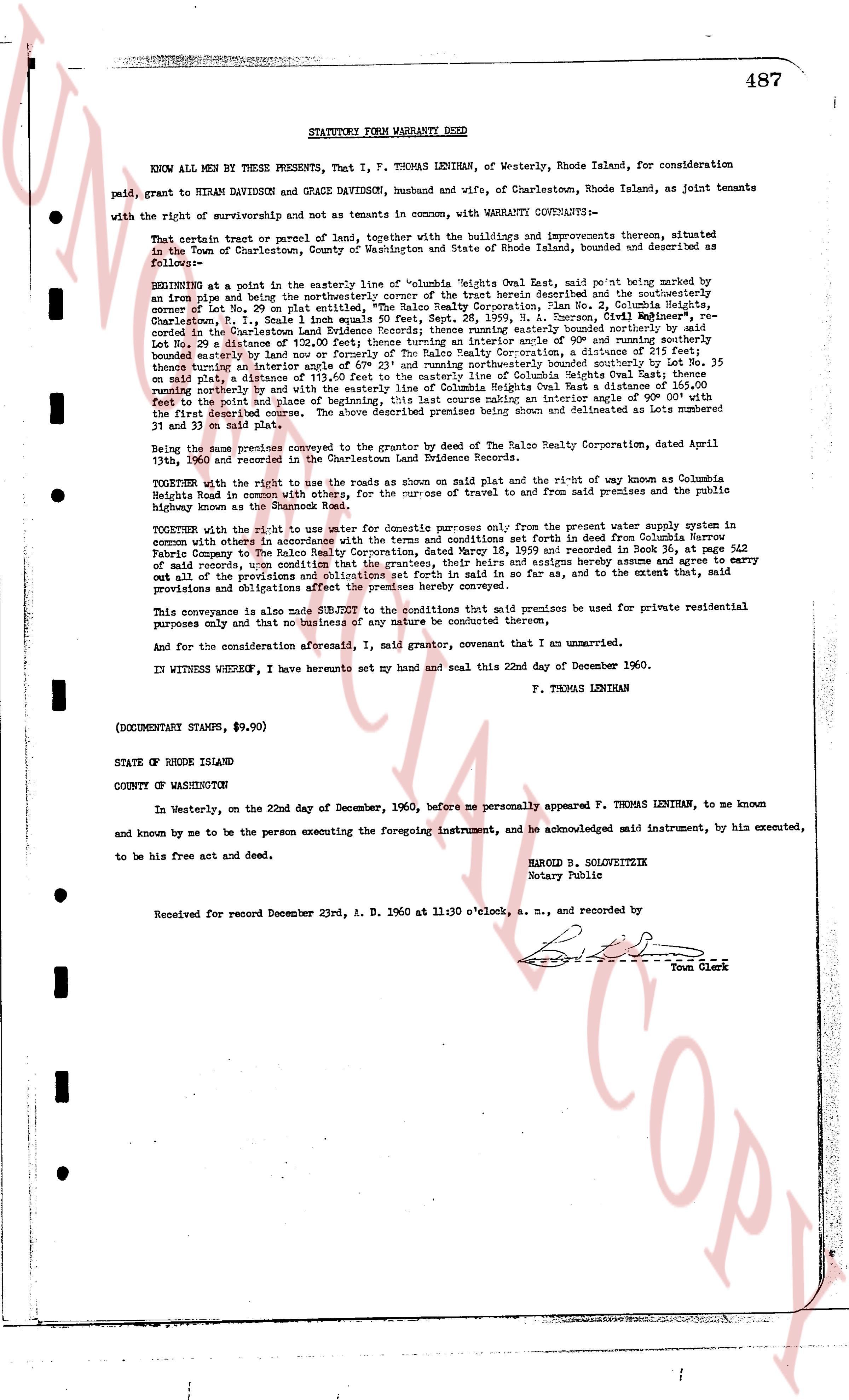
STATUTORY FORM WARRANTY DEED
KNOW ALL MEN BY THESE PRESENTS, That I, F. THOMAS LENIHAN, of Westerly, Rhode Island, for consideration paid, grant to HIRAM DAVIDSON and GRACE DAVIDSON, husband and wife, of Charlestown, Rhode Island, as joint tenants with the right of survivorship and not as tenants in common, with WARRANTY COVENANTS—
That certain tract or parcel of land, together with the buildings and improvements thereon, situated in the Town of Charlestown, County of Washington and State of Rhode Island, bounded and described as follows—
BEGINNING at a point in the easterly line of "Columbia Heights East Way, east point" marked by an iron pipe and being the northeasterly corner of the tract herein described and the southeasterly corner of Lot 29 in the subdivision of land known as "Columbia Heights No. 2, Charlestown, Rhode Island, Plat 1, P. Sheet 1" equals north 50 equals east, Sept. 28, 1959, N. Emerson, Civil Engineer's, re-survey of the subdivision and plat, said point being marked by an iron pipe and being the southeasterly corner of Lot 29, a distance of 120.00 feet, thence turning an interior angle of 90° and running southerly bounded easterly by said Lot No. 29 a distance of 120.00 feet, thence running southerly, a distance of 100.00 feet, thence turning an interior angle of 67° 23' and running northeasterly bounded southerly by Lot No. 35 on said plat, a distance of 155.00 feet, thence running northeasterly along the easterly line of Columbia Heights East Way, a distance of 165.00 feet, running northerly by the width and by the easterly line of Columbia Heights East Way, a distance of 100.00 feet, running northerly by the width and by the easterly line of Columbia Heights East Way, a distance of 165.00 feet, bounded on the east by the plat line of Columbia Heights No. 2, by an interior angle of 90° and running westerly with the first described course. The above described premises being shown and delineated as Lots number 31 and 33 on said plat.
Being the same premises conveyed to the Grantor by deed of The Ralo Realty Corporation, dated April 13th, 1960, and recorded in the Charlestown Land Evidence Book.
TOGETHER with the right to use the roads as shown on said Plats and the right of way known as Columbia Heights Road in common with others, for the purpose of travel to and from said premises and the public highway known as Columbia Heights Road.
TOGETHER with the right to use water for domestic purposes only from the present water supply system in common with others in accordance with the terms and conditions set forth in deed from Columbia Narrow Fabric Company to The Ralo Realty Corporation, dated June 13, 1958, and recorded in Land Evidence Book 342 page 542 of said records, upon condition that the grantees, their heirs and assigns hereby assume and agree to carry out all the provisions and obligations contained in said deed as far as, and to the extent that, said provisions and obligations affect the premises hereby conveyed.
This conveyance is also made SUBJECT to the conditions that said premises be used for private residential purposes only and that no business of any nature be conducted thereon.
And for the consideration aforesaid, I, said grantor, covenant that I am unmarried.
IN WITNESS WHEREOF, I have hereunto set my hand and seal this 22nd day of December 1960.
F. THOMAS LENIHAN
(DOCUMENTARY STAMPS, $9.20)
STATE OF RHODE ISLAND
COUNTY OF WASHINGTON
In Westerly, on the 22nd day of December, 1960, before me personally appeared F. THOMAS LENIHAN, to me known and known by me to be the person executing the foregoing instrument, and he acknowledged said instrument, by his executed, and to be his free act and deed.
HAROLD B. SOLVEITZEK
Notary Public
Received for record December 23rd, A. D. 1960 at 11:30 o'clock, a. m., and recorded by
Town Clerk
The page as recorded