The instrument's own words
page 1 · read by Gemma vision
463
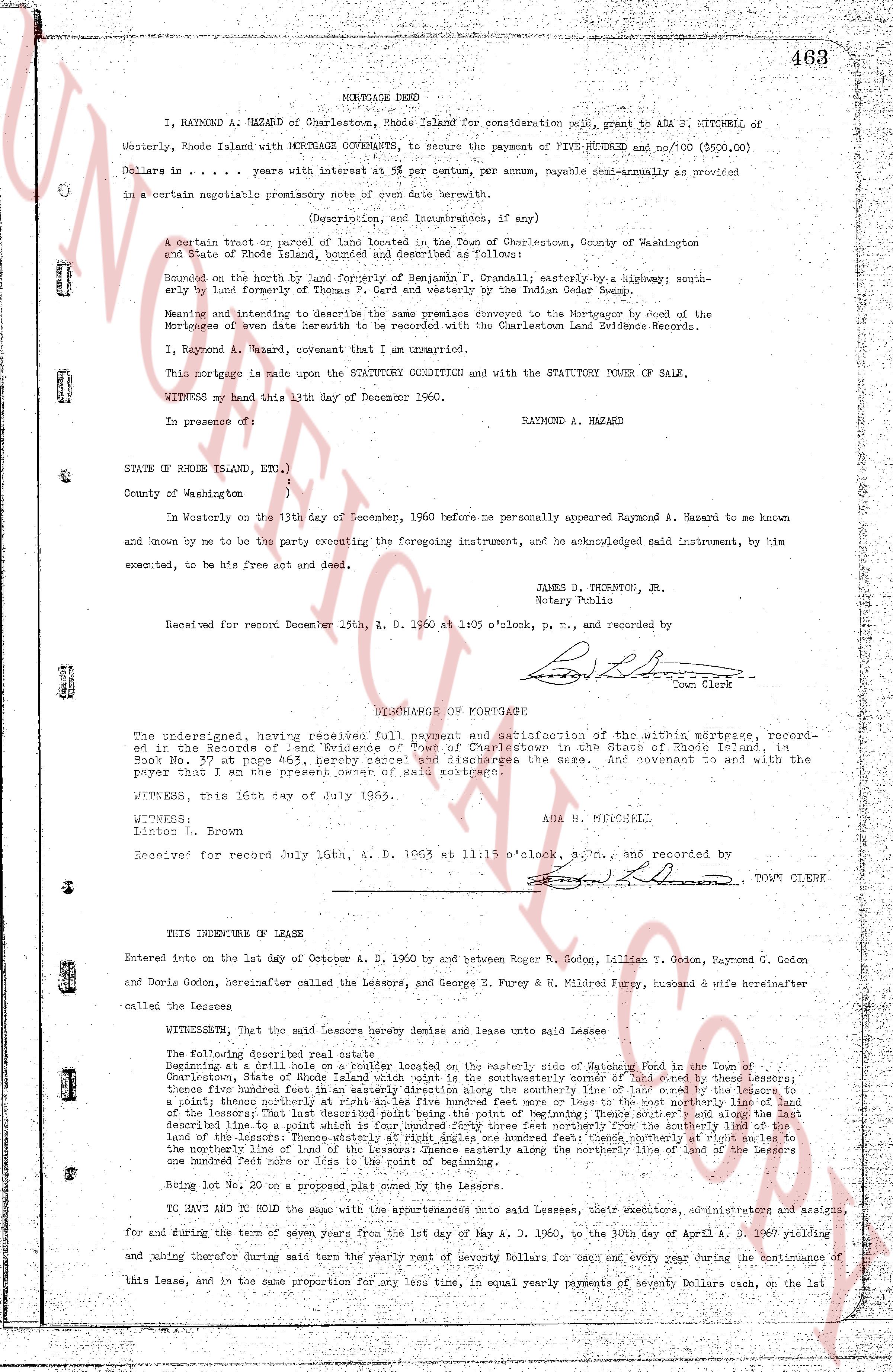
MORTGAGE DEED
I, RAYMOND A. HAZARD of Charlestown, Rhode Island for consideration paid, grant to ADA B. MITCHELL of Westerly, Rhode Island with MORTGAGE COVENANTS, to secure the payment of FIVE HUNDRED and no/100 ($500.00) Dollars in .................... years with interest at 5 per centum, per annum, payable semi-annually as provided in a certain mortgage promissory note of even date herewith.
(Description, and Incumbrances, if any)
A certain tract or parcel of land located in the Town of Charlestown, County of Washington and State of Rhode Island, bounded and described as follows:
Bounded on the north by land formerly of Benjamin T. Crandall; easterly by a highway; southerly bounded by land of the grantor; and westerly by land belonging to the Indian Cedar Swamp.
Meaning and intending to describe the same premises conveyed to the Mortgagor by deed of the Mortgagee of even date herewith to be recorded with the Charlestown Land Evidence Records.
I, Raymond A. Hazard, covenant that I am unmarried.
This mortgage is made upon the STATUTORY CONDITION and with the STATUTORY POWER OF SALE.
WITNESS my hand this 13th day of December 1960.
RAYMOND A. HAZARD
In presence of:
[?]
[?]
STATE OF RHODE ISLAND, ETC.,
ss
County of Washington
)
In Westerly on the 13th day of December, 1960 before me personally appeared Raymond A. Hazard to me known and known by me to be the party executing the foregoing instrument, and acknowledged said instrument, by him executed, to be his free act and deed.
JAMES D. THORNTON, Jr.
Notary Public
Received for record December 15th, A. D. 1960 at 1:05 o'clock, p. m., and recorded by
[Signature]
Town Clerk
DISCHARGE OF MORTGAGE
The undersigned, having received full payment and satisfaction of the within mortgage, recorded in the Records of Land Evidence of Town of Charlestown in the State of Rhode Island, in Book No. 37 page 463, hereby cancel and discharge the same. And covenant to and with the party in whose favor the present deed of said mortgage is.
WITNESS, this 16th day of July 1965.
ADA B. MITCHELL
WITNESS:
Linton L. Brown
Received for record July 16th, A. D. 1965 at 11:15 o'clock, a.m., and recorded by
[Signature]
TOWN CLERK
----
THIS INDENTURE of Lease
Entered into on the 1st day of October A. D. 1960 by and between Roger B. Godon, Lillian T. Godon, Raymond G. Godon and Doris Godon, hereinafter called the Lessors, and George E. Fury & H. Mildred Fury, husband & wife hereinafter called the Lessees
WITNESSETH, that the said Lessors hereby demise and lease unto said Lessees
The following described real estate, that
Beginning at a drill site on a boulder located on the easterly side of Godon's Meadow in the Town of Charlestown, State of Rhode Island, at a point which is the southeasterly corner of land owned by these lessors; thence five hundred feet in an easterly direction along the southerly line of land owned by the lessors to a point; thence northerly at right angles since five hundred feet more and less to the most northerly line of land of the lessors; thence westerly five hundred feet along the northerly line of these lessors to a point which is the northwest described line to a point which is four hundred forty three feet northerly from the southerly line of the land of these lessors; thence southerly four hundred forty three feet to the point of beginning; and thence on the northerly line of land of the Lessors thence easterly along the northerly line of land of the Lessors one hundred ninety one feet and thence northerly to the point of beginning.
Being Lot No. 20 on a proposed plat mapped by the Lessors.
TO HAVE AND TO HOLD the same with the appurtenances unto said Lessees, their executors, administrators and assigns, for and during the term of seven years from the 1st day of May A. D. 1960, to the 30th day of April A. D. 1967 yielding and paying therefor during said term the yearly rent of seventy Dollars for each and every year during the continuance of this lease, and in the same proportion for any less time, in equal yearly payments of seventy Dollars each, on the last
The page as recorded