The instrument's own words
page 1 · read by Gemma vision
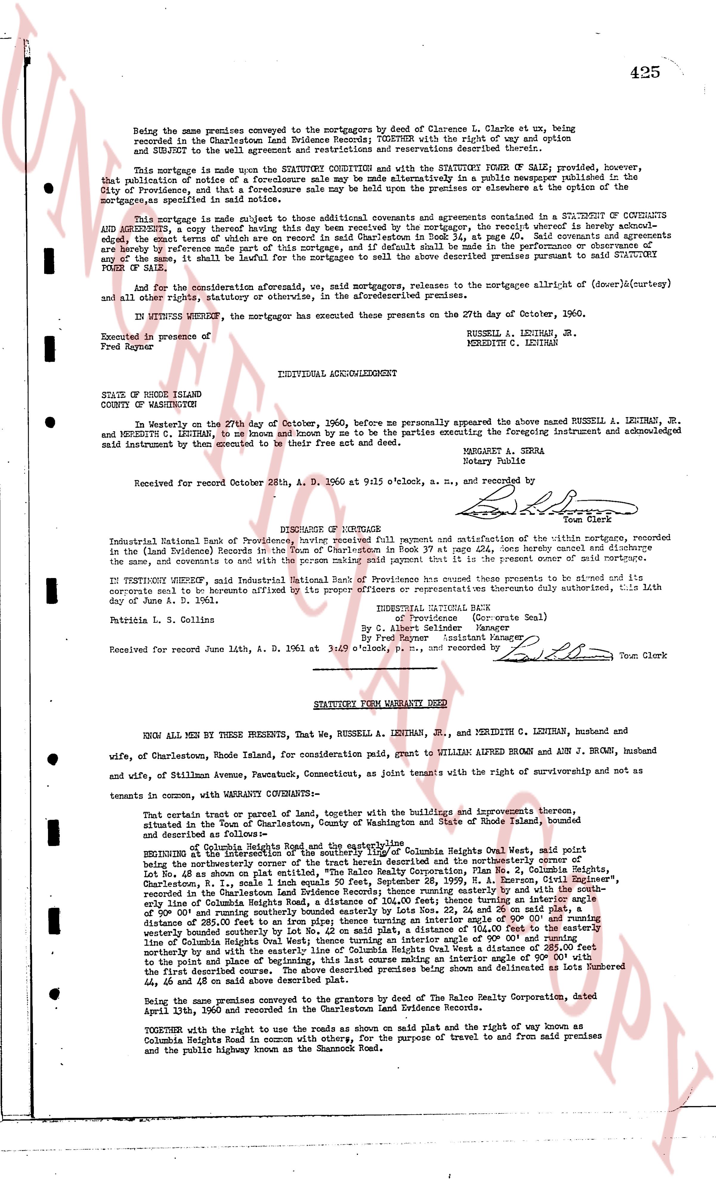
425
Being the same premises conveyed to the mortgagors by deed of Clarence L. Clarks et ux, being recorded in the Charlestown Land Evidence Records; Town Book 37, page 411 as to the right of way and option described therein, and subject to all easements and restrictions and reservations described therein.
This mortgage is made upon the STATUTORY CONVEYANCE and with the STATUTORY POWER OF SALE; provided, however, that publication of notice of a foreclosure sale may be made alternatively in a newspaper published in the City of Providence, and that a foreclosure sale may be held upon the premises or elsewhere at the option of the mortgagee, as specified in said statutory power of sale.
This mortgage is made subject to those additional covenants and agreements contained in the SUPPLEMENT A COPY OF COVENANTS AND AGREEMENTS, a copy thereof having this date been delivered to the mortgagors, the receipt whereof is acknowledged, which is recorded in the Charlestown Land Evidence Records, Town Book 34, page 40. Said covenants and agreements are hereby by reference made part of this mortgage, and if default shall be made in the performance or observance of any thereof, it shall be lawful for the mortgagee to sell the above described premises pursuant to said STATUTORY POWER OF SALE.
And for the consideration aforesaid paid by the mortgagors, releasees to the mortgagee allright of (dower)(curtesy) and all other rights, statutory or otherwise, in the aforementioned premises.
IN WITNESS WHEREOF, the mortgagors have executed these presents on the 27th day of October, 1960.
Executed in presence of
Fred Reyner
RUSSELL A. LENIHAN, Jr.
MEREDITH C. LENIHAN
INDIVIDUAL ACKNOWLEDGMENT
STATE OF RHODE ISLAND
COUNTY OF WASHINGTON
In Westerly on the 27th day of October, 1960, before me personally appeared the above named RUSSELL A. LENIHAN, Jr. and MEREDITH C. LENIHAN, to me known and known by me to be the parties executing the foregoing instrument and acknowledged said instruments by them executed to be their free act and deed.
MARGARET A. SIERA
Notary Public
Received for record October 28th, A. D. 1960 at 9:15 o'clock, a. m., and recorded by [?]
Town Clerk
RELEASE OF MORTGAGE
Industrial National Bank of Providence, having received full payment and satisfaction of the within mortgage, recorded in the (Land Evidence Records) in the Town of Charlestown in Book 37 at page 424, does hereby cancel and discharge the same and covenants to and promises to the present owners to execute any present further assurance.
IN TESTIMONY WHEREOF, said Industrial National Bank of Providence has caused these presents to be signed and its corporate seal to be hereunto affixed by its proper officers or representatives duly authorized, this 4th day of June A. D. 1961.
Patricia L. S. Collins
INDUSTRIAL NATIONAL BANK
By [Signature] (Corporate Seal)
By Col. Albert Sellmer Assistant Manager
By Fred Reyner Manager
Received for record June 14th, A. D. 1961 at 3:40 p'clock, P.M., and recorded by [?]
Town Clerk
----
STATUTORY FORM WARRANTY DEED
KNOW ALL MEN BY THESE PRESENTS, That We, RUSSELL A. LENIHAN, Jr., and MEREDITH C. LENIHAN, husband and wife, of Charlestown, Rhode Island, for consideration paid, grant to WILLIAM ALFRED BROWN and ANN J. BROWN, husband and wife, of Stillman Avenue, Watertown, Connecticut, as joint tenants with the right of survivorship and not as tenants in common, with WARRANTY COVENANTS-
That certain parcel of land, part of the saltwater marshes, with the buildings and improvements thereon, situated in the Town of Charlestown, County of Washington and State of Rhode Island, bounded and described as follows-
Beginning at the southeasterly corner of the highway called Columbia Heights Oval, said point joint beginning of the boundaries of the saltwater marshes herein described and the property northerly and the southerly corner of Lot No. 48 as shown on plat entitled, "The Rhode Island Realty Corporation, Plat No. 2, Columbia Heights, Charlestown, R. I." each line indicated by a dotted line on said Plat, recorded June 19, 1932, in the Charlestown Land Evidence Records; thence running easterly and by the south westerly boundary line of Columbia Heights Road, a distance of 100.00 feet to the south westerly boundary line of Columbia Heights Road, a distance of 100.00 feet to the south westerly boundary line of Columbia Heights Road, a distance of 100.00 feet to the south westerly boundary line of Columbia Heights Road, a distance of 100.00 feet to the south westerly boundary line of Columbia Heights Road, a distance of 100.00 feet to the south westerly boundary line of Columbia Heights Road, a distance of 100.00 feet to the south westerly boundary line of Columbia Heights Road, a distance of 100.00 feet to the south westerly boundary line of Columbia Heights Road, a distance of 100.00 feet to the south westerly boundary line of Columbia Heights Road, a distance of 100.00 feet to the south westerly boundary line of Columbia Heights Road, a distance of 100.00 feet to the south westerly boundary line of Columbia Heights Road, a distance of 100.00 feet to the south westerly boundary line of Columbia Heights Road, a distance of 100.00 feet to the south westerly boundary line of Columbia Heights Road, a distance of 100.00 feet to the south westerly boundary line of Columbia Heights Road, a distance of 100.00 feet to the south westerly boundary line of Columbia Heights Road, a distance of 100.00 feet to the south westerly boundary line of Columbia Heights Road, a distance of 100.00 feet to the south westerly boundary line of Columbia Heights Road, a distance of 100.00 feet to the south westerly boundary line of Columbia Heights Road, a distance of 100.00 feet to the south westerly boundary line of Columbia Heights Road, a distance of 100.00 feet to the south westerly boundary line of Columbia Heights Road, a distance of 100.00 feet to the south westerly boundary line of Columbia Heights Road, a distance of 100.00 feet to the south westerly boundary line of Columbia Heights Road, a distance of 100.00 feet to the south westerly boundary line of Columbia Heights Road, a distance of 100.00 feet to the south westerly boundary line of Columbia Heights Road, a distance of 100.00 feet to the south westerly boundary line of Columbia Heights Road, a distance of 100.00 feet to the south westerly boundary line of Columbia Heights Road, a distance of 100.00 feet to the south westerly boundary line of Columbia Heights Road, a distance of 100.00 feet to the south westerly boundary line of Columbia Heights Road, a distance of 100.00 feet to the south westerly boundary line of Columbia Heights Road, a distance of 100.00 feet to the south westerly boundary line of Columbia Heights Road, a distance of 100.00 feet to the south westerly boundary line of Columbia Heights Road, a distance of 100.00 feet to the south westerly boundary line of Columbia Heights Road, a distance of 100.00 feet to the south westerly boundary line of Columbia Heights Road, a distance of 100.00 feet to the south westerly boundary line of Columbia Heights Road, a distance of 100.00 feet to the south westerly boundary line of Columbia Heights Road, a distance of 100.00 feet to the south westerly boundary line of Columbia Heights Road, a distance of 100.00 feet to the south westerly boundary line of Columbia Heights Road, a distance of 100.00 feet to the south westerly boundary line of Columbia Heights Road, a distance of 100.00 feet to the south westerly boundary line of Columbia Heights Road, a distance of 100.00 feet to the south westerly boundary line of Columbia Heights Road, a distance of 100.00 feet to the south westerly boundary line of Columbia Heights Road, a distance of 100.00 feet to the south westerly boundary line of Columbia Heights Road, a distance of 100.00 feet to the south westerly boundary line of Columbia Heights Road, a distance of 100.00 feet to the south westerly boundary line of Columbia Heights Road, a distance of 100.00 feet to the south westerly boundary line of Columbia Heights Road, a distance of 100.00 feet to the south westerly boundary line of Columbia Heights Road, a distance of 100.00 feet to the south westerly boundary line of Columbia Heights Road, a distance of 100.00 feet to the south westerly boundary line of Columbia Heights Road, a distance of 100.00 feet to the south westerly boundary line of Columbia Heights Road, a distance of 100.00 feet to the south westerly boundary line of Columbia Heights Road, a distance of 100.00 feet to the south westerly boundary line of Columbia Heights Road, a distance of 100.00 feet to the south westerly boundary line of Columbia Heights Road, a distance of 100.00 feet to the south westerly boundary line of Columbia Heights Road, a distance of 100.00 feet to the south westerly boundary line of Columbia Heights Road, a distance of 100.00 feet to the south westerly boundary line of Columbia Heights Road, a distance of 100.00 feet to the south westerly boundary line of Columbia Heights Road, a distance of 100.00 feet to the south westerly boundary line of Columbia Heights Road, a distance of 100.00 feet to the south westerly boundary line of Columbia Heights Road, a distance of 100.00 feet to the south westerly boundary line of Columbia Heights Road, a distance of 100.00 feet to the south westerly boundary line of Columbia Heights Road, a distance of 100.00 feet to the south westerly boundary line of Columbia Heights Road, a distance of 100.00 feet to the south westerly boundary line of Columbia Heights Road, a distance of 100.00 feet to the south westerly boundary line of Columbia Heights Road, a distance of 100.00 feet to the south westerly boundary line of Columbia Heights Road, a distance of 100.00 feet to the south westerly boundary line of Columbia Heights Road, a distance of 100.00 feet to the south westerly boundary line of Columbia Heights Road, a distance of 100.00 feet to the south westerly boundary line of Columbia Heights Road, a distance of 100.00 feet to the south westerly boundary line of Columbia Heights Road, a distance of 100.00 feet to the south westerly boundary line of Columbia Heights Road, a distance of 100.00 feet to the south westerly boundary line of Columbia Heights Road, a distance of 100.00 feet to the south westerly boundary line of Columbia Heights Road, a distance of 100.00 feet to the south westerly boundary line of Columbia Heights Road, a distance of 100.00 feet to the south westerly boundary line of Columbia Heights Road, a distance of 100.00 feet to the south westerly boundary line of Columbia Heights Road, a distance of 100.00 feet to the south westerly boundary line of Columbia Heights Road, a distance of 100.00 feet to the south westerly boundary line of Columbia Heights Road, a distance of 100.00 feet to the south westerly boundary line of Columbia Heights Road, a distance of 100.00 feet to the south westerly boundary line of Columbia Heights Road, a distance of 100.00 feet to the south westerly boundary line of Columbia Heights Road, a distance of 100.00 feet to the south westerly boundary line of Columbia Heights Road, a distance of 100.00 feet to the south westerly boundary line of Columbia Heights Road, a distance of 100.00 feet to the south westerly boundary line of Columbia Heights Road, a distance of 100.00 feet to the south westerly boundary line of Columbia Heights Road, a distance of 100.00 feet to the south westerly boundary line of Columbia Heights Road, a distance of 100.00 feet to the south westerly boundary line of Columbia Heights Road, a distance of 100.00 feet to the south westerly boundary line of Columbia Heights Road, a distance of 100.00 feet to the south westerly boundary line of Columbia Heights Road, a distance of 100.00 feet to the south westerly boundary line of Columbia Heights Road, a distance of 100.00 feet to the south westerly boundary line of Columbia Heights Road, a distance of 100.00 feet to the south westerly boundary line of Columbia Heights Road, a distance of 100.00 feet to the south westerly boundary line of Columbia Heights Road, a
The page as recorded