The instrument's own words
page 1 · read by Gemma vision
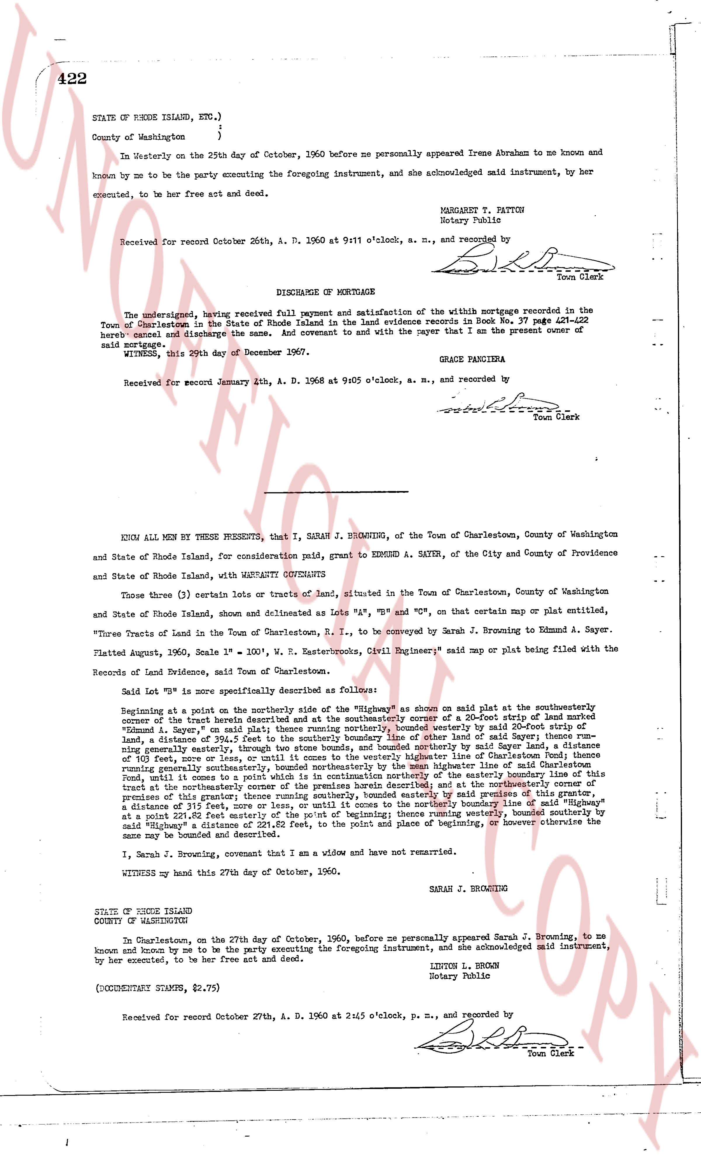
422
STATE OF RHODE ISLAND, ETC.)
County of Washington }
}
In Westerly on the 25th day of October, 1960 before me personally appeared Irene Abraham to me known and
known by me to be the party executing the foregoing instrument, and she acknowledged said instrument, by her
executed, to be her free act and deed.
MARGARET Y. FATTON
Notary Public
Received for record October 26th, A. D. 1960 at 9:11 o'clock, a. m., and recorded by
[Signature]
Town Clerk
----
DISCHARGE OF MORTGAGE
The undersigned, having received full payment and satisfaction of the within mortgage recorded in the
Town of Charlestown in the State of Rhode Island land evidence books in Book No. 37 page 422
hereby cancel and discharge the same. And covenant to and with the payer that I am the present owner of
said mortgage.
WITNESS, this 29th day of December 1957.
GRACE PANCIERA
Received for record January 2th, A. D. 1968 at 9:05 o'clock, a. m., and recorded by
[Signature]
Town Clerk
----
KNOW ALL MEN BY THESE PRESENTS, that I, SARAH J. BROWNING, of the Town of Charlestown, County of Washington
and State of Rhode Island, for consideration paid, grant to EDMUND A. SAYER, of the City and County of Providence
and State of Rhode Island, with WARRANTY COVENANTS
Those three (3) certain lots or tracts of land, situated in the Town of Charlestown, County of Washington
and State of Rhode Island, shown and described as Lots "A", "B" and "C", on that certain map or plat entitled,
"Three Tracts of Land in the Town of Charlestown, R. I." to be conveyed by Sarah J. Browning to Edmund A. Sayer.
Platted August, 1960, Scale 1" = 100', W. E. Rasterworks, "Civil Engineer" said map or plat being filed with the
Records of Land Evidence, said Town of Charlestown.
Said Lot "B" is more specifically described as follows:
Beginning at a point on the northerly side of the "Highway" as shown on said plat at the southeasterly
corner of the tract herein described and at the southeasterly corner of a 20-foot strip of land marked
"Common - way" as shown on said plat; thence southeasterly, bounded westerly by said 20-foot strip of
land, a distance of 394.51 feet to the southerly boundary line of other land of said Sayer; thence east-
erly, bounded southerly by said southerly boundary line of other land of said Sayer; thence northerly a distance
of 101 feet, more or less, or until it comes to the westerly highway line of Charlestown Pond; thence east-
erly, bounded southerly by said highway line of Charlestown Pond, a distance of 111 feet to the northeasterly
Pond, until it comes to a point which is on continuing northerly at the easterly boundary line of this
tract; thence northerly, thence southerly, bounded easterly by said premises of this grantor, a
distance of 31 feet, thence westerly, bounded northerly by said highway line of Charlestown Pond,
at a point 231.52 feet easterly of the point of beginning; thence westerly, bounded southerly by
said highway, a distance of 101 feet, to the point and place of beginning, or however otherwise the
same may be bounded and described.
I, Sarah J. Browning, covenant that I am a widow and have not remarried.
WITNESS my hand this 27th day of October, 1960.
SARAH J. BROWNING
STATE OF RHODE ISLAND
COUNTY OF WASHINGTON
At Charlestown, on the 27th day of October, 1960, before me personally appeared Sarah J. Browning, to me
known and known by me to be the party executing the foregoing instrument, and she acknowledged said instrument,
by her executed, to be her free act and deed.
LINTON L. BROWN
Notary Public
(DOCUMENTARY STAMPS, $2.75)
Received for record October 27th, A. D. 1960 at 2:45 o'clock, p. m., and recorded by
[Signature]
Town Clerk
The page as recorded