The instrument's own words
page 1 · read by Gemma vision
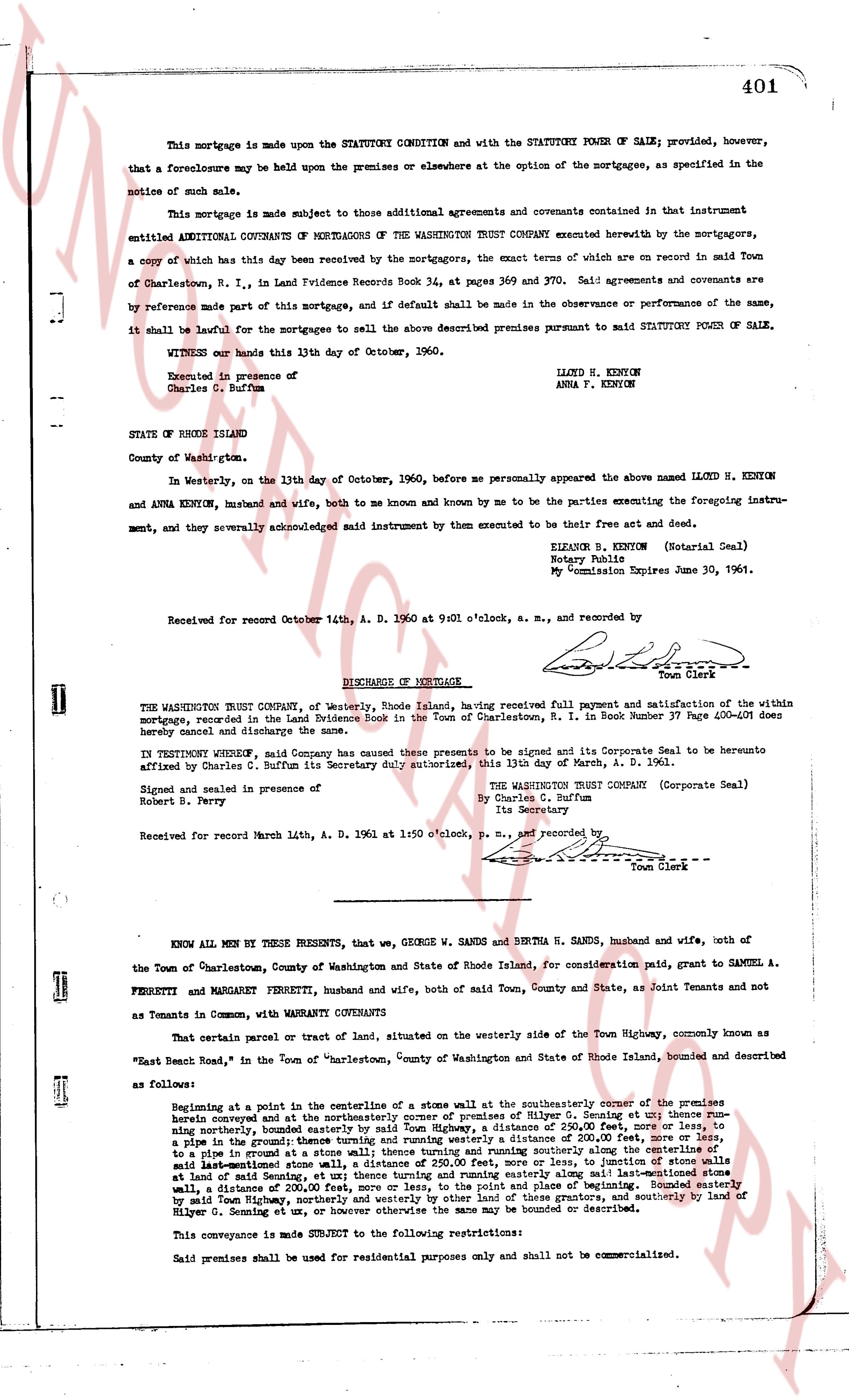
401
This mortgage is made upon the STATUTORY CONDITION and with the STATUTORY POWER OF SALE; provided, however, that a foreclosure may be held upon the premises or elsewhere at the option of the mortgagees, as specified in the notice of such sale.
This mortgage is made subject to those additional agreements and covenants contained in that instrument entitled ADDITIONAL COVENANTS OF MORTGAGEES OF THE WASHINGTON TRUST COMPANY executed herewith by the mortgagors, a copy of which has this day been delivered by the mortgagors, the exact terms of which are on record in said Town of Charlestown, R. I., in Land Providence Records Book 34, at pages 369 and 370. Said agreements and covenants are by reference made part of this mortgage, and if default shall be made in the observance or performance of the same, it shall be lawful for the mortgagees to sell the above described premises pursuant to said STATUTORY POWER OF SALE.
WITNESS our hands this 13th day of October, 1960.
Executed in presence of
Charles C. Buffum
LLOYD H. KENYON
ANNA P. KENYON
STATE OF RHODE ISLAND
County of Washington.
In Westerly, on the 13th day of October, 1960, before me personally appeared the above named LLOYD H. KENYON and ANNA KENYON, husband and wife, both to me known and known by me to be the parties executing the foregoing instrument, and they severally acknowledged said instrument by them executed to be their free act and deed.
ELIZABAR B. KENYON (Notarial Seal)
Notary Public
My Commission Expires June 30, 1961.
Received for record October 14th, A. D. 1960 at 9:01 o'clock, a. m., and recorded by
[Signature]
Town Clerk
----
DISCHARGE OF MORTGAGE
THE WASHINGTON TRUST COMPANY, of Westerly, Rhode Island, having received full payment and satisfaction of the within mortgage, recorded in the Land Evidence Book in the Town of Charlestown, R. I. Number 37 Page 400-401 does hereby cancel and discharge the same.
IN TESTIMONY WHEREOF, said Company has caused these presents to be signed and its Corporate Seal to be hereunto affixed by Charles C. Buffum its Secretary duly authorized, this 13th day of March, A. D. 1961.
Signed and sealed in presence of
Robert B. Perry
THE WASHINGTON TRUST COMPANY (Corporate Seal)
By Charles C. Buffum
Its Secretary
Received for record March 14th, A. D. 1961 at 1:50 o'clock, p. m., and recorded by
[Signature]
Town Clerk
----
KNOW ALL MEN BY THESE PRESENTS, that we, GEORGE W. SANDS and BERTHA H. SANDS, husband and wife, both of the Town of Charlestown, County of Washington and State of Rhode Island, for consideration paid, grant to SAMUEL A. FERRETTI and MARGARET FERRETTI, husband and wife, both of said Town, County and State, as Joint Tenants and not as Tenants in Common, with WARRANTY CONVEYANTS
That certain parcel or tract of land, situated on the westerly side of the Town Highway, commonly known as "East Beach Road", in the Town of Charlestown, County of Washington and State of Rhode Island, bounded and described as follows:
Beginning at a point in the centerline of a stone wall situated at the southeasterly corner of the premises herein conveyed at the intersection of said stone wall and premises of Hilyer G. Sometting et ux; thence running northerly, bounded easterly by said Town Highway, a distance of 250.00 feet, more or less, to a pipe in the ground; thence turning and running westerly a distance of 200.00 feet, more or less, to a stake in the ground; thence turning and running northerly a distance of 200.00 feet, more or less, to said last-mentioned stone wall; a distance of 250.00 feet, more or less, to intersection of stone walls at end of said Setting in the ground; thence turning and running east a distance of 200.00 feet, more or less, to said wall, a distance of 200.00 feet, more or less, to the point of place and beginning. Bounded easterly by said Town Highway; northerly by premises of [?] and [?] grantees, and southerly by land of Hilyer G. Sometting et ux, or however otherwise the same may be bounded or described.
This conveyance is made SUBJECT to the following restrictions:
Said premises shall be used for residential purposes only and shall not be commercialized.
page 2 · read by Gemma vision
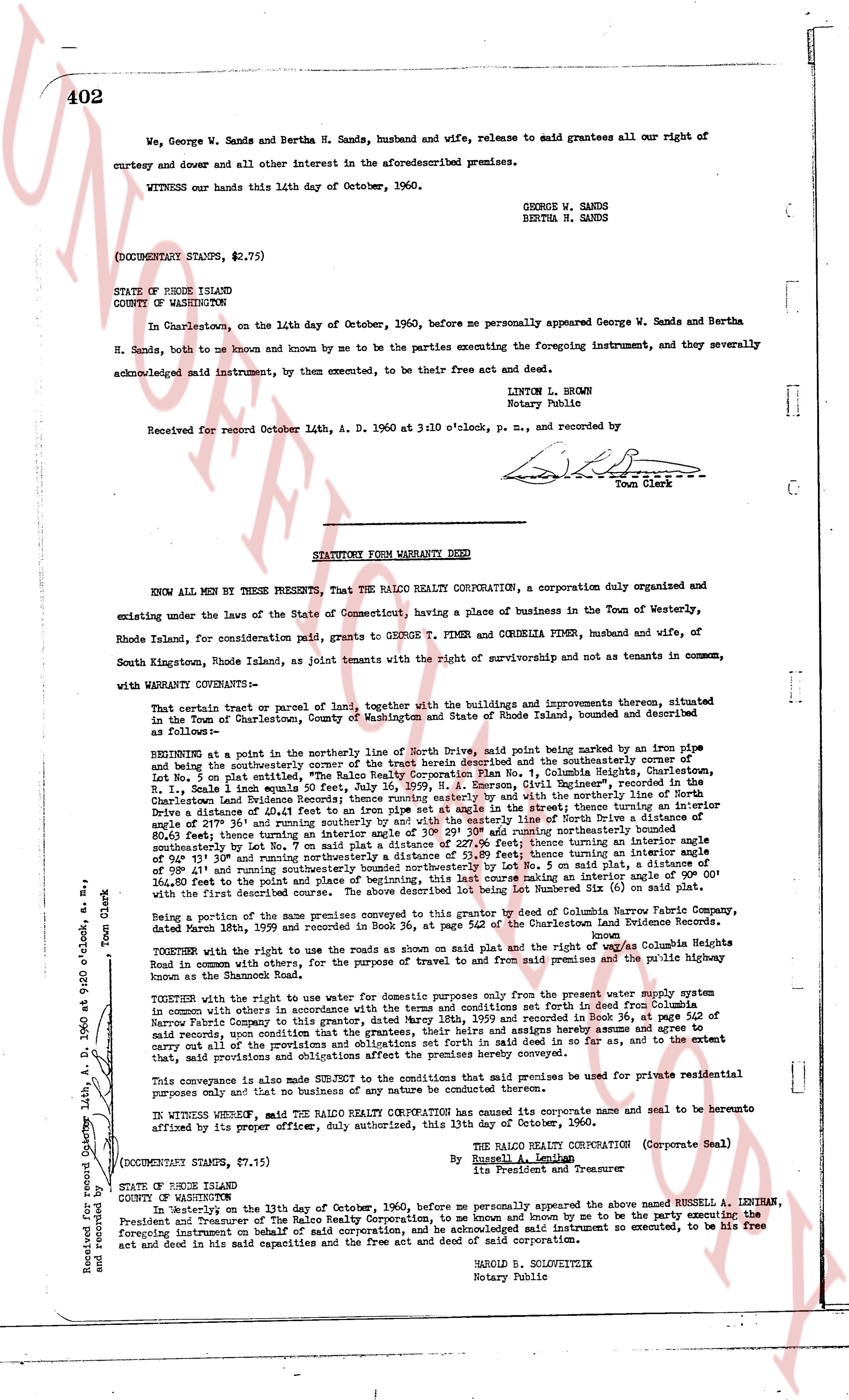
402
We, George W. Sands and Bertha H. Sands, husband and wife, release to said grantees all our right of curtesy and dower and all other interest in the aforesaid premises.
WITNESS our hands this 14th day of October, 1960.
GEORGE W. SANDS
BERTHA H. SANDS
(DOCUMENTARY STAMPS, $2.75)
STATE OF RHODE ISLAND
COUNTY OF WASHINGTON
In Charlestown, on the 14th day of October, 1960, before me personally appeared George W. Sands and Bertha H. Sands, both to me known and by me to be the parties executing the foregoing instrument, and they severally acknowledged said instrument, by them executed, to be their free act and deed.
LINTON L. BROWN
Notary Public
Received for record October 14th, A. D. 1960 at 3:10 o'clock, p. m., and recorded by
[Signature]
Town Clerk
----
STATUTORY FORM WARRANTY DEED
KNOW ALL MEN BY THESE PRESENTS, That THE RALO REALTY CORPORATION, a corporation duly organised and existing under the laws of the State of Connecticut, having a place of business in the Town of Westerly, Rhode Island, for consideration paid, grants to GEORGE T. FINER and CORDELIA FINER, husband and wife, of South Kingstown, Rhode Island, as joint tenants with the right of survivorship and not as tenants in common, with WARRANTY CONVEYANCE:
That certain tract or parcel of land, together with the buildings and improvements thereon, situated in the Town of Charlestown, County of Washington and State of Rhode Island, bounded and described as follows:
BEGINNING at a point in the northerly line of North Drive, said point being marked by an iron pipe 1 1/2" in diameter and being the southeasterly corner of the tract herein described and the southeasterly corner of Lot 108 on plat 104, as shown on the map of "The Pines" recorded in Book 31, page 401, Charlestown, R. I., Scale 1 inch equals 50 feet, July 26, 1959, by "A. CONNORS, Civil Engineer", recorded in the Charlestown Land Evidence Records; thence running south 15° 15' west along the northerly line of North Drive a distance of 10.41 feet to an iron pipe set at angle 90° in the street thence turning an interior angle of 27° 30' and running south 75° 15' west along the southeasterly line of North Drive a distance of 115.30 feet, 80.63 feet; thence turning an interior angle of 30° 29' 305 and running northerly northeasterly bounded southwesterly by land of George W. Sands and Bertha H. Sands, a distance of 115.30 feet; thence turning an interior angle of 94° 35' and running northeasterly a distance of 51.89 feet; thence turning an interior angle 115° 30' and running north 15° 15' east a distance of 10.41 feet to an iron pipe, 1 1/2" in diameter, and 50 said plat, thence turning an interior angle of 90° 00' and running north 75° 15' east to the point of beginning, this last course making an interior angle of 90° 00' with the first and described course. The above described lot being Lot number 108 on plat 104 as shown on said map.
being a portion of the above mentioned premises conveyed to The Ralo Realty Corporation by deed of Columbia Narrow Fabric Company, recorded in Book 34, page 362 of the Charlestown Land Evidence Records.
TOGETHER with the right to use the roads as shown on said plat and the right way of access via Columbia Heights Road in common with others, for the purpose of travel to and from said premises and the public highway bound for said premises.
TOGETHER with the right to use water for domestic purposes only from the present water supply system in common with others in accordance with the terms and conditions set forth in deed from Columbia, berupa [?] to The Ralo Realty Corporation, dated June 15, 1960, and recorded in Book 34, page 362 of said records, upon the condition that the grantees, their heirs and assigns hereby agree and accrue to expenses of maintenance and repair of said system as they shall see fit to do so, and as to the extent that, said provisions and colligations affect the premises hereby conveyed.
This conveyance is also made SUBJECT to the condition that said premises be used for private residential purposes only and that no business of any nature be conducted thereon.
IN WITNESS WHEREOF, said THE RALO REALTY CORPORATION has caused its corporate name and seal to be hereunto affixed by the proper officer, duly authorized, this 13th day of October, 1960.
THE RALO REALTY CORPORATION (Corporate Seal)
By Russell A. Levinman
President and Treasurer
(DOCUMENTARY STAMPS, $7.15)
STATE OF RHODE ISLAND
COUNTY OF WASHINGTON
In Westerly on the 13th day of October, 1960, before me personally appeared the above named RUSSELL A. LEVINMAN, President and Treasurer of The Ralo Realty Corporation, to me known and by me to be the party executing the foregoing instrument on behalf of said corporation, and acknowledged said instrument so executed, to be his free act and deed in his said capacities and the free act and deed of said corporation.
HAROLD B. SOLOVEITSKY
Notary Public
Received for record October 14th, A. D. 1960 at 3:20 o'clock, p. m., and recorded by
[Signature]
Town Clerk
The page as recorded