The instrument's own words
page 1 · read by Gemma vision
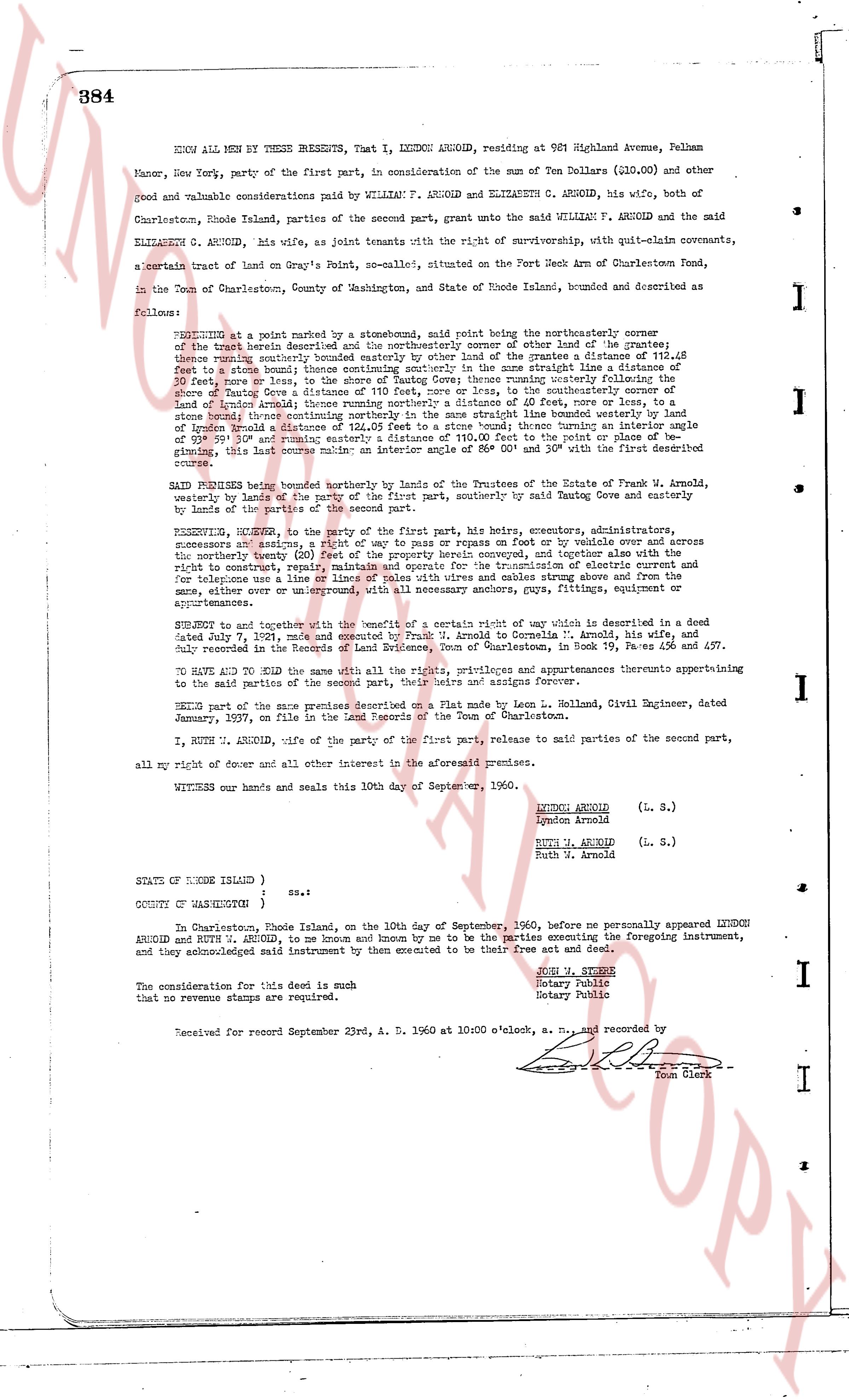
384
KNOW ALL MEN BY THESE PRESENTS, That I, LYNDON ARNOLD, residing at 981 Highland Avenue, Pelham Manor, New York, party of the first part, in consideration of the sum of Ten Dollars ($10.00) and other good and valuable considerations paid by WILLIAM F. ARNOLD and ELIZABETH C. ARNOLD, his wife, both of Charlestown, Rhode Island, parties of the second part, grant unto the said WILLIAM F. ARNOLD and the said ELIZABETH C. ARNOLD, his wife, as joint tenants with the right of survivorship, with quit-claim covenants,
a certain tract of land on Gray's Point, no-scale, situated on the Port Neck Arm of Charlestown Pond, in the Town of Charlestown, County of Washington, and State of Rhode Island, bounded and described as follows:
BEGINNING at a point marked by a stonewall, said point being the northeasterly corner of the tract herein described and the northeasterly corner of other land of the grantor the thence running westerly along said stonewall to a point marked by a stone bound 214.48 feet to a stone bound; thence continuing southerly in the same straight line a distance of 20.00 feet, more or less, to a stone bound; thence running southeasterly a distance of 114.48 feet to a stone bound; thence continuing south a distance of 110 feet, more or less, to the southeasterly corner of what is now Tautog Cove a distance of 110 feet, more or less, to the southeasterly corner of land of Arnold Arnold; thence running southeasterly a distance of 45 feet to a stone bound; thence running southeasterly a distance of 120.00 feet to a stone bound; thence continuing an interior angle of 90° 00' and running northwesterly a distance of 120.00 feet to the point of beginning, this last course making an interior angle of 86° 00' and 30" with the first described boundary.
SAID PREMISES being bounded northerly by the lands of The Estate of Frank W. Arnold, westerly by lands of the party of the first part, southerly by said Tautog Cove and easterly by land of the party of the first part.
RESERVING, however, to the party of the first part, his heirs, executors, administrators, successors and assigns, a right of way to pass by or traverse on foot or by vehicle over and across the northerly section of said land a distance of 20 feet wide, together with a perpetual right to construct, repair, maintain and operate for the maintenance of transmission electric current and for telephone wires all such poles, wires, cables, conduits, antennas and other things as are necessary, either over or underground, with all necessary anchors, guys, fittings, equipment or appurtenances.
SUBJECT to and together with the benefit of a certain right of way which is described in a deed dated July 7, 1921, made and executed by Frank J. Arnold to Cornelia M. Arnold, his wife, and duly recorded in the Records of Land Evidence, Town of Charlestown, in Book 19, Pages 456 and 457.
TO HAVE AND TO HOLD the same with all the rights, privileges and appurtenances thereunto appertaining to the said parties of the second part, their heirs and assigns forever.
BEING part of the same premises described on a Plat made by Leon L. Holland, Civil Engineer, dated January, 1937, on file in the Land Records of the Town of Charlestown.
I, RUTH W. ARNOLD, wife of the party of the first part, release to said parties of the second part, all my right of dower and all other interest in the aforementioned premises.
WITNESS our hands and seals this 10th day of September, 1960.
LYNDON ARNOLD
Lyndon Arnold (L. S.)
RUTH W. ARNOLD
Ruth W. Arnold (L. S.)
STATE OF RHODE ISLAND )
COUNTY OF WASHINGTON ) ss.
In Charlestown, Rhode Island, on the 10th day of September, 1960, before me personally appeared LYNDON ARNOLD and RUTH W. ARNOLD, to me known and by me known to be the parties executing the foregoing instrument, and they acknowledged said instrument by them executed to be their free act and deed.
JOSH M. STONEY
Notary Public
Notary Public
The consideration for this deed is such that no revenue stamps are required, a. m. and recorded by
Received for record September 23rd, A. D. 1960 at 10:00 o'clock, a. m. and recorded by
Town Clerk
The page as recorded