The instrument's own words
page 1 · read by Gemma vision
383
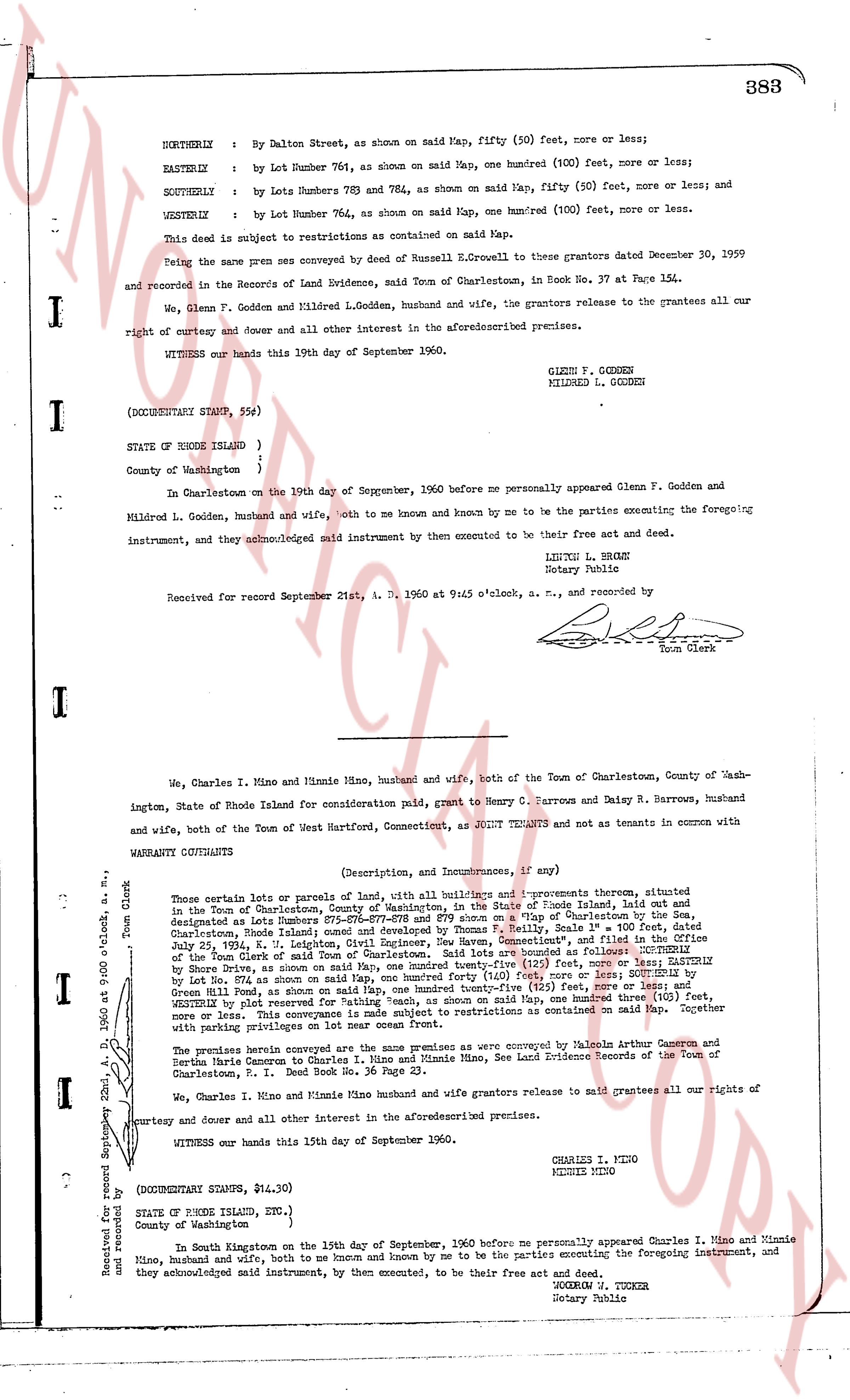
NORTHERLY : By Dalton Street, as shown on said Map, fifty (50) feet, more or less;
EASTERLY : by Lot Number 761, as shown on said Map, one hundred (100) feet, more or less;
SOUTHERLY : by Lots Numbers 763 and 764, as shown on said Map, fifty (50) feet, more or less; and
WESTERLY : by Lot Number 764, as shown on said Map, one hundred (100) feet, more or less.
This deed is subject to restrictions as contained on said Map.
Being the same premises conveyed by Russell N. Ecrowell to these grantors dated December 30, 1959 and recorded in the Records of Land Evidence, said Town of Charlestown, in Book No. 37 at Page 154.
We, Glenn F. Godden and Mildred L. Godden, husband and wife, the grantors release to the grantees all our right of curtesy and dower and all other interest Lodged in the aforementioned premises.
WITNESS our hands this 19th day of September 1960.
GLENN F. GODDEN
MILDRED L. GODDEN
(DOCUMENTARY STAMP, 55¢)
STATE OF RHODE ISLAND )
County of Washington )
In Charlestown on the 19th day of September, 1960 before me personally appeared Glenn F. Godden and Mildred L. Godden, husband and wife, both to me known and known by me to be the parties executing the foregoing instrument, and they acknowledged said instrument by then executed to be their free act and deed.
LEIGHTON L. BRYANT
Notary Public
Received for record September 21st, A. D. 1960 at 9:45 o'clock, a. m., and recorded by
[Signature]
Town Clerk
----
We, Charles I. Mino and Minnie Mino, husband and wife, both of the Town of Charlestown, County of Washington, State of Rhode Island for consideration paid, grant to Henry C. Barrows and Daisy R. Barrows, husband and wife, both of the Town of West Hartford, Connecticut, as JOINT TENANTS and not as tenants in common with
WARRANTY COVENANTS (Description, Incumbrances, if any)
Those certain lots or parcels of land, with all buildings and improvements thereon, situated in the Town of Charlestown, County of Washington, in the State of Rhode Island, laid out and designated as Lots Numbers 671-672-673-674-675 and 679 shown on a "Map of Improvements" in the Town of Charlestown, County of Washington, State of Rhode Island, Scale 1" = 100' feet, dated July 25, 1934, L. H. Leighton, Civil Engineer, Dew New Covenant, and filed in the Office of the Town Clerk, as follows: Lot 671 is bounded as follows: EASTERLY by Lot 672, by Shore Drive, as shown on said Map, one hundred twenty-five (125) feet, more or less; EASTERLY by Lot 672, by Shore Drive, as shown on said Map, one hundred twenty-five (125) feet, more or less; SOUTHERLY by Lot 673, by Green Hill Road, as shown on said Map, one hundred twenty-five (125) feet, more or less; and WESTERLY by Lot 671, by Shore Drive, as shown on said Map, one hundred twenty-five (125) feet, more or less; and Lot 679 is similarly bounded and is subject to restrictions as contained on said Map. Together with privileges on parking areas with lot one hundred ten.
The premises herein conveyed are the same premises as were conveyed by Malcolm Arthur Cameron and Bertha Jane Cameron to Charles I. Mino and Minnie Mino, See Land Evidence Records of the Town of Charlestown, P. I. Deed Book No. 36 Page 23.
We, Charles I. Mino and Minnie Mino husband and wife grantors release to said grantees all our rights of curtesy and dower and all other interest in the aforementioned premises.
WITNESS our hands this 15th day of September 1960.
CHARLES I. MINO
MINNIE MINO
(DOCUMENTARY STAMP, $14.30)
STATE OF RHODE ISLAND, ETC., )
County of Washington )
In South Kingstown on the 15th day of September, 1960 before me personally appeared Charles I. Mino and Minnie Mino, husband and wife, both to me known and known by me to be the parties executing the foregoing instrument, and they acknowledged said instrument, by them executed, to be their free act and deed.
GEORGE H. TUCKER
Notary Public
Received for record September 22nd, A. D. 1960 at 9:00 o'clock a. m., and recorded by
[Signature]
Town Clerk
The page as recorded