The instrument's own words
page 1 · read by Gemma vision
365
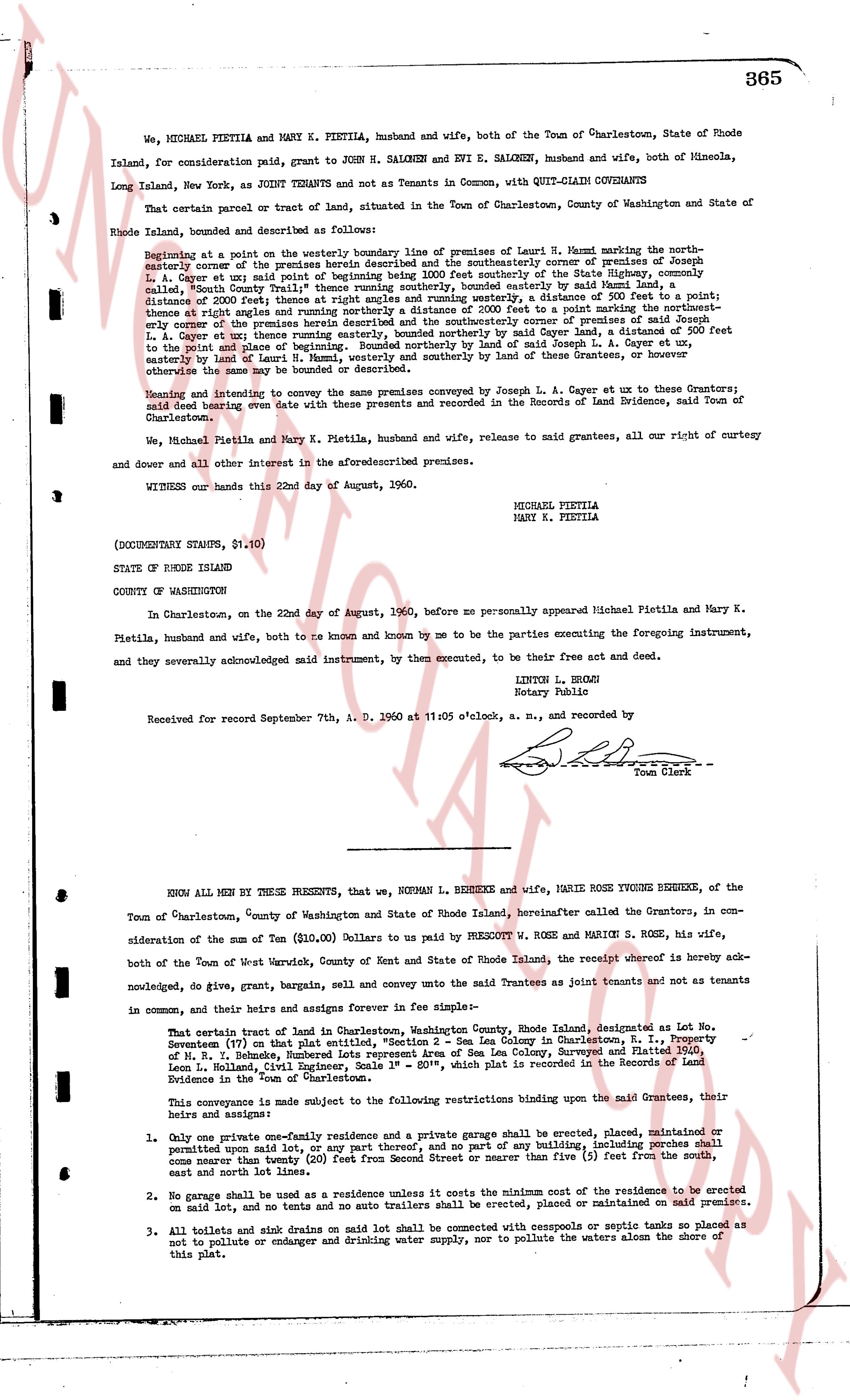
We, MICHAEL PIETILA and MARY K. PIETILA, husband and wife, both of the Town of Charlestown, State of Rhode Island, for consideration paid, grant to JOHN N. SALKEN and EVI E. SALKEN, husband and wife, both of Mineola, Long Island, New York, as JOINT TENANTS and not as Tenants in Common, with QUIT-CLAIM COVENANTS
That certain parcel or tract of land, situated in the Town of Charlestown, County of Washington and State of Rhode Island, bounded and described as follows:
Beginning at a point on the westerly boundary line of premises of laund R. Hamm marking the northwestern corner of the premises herein described and the southwestern corner of premises of Joseph L. A. Cayot et ux said point of beginning being 200 feet Southerly of the State Highway, commonly called Main Road, County Road, the said point of beginning being easterly by said Main Road Highway a distance of 2000 feet begins at right angles and running westerly, a distance of 200 feet to a point; thence turning right North 10 degrees 30 minutes East, a distance of 200 feet to a point marking the north eastern corner of the premises herein described and the southwestern corner of premises of said Joseph L. A. Cayot et ux said point being 200 feet Northerly of said Cayot land, a distance of 200 feet to the point of place of beginning, Bounded northerly by land of said Joseph L. A. Cayot ex ux, easterly by land of Laur R. Hamm, westerly and southerly by land of these Grantors, or however else the same may be bounded.
Meaning and intending to convey the same premises conveyed by Joseph L. A. Cayot ex ux to these Grantors; said deed being recorded oven with these presents and recorded in the Records of Land Evidence, said Town of Charlestown.
We, Michael Pietila and Mary K. Pietila, husband and wife, release to said grantees, all our right of curtesy and dower and all other interest in the aforesaid described premises.
WITNESS our hands this 22nd day of August, 1960.
MICHAEL PIETILA
MARY K. PIETILA
(DOCUMENTARY STAMPS, $1.10)
STATE OF RHODE ISLAND
COUNTY OF WASHINGTON
In Charlestown, on the 22nd day of August, 1960, before me personally appeared Michael Pietila and Mary K. Pietila, husband and wife, both to me known and known by me to be the parties executing the foregoing instrument, and they severally acknowledged said instrument, by them executed, to be their free act and deed.
LINTON L. BROMS
Notary Public
Received for record September 7th, A. D. 1960 at 11:05 o'clock, a. m., and recorded by
[Signature]
Town Clerk
----
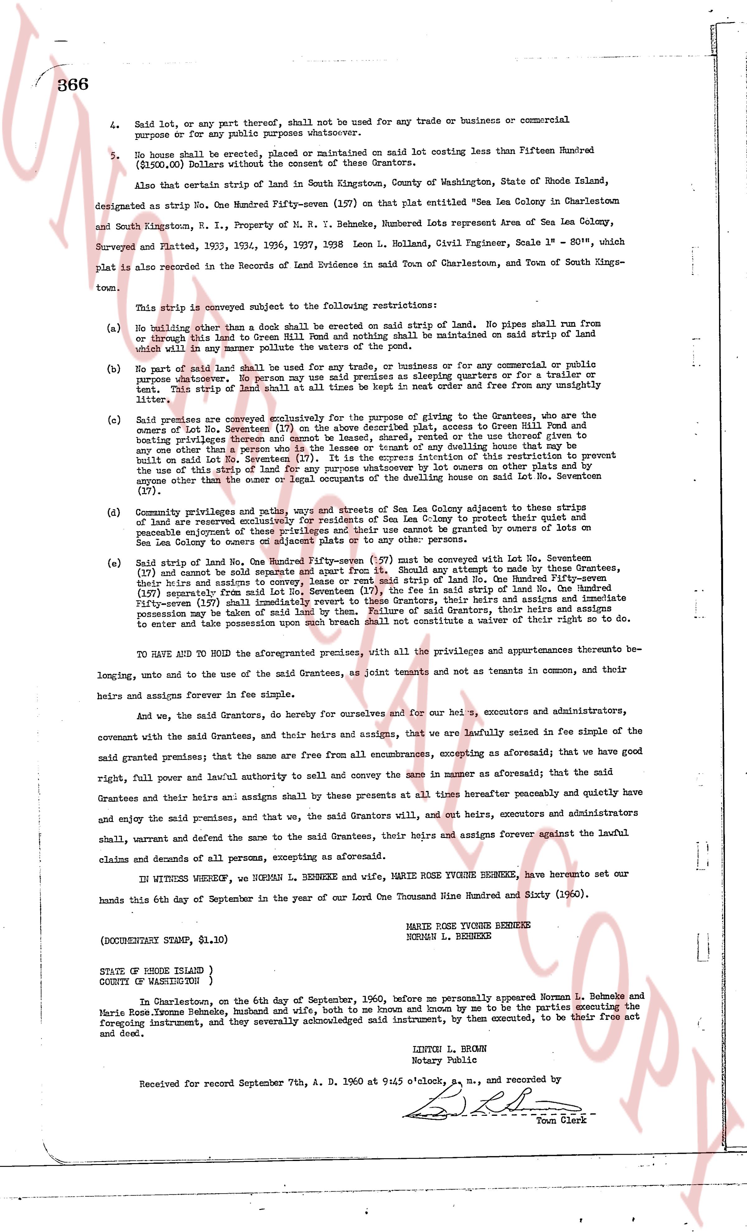
KNOW ALL MEN BY THESE PRESENTS, that we, NORMAN L. BEHNEKE and wife, MARIE ROSE YVONNE BEHNEKE, of the Town of Charlestown, County of Washington and State of Rhode Island, hereinafter called the Grantors, in consideration of the sum of Ten ($10.00) Dollars to us paid by PRESCOTT W. ROSE and MARION S. ROSE, his wife, both of the Town of West Warwick, County of Kent and State of Rhode Island, the receipt whereof is hereby acknowledged, do give, grant, bargain, sell and convey unto the said Grantees as joint tenants and not as tenants in common, and their heirs and assigns forever in fee simple:
That certain tract of land in Charlestown, Washington County, Rhode Island, designated as Lot No. Seven(7) on that plat marked "Proposed Subdivision of the former Lee Colony in Charlestown, R. I., Property of N. R. Behneke, Huberts Representative Agent of Sea Lon Colony, Surveyed and Platted 3530, Leon L. Palmer, Chief Surveyor" with scale 1" = 80', which plat is recorded in the Records of Land Evidence in the Town of Charlestown.
This conveyance is made subject to the following restrictions binding upon the said Grantees, their heirs and assigns:
1. Only one private one-family residence and a private garage shall be erected, placed, maintained or permitted upon said lot, or any part thereof, and no part or any building, including porches shall come nearer than twenty (20) feet from Street or nearer than five (5) feet from the south, east and north lines.
2. No garage shall be used as a residence unless it costs the minimum cost of the residence to be erected on said lot, and no tents and no auto trailers shall be erected, placed or maintained on said premises.
3. All toilets and sink drains on said lot shall be connected with cesspools or septic tanks so placed as not to pollute or endanger any drinking water supply, nor to pollute the waters along the shore of this plat.
page 2 · read by Gemma vision
4. Said lot, or any part thereof, shall not be used for any trade or business or commercial purpose or for any other purposes whatsoever.
5. No house shall be erected, placed or maintained on said lot costing less than Fifteen Hundred ($1500.00) Dollars without the consent of these Grantors.
Also that certain strip of land in South Kingstown, County of Washington, State of Rhode Island, designated as strip No. One Hundred Fifty-seven (157) on that plat entitled "Sea Lea Colony in Charlestown and South Kingstown, R. I., Property of N. R. Behneke, Number Lots Represent area of Sea Lea Colony, Surveyed and Platted, 1933, 1934, 1936, 1937, 1938 Leon L. Holland, Civil Engineer, Scale 1" = 80'", which plat is also recorded in the Records of Land Evidence in void Main of Charlestown, and Town of South Kingstown.
This [?] colony is subject to the following restrictions:
(a) No building other than a dock shall be erected on said strip of land. No pipes shall run from or through this land to Green Hill Pond and nothing shall be maintained on said strip of land and water which in any manner pollutes said pond.
(b) No part of said land shall be used for any trade, or business or for any commercial or public purpose whatsoever. No person may use said premises as sleeping quarters or for a trailer or tent. No strip of said land shall be used as a dump site and free from any nuisance or unsightly litter.
(c) Said premises are conveyed exclusively for the purpose of giving the Grantees, who are the owners of lot No. Seventeen (17) on the above described plat, access to Green Hill Pond and boating privileges thereon and cannot be leased, rented, used or the title given away to any other person but the grantees and their heirs or owning dealers that have a first right to build on said lot No. Seventeen (17). It is the express intention of this restriction to prevent the use of this strip of land for any purpose other than its use by owners on other plats within the colony except other than the user or local occupants of the dwelling house on said lot No. Seventeen (17).
(d) Immediately privately and pathways, piers and streets of the Sea Lea Colony adjacent to these strips of land are reserved exclusively for residents of Sea Lea Colony to protect their quiet and peaceful enjoyment of land and water. These strips of land cannot be acquired by owners of lots on Sea Lea Colony or conveyed to owners on adjacent plats or to any other persons.
(e) Said strip of land No. One Hundred Fifty-seven (157) must be conveyed with lot No. Seventeen (17) and cannot be sold separate and apart from it. Should this occur it must be done by the Grantees, their heirs and assigns and subject to the restriction that lot No. One Hundred Fifty-seven (157) separately from said lot No. Seventeen (17), the fee in said strip of land No. One Hundred Fifty-seven (157) shall automatically revert to the Grantors, their heirs and assigns and immediate possession may be taken by said lot of them. Failure of said Grantors, their heirs and assigns to enter and take possession upon such breach shall not constitute a waiver of their right so to do.
TO HAVE AND TO HOLD the aforesaid premises, with all the privileges and appurtenances therunto belonging, unto and to the use of the said Grantees, as joint tenants and not as tenants in common, and their heirs and assigns forever in fee simple.
And we, the said Grantors, for ourselves and for our heirs, executors and administrators, covenant with the said Grantees, and their heirs and assigns, that we are lawfully seised in fee simple of the said granted premises; that the same are free from all encumbrances, excepting as aforementioned; that we have good right, full power and lawful authority to sell and convey the same in manner as aforementioned; that the said Grantees and their heirs and assigns shall by these presents at these and all times hereafter peaceably and quietly have and enjoy the said premises, and that we, the said Grantors will, and our heirs, executors and administrators shall, warrant and defend the same to the said Grantees, their heirs and assigns forever against the lawful claims and demands of all persons, except as aforementioned.
IN WITNESS WHEREOF, we NORMAN L. BEHNEKE and, MARIE ROSE YVONNE BEHNEKE, hereunto set our hands this 6th day of September in the year of our Lord Two Thousand Nine Hundred and Sixty (1960).
MARIE ROSE YVONNE BEHNEKE
NORMAN L. BEHNEKE
(DOCUMENTARY STAMP, $1.10)
STATE OF RHODE ISLAND }
COUNTY OF WASHINGTON }
In Charlestown, on the 6th day of September, 1960, before me personally appeared Norman L. Behneke and Marie Rose Yvonne Behneke, husband and wife, both to me known and by me to be the parties executing the foregoing instrument, and they severally acknowledged said instrument, by them executed, to be their free act and deed.
LINTON L. BROWN
Notary Public
Received for record September 7th, A. D. 1960 at 9:45 o'clock, a. m., and recorded by
[Signature]
Town Clerk
The page as recorded