The instrument's own words
page 1 · read by Gemma vision
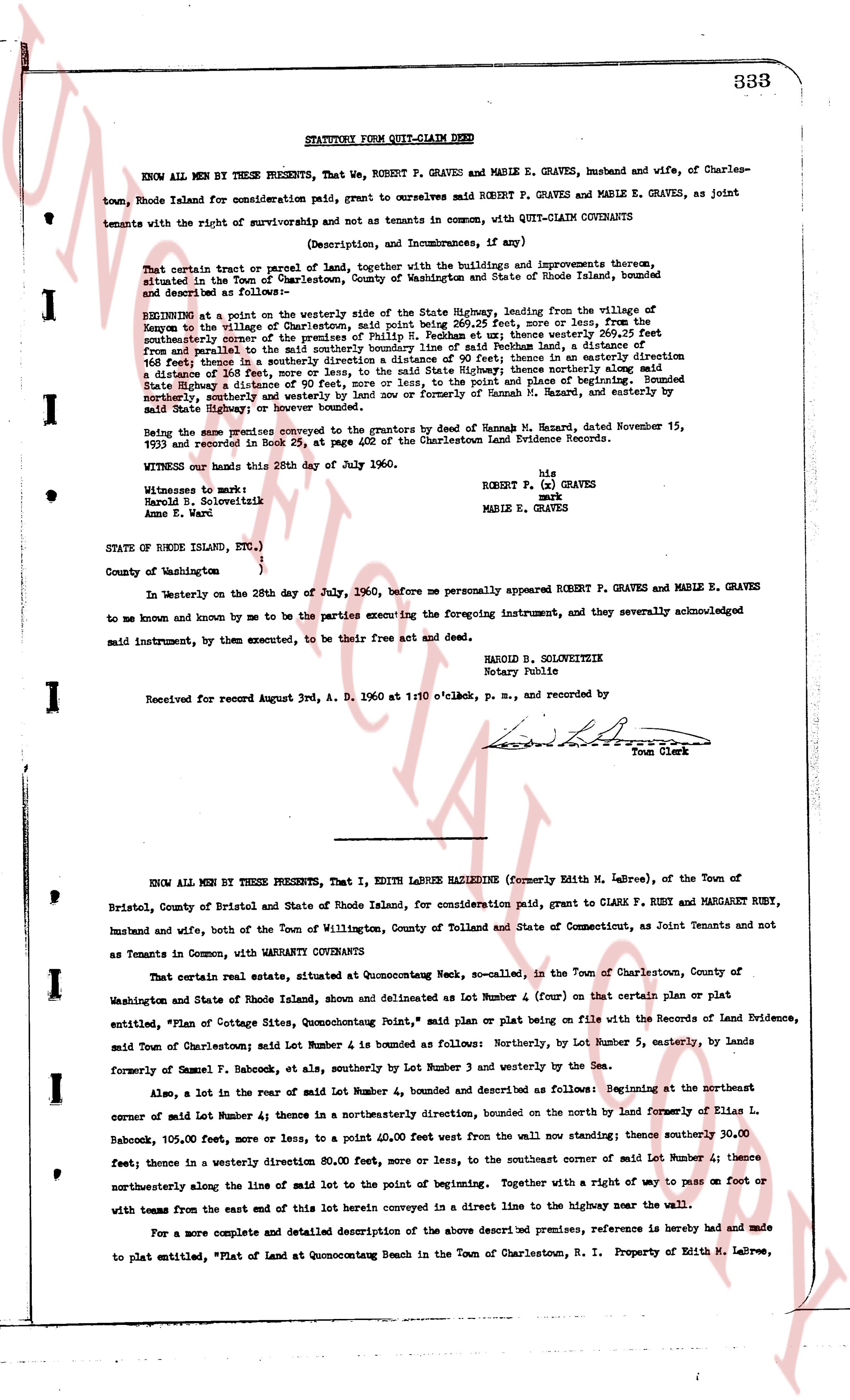
333
STATUTORY FORM QUIT-CLAIM DEED
KNOW ALL MEN BY THESE PRESENTS, That We, ROBERT P. GRAVES and MABLE E. GRAVES, husband and wife, of Charlestown, Rhode Island for consideration paid, grant to ourselves said ROBERT P. GRAVES and MABLE E. GRAVES, as Joint tenants with the right of survivorship and not as tenants in common, with QUIT-CLAIM COVENANTS
(Description, and Incumbrances, if any)
That certain tract or parcel of land, together with the buildings and improvements thereon, situated in the Town of Charlestown, County of Washington and State of Rhode Island, bounded and described as follows:
Beginning at a point on the westerly side of the State Highway, leading from the village of Quonochontaug in the village of Charlestown, said point being 26 1/2 feet, more or less, from the center of the Highway to the westerly side of the Highway; thence southerly 200 feet and thence southerly the center of the southerly boundary line of said Rochland land, a distance of 100 feet; thence in a southerly direction a distance of 90 feet; thence in a southeasterly direction a distance of 100 feet; thence in a southerly direction a distance of 100 feet; thence northerly along said State Highway a distance of 90 feet, more or less, to the point and place of beginning. Bounded northerly, southerly and westerly by the State Highway now and formerly of Hannah H. Hazard, and easterly by said State Highway or however bounded.
Being the same land conveyed to the grantors by the deed of Hannah H. Hazard, dated November 15, 1903 and recorded in book 23, at page 406 of the Charlestown Land Evidence Records.
Witness our hands this 20th day of July 1960.
Witnesses to mark:
Harold B. Solweiztik
Anne E. Ward
(ls)
ROBERT P. (x) GRAVES
mark
MABLE E. GRAVES
STATE OF RHODE ISLAND, ETC.,)
)
County of Washington )
In Westerly on the 28th day of July, 1960, before me personally appeared ROBERT P. GRAVES and MABLE E. GRAVES to me known and known by me to be the parties executing the foregoing instrument, and they severally acknowledged said instrument, by them executed, to be their free act and deed.
HAROLD B. SOLWEIZTIK
Notary Public
Received for Record Aug 3d, A. D. 1960 at 11:10 o'clock, p. m., and recorded by
(ls)
Town Clerk
----
KNOW ALL MEN BY THESE PRESENTS, That I, EDITH LABREE HAZLEDINE (formerly Edith M. Labree), of the Town of Bristol, County of Bristol and State of Rhode Island, for consideration paid, grant to CLARK F. RUBY and MARGARET RUBY, husband and wife, both of the Town of Willington, County of Tolland and State of Connecticut, as Joint Tenants and not as Tenants in Common, with WARRANTY COVENANTS
That certain real estate, situated at Quonochontaug Neck, so-called, in the Town of Charlestown, County of Washington and State of Rhode Island, shown and delineated as Lot Number 4 (four) on that certain plan or plat entitled, "Plan of Cottage Sites, Quonochontaug Point," said plan or plat being on file with the Records of Land Evidence, said Town of Charlestown; said Lot Number 4 is bounded as follows: Northerly, by Lot Number 5, easterly, by Lands formerly of Samuel F. Babcock, et als, southerly by Lot Number 3 and westerly by the Sea.
Also, a lot in the rear of said Lot Number 4, bounded and described as follows: Beginning at the northeast corner of said Lot Number 4; thence in a northeasterly direction, bounded on the north by Land formerly of Eise L. Babcock, 105.00 feet, more or less, to a point 40.00 feet west from the wall now standing; thence southerly 30.00 feet; thence in a westerly direction 80.00 feet, more or less, to the southeast corner of said Lot Number 4; thence northeasterly along the line of said lot to the point of beginning. Together with a right of way to pass on foot or with teams from the east end of this lot herein conveyed in a direct line to the highway near the wall.
For a more complete and detailed description of the above described premises, reference is hereby made and made to plat entitled, "Plat of Land at Quonochontaug Beach in the Town of Charlestown, R. I. Property of Edith M. Labree,
page 2 · read by Gemma vision
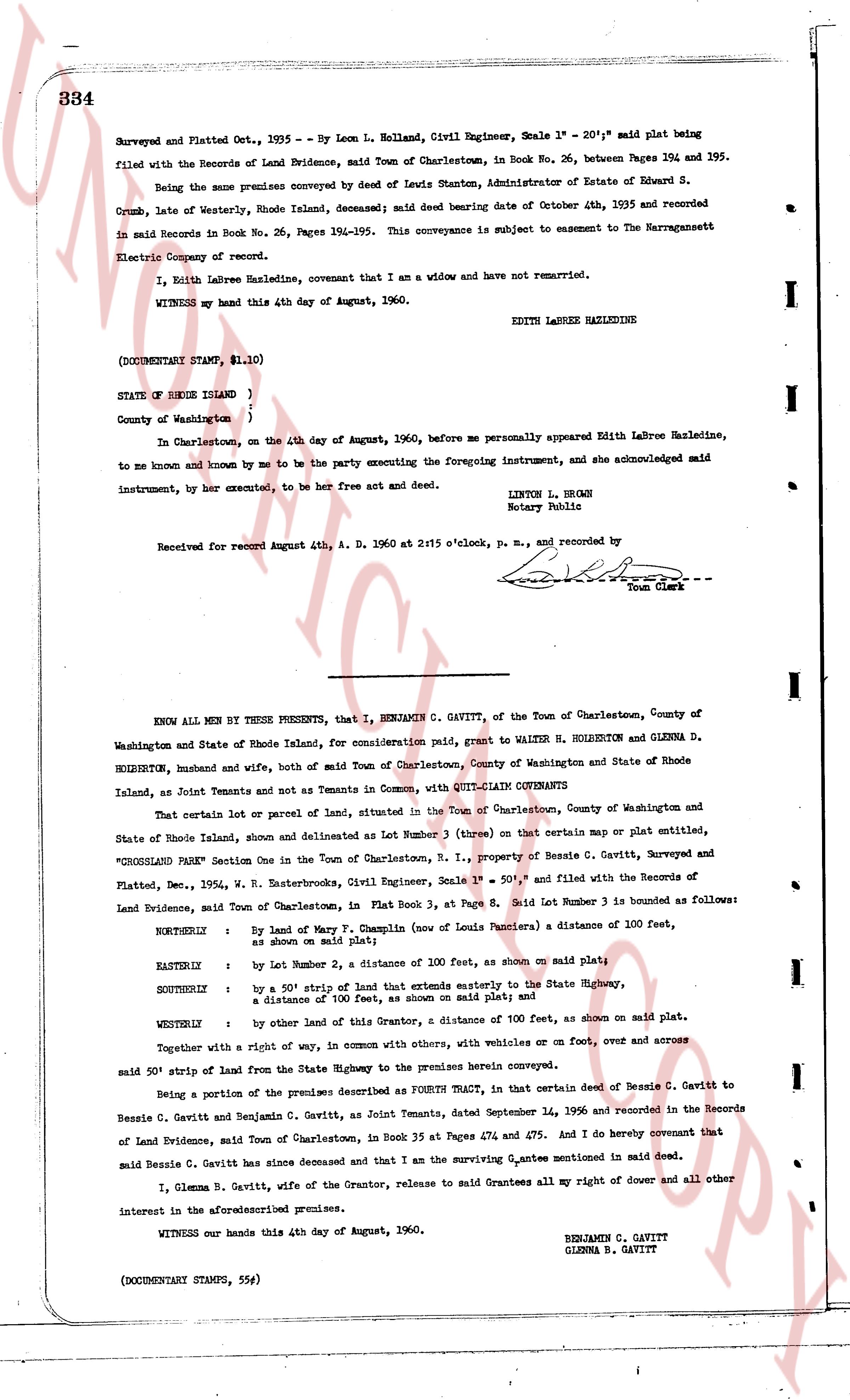
334
Surveyed and Platted Oct., 1935 - By Leon L. Holland, Civil Engineer, Scale 1" = 20"; said plat being filed with the Records of Land Evidence, said Town of Charlestown, in Book No. 26, between Pages 354 and 395.
Being the same premises conveyed by deed of Louis Stanton, Administrator of Estate of Edward S. Grumb, Late of Westerly, Rhode Island, deceased; said deed bearing date of October 4th, 1935 and recorded in said Record in Book No. 26, Pages 194-195. This conveyance is subject to easement to the Narragansett Electric Company of record.
I, Edith Labree Hazledine, covenant that I am a widow and have not remarried.
WITNESS my hand this 4th day of August, 1960. EDITH LABREE HAZLEDINE
(DOCUMENTARY STAMP, $1.10)
STATE OF RHODE ISLAND )
County of Washington )
In Charlestown, on the 4th day of August, 1960, before me personally appeared Edith Labree Hazledine, to me known and known by me to be the party executing the foregoing instrument, and she acknowledged said instrument, by her executed, to be her free act and deed. LITERON L. BROWN
Notary Public
Received for record August 4th, A. D. 1960 at 2:15 o'clock, p. m., and recorded by
[signature] Town Clerk
----
KNOW ALL MEN BY THESE PRESENTS, that I, BENJAMIN G. GAVITT, of the Town of Charlestown, County of Washington and State of Rhode Island, for consideration paid, grant to WALTER H. HOLBERTON and GLENNA D. HOLBERTON, husband and wife, both of said Town of Charlestown, County of Washington and State of Rhode Island, as Joint Tenants and not as Tenants in Common, with QUITCLAIM COVENANTS
That certain lot or parcel of land, situated in the Town of Charlestown, County of Washington and State of Rhode Island, shown and delineated as Lot Number 3 (three) on that certain map or plat entitled, "CROSSLAND PARK Section One in the Town of Charlestown, R. I., property of Bessie C. Gavitt, Surveyed and Platted, Dec., 1954, W. R. Easterbrook, Civil Engineer, Scale 1" = 50'", and filed with the Records of Land Evidence, said Town of Charlestown, in Book 31, Page 8. Said Lot Number 3 is bounded as follows:
NORTHERLY : By land of Mary T. Champin (now of Louis Panciare) a distance of 100 feet, as shown on said plat;
EASTERLY : by Lot Number 2, a distance of 100 feet, as shown on said plat;
SOUTHERLY : by a 50' strip of land that extends easterly to the State Highway, a distance of 100 feet, as shown on said plat; and
WESTERLY : by other land of this Grantor, a distance of 100 feet, as shown on said plat.
Together with a right of way, in common with others, with vehicles or on foot, over and across
said 50' strip of land from the State Highway to the premises herein conveyed.
Being a portion of the premises described as FOURTH TRACT, in that certain deed of Bessie C. Gavitt to Bessie C. Gavitt and Benjamin C. Gavitt, as Joint Tenants, dated September 14, 1956 and recorded in the Records of Land Evidence, said Town of Charlestown, in Book 35 at Pages 474 and 475. And I do hereby covenant that said Bessie C. Gavitt has since deceased and that I am the surviving Grantee mentioned in said deed.
I, Glenna B. Gavitt, wife of the Grantor, release to said Grantees all my right of dower and all other interest in the aforesaid premises.
WITNESS our hands this 4th day of August, 1960. BENJAMIN G. GAVITT
GLENNA B. GAVITT
(DOCUMENTARY STAMPS, 55¢)
The page as recorded