The instrument's own words
page 1 · read by Gemma vision
319
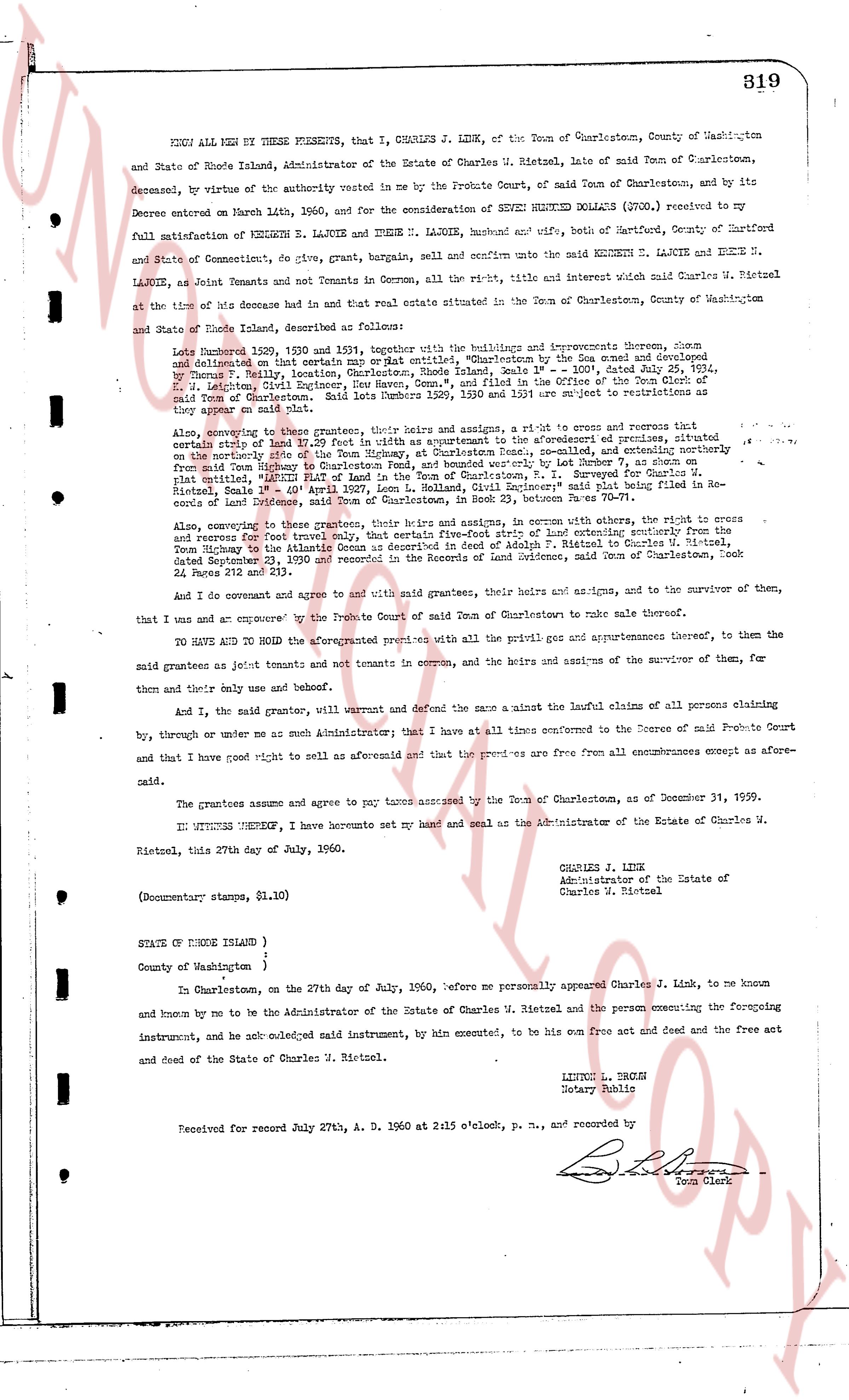
KNOW ALL MEN BY THESE PRESENTS, that I, CHARLES J. LINK, of the Town of Charlestown, County of Washington and State of Rhode Island, Administrator of the Estate of Charles W. Rietzel, late of said Town of Charlestown, deceased, by virtue of the authority vested in me by the Probate Court, of said Town of Charlestown, and by its Decree entered on March 4th, 1960, and for the consideration of SEVEN HUNDRED DOLLARS ($700) received by me full satisfaction of KENNETH E. LAJOIE and IRENE N. LAJOIE, husband and wife, both of Hartford, County of Hartford and State of Connecticut, do give, grant, bargain, sell and confirm unto the said KENNETH E. LAJOIE and IRENE N. LAJOIE, as Joint Tenants and not Tenants in Common, all the right, title and interest which said Charles W. Rietzel attained of the time of his decease had in that real estate situated in the Town of Charlestown, County of Washington and State of Rhode Island, described as follows:
Lots numbered 1529, 1530 and 1531, together with the buildings and improvements thereon, being and delineated on that certain map or Plat entitled, "Map of the area enclosed by the [?] Scale 1" = 100', dated July 29, 1954, by George S. Kelly, Registered Surveyor, Rhode Island, Scale 1" = 100', dated July 29, 1954, S. M. Leighton, Civil Engineer, Rye New Hampshire, and filed in the Office of the Town Clerk of the said Town of Charlestown, Rhode Island, on July 29, 1954, and as they appear or are subject to the easements as they appear on said plat.
Also, conveying to the grantees, their heirs and assigns, a right-of-way and access to reserves and certain rights to use and have up to 20 feet in width as appurtenant to the aforementioned premises, situated north of the northerly side of the Tom Highway, at Charlestown Rhode Island, and extending northerly from the northerly side of the Tom Highway to the northerly boundary of Lot 1531, recorded July 29, 1954, in Plat entitled, "RIETZEL PLAT of Land in the Town of Charlestown, R. I." Surveyed for Charles W. Rietzel, Rhode Island, by George S. Kelly, Registered Surveyor, Rhode Island's said plat being filed in Records of Land Evidence, said Town of Charlestown, in Book 77, between Pages 70-71.
Also, conveying to the grantees, their heirs and assigns, in common with others, a right-of-way and easement for access to and reserves for travel and transport of materials, from the Tom Highway, and extending northerly from the Tom Highway to the Atlantic Ocean as described in deed of Adolph F. Rietzel to Charles W. Rietzel, dated September 23, 1939 and recorded in the Records of Land Evidence, said Town of Charlestown, Book 42, Page 219 and 220.
And I do covenant and agree to and with said grantees, their heirs and assigns, to the survivor of them, that I do use and an empowered by the Probate Court of said Town of Charlestown to make sale thereof.
TO HAVE AND TO HOLD the aforementioned premises with all the priviliges and appurtenances thereof, to the said grantees as joint tenants and not tenants in common, and the heirs and assigns of the survivor of them, for them and their only use and benefit.
And I, the said grantor, will warrant and defend the same against the lawful claims of all persons claiming by, through or under me as such Administrator; that I have at all times entered to the Decree of said Probate Court and that I have good right to sell as aforesaid and that the premises are free from all encumbrances except as aforesaid.
The grantees assume and agree to pay taxes assessed by the Town of Charlestown, as of December 31, 1959.
IN WITNESS WHEREOF, I have hereunto set my hand and seal as the Administrator of the Estate of Charles W. Rietzel, this 27th day of July, 1960.
CHARLES J. LINK
Administrator of the Estate of
Charles W. Rietzel
(Documentary stamps, $1.10)
STATE OF RHODE ISLAND )
County of Washington )
In Charlestown, on the 27th day of July, 1960, before me personally appeared Charles J. Link, to me known and known by me to be the Administrator of the Estate of Charles W. Rietzel and the person executing the foregoing instrument, and he acknowledged said instrument, by hin executed, to be his act and deed and the free act and deed of the Estate of Charles W. Rietzel.
LINDA L. BROWN
Notary Public
Received for record July 27th, A. D. 1960 at 2:15 o'clock, p. m., and recorded by
[Signature]
Town Clerk
The page as recorded