The instrument's own words
page 1 · read by Gemma vision
288
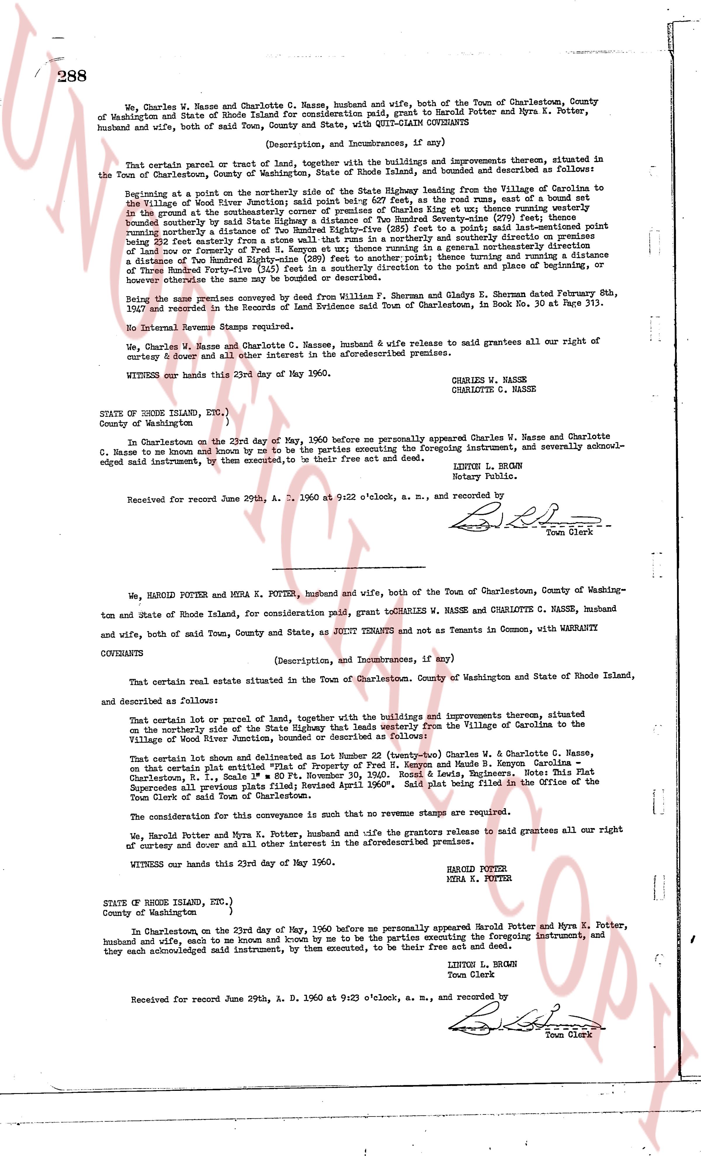
We, Charles W. Nasse and Charlotte C. Nasse, husband and wife, both of the Town of Charlestown, County of Washington and State of Rhode Island for consideration paid, grant to Harold Potter and Myra K. Potter, husband and wife, both of said Town, County and State, with QUIT-CLAIM COVENANTS
(Description, and Improvements, if any)
That certain parcel or tract of land, together with the buildings and improvements thereon, situated in the Town of Charlestown, County of Washington, State of Rhode Island, bounded and described as follows:
Beginning at a point on the northerly side of the State Highway leading from the Village of Carolina to the Village of Wood River, town of Charlestown, at the intersection of the road way, and running westerly in the ground on the southerly intersection corner of premises of Charles King et ux; thence running westerly bounded northerly by a tract of land conveyed to George S. Gonsalves (see Book 30 at Page 313) running southerly a distance of Two Hundred Eighty-five (285) feet to a point, said last-mentioned point being southerly a distance of 230 feet westerly from the northerly line of premises of Fred H. Kenyon et ux; thence running in a generally northeasterly direction a distance of Two Hundred Eighty-five (285) feet to a point, said point being southerly a distance of Two Hundred Thirty (230) feet (5) feet in a generally southerly direction to the point and place of beginning, or otherwise the same may be bounded or described.
being the same premises conveyed by deed from William F. Sherman and Gladys E. Sherman dated February 8th, 1937 and recorded in the Record of Land Evidence said Town of Charlestown, in Book No. 30 at Page 313.
No Internal Revenue Stamps were required.
We, Charles W. Nasse and Charlotte C. Nasse, husband & wife release to said grantees all our right of curtesy & dower and all other interest in the aforementioned premises.
WITNESS our hands this 23rd day of May 1960.
CHARLES W. NASSE
CHARLOTTE C. NASSE
STATE OF RHODE ISLAND, ETC.)
County of Washington )
In Charlestown on the 23rd day of May, 1960 before me personally appeared Charles W. Nasse and Charlotte C. Nasse to me known and known by me to be the parties executing the foregoing instrument, and severally acknowledged said instrument, by them executed, to be their free act and deed.
LINTON L. BROWN
Notary Public.
Received for record June 29th, A. D. 1960 at 9:22 o'clock, a. m., and recorded by [signature]
Town Clerk
----
We, HAROLD POTTER and MYRA K. POTTER, husband and wife, both of the Town of Charlestown, County of Washington and State of Rhode Island, for consideration paid, grant to CHARLES W. NASSE and CHARLOTTE C. NASSE, husband and wife, both of said Town, County and State, as JOINT TENANTS and not as Tenants in Common, with WARRANTY COVENANTS
(Description, and Improvements, if any)
That certain real estate situated in the Town of Charlestown, County of Washington and State of Rhode Island, and described as follows:
That certain real estate lot or parcel of land, together with the buildings and improvements thereon, situated on the northerly side of the State Highway that leads westerly from the Village of Carolina to the Village of Wood River jurisdiction, bounded or described as follows:
That certain lot shown and delineated as Lot Number 20 (twenty-two) Charles W. & Charlotte C. Nasse, on that certain plat entitled "Plan of Lands of Fred H. Kenyon and Maude B. Kenyon Carolina Charlestown, R. I., Scale 1" = 80' Pt November 30, 1950." Roebls & Verbins, Notaries. This Plat superseded all previous plats and was recorded April 1960". said plat being filed in the Office of the Town Clerk of said Town of Charlestown.
The consideration for this conveyance is such that no revenue stamps are required.
We, Harold Potter and Myra K. Potter, husband and wife the grantors release to said grantees all our right of curtesy and dower and all other interest in the aforementioned premises.
WITNESS our hands this 23rd day of May 1960.
HAROLD POTTER
MYRA K. POTTER
STATE OF RHODE ISLAND, ETC.)
County of Washington )
In Charlestown on the 23rd day of May, 1960 before me personally appeared Harold Potter and Myra K. Potter, husband and wife, each to me known and known by me to be the parties executing the foregoing instrument, and they each acknowledged said instrument, by them executed, to be their free act and deed.
LINTON L. BROWN
Town Clerk
Received for record June 29th, A. D. 1960 at 9:23 o'clock, a. m., and recorded by [signature]
Town Clerk
The page as recorded