The instrument's own words
page 1 · read by Gemma vision
284
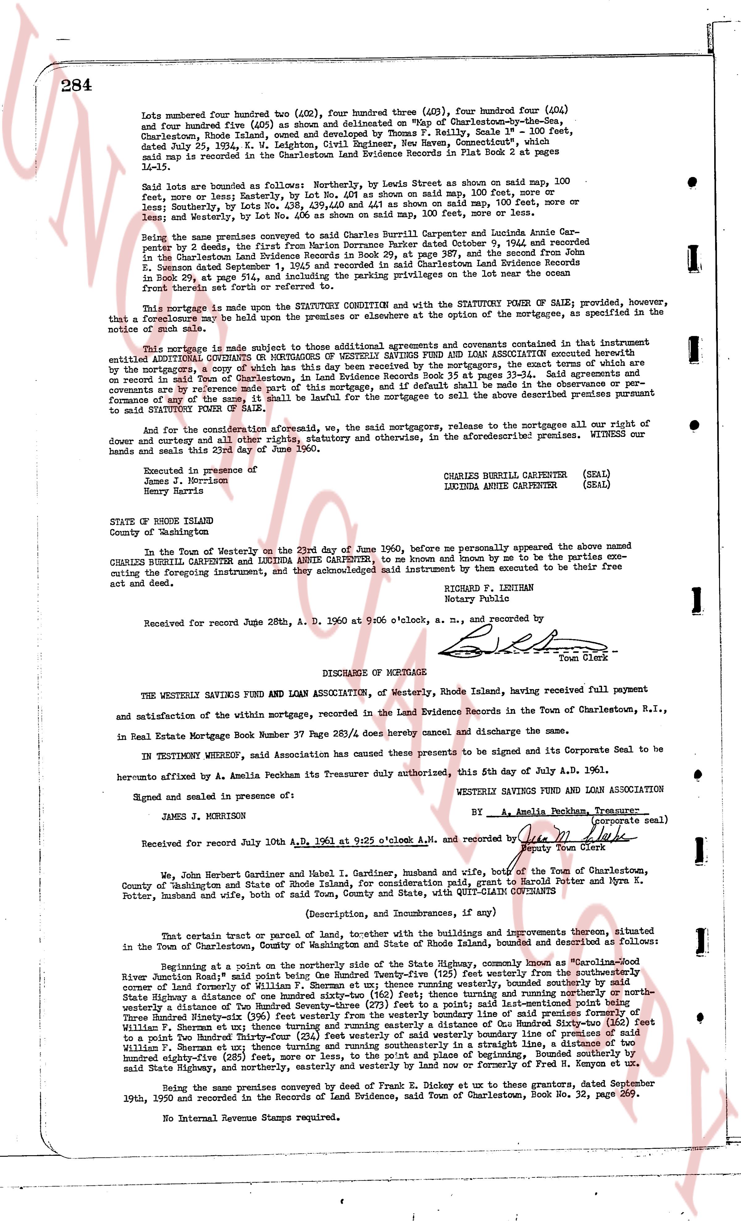
Lots numbered four hundred two (402), four hundred three (403), four hundred four (404)
and four hundred five (405) as shown and delineated on "Map of Charlestown-by-the-Sea,
Charlestown, Rhode Island" signed by surveyor F. Reilly, Scale 1" = 100 feet,
dated July 25, 1924, K. W. Leighton, Civil Engineer, New Haven, Connecticut", which
said map is recorded in the Charlestown Land Evidence Records in Book 43 at pages
14-15.
Said lots are bounded as follows: Lot four hundred two is bounded on said map, 100 feet,
more or less, northerly by Lot no. 401; by Lot no. 403 as shown on said map, 100 feet, more or
less, southerly by Lot no. 406; and westerly by Lot no. 404 as shown on said map, 100 feet, more or
less, and easterly by Lot no. 401 as shown on said map, 100 feet, more or less.
Being the same premises conveyed to Charles Herbert Carpenter and Lucinda Annie Car-
penter by deed, the first part by deed from Marion Dorrance Parker dated October 9, 1962 and
recorded in the Charlestown Land Evidence Records in Book 29, at page 387 and the second
part conveyed by deed from Marion Dorrance Parker to Charles Herbert Carpenter Land Evidence
Records in Book 29, at page 914, and including the preaching properties on the lot near the ocean
front as described in said first deed.
This mortgage is made upon the STATUTORY CONDITION and with the STATUTORY POWER OF SALE; provided, however,
that a foreclosure may be held upon the premises and or elsewhere at the option of the mortgagees, as specified in the
note.
This mortgage is made subject to those additional agreements and covenants contained in that
additional CONDITIONAL COVENANT or MORTGAGE OF WESTERLY SAVINGS FUND AND LOAN ASSOCIATION connected
herewith by a certain Assignment of Mortgage dated June 23, 1960, which Assignment of Mortgage is
on record in said Town of Charlestown, in Land Evidence Records Book 35 at pages 33-34. Said agreements and
covenants are hereby made a part of this mortgage and shall be binding on the mortgagor and his heirs in the
performance of any of the same, it shall be lawful for the mortgagee to sell the above described premises pursuant
to said STATUTORY POWER OF SALE.
And for the consideration aforesaid, we, the said mortgagors, release to the mortgagees all our right of
dowry, curtesy and all other rights, statutory and otherwise, in the aforementioned premises. WITNESS our
hands and seals this 23rd day of June 1960.
Executed in presence of
James J. Morrison
Henry Harris
CHARLES HERBERT CARPENTER (SEAL)
LUCINDA ANNIE CARPENTER (SEAL)
STATE OF RHODE ISLAND
County of Washington
In the Town of Westerly on the 23rd day of June 1960, before me personally appeared the above named
CHARLES HERBERT CARPENTER and LUCINDA ANNIE CARPENTER, to me known by and known to me to be the parties ex-
cuting the foregoing instrument, and they acknowledged said instrument by them executed to be their free
act and deed.
RICHARD F. LEIGHTON
Notary Public
Received for record June 28th, A. D. 1960 at 9:00 o'clock a.m., and recorded by
[Signature]
Town Clerk
----
DISCHARGE of MORTGAGE
THE WESTERLY SAVINGS FUND AND LOAN ASSOCIATION, of Westerly, Rhode Island, having received full payment
and satisfaction of the within mortgage, recorded in the Land Evidence Records in the Town of Charlestown, R.I.,
in Real Estate Mortgage Record Book 37 Page 284/dvs hereby cancels and discharge the same.
IN TESTIMONY WHEREOF, said Association has caused the presents to be signed and its Corporate Seal to be
hereto affixed by A. Amelia Pechakan its Treasurer duly authorized this, 5th day of July A.D. 1961.
Signed and sealed in presence of:
WESTERLY SAVINGS FUND AND LOAN ASSOCIATION
JAMES J. MORRISON
By A. Amelia Pechakan, Treasurer (corporate seal)
Received for record July 10th A.D. 1961 at 9:25 o'clock A.N. and recorded by
[Signature]
Deputy Town Clerk
We, John Herbert Gardiner and Mabel I. Gardiner, Husband and wife, both of the Town of Charlestown,
County of Washington and State of Rhode Island, for consideration, paid grant to Harold P. Potter and Myra K.
Potter, Husband and wife, both of said Town, County and State, with QUIT-CLAIM GRANTED
(Description, and Dimensions, and Improvements), as follows:
That certain parcel of land, together with the buildings and improvements thereon, situated
in the Town of Charlestown, County of Washington and State of Rhode Island, bounded and described as follows:
Beginning at a point on the northerly side of the State Highway, commonly known as "Charlestown-
Rhode River Junction road" said point being One Hundred Twenty-five (125) feet westerly from the southwesterly
corner land formerly of Silas S. & Sarah A. Moore; thence northerly, westerly bounded, 100 feet, more or less, to the
State Highway a distance of One hundred sixty-two (162) feet thence turning and running northerly or northwesterly
a distance of One hundred twenty-five (125) feet to the westerly boundary line of said premises formerly of
Silas S. & Sarah A. Moore; thence running easterly, 100 feet, more or less, to the easterly boundary line of said premises
to a point One Hundred Twenty-four (124) feet westerly of said westerly boundary line of premises of said
Silas S. & Sarah A. Moore; thence running southerly, 100 feet, more or less, to the State Highway; thence running south-
easterly one hundred eighty-five (185) feet, more or less, to the point of and place of beginning, Bounded southerly by
said State Highway, and northerly, easterly and westerly by land now or formerly of Fred H. Kenyon et al.
Being the same premises conveyed by deed of Frank D. Olney at the same date and in these same premises September
19th, 1950 and recorded in the Records of Land Evidence, said town of Charlestown, Book No. 32, page 269.
No Internal Revenue Stamps required.
page 2 · read by Gemma vision
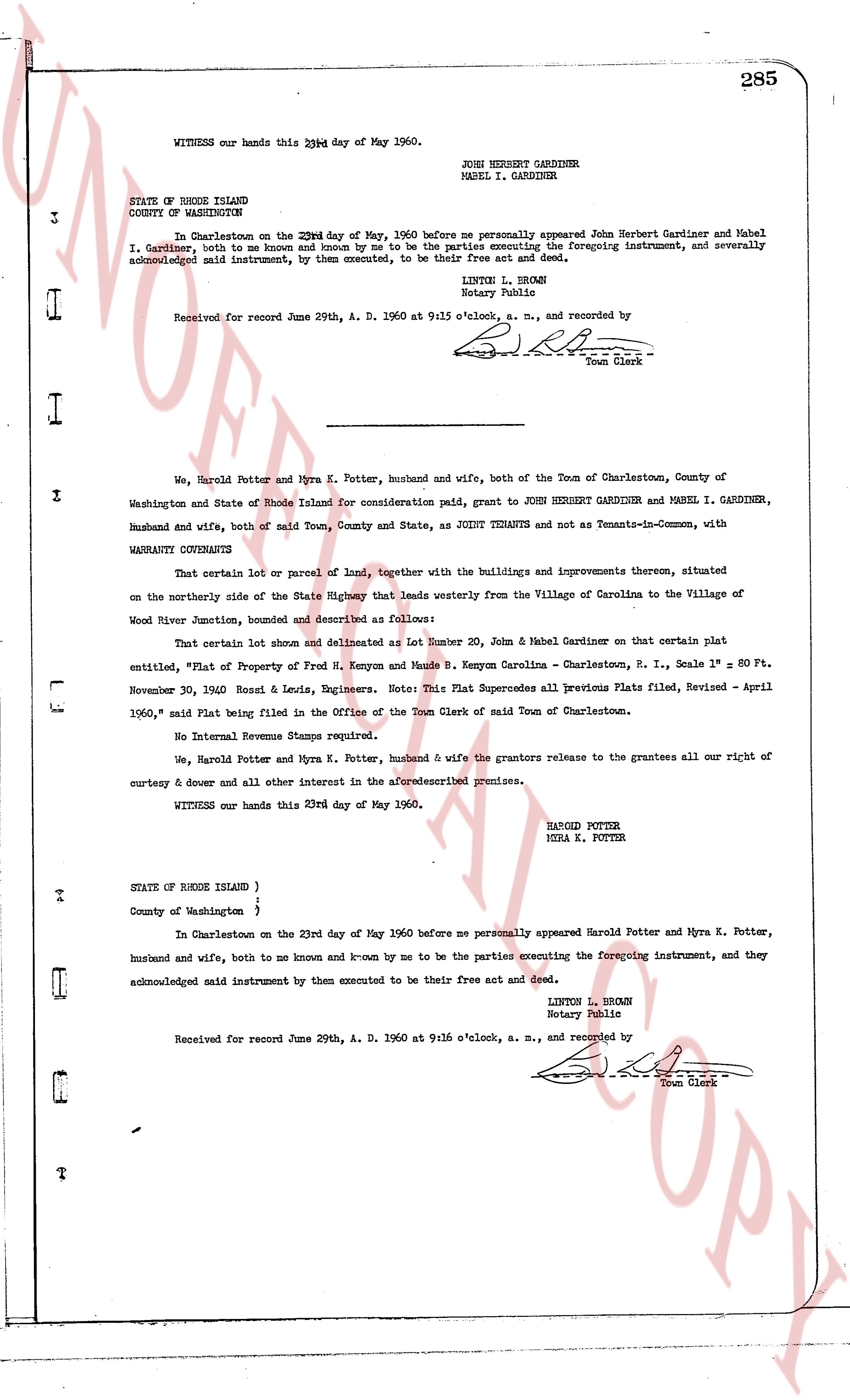
WITNESS our hands this 23rd day of May 1960.
JOHN HERBERT GARDINER
MABEL I. GARDINER
STATE OF RHODE ISLAND
COUNTY OF WASHINGTON
In Charlestown on the 23rd day of May, 1960 before me personally appeared John Herbert Gardiner and Mabel I. Gardiner, both to me known and known by me to be the parties executing the foregoing instrument, and severally acknowledged said instrument, by them executed, to be their free act and deed.
LINTON L. BROWN
Notary Public
Received for record June 29th, A. D. 1960 at 9:15 o'clock, a. m., and recorded by
[Signature]
Town Clerk
We, Harold Potter and Myra K. Potter, husband and wife, both of the Town of Charlestown, County of
Washington and State of Rhode Island for consideration paid, grant to JOHN HERBERT GARDINER and MABEL I. GARDINER,
husband and wife, both of said Town, County and State, as JOINT TENANTS and not as Tenants-in-Common, with
WARRANTY COVENANTS
That certain lot or parcel of land, together with the buildings and improvements thereon, situated
on the northerly side of the State Highway that leads westerly from the Village of Carolina to the Village of
Wood River Junction, bounded and described as follows:
That certain lot shown and delineated as Lot Number 20, John & Mabel Gardiner on that certain plat
entitled, "Plat of Property of Fred H. Kenyon and Bessie B. Kenyon Carolina - Charlestown, R. I., Scale 1" = 80 Ft.
November 30, 1940 Bonsi & Lewis, Engineers. Note: This Plat Supersedes all previous Plats filed, Revised - April
1960," said Plat being filed in the Office of the Town Clerk of said Town of Charlestown.
No Internal Revenue Stamps required.
We, Harold Potter and Myra K. Potter, husband & wife the grantors release to the grantees all our right of
curtesy & dower and all other interest in the aforesaid premises.
WITNESS our hands this 23rd day of May 1960.
HAROLD POTTER
MYRA K. POTTER
STATE OF RHODE ISLAND }
County of Washington }
In Charlestown on the 23rd day of May 1960 before me personally appeared Harold Potter and Myra K. Potter,
husband and wife, both to me known and k-now by me to be the parties executing the foregoing instrument, and they
acknowledged said instrument by them executed to be their free act and deed.
LINTON L. BROWN
Notary Public
Received for record June 29th, A. D. 1960 at 9:16 o'clock, a. m., and recorded by
[Signature]
Town Clerk
The page as recorded