The instrument's own words
page 1 · read by Gemma vision
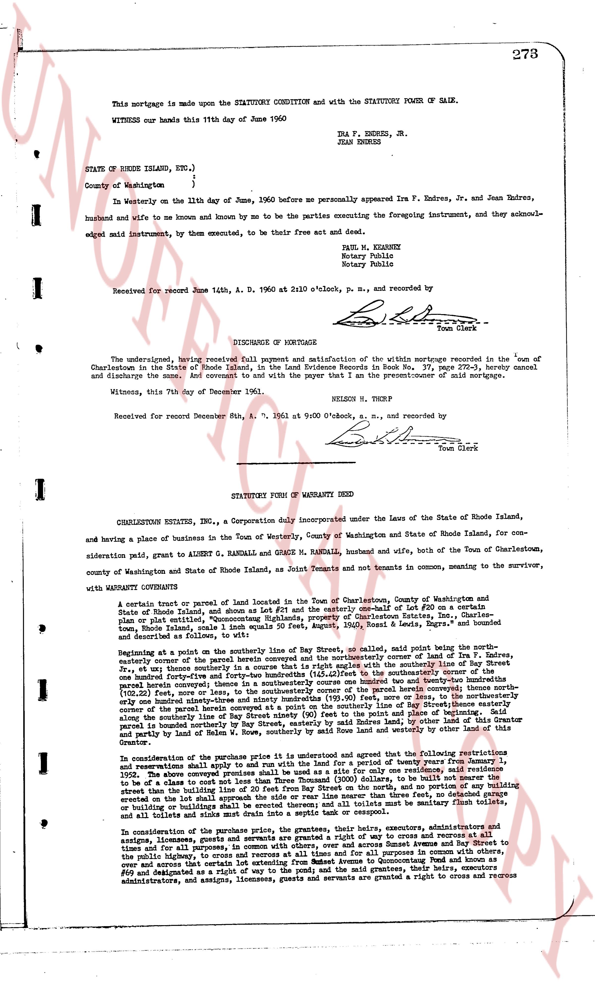
This mortgage is made upon the STATUTORY CONDITION and with the STATUTORY POWER OF SALE.
WITNESS our hands this 11th day of June 1960
IRA F. ENDRES, JR.
JEAN ENDRES
STATE OF RHODE ISLAND, ETC.)
County of Washington )
In Westerly on the 11th day of June, 1960 before me personally appeared Ira F. Endres, Jr. and Jean Endres, husband and wife to me known and by me to be the parties executing the foregoing instrument, and they acknowledged said instrument, by them executed, to be their free act and deed.
PAUL M. KEARNEY
Notary Public
Notary Public
Received for record June 14th, A. D. 1960 at 2x10 o'clock, p. m., and recorded by
[Signature] Town Clerk
----
DISCHARGE OF MORTGAGE
The undersigned, having received full payment and satisfaction of the within mortgage recorded in the town of Charlestown in the State of Rhode Island, in the Land Evidence Books in Book 37, page 273-3, hereby cancel and discharge the same. And covenant to and with the payer that I am the present owner of said mortgage.
Witness, this 7th day of December 1961.
NELSON H. THORP
Received for record December 8th, A. D. 1961 at 9:00 o'clock, a. m., and recorded by
[Signature] Town Clerk
----
STATUTORY FORM OF WARRANTY DEED
CHARLESTOWN ESTATES, INC., a Corporation duly incorporated under the Laws of the State of Rhode Island, and having a place of business in the Town of Westerly, County of Washington and State of Rhode Island, for consideration paid, grant to ALBERT G. RANDALL and GRACE M. RANDALL, husband and wife, both of the Town of Charlestown, county of Washington and State of Rhode Island, as Joint Tenants and not tenants in common, meaning to the survivor, with WARRANTY CONVEYANCE
A certain tract or parcel of land located in the Town of Charlestown, County of Washington and State of Rhode Island, and shown as Lot #21 and the easterly one-half of Lot #20 on a certain Plan or plat entitled, "Quonocutt Highlands property of Charlestown Estates, Inc.", Charles [?], Engineer, and described following: The boundaries are 1 inch equals 50 feet, August, 1960, Rossil & Lewis, Engrs. and bounded as follows:
Beginning at a point on the southerly line of Bay Street, as scaled, said point being the southeasterly corner of the parcel herein conveyed and the southeasterly corner of land of Ira F. Endres, easterly corner of the parcel herein conveyed the northerly boundary and with the southerly line of Bay Street, by a curve having a radius of 20 feet from the center of the curve, running easterly three feet, and then southerly one hundred forty-five and forty-two hundredths inches (145.42) feet to the southerly boundary of the parcel herein conveyed, thence running westerly one hundred forty-five and forty-two hundredths inches (145.42) feet, and then southerly twenty-three hundredths inches (102.22) feet, more or less, to the southerly corner of the parcel herein conveyed; thence southerly to the southerly boundary of the parcel herein conveyed, thence running easterly one hundred forty-five and forty-two hundredths inches (145.42) feet, or over and across the Bay Street, to the northeasterly corner of the parcel herein conveyed at the point on the southerly line of Bay Street, easterly along the previously mentioned curve to the point of beginning; the northerly boundary of the parcel herein conveyed is parcel bounded on northerly by Bay Street, easterly by said Endres land; by other land of this Grantor and partly by land of Helm W. Snow, southerly boundary is bounded by other land of this Grantor and partly by land of Helm W. Snow, southerly boundary is bounded by other land of this Grantor.
In consideration of the purchase price the grantor, its successors and assigns, agree and that the following restrictions and reservations shall apply to and run with the land for a period of twenty three years from anniversary January 1, 1962. The above conveyed premises shall be used as a site for only one residence, said residence to be of a class to cost not less than $10,000.00 exclusive of land, garage, or bath house, to be built at least twenty feet from the building line of the public street and twenty feet from Bay Street on the norths, and no portion of any building structure shall be erected on the slope area said slope area is defined as the area between the high water mark of the pond or beach and the top of the slope area, however, and all toilets must be sanitary flush toilets, or building on building shall be septic tank system, however, and all toilets must be sanitary flush toilets, or all toilets and sinks must drain into a septic tank or cesspool.
In consideration of the purchase price the grantor, the heirs, executors, administrators and assigns, licensees, guests and grantees are granted a right of way to cross and access to recreation at all times, for all purposes, and in common with others, over and across Sunset Avenue from Sunset Avenue to the public highway, and over and across the land of the grantor, in all purposes in common with others, over and across that certain lot extending from Sunset Avenue to Quonocutt Pond and known as Lot #69 and designated as such on the plan referred to and on the said grantor, but the heirs, executors, administrators, and assigns, licensees, guests and grantees are granted a right to cross and access
The page as recorded