The instrument's own words
page 1 · read by Gemma vision
265
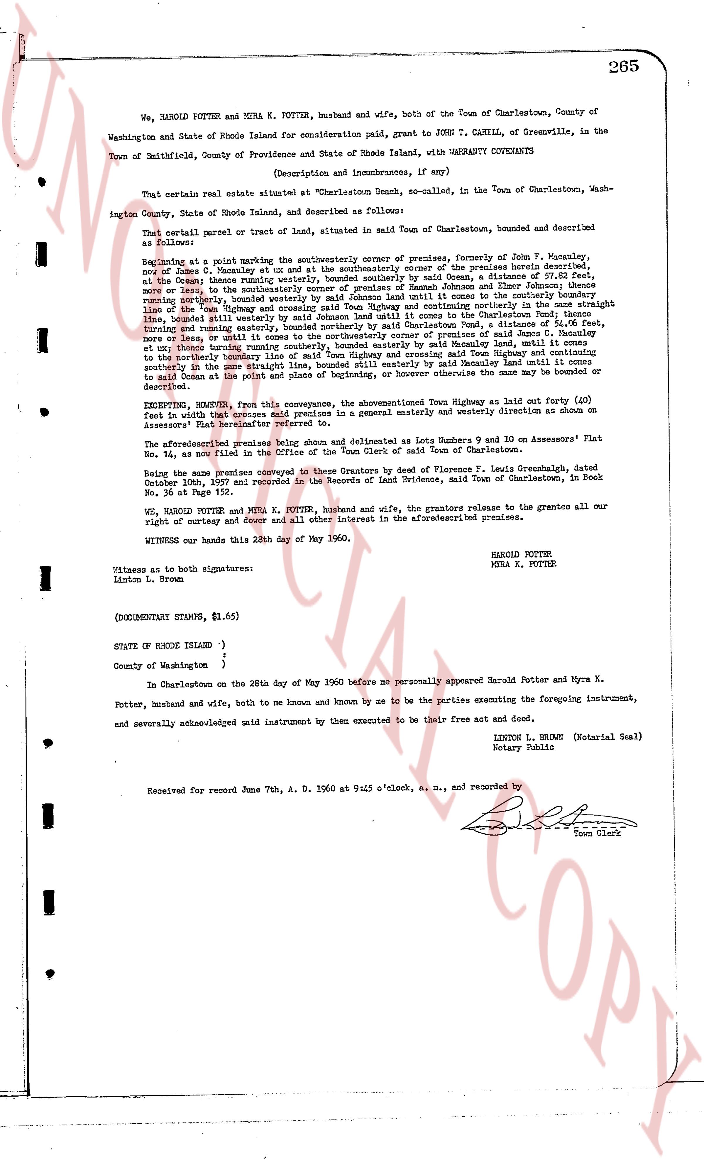
We, HAROLD POTTER and MYRA K. POTTER, husband and wife, both of the Town of Charlestown, County of Washington and State of Rhode Island for consideration paid, grant to JOHN T. CAHILL, of Greenville, in the Town of Smithfield, County of Providence and State of Rhode Island, with WARRANTY COVENANTS
(Description and incumbrances, if any)
That certain real estate situated at "Charlestown Beach, so called, in the Town of Charlestown, Washington County, State of Rhode Island, and described as follows:
That certain parcel or tract of land, situated in said Town of Charlestown, bounded and described as follows:
Beginning at a point marking the southeasterly corner of premises, formerly of John F. Manucy, now of James G. Manucy and others ux and at the southeasterly corner of the premises herein described, at the Ocean Avenue road marking the southeasterly corner of said road, a distance of 110 feet, more or less, then southeasterly to the southeasterly corner of premises of Hannah Johnson and Elnor Johnson; thence southeasterly running northerly, bounded westerly by said Johnson land; thence running north in the center line of the Highway then known as the Charlestown-Beach Highway and continuing northerly in the same straight line, bounded easterly by said Johnson land and continuing northerly in the same straight line, bounded easterly by said Johnson land until reaching the center line of the Highway then known as the Charlestown-Beach Highway, a distance of 34.06 feet, more or less, until it comes to the northeasterly corner of premises of said Manucy; thence running northerly in the same straight line, bounded easterly by said Manucy land, until it comes to the northerly boundary line of said Main Highway and crossing said Town Highway and continuing northerly in the same straight line, bounded easterly by said Manucy land and continuing northerly in the same straight line to said Ocean av at the point and place of beginning, or however otherwise the same may be bounded or described.
EXCEPTING, HOWEVER, from this conveyance, the aforementioned Town Highway as laid out forty (40) feet in width that crosses said premises in a general easterly and westerly direction as shown on Assessors' Plat No. 14, filed in the Office of the Town Clerk.
The aforementioned premises being shown and delineated as Lots Numbers 9 and 10 on Assessors' Plat No. 14, as now filed in the Office of the Town Clerk of said Town of Charlestown.
Being the same premises conveyed to these Grantors by deed of Florence F. Lewis Greenhatch, dated October 10th, 1927 and recorded in the Records of Land Evidence, said Town of Charlestown, in Book No. 36 at Page 172.
We, HAROLD POTTER and MYRA K. POTTER, husband and wife, the grantors release to the grantee all our right of curtesy and dower and all other interest in the aforementioned premises.
WITNESS our hands this 28th day of May 1960.
HAROLD POTTER
MYRA K. POTTER
Witness as to both signatures:
Linton L. Brown
(DOCUMENTARY STAMPS, $1.65)
STATE OF RHODE ISLAND )
)
County of Washington )
In Charlestown on the 28th day of May 1960 before me personally appeared Harold Potter and Myra K. Potter, husband and wife, both to me known and known by me to be the parties executing the foregoing instrument, and severally acknowledged said instrument by them executed to be their free act and deed.
LINTON L. BROWN (Notarial Seal)
Notary Public
Received for record June 7th, A. D. 1960 at 9:45 o'clock, a. m., and recorded by
[Signature]
Town Clerk
The page as recorded