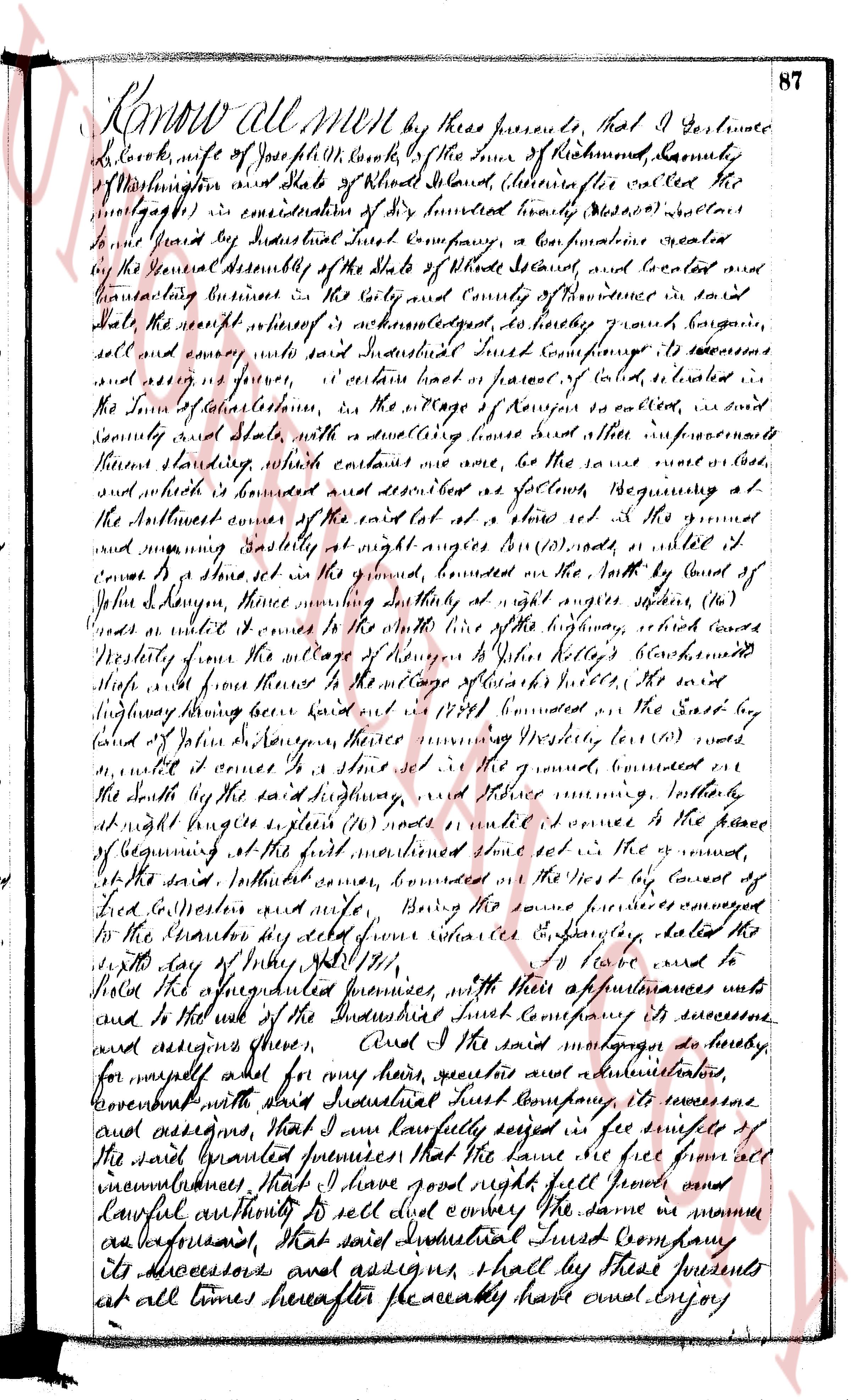
The instrument's own words
Attribution under review. The portal's file number is shared by more than one instrument, and the words below could not be placed with certainty on this one by their own evidence (page stamp, parties, dates); they may belong to a neighbouring instrument. Read them as the record of the page, not yet as this deed's own.
page 1
601
I, William H. Harney, of the Town of Charlestown, County of Washington State
of Rhode Island for consideration paid grant to NICHOLAS B. LAMPHERE, of the Town of South Kings-
town, County of Washington, State of Rhode Island, with MORTGAGE COVENANTS, to secure the payment
of ONE HUNDRED DOLLARS in one year with interest at six per centum per annum, payable semi-annu-
ally in advance as provided in a certain negotiable promissory note of even date, herewith.
That certain real estate situated in the Town of Charlestown, County of Washington State
of Rhode Island, and described as follows:
Two certain tracts or parcels of land, situated in said Town of Charlestown, bounded
and described as follows, to wit:
Beginning at the northeasterly corner of land, formerly of William P. Segar, at a stone
marked "$\text{X}$"; thence running southerly one hundred six (106) feet to a stone marked "$\text{B}$"; thence
westerly one hundred six (106) feet to a car path and stone marked "$\text{D}$"; thence northerly one
hundred seven (107) feet to the land formerly of the Pennington Stonington Railroad Company and a
stone marked "$\text{C}$"; thence easterly one hundred forty-six (146) feet to the place of beginning.
The second tract Commencing thirty-two (32) feet west of the aforementioned bound mark
"$\text{X}$" (it being the width of the car path not conveyed by this deed) at a stone marked "$\text{F}$" and
running southerly one hundred seven (107) feet to a stone marked "$\text{G}$"; thence westerly one hundred
forty-six (146) feet to a stone marked "$\text{H}$"; thence northerly one hundred six (106) feet to land
formerly of the Railroad Company, aforesaid, and stone marked "$\text{I}$"; thence easterly one hundred
six (106) feet to the first mentioned bound.
Being the premises described in deed from this Mortgagor to this Mortgagor, of even date
with these presents, and subject to the rights, privileges, covenants, conditions and restrictions
contained therein or thereto is referred to.
This Mortgage is made upon the STATUTORY CONDITION and with THE STATUTORY POWER OF SALE.
I, Mary Harney wife of the mortgagor release to the mortgagee all my right of dower
and all other interest in the aforementioned premises.
WITNESS our hands this 3rd day of May, 1939
'Witnesses as to mark of Mary Harney:
ALFRED S. PENDLETON
LINTON L. BROWN
WILLIAM H. HARNEY
$\text{his}$
MARY $(\text{x})$ HARNEY
$\text{mark}$
STATE OF RHODE ISLAND)
County of Washington )
In Charlestown on the 3rd day of May, 1939 before me personally appeared William H.
Harney and Mary Harney, husband and wife, both to me known and known by me to be the parties
executing the foregoing instrument, and they acknowledged said instrument, by them executed to be
their free act and deed.
LINTON L. BROWN
Notary Public
Received for record May 3rd, A. D. 1939 at 1:55 o'clock, p. m., and recorded by
[Signature]
Town Clerk
I, the undersigned, having received full payment and satisfaction of the within mortgage re-
corded in the Land Evidence records of land situated in the Town of Charlestown in the State of Rhode Island,
in Land Evidence Book Number 27, at page 601, hereby cancel and discharge the said mortgage and covenant
to and with the person making said payment, that I am the present owner of said mortgage.
In Witness Whereof, I have hereunto set my hand this 22nd day of September, 1949.
N. B. LAMPHERE
Above discharge received for record September 22nd, A. D. 1949 at $11\text{oo}$ o'clock, $\text{a. m.}$, and
recorded by
[Signature]
Town Clerk
page 2
258
cemetery a distance of 41.12 feet to the southeasterly corner; thence running easterly
bounded northerly by the cemetery a distance of 92 feet, more or less, to the westerly
line of Parcel 6; thence running southerly on the westerly line of Parcel 6, bounded
Road, a distance of 462.60 feet to a stone wall; thence following the line of a
circle from southerly to westerly with a radius of 30 feet a distance of 59.02 feet,
thence running westerly along the stone wall, bounded northerly by the Rainey Corpora-
tion by this granten by deed other eve date hereof, a distance of 45.16 feet to the east-
ern line of other land of said Rainey Corporation; thence continuing in a straight line
and bounded westerly by other land of these grantces, a distance of 153.24 feet to an
iron pipe set in those bounds; thence running easterly by said granten with a distance
of 34.50 feet to an iron pipe set in the easterly line of land of the Columbia Narrow
Fabric Company; thence out of said iron pipe westerly by said granten with a distance
of 34.50 feet to the westerly line of land of the Columbia Narrow
Fabric Company, a distance of 15 feet to the southeasterly line of land of the New York,
New Haven and Hartford Railroad Company; thence continuing in an irregular line bounded
northerly by said railroad a distance of 928.87 feet to the point and place of beginning.
Being all of said Parcel I as shown on paid map EXCEPTING the southerly strip thereof
being conveyed to The Rainey Realty Corporation by deed of even date hereof, TOGETHER with
the right of way over and across said southerly strip of land from Columbia Heights toward
the cemetery.
This conveyance is made SUBJECT to taxes assessed by the Town of Charlestown on December
31, 1959.
IN WITNESS WHEREOF, said INDUSTRIAL NATIONAL BANK OF PROVIDENCE, in its capacity aforesaid, has caused
these presents to be signed and its corporate seal to be hereunto affixed by its proper officers, duly
authorized, this 23rd day of May 1960.
INDUSTRIAL NATIONAL BANK
OF PROVIDENCE (Corporate Seal)
Executor under the will of
Anne A. Haste, deceased.
By Thomas H. McGovern, Jr.
Vice Pres.
R. L. Fletcher, Jr.
Trust Officer
In the presence of:
Alice E. Gallivan
STATE OF RHODE ISLAND
COUNTY OF PROVIDENCE
In Providence, on the 23rd day of May 1960, before me personally appeared the above named Thomas H.
McGovern, Jr., Vice President and R. L. Fletcher, Jr., Trust Officer, respectively, of Industrial National
Bank of Providence, to me known and known by me to be the parties executing the foregoing instrument in behalf
of said corporation and acknowledged said instrument so executed to be their free act and deed in their said
capacities and the free act and deed of said corporation in its capacity as such Executor.
RUSSELL G. FINCH (Notarial Seal)
Notary Public
My Commission expires June 30, 1961
(DOCUMENTARY STAMPS, $3.30)
Received for record May 27th, A. D. 1960 at 2:00 o'clock, p. m., and recorded by
[Signature]
Town Clerk
The page as recorded