The instrument's own words
page 1 · read by Gemma vision
243
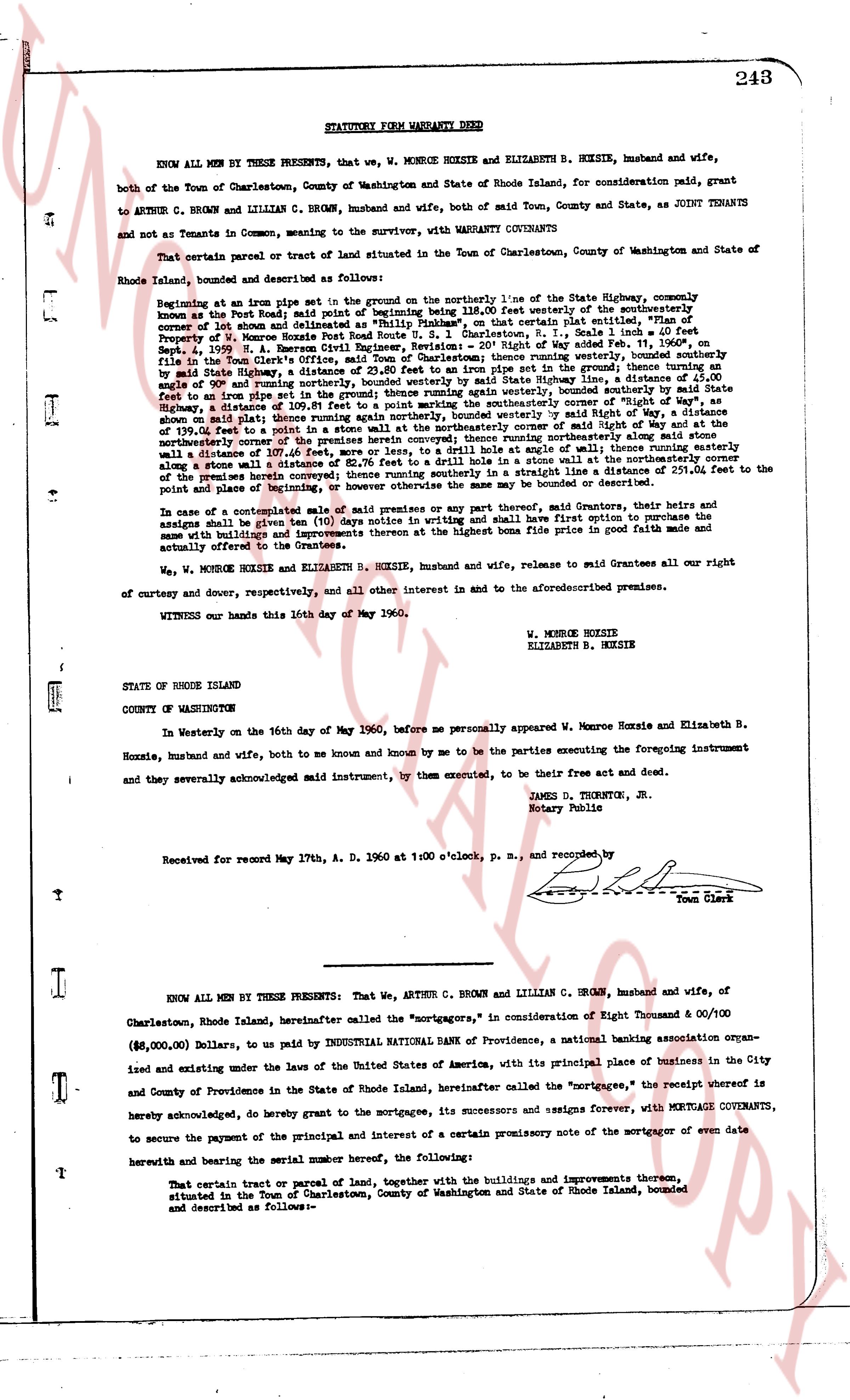
STATUTORY FORM WARRANTY DEED
KNOW ALL MEN BY THESE PRESENTS, that we, W. MONROE HOXSIE and ELIZABETH B. HOXSIE, husband and wife, both of the Town of Charlestown, County of Washington and State of Rhode Island, for consideration paid, grant to ARTHUR C. BROWN and LILLIAN C. BROWN, husband and wife, both of said Town, County and State, as JOINT TENANTS and not as Tenants in Common, merging to the survivor, with WARRANTY COVENANTS
That certain parcel or tract of land situated in the Town of Charlestown, County of Washington and State of Rhode Island, bounded and described as follows:
Beginning at an iron pipe found set in a stone wall bounding on the northerly line of the State Highway, commonly known as the Post Road, said point being approximately 118.00 feet westerly of the southernmost corner of lot known and delineated as "Philip Hinkley", on that certain plat entitled "Plan of Property of W. Monroe Hoxsie", dated June 1, 1938, Sheet 2, Scale 1" = 100', recorded on May 19, 1939, in the Charlestown Civil Engineer's Revision, "20th Right of Way Map" filed in the Town Clerk's office, starting at said iron pipe and running southerly 11.00 feet to a point; thence running southerly by a nail in a stone wall a distance of 23.80 feet to an iron pipe set in the ground; thence running at angle of 90° and running northerly, bounded westerly by State Highway, and running northerly by a nail in a stone wall a distance of 139.06 feet to a point; thence running easterly again winter bounded, thence southerly by said State Highway, a distance of 109.81 feet to a point marking the southernmost line of the property of Arthur C. Brown, as shown on the plat aforementioned, and running southerly by a nail in a stone wall, bounded by said Right of Way, a distance of 139.06 feet to a point in a stone wall at the northeasterly corner of said Brown property; thence running easterly by a nail in a stone wall a distance of 107.46 feet to a point; thence northerly along said stone wall a distance of 107.46 feet, more or less, to a drill hole at angle of some [?] degrees; thence running easterly along a stone wall a distance of 107.46 feet to a point; thence running northerly a distance of 253.00 feet to the point of the premises herein conveyed; thence running northerly in a straight line a distance of 255.00 feet to the point of place and boundary of the property of W. Monroe Hoxsie, and thence running west or westward to the point of beginning.
In case of a subsequent sale or sale presents of any part thereof, said Grantors, their heirs and assigns shall be given ten (10) days notice in writing and shall have first option to purchase the same with its buildings and improvements thereon at the highest bona fide price in good faith made and actually offered to the Grantees.
We, W. MONROE HOXSIE and ELIZABETH B. HOXSIE, husband and wife, release to said Grantees all our right of curtesy and dower, respectively, and all other interest in and to the aforementioned premises.
WITNESS our hands this 16th day of May 1960.
W. MONROE HOXSIE
ELIZABETH B. HOXSIE
STATE OF RHODE ISLAND
COUNTY OF WASHINGTON
In Westerly on the 16th day of May 1960, before me personally appeared W. Monroe Hoxsie and Elizabeth B. Hoxsie, husband and wife, both to me known and known by me to be the parties executing the foregoing instrument and they severally acknowledged said instrument, by them executed, to be their free act and deed.
JAMES D. THORNTON, JR.
Notary Public
Received for record May 17th, A. D. 1960 at 1:00 o'clock, p. m., and recorded, by
[Signature]
Town Clerk
----
KNOW ALL MEN BY THESE PRESENTS: That We, ARTHUR C. BROWN and LILLIAN C. BROWN, husband and wife, of Charlestown, Rhode Island, hereinafter called the "mortgagors," in consideration of Eight Thousand & 00/100 Dollars, ($\$8,000.00$), Dollars, to pay to INDUSTRIAL NATIONAL BANK of Providence, a national banking association organized and existing under the laws of the United States of America, with its principal place of business in the City and County of Providence in the State of Rhode Island, hereinafter called the "mortgagee," the receipt whereof is hereby acknowledged, do hereby grant to the mortgagee, its successors and assigns forever, with MORTGAGE COVENANTS, to secure the payment of the principal and interest of a certain promissory note of the mortgagor of even date herewith and bearing the serial number hereof, the following:
That certain tract or parcel of land, together with the buildings and improvements thereon, situated in the Town of Charlestown, County of Washington and State of Rhode Island, bounded and described as follows:-
The page as recorded