The instrument's own words
page 1 · read by Gemma vision
231
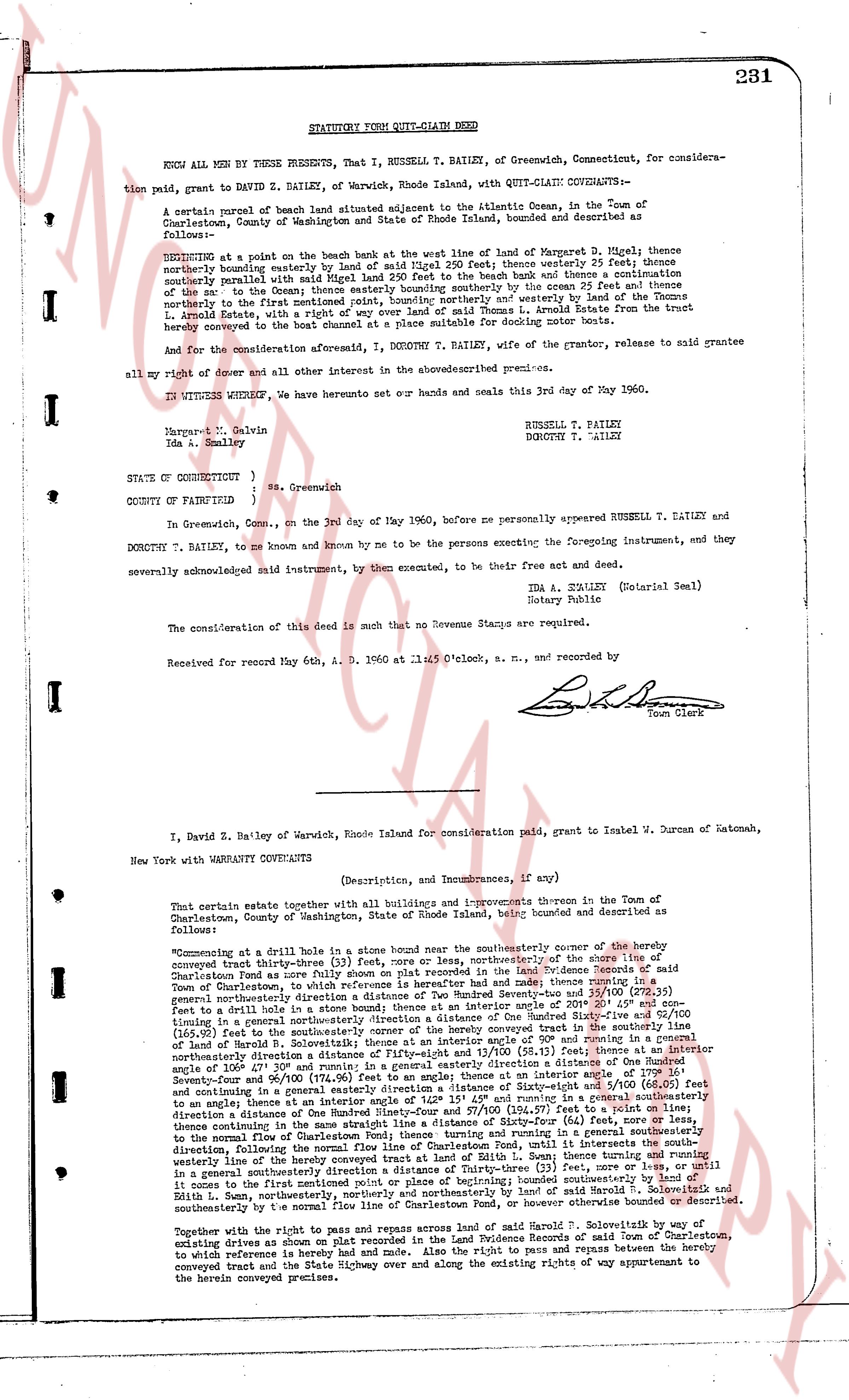
STATUTORY FORM QUIT-CLAIM DEED
KNOW ALL MEN BY THESE PRESENTS, That I, RUSSELL T. BAILEY, of Greenwich, Connecticut, for conside-
ration paid, grant to DAVID Z. BAILEY, of Warwick, Rhode Island, with QUIT-CLAIM COVENANTS:-
A certain parcel of marsh beach land situated adjacent to the Atlantic Ocean, in the Town of
Charlestown, County of Washington, State of Rhode Island, bounded and described as
follows:-
BEGINNING at a stake in the beach at the west line of land of Warner D. Bigel; thence nor
therly, bounding easterly boundary land of said Bigel 250 feet; thence westerly 25 feet; thence
northerly parallel with said Bigel land 250 feet to the beach bank and thence a termination
of the tide at the low water mark; thence easterly along the beach by the ocean 25 feet; thence
northerly to the first mentioned point, bounding northerly and westerly by land of the Thomas
L. Arnold Estate, with the right of way 20 feet wide, from the beach to the trust beach
hereby conveyed in the trust deed conveyed at a place suitable for docking motor boats.
And for the consideration aforesaid, I, DOROTHY T. BAILEY, wife of the grantor, release to said grantee
all my right of dower and all other interest in the above described premises.
In WITNESS WHEREOF, we have hereunto set our hands and seals this 3rd day of May 1960.
Margaret M. Galvin
Ida A. Straley
RUSSELL T. BAILEY
DOROTHY T. BAILEY
STATE OF CONNECTICUT }
)
COUNTY OF FAIRFIELD } ss. Greenwich
In GREENWICH, Conn., on the 3rd day of May 1960, before me personally appeared RUSSELL T. BAILEY and
DOROTHY T. BAILEY, to me known and by me to be the persons executing the foregoing instrument, and they
severally acknowledged said instrument, by them executed, to be their free act and deed.
Ida A. STRALEY (Notarial Seal)
Notary Public
The consideration of this Deed is such that no Revenue Stamps are required.
Received for record May 6th, A. D. 1960 at 11:05 O'clock, a. m., and recorded by
[Signature]
Town Clerk
----
I, David Z. Bailey of Warwick, Rhode Island for consideration paid grant to Ismael M. Duran of Natomas,
New York with WARRANTY COVENANTS
(Description, and Incumbrances, if any)
That certain estate together with all buildings and improvements thereon in the Town of
Charlestown, County of Washington, State of Rhode Island, being bounded and described as
follows:
"Commencing at a drill hole in a stone bound near the southeasterly corner of the hereby
conveyed tract three-thirty (33) feet, more or less, northerly, or southeasterly, of the boundary line of
Charlestown fee as more fully described in the Land Evidence Records of said
Town of Charlestown, to which reference is heretofore made and here in part described as
follows: a line of boundary between the parcels of land of Frederick Devenport and 35/100 (278.32)
feet to a drill hole in a stone bound; thence at an interior angle of 20° 45' and 45" easterly 179
feet to a drill hole in a stone bound; thence along the corner boundary line of said Devenport 317.15
(317.15) feet to the southeasterly corner of the hereby conveyed tract in the southerly line of
said Devenport fee; thence along said southerly line of Devenport fee easterly 179 feet to a
drill hole in a stone bound; thence northerly a distance of Fifty-eight 17/100 and 13/100 (58.17) feet,
thence at an interior angle of 179° 15' and 15" northerly a distance of One hundred seventy-nine
Seveny-four and 96/100 (179.74) feet along the west line of the hereby conveyed tract, and thence
to a point intersecting a line of boundary between the parcels of land of Frederick Devenport and
said estate, at an angle an interior angle of 179° 15' and 15" running in a general southeasterly
direction to a drill hole in a stone bound, thence northerly 250 feet to the beach bank and thence
thence continuing in the same easterly direction a line of Sixty-four (64) feet, more or less,
thence southerly to the normal flow line of Charlestown Pond, thence easterly 250 feet, bounding
southerly by the normal flow line of Charlestown Pond, until it intersects the south-
westerly line of the hereby conveyed tract, thence northerly 250 feet to the beach bank, bounding
in a general southeasterly direction a line of Thirty-three (33) feet, more or less, and until it
intersects a point at the first mentioned point or place of beginning; bounded northerly by land
of said Frederick Devenport, and bounded easterly and southerly by land of Sarah H. Solomonsik and
southwesterly by the normal flow line of Charlestown Pond, or however otherwise bounded or described.
Together with the right to pass and repass across land of said Sarah H. Solomonsik via an existing
driveway known as the driveway of Sarah H. Solomonsik, in the Town of Charlestown,
to which reference is hereby made and noted. Also the right to pass and repass between the hereby
conveyed tract and the State Highway and over and along the existing rights of way appurtenant to
the hereby conveyed premise.
The page as recorded