The instrument's own words
page 1 · read by Gemma vision
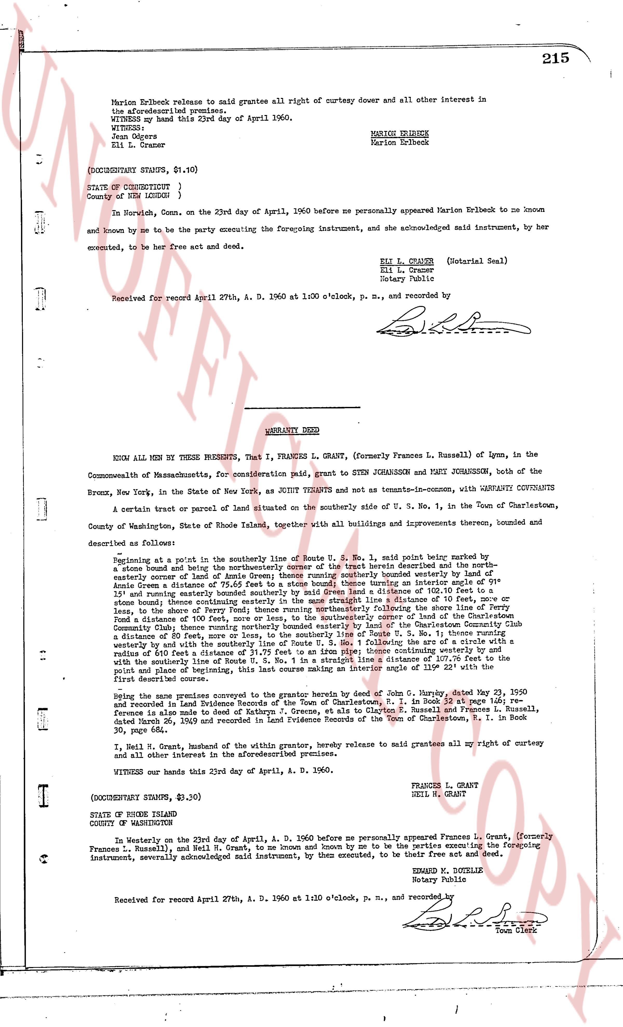
215
Marion Erlbeck release to said grantee all right of curtesy dower and all other interest in
the aforesaid premises.
WITNESS my hand this 23d day of April 1960.
WITNESS:
Jean Odgers
Eli L. Cramer
MARION ERLBECK
Marion Erlbeck
(DOCUMENTARY STAMPS, $1.10)
STATE OF CONNECTICUT }
County of NEW LONDON }
In Nurwich, Conn. on the 23rd day of April, 1960 before me personally appeared Marion Erlbeck to me known
and known by me to be the party executing the foregoing instrument, and she acknowledged said instrument, by her
executed, to be her free act and deed.
ELI L. Cramer (Notarial Seal)
Eli L. Cramer
Notary Public
Received for record April 27th, A. D. 1960 at 1:00 o'clock, p. m., and recorded by
----
WARRANTY DEED
KNOW ALL MEN BY THESE PRESENTS, That I, FRANCES L. GRANT, (formerly Frances L. Russell) of Lynn, in the
Commonwealth of Massachusetts, for consideration paid, grant to STEN JOHANSSON and MARY JOHANSSON, both of the
Bronx, New York, in the State of New York, as JOINT TENANTS and not as tenants-in-common, with WARRANTY COVENANTS
A certain tract or parcel of land situated on the southerly side of Route U. S. No. 1, in the Town of Charlestown,
County of Washington, State of Rhode Island, together with all buildings and improvements thereon, bounded and
described as follows:
Beginning at a point in the southerly line of Route U. S. No. 1, said point being marked by a
stone bound and being the northerly corner of the street herein described and the north-
easterly corner of land of Annie Green land running southerly bounded easterly by a stone bound and
running south 15° 30' east 110 feet to a stone bound running an interior angle of 91°
15' and running easterly bounded southerly by said Green land a distance of 103.70 feet to a
stone bound thence continuing southerly bounded easterly by land of the Community Chest for the
blind a distance of 100 feet to a stone bound thence running west a distance of 51 feet to a stone bound or
lease, to the shore of Perry Pond; thence running westerly following the shore line of Perry
Pond a distance of 100 feet, more or less, to a stone bound thence running south 15° 30' east 110 feet to a
stone bound thence running northerly bounded easterly by land of the Charlestown Community Club
a distance of 100 feet, more or less, to a stone bound thence running north 75° 30' west along the southerly
line of Route U. S. No. 1 following the arc of a circle with a radius of 100 feet a distance of 110 feet to a stone bound running an interior angle westernly the
with the southerly line of Route U. S. No. 1 in a straight line a distance of 107.70 feet to the
point and place of beginning, this last course making an interior angle 119° 22' with the first
course described above.
Being the same premises conveyed to the grantor herein by deed of John G. Murphy, dated May 23, 1950
and recorded in Land Evidence Records of the Town of Charlestown, R. I. in Book 34, page 165; re-
conveyance is alleged to be due of Nathan G. Spruce, et al to Clayton G. Spruce and Frances L. Russell,
dated March 26, 1949 and recorded in Land Evidence Records of the Town of Charlestown, R. I. in Book
30, page 215.
I, Neil H. Grant, husband of the within grantor, hereby release to said grantees all my right of curtesy and
all other interest in the aforesaid premises.
Witness my hand this 23rd day of April, A. D. 1960.
FRANCES L. GRANT
NEIL H. GRANT
(DOCUMENTARY STAMPS, $3.30)
STATE OF RHODE ISLAND
COUNTY OF WASHINGTON
In Westerly on the 23rd day of April, A. D. 1960 before me personally appeared Frances L. Grant, (formerly
Frances L. Russell) and Neil H. Grant, to me known and known by me to be the parties executing the foregoing
instrument, severally acknowledged said instrument, by them executed, to be their free act and deed.
EDWARD M. BOTELLE
Notary Public
Received for record April 27th, A. D. 1960 at 1:10 o'clock, p. m., and recorded by
[Signature]
Town Clerk
The page as recorded