The instrument's own words
page 1 · read by Gemma vision
213
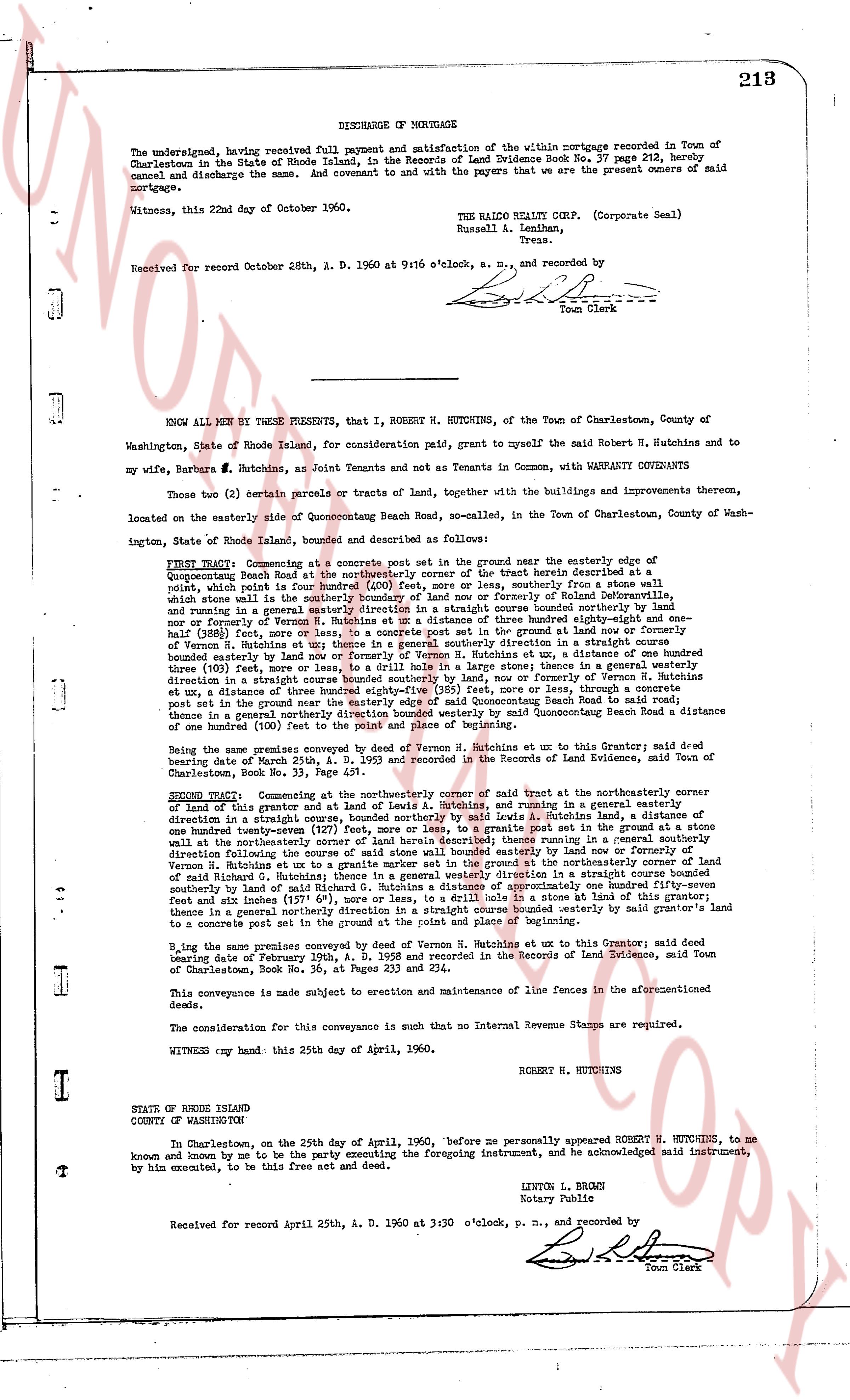
DISCHARGE OF MORTGAGE
The undersigned, having received full payment and satisfaction of the within mortgage recorded in Town of Charlestown in the State of Rhode Island, in the Records of Land Evidence Book No. 37 page 212, hereby cancel and discharge the same. And covenant to and with the payees that we are the present owners of said mortgage.
Witness, this 22nd day of October 1960.
THE RALCO REALTY CORP. (Corporate Seal)
Russell A. Lenihan,
Pres.
Received for record October 28th, A. D. 1960 at 9:16 o'clock, a. m., and recorded by
[Signature]
Town Clerk
----
KNOW ALL MEN BY THESE PRESENTS, that I, ROBERT H. HUTCHINS, of the Town of Charlestown, County of Washington, State of Rhode Island, for consideration paid, grant to myself the said Robert H. Hutchins and to my wife, Barbara S. Hutchins, as Joint Tenants and not as Tenants in Common, with WARRANTY COVENANTS
Those two (2) certain parcels or tracts of land, together with the buildings and improvements thereon, located on the easterly side of Quonochontaug Beach Road, so-called, in the Town of Charlestown, County of Washington, State of Rhode Island, bounded and described as follows:
FIRST TRACT: Commencing at a concrete post set in the ground near the easterly edge of Quonochontaug Beach Road in the Town of Charlestown, and of the tract herein described at a point, which point is four feet beyond (400) feet, more or less, southerly from a stone wall which stone wall is in the land of Robert H. Hutchins or formerly of Ralph M. Wolcott, and running in a general easterly direction in a straight course bounded easterly by land now or formerly of Robert H. Hutchins, to a concrete post set in the ground at ran distance of three hundred eighty-three (383) feet, more or less, to a concrete post set in the ground at land now or formerly of Robert H. Hutchins at a point, thence running in a straight course direction in a straight course bounded easterly by land now or formerly of Vernon R. Hutchins, at a distance of one hundred three (103) feet, more or less, to a concrete post set in the ground, thence in a general southerly direction following the course of said stone wall bounded easterly by land now or formerly of Robert H. Hutchins, to a point, thence running in a general westerly direction in a straight course bounded southerly by land now, or formerly of Vernon R. Hutchins a distance of one hundred four (104) feet, more or less, to a concrete post set in the ground, thence running in a general northerly direction near the easterly edge of Quonochontaug Beach Road to said reach road, thence in a general northerly direction bounded westerly by said Quonochontaug Beach Road a distance of one hundred four (104) feet, more or less, to the point of beginning.
Being the same premises conveyed by deed of Vernon R. Hutchins et ux to this Grantor; said deed bearing date of March 25th, A. D. 1935, and recorded in the Records of Land Evidence, said Town of Charlestown, Book No. 28 page 131.
SECOND TRACT: Commencing at the northeasterly corner of said tract at the northeasterly corner of lot 1 of said tract at a distance of 143 feet, and running in a general easterly direction in a straight course bounded easterly by land now or formerly of Robert H. Hutchins, a distance of one hundred twenty-seven (127) feet, more or less, to a granite post set in the ground at a stone wall at the northeasterly corner of said tract, thence running in a general southerly direction in a straight course bounded easterly by land now or formerly of Robert H. Hutchins, to a point, thence running in a general southerly direction in a straight course bounded easterly by land now or formerly of Robert H. Hutchins, to a point, thence running in a general southerly direction in a straight course bounded easterly by land of Richard C. Hutchins; thence running in a general westerly direction in a straight course bounded southerly by land now or formerly of Robert H. Hutchins, approximately one hundred forty-four feet and six inches (144' 6"), more or less, to a drill hole in a stone at land of this grantor; thence in a general northerly direction running in a straight course bounded westerly by said grantor's land to a concrete post set in the ground at the point and place of beginning.
Being the same premises conveyed by deed of Vernon R. Hutchins et ux to this Grantor; said deed bearing date of February 1934, A. D. 1934, and recorded in the Records of Land Evidence, said Town of Charlestown, Book No. 26 page 233 and 234.
This conveyance is made subject to execution and maintenance of line fences in the aforementioned deeds.
The consideration for this conveyance is such that no Internal Revenue Stamps are required.
WITNESS my hand this 25th day of April, 1960.
ROBERT H. HUTCHINS
STATE OF RHODE ISLAND
COUNTY OF WASHINGTON
At Charlestown, on the twenty-fifth day of April, 1960, before me personally appeared ROBERT H. HUTCHINS, to me known and known by me to be the party executing the foregoing instrument, and he acknowledged said instrument, by him executed, to be his free act and deed.
LINTON L. BROWN
Notary Public
Received for record April 25th, A. D. 1960 at 3:30 o'clock, p. m., and recorded by
[Signature]
Town Clerk
The page as recorded