The instrument's own words
page 1 · read by Gemma vision
170
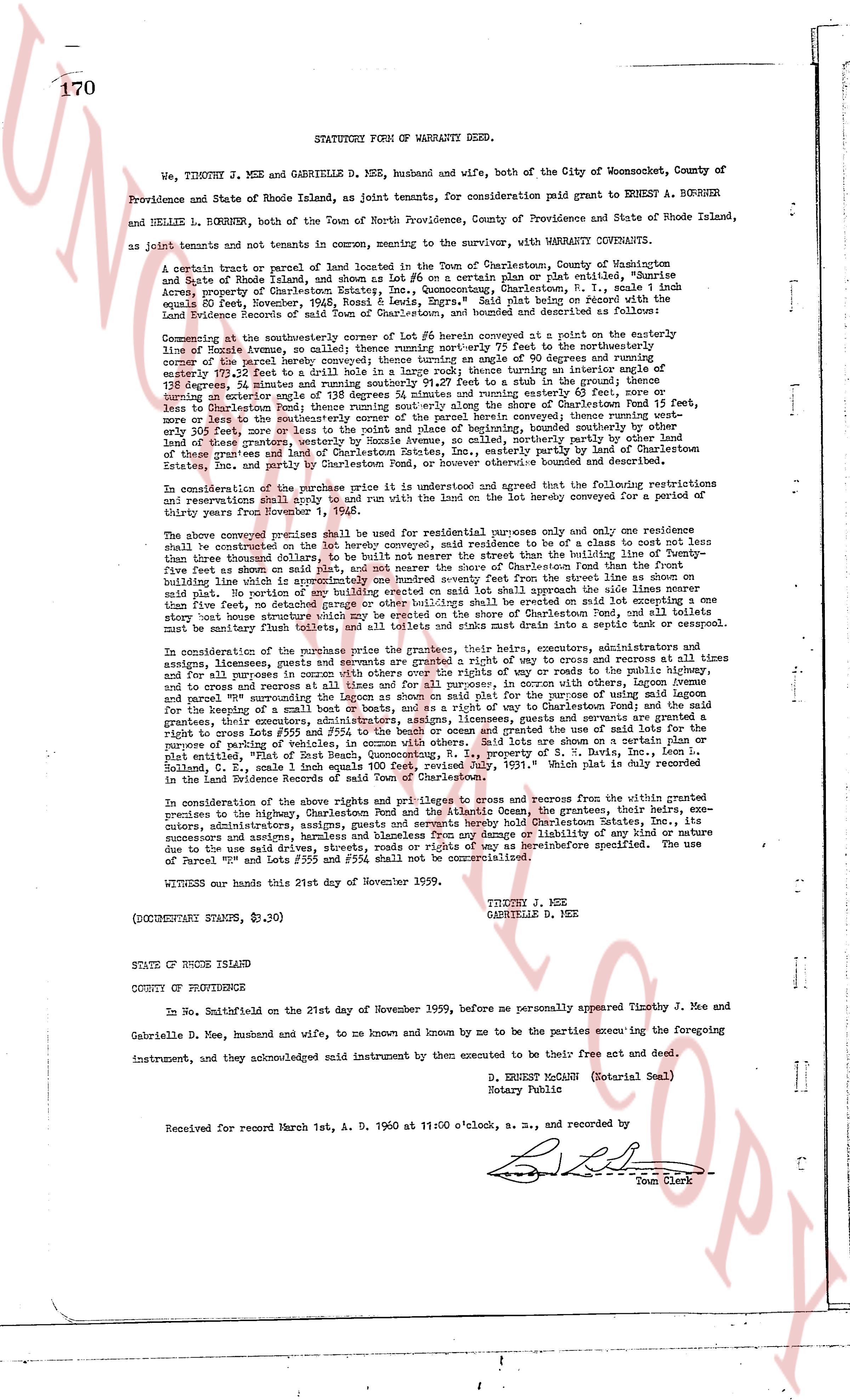
STATUTORY FORM OF WARRANTY DEED.
We, TIMOTHY J. MEE and GABRIELLE D. MEE, husband and wife, both of the City of Woonsocket, County of Providence and State of Rhode Island, as joint tenants, for consideration paid grant to ERNEST A. BORRNER and NELLIE L. BORRNER, both of the Town of North Providence, County of Providence and State of Rhode Island, as joint tenants and not tenants in common, meaning to sever the underwriting, with WARRANTY COVENANTS.
A certain tract or parcel of land located in the Town of Charlestown, County of Washington and State of Rhode Island, shown as lot #26 on a certain plan or plat entitled, "Sunrise Acres, property of Captain J. S. & Mrs. J. S. Luttrell, Charlestown, R. I." dated and signed double equal to February, 1926, Ronald R. Leeds, Engr." Said plat being recorded on the Land Evidence Records of said Town of Charlestown, book and designated as shoreline "Sunrise".
Commencing at the southwesterly corner of the surf line, then running northerly 76.7 feet to the northwesterly line of Rhode Avenue as shown on said plat, then running northerly 76.7 feet to the northwesterly corner of the parcel hereby conveyed; thence turning sunny 90.4 feet at an interior angle sum of 128 degrees, 24 minutes and running southeasterly 91.27 feet to a stake in the ground; thence turning 128 degrees, 24 minutes and running southwesterly 76.7 feet; thence turning 90 degrees and running 83 feet or less than shoreline Charlestown Find 15 feet more, or less than the shoreline; thence running southerly along the shore of Charlestown Find 15 feet more, or less than the shoreline; thence running southwesterly along the shore of Charlestown Find 15 feet more, or less than shoreline 200 feet more, or less than the point of beginning, bounded southerly along the shore of land less than shoreline; thence running northerly along the shore of Charlestown Find 15 feet more, or less than the shoreline; and bounded northerly, easterly and westerly by the lands of the other grantees and land of Charlestown Estate, Inc., easterly partly by land of Charlestown Estate, Inc. and southerly by the Atlantic Ocean. The total area is approximately 6,000 square feet.
In consideration of the purchase price it is understood and agreed that the following restrictions and reservations shall bind and or run with the land on the lot hereby conveyed for a period of thirty years from September 1, 1959.
That the above described premises shall be used for residential purposes only and only one residence shall be constructed on the lot hereby conveyed, and said residence to be of a class to not cost less than five thousand dollars to construct and shall be of a type and style that shall be in harmony with the other residences on said plat. No building five feet or more on said plat, and neither side or shore of Charlestown Find than the water line shall be constructed. No part of any building erected on said lot shall approach the side lines nearer than five feet. No detached garage or other building shall be erected on said lot. No fence shall be constructed more than five feet high, and no fence shall be erected on the shore of Charlestown Find, and all toilets site must be sanitary flush toilets, and all toilets and sinks must drain into a septic tank or cesspool.
In consideration of the purchase price the grantees, their heirs, executors, administrators, assigns, licensees, grantees, users, and successors are granted a right of way to cross and recross at all times and for all purposes in common with othery over the rights of way to roads the public highway, and to cross and recross the roads and rights of way as shown on said plat and the shoreline of Charlestown and parcel "PV" surrounding the Lagoon as shown on said plat for the purpose of using said lagoon for the benefit of a boat house of 20' x 20' to be built on Charlestown Find. The grantees, their heirs, grantees, their executors, administrators, licensees, grantees, users and successors are granted a right of way to cross and recross the roads and rights of way as shown on said plat and the shoreline of the parking of vehicles, in manner with others. Said lot are shown on a certain plan or plat entitled, "Plat of the property of Captain J. S. & Mrs. J. S. Luttrell, Charlestown, R. I., Solland, C. E., scale 1 inch equals 100 feet, revised July, 1951." Which plat is duly recorded in the Land Evidence Records of said Town of Charlestown.
In consideration of the above rights and privileges to cross and recross from the within granted premises to the highway, Charlestown Pond and the Atlantic Ocean, the grantees, their heirs, executors, administrators, assigns, licensees, grantees, users and successors shall hold Charlestown Estate, Inc. and its successors and assigns, harmless from any damage or liability of any kind or nature due to the use said drives, streets, roads, and rights of way as hereinbefore specified. The use of Parcel "PV" and roads #255 and #256 shall not be commercialized.
WITNESSED our hands this 21st day of November 1959.
TIMOTHY J. MEE
GABRIELLE D. MEE
(DOCUMENTARY STAMPS, $3.90)
STATE OF RHODE ISLAND
COUNTY OF PROVIDENCE
In No Smithfield on the 21st day of November 1959, before me personally appeared Timothy J. Mee and Gabrielle D. Mee, husband and wife, to me known and known by me to be the parties executing the foregoing instrument, and they acknowledged said instrument by their own executed to be their free act and deed.
D. ERNEST MCCANN (Notarial Seal)
Notary Public
Received for record March 1st, A. D. 1960 at 11:00 o'clock, s. m., and recorded by
[Signature]
Town Clerk
The page as recorded