The instrument's own words
page 1 · read by Gemma vision
162
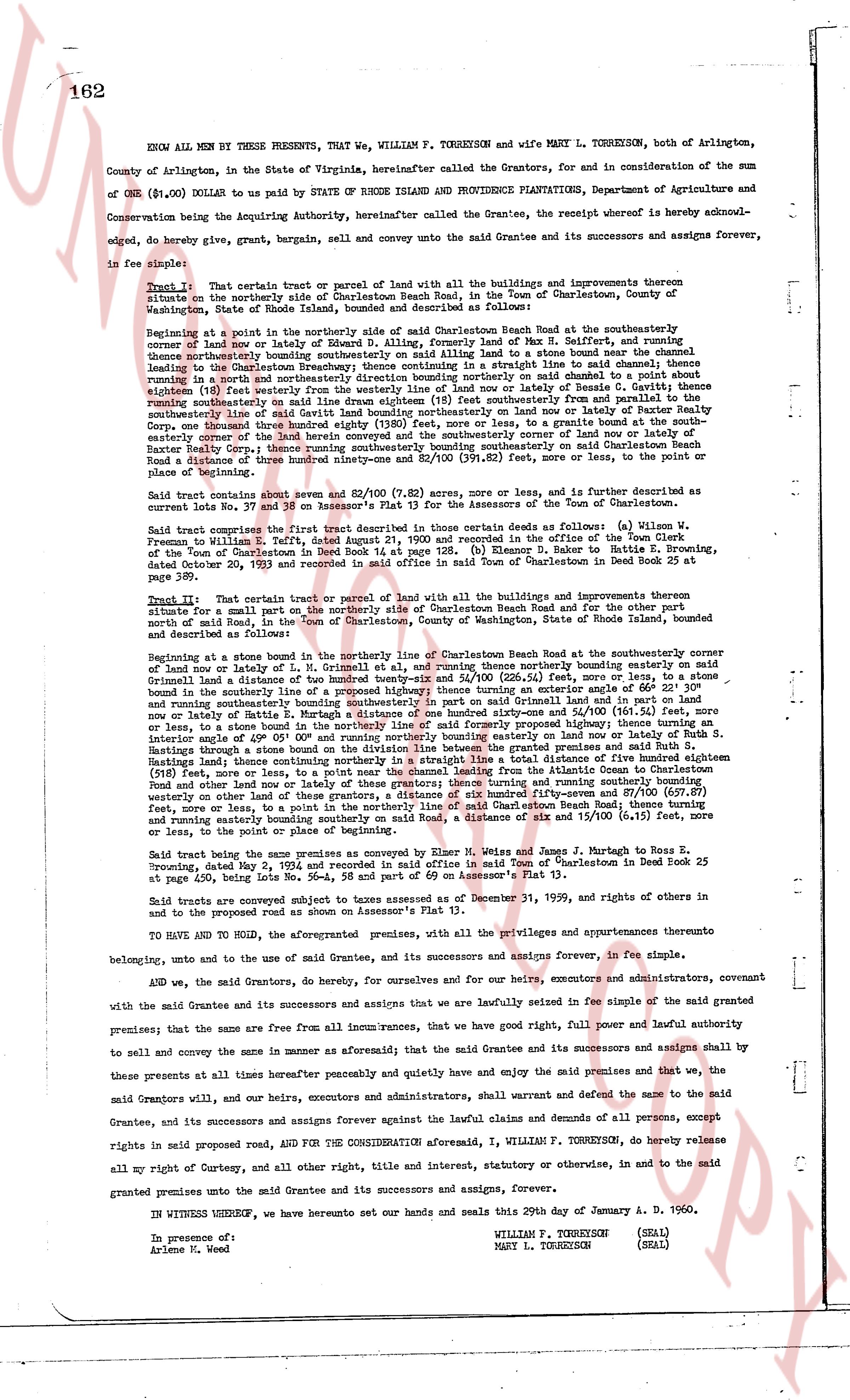
KNOW ALL MEN BY THESE PRESENTS, That We, WILLIAM F. TORREYSON and wife MARY L. TORREYSON, both of Arlington, County of (Arlington), in the State of Virginia, hereinafter called the Grantors, and for consideration of the sum of ONE ($1.00) DOLLAR to us paid by STATE OF RHODE ISLAND AND PROVIDENCE PLANTATIONS, Department of Agriculture and Conservation being the Acquiring Authority, hereinafter called the Grantee, the receipt whereof is hereby acknowledged, do hereby give, grant, bargain, sell and convey unto the said Grantee and its successors and assigns forever, in fee simple:
Tract I: That certain tract or parcel of land with all the buildings and improvements thereon situated on the northerly side of Charlestown Beach Road in the Town of Charlestown, County of Washington, State of Rhode Island, which is described as follows:
Beginning at a point in the northerly side of said Charlestown Beach Road from the southerly line of corner of land or lotway of Edward D. Alling, formerly land of Mary M. Butterfield and running thence northeasterly boundary line of said Edward D. Alling to a point thence running easterly to a stone bound on the chain leading thence to the Charlestown Breakwater thence continuing in a straight line to said (chain) thence running southerly along the boundary line of said (chain) and the said chain to a bound stone running eighteenth (18) feet westerly from the westerly line of now land or lotway of Bessie C. Gavitt; thence running southerly along the boundary line of said Gavitt land to a point on the southerly line of southerly line of said Gavitt land running southerly northerly on land nor lotway of Parker R. Coey, one thousand three hundred eighty eight (1388) feet, to a point on the boundary line of the easterly corner of the land of the said Parker R. Coey and the southerly corner of now land or lotway of said Charlestown Beach Road thence running southerly boundary line of said Charlestown Beach Road one thousand three hundred eighty eight (1388) feet, more or less, to the point or to the point of beginning.
Said tract contains about seven And 32/100 (7.32) acres, more or less, and is further described as containing Road course No. 97 and 38 on Assessors' Flat 13 for the Assessors of the Town of Charlestown.
Said tract comprises the first tract described in those deeds as follows: (a) Wilson W. Freeman, to William S. Tefft, dated August 21, 1900 and recorded in office of the Town Clerk of the Town of Charlestown in Deed Book 23 page 19; (b) Freeman T. Baker to Ruth Butterfield, dated October 20, 1903 and recorded in said office in said Town of Charlestown in Deed Book 23 page 47.
Tract II: That certain tract or parcel of land with all the buildings and improvements thereon situated for a small part on the northerly side of Charlestown Beach Road and for the other part north and east Road, in the Town of Charlestown, County of Washington, State of Rhode Island which is described and delineated as follows:
Beginning at a stone bound in the northerly side of Charlestown Beach Road at the southerly corner of land or lotway of H. G. Crandall, et al, and running thence northerly boundary line on said eastern boundary line of a granted 도로 twenty-four and 31/100 (24.31) feet (564 perches), more or less, to a stone bound in the northerly line of said Crandall land and running thence easterly along the northerly boundary line and running southerly boundary line on part in said Crandall land and partly in land on now lotway of Natalie M. Shurla at a distance of one hundred twenty-four (124) feet, more or less, to a stone bound in the northerly line of said formerly said properties however this line running at interior angle of 49° 00 running straight boundary line on land or lotway of said Natalie M. Shurla to a point on the boundary line of said Natalie M. Shurla and the granted premises and said Ruth S. Hastings land; thence continuing northerly in a straight line to a total distance of one hundred eighteen (118) feet, more or less, to a point on the boundary line of the Atlantic Ocean to Charlestown Pond and one other land now or lately of these grantors then running and running southerly boundary line (western) boundary line of said land to a point at a distance of 115 feet (115 feet), more or less, to a point in the northerly line of said Charlestown Beach Road; thence running and easterly boundary line of said land to a point at a distance of 17 12/100 (17.12) feet, more or less, to the point or point of beginning.
Said tract being the same premises as conveyed by Elmer M. Wise and James J. Murtagh to Ross R. TreeSet, dated July 2, 1936 and recorded in said office in said Town of Charlestown in Deed Book 25 at page 450, being Lots No. 56-a, 56-b and part of Lot 59 on Assessors' Flat 13.
Said tracts are conveyed subject to taxes assessed as of December 31, 1959, and rights of others in and to the proposed road as shown on Assessors' Flat 13.
TO HAVE AND TO HOLD, the aforementioned premises, with all the appurtenances and perquisites thereunto belonging, unto and to the use of the said Grantee, and its successors and assigns forever, in fee simple.
AND we, the said Grantors, do hereby, for ourselves and our heirs, executors and administrators, covenant and promise that we and the said Grantee and its successors and assigns that we are lawfully seized in fee simple of the said granted premises; that the same are free from all incumbrances, that we have good right, full power and lawful authority to sell and convey the same in and manner as aforesaid) that the said Grantee and its successors and assigns shall by these presents at all times hereafter peaceably and quietly have and enjoy the said premises and that we, the said Grantors will warrant), and our heirs, executors and administrators, shall warrant and defend the same to the said Grantee, and its successors and assigns forever against the lawful claims and demands of all persons, except rights in said proposed road, AND FOR THE CONSIDERATION AFORESAID, I, WILLIAM F. TORREYSON, do hereby release all my right of Curtsy, and all other right, title and interest, statutory or otherwise, in and to the said granted premises unto the said Grantee and its successors and assigns forever.
IN WITNESS WHEREOF, we have hereunto set our hands and seals this 29th day of January A. D. 1960.
In presence of:
Arlene M. Wood
WILLIAM F. TORREYSON (SEAL)
MARY L. TORREYSON (SEAL)
page 2 · read by Gemma vision
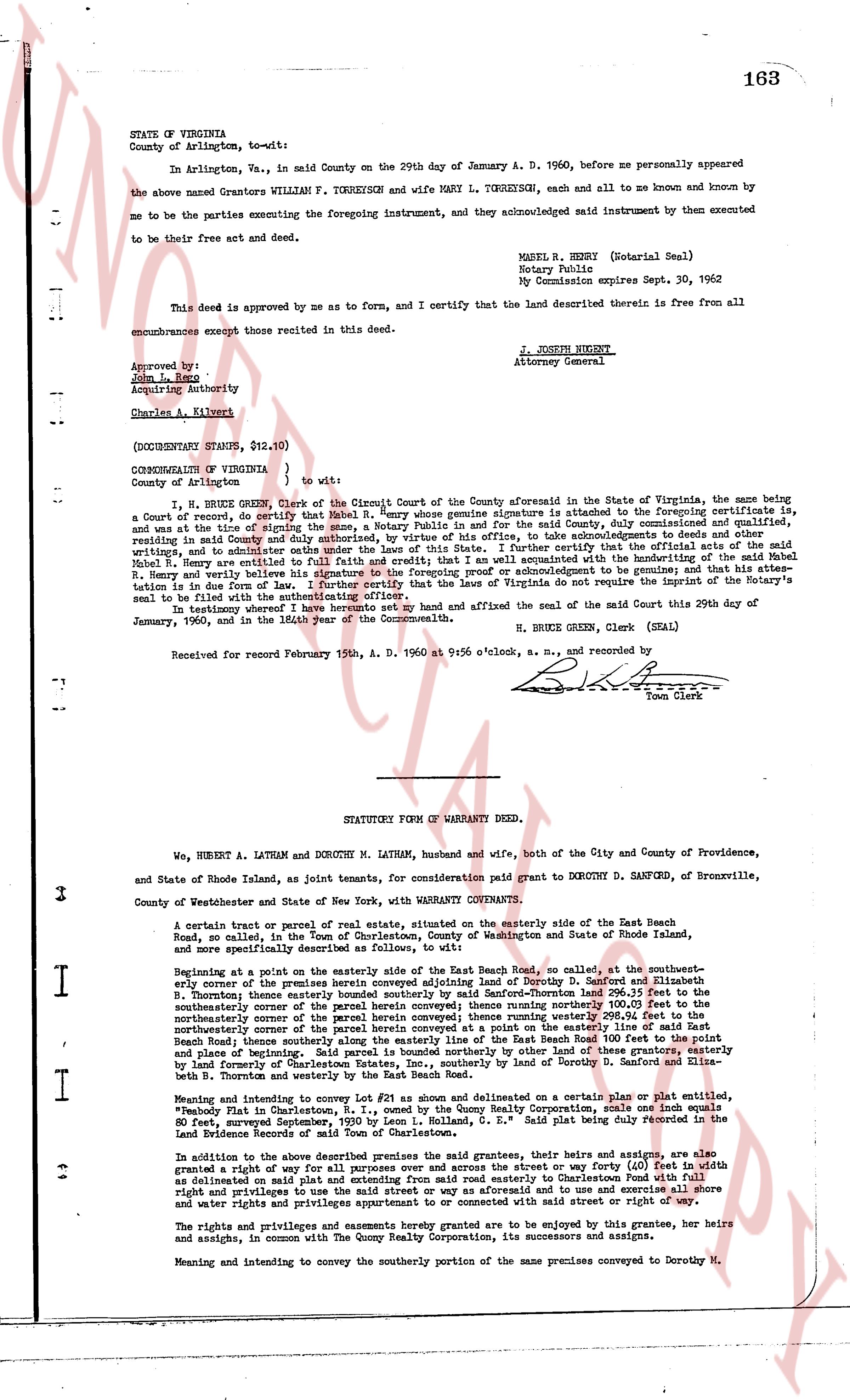
STATE OF VIRGINIA
County of Arlington, to-wit:
In Arlington, Va., in said County on the 29th day of January A. D. 1960, before me personally appeared the above named Grantors WILLIAM F. TORREYSON and MARY L. TORREYSON, each and all of me to known and known by me to be the parties executing the foregoing instrument, and acknowledged said instrument to be their free act and deed.
MARY B. HENRY (Notarial Seal)
Notary Public
My Commission expires Sept. 30, 1962
This deed is approved by me as to form, and I certify that the Land described therein is free from encumbrances except those recited in this deed.
JOSEPH HUGHES
Attorney General
Approved by:
John L. Berg
Acquiring Authority
Charles A. Kilvert
(DOCUMENTARY STAMPS, $12.10)
COMMONWEALTH OF VIRGINIA
County of Arlington to-wit:
I, H. BRUCE GREEN, Clerk of the Circuit Court of the County aforesaid in the State of Virginia, the same being a court of record, do certify that Mabel H. Henry whose signature is attached to the foregoing certificate is, and was at the time of the signing of the same, a Notary Public in and for the said County, duly commissioned and qualified, and residing in said County and duly authorized, by virtue of this office, to administer oaths and certify documents, and to attest the signatures of officers and other persons. I further certify that the official acts of the said notary evidence, and in authenticating the same, I further certify that I am well acquainted with the handwriting of the said Mabel H. Henry are entitled to full faith and credit; that the handwriting of the said notary to be her handwriting and that its signature is true and correct. I further certify that the laws of Virginia do not require the imprint of the Notary's seal to be affixed to this form. I further certify that the laws of Virginia do not require the imprint of the Notary's seal to be affixed with the seal of the Court.
In testimony whereof I have hereunto set my hand and affixed the seal of the said Court this 29th day of January, 1960, and in the 1814th year of the Commonwealth.
H. BRUCE GREEN, Clerk (SEAL)
Received for record February 15th, A. D. 1960 at 9:50 o'clock, a. m., and recorded by
[Signature]
Town Clerk
----
STATUTORY FORM OF WARRANTY DEED.
We, HUBERT A. LATHAM and DOROTHY M. LATHAM, husband and wife, both of the City and County of Providence, and State of Rhode Island, as joint tenants, for consideration paid grant to DOROTHY D. SANFORD, of Bronxville, County of Westchester and State of New York, with WARRANTY COVENANTS.
A certain tract or parcel of real estate, situated on the easterly side of the East Beach Road, so called, in the Town of Charlestown, County of Washington and State of Rhode Island, and more specifically described as following to wit:
Beginning at a point on the easterly side of the East Beach Road, situated at the southeasterly corner of the premises herein conveyed adjoining land of Dorothy D. Sanford and Elizabeth B. Thornton, said point being on the easterly side of said East Beach Road then northerly 139.03 feet to the southeasterly corner of the parcel herein conveyed then running northerly 100.03 feet to the southeasterly corner of the northeast corner of the said parcel then running easterly 20.00 feet to the northeasterly corner of the said parcel herein conveyed at a point on the easterly line of said East Beach Road then southerly 239.06 feet to a point on East Beach Road 100.00 feet south of the point and place of beginning. Said parcel is bounded northerly by other land of these grantors, easterly by land of Dorothy D. Sanford of Bronxville, New York, southerly by land of Dorothy D. Sanford and westerly on both the Northern and Western by the easterly side of East Beach Road.
Meaning and intending to convey Lot #21 as shown and delineated on a certain plan or plat entitled, "Beachside Plot at Charlestown, Rhode Island, the Rhode Island State Corporation, scale one inch equals 80 feet, surveyed September, 1930 by Leon L. Bullard, C. E." Said plat being duly recorded in the Land Evidence Records of said Town.
In addition to the above described premises the said grantees, their heirs and assigns, are also granted a right of way for all purposes over and across the street or way (forty feet in width) as delineated on said plat and recorded as aforesaid, specifically to facilitate access to the said rights and privileges and to use the said street or way as aforesaid to and use and exercise all shore and water rights and privileges and privileges appurtenant to or connected with said street or right of way.
The rights and privileges and easements hereby granted to be enjoyed by this grantees, their heirs and assigns, in common with the Town Property Corporation, its successors and assigns.
Meaning and intending to convey the southerly portion of the same premises conveyed to Dorothy M.
The page as recorded