The instrument's own words
page 1 · read by Gemma vision
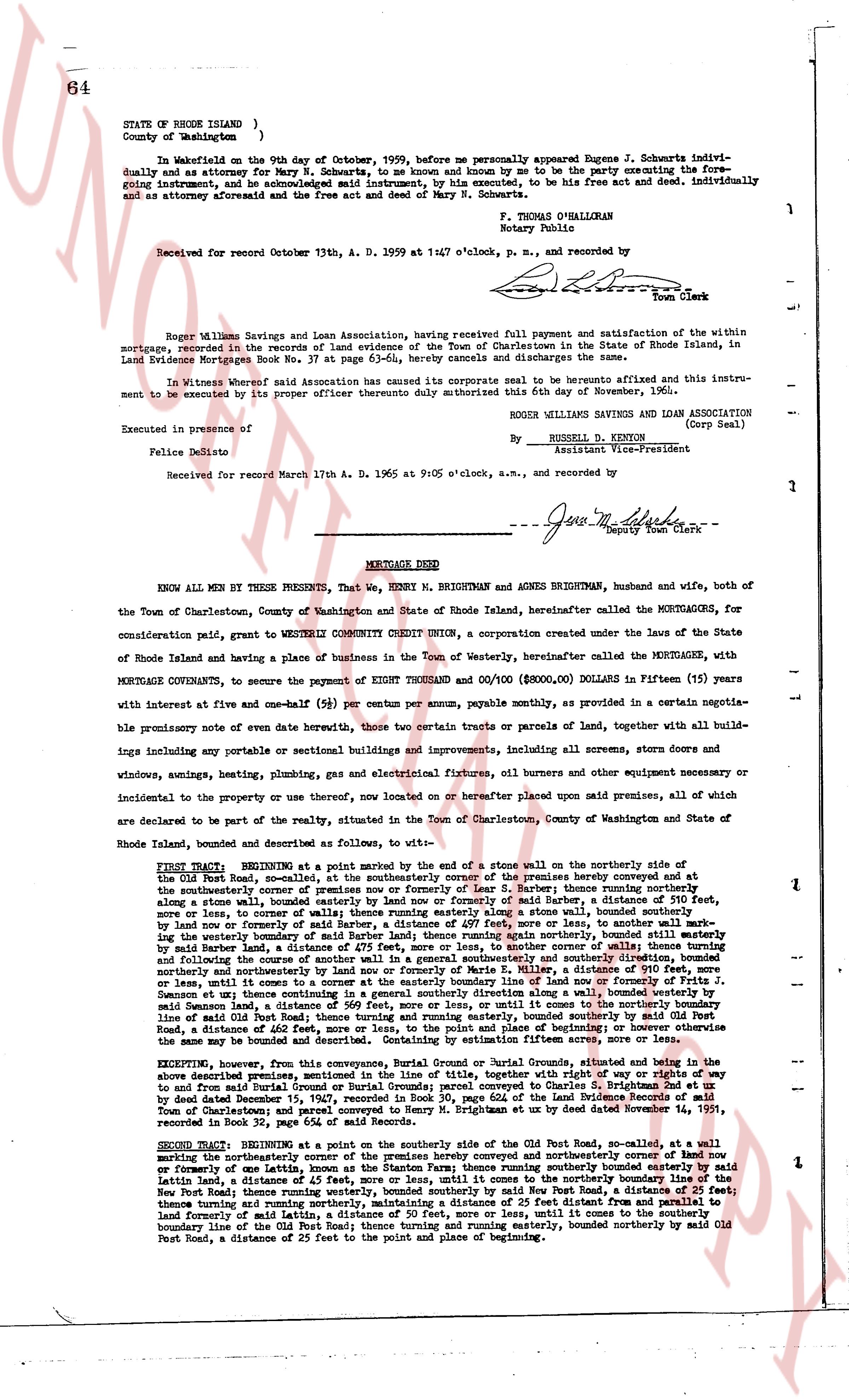
64
STATE OF RHODE ISLAND )
County of Washington } ss:
In Wakefield on the 9th day of October, 1959, before me personally appeared Eugene J. Schwartz individually and as attorney for Mary N. Schwartz, to me known and by me to be the party executing the foregoing instrument, and be acknowledged said instrument, by his executed, to be his free act and deed. Individually and as attorney aforesaid and the free act and deed of Mary N. Schwartz.
F. Thomas O'Halleran
Notary Public
Received for record October 13th, A. D. 1959 at 1/4 o'clock p. m., and recorded by
[Signature]
Town Clerk
Roger Williams Savings and Loan Association, having received full payment and satisfaction of the within mortgage, recorded in the records of land evidence of the Town of Charlestown in the State of Rhode Island, in Land Evidence Mortgages Book No. 37 at page 63-64, hereby cancels and discharges the same.
In Witness whereof said Association has caused its corporate seal to be hereunto affixed and this instrument to be executed by its proper officer thereunto duly authorized on the 6th day of November, 1960.
ROGER WILLIAMS SAVINGS AND LOAN ASSOCIATION
(Corp Seal)
By RUSSELL D. KENTON
Assistant Vice-President
Executed in presence of
Felice Polizio
Received for record March 17th A. D. 1965 at 9:05 o'clock, a.m., and recorded by
[Signature]
Deputy Town Clerk
----
MORTGAGE DEED
KNOW ALL MEN BY THESE PRESENTS, That we, HENRY N. BRIGHTMAN and AGNES BRIGHTMAN, husband and wife, both of the Town of Charlestown, County of Washington and State of Rhode Island, hereinafter called the MORTGAGORS, for consideration paid, grant to WESTERLY COMMUNITY CREDIT UNION, a corporation created under the laws of the State of Rhode Island and having a place of business in the Town of Westerly, hereinafter called the MORTGAGEE, with MORTGAGE COVENANTS, to secure the payment of EIGHT THOUSAND and 00/100 ($8,000.00) DOLLARS in Fifteen (15) years with interest at five and one-half (5%) per centum per annum, payable monthly, specified in a certain negotiable promissory note of even date herewith, those two certain tracts or parcels of land, together with all buildings including any possible or actual sectional buildings and improvements including all screens, storm doors and windows, awnings, heating, plumbing, gas and electrical equipment, fixtures, oil burners and other equipment necessary or incidental to the property or its use thereon, now located on or hereafter placed upon said premises, all of which are declared to be part of the realty, situated in the Town of Charlestown, County of Washington and State of Rhode Island, bounded and described as follows, to wit:
FIRST TRACT: BEGINNING at a point marked by the end of a stone wall on the northerly side of the Old Post Road, so-called, at the southeasterly corner of the premises hereby conveyed and extending northerly along a stone wall, bounded easterly by the land of R. Butler, a distance of 310 feet, then turning easterly along a stone wall, bounded northerly by the land of R. Butler, a distance of 111 feet, bounded by land now or formerly owned by said Butler, a distance of 437 feet, more or less, to another wall marking the westerly boundary of the land of R. Butler, then turning northerly along said wall, bounded easterly by land now or formerly owned by said Butler, a distance of 475 feet, more or less, to another corner of the wall marking the westerly boundary of the land of R. Butler, then turning easterly along said wall, bounded northerly by land now or formerly owned by said Butler, a distance of 475 feet, more or less, to another corner of the wall; thence turning northerly and southeasterly along a stone wall, bounded easterly by the land of Marie E. Miller, a distance of 910 feet, more or less, until it comes to the easterly boundary line of now or formerly owned by S. [?] and bounded westerly by the land of Eugene J. Schwartz and Mary N. Schwartz by Atty, a distance of 310 feet, along a wall bounded westerly by said Samson land, a distance of 569 feet, more or less, or until it comes to the northerly boundary line of said Old Post Road, then turning southerly along said road, bounded northerly by said road, a distance of 605 feet, more or less, or until it comes to the point of beginning or however otherwise the same may be bounded and described, containing 3.15 acres more or less.
EXCEPTING, however, from this conveyance, Burial Ground or Burial Grounds, situated and being in the above described premises, contained in the line of title, together with right of way or rights of way to and from said burial ground, conveyed to the said Samson to Daniel E. Brightman by deed dated December 15, 1927, recorded in Book 30, page 604 of the Land Evidence Records of said Town at said office. Also excepting the burial ground situated on the land by deed dated November 14, 1931, recorded in Book 32, page 564 of said Records.
SECOND TRACT: BEGINNING at a point on the southerly side of the Old Post Road, so-called, now or formerly conveyed and mortgaged now or formerly owned by the heirs of Lennon, the Stone Farm; thence running southerly bounded easterly by said Old Post Road, a distance of 23 feet; thence running westerly, bounded southerly by said New Post Road, a distance of 23 feet; thence turning running westerly, bounded southerly by said New Post Road, a distance of 23 feet, then turning easterly and running northerly, maintaining a distance of 23 feet from the southerly boundary line of said land formerly of said Lennon, a distance of 23 feet, more or less, until it comes to the southerly boundary line of the Old Post Road; thence turning and running easterly, bounded northerly by said Old Post Road, a distance of 22 feet to the point and place of beginning or described.
The page as recorded