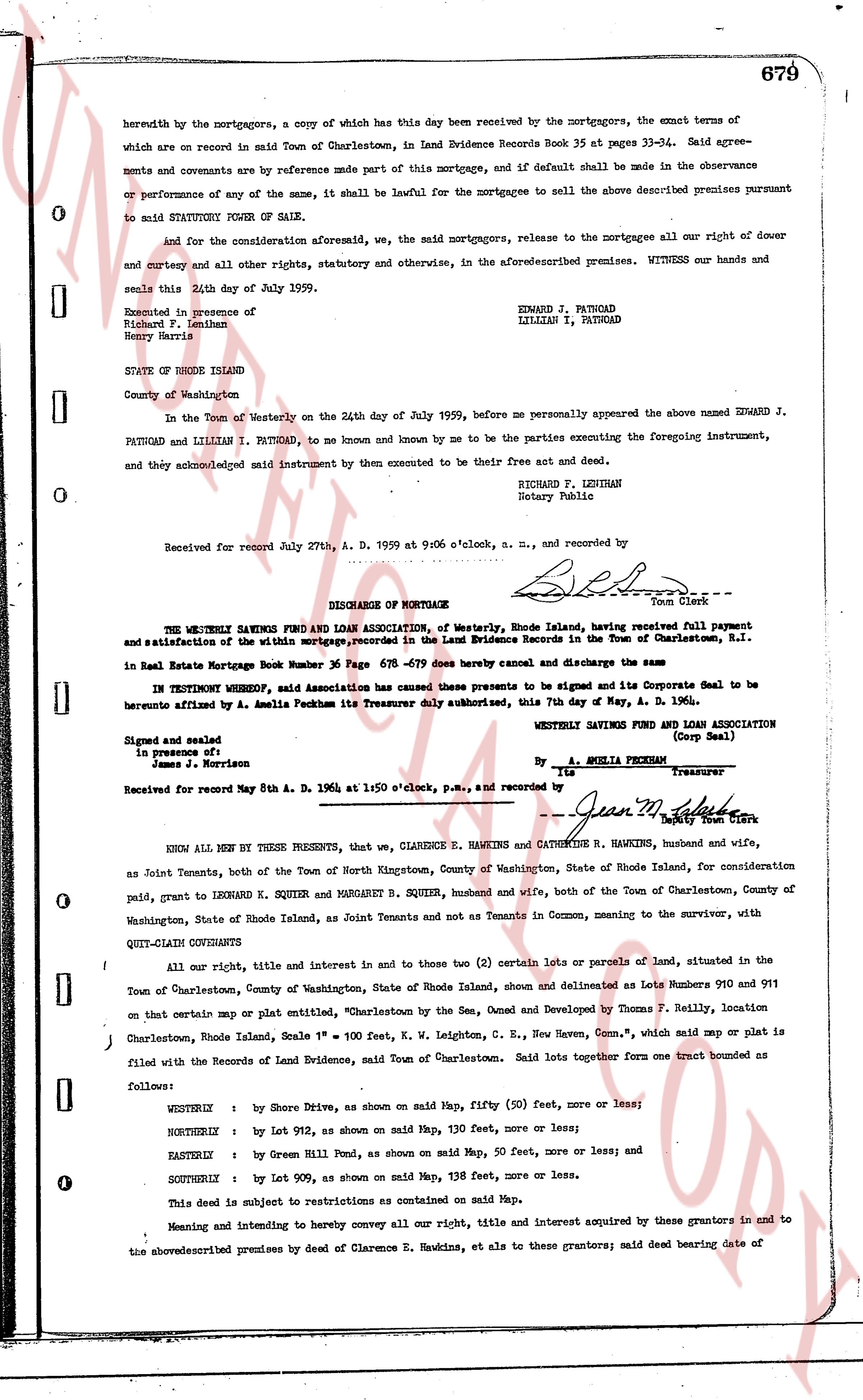
The instrument's own words
page 1 · read by Gemma vision
679
herewith by the mortgagors, a copy of which has this day been received by the mortgagors, the exact terms of which are on record in said Town of Charlestown, in Land Evidence Records Book 35 at pages 33-34. Said agreements and covenants are by reference made part of this mortgage, and if default shall be made in the observance or performance of any one of the same, it shall be lawful for the mortgagee to sell the above described premises pursuant to said STATUTORY POWER OF SALE.
and for the consideration aforesaid, we, the said mortgagors, release to the mortgagee all our right of dower and curtesy and all other rights, statutory and otherwise, in the aforementioned premises. Witness our hands and seals this 24th day of July 1959.
Executed in presence of
Richard F. Lenihan
Henry Harris
STATE OF RHODE ISLAND
County of Washington
In the Town of Westerly on the 24th day of July 1959, before me personally appeared the above named EDWARD J. PATNOAD and LILLIAN I. PATNOAD, to me and known by me to be the parties executing the foregoing instrument, and they acknowledged said instrument by them executed to be their free act and deed.
RICHARD F. LENIHAN
Notary Public
Received for record July 27th, A. D. 1959 at 9:06 o'clock, a. m., and recorded by
[Signature]
Town Clerk
----
DISCHARGE OF MORTGAGE
The WESTERLY SAVINGS FUND AND LOAN ASSOCIATION, of Westerly, Rhode Island, having received full payment and satisfaction of the within mortgage, recorded in the Land Evidence Records in the Town of Charlestown, R.I. in Real Estate Mortgage Book No. 36 Page 679 -679 does hereby cancel and discharge the same
IN TESTIMONY WHEREOF, said Association has caused these presents to be signed and its Corporate Seal to be hereunto affixed by A. Amelia Peckham its Treasurer duly authorized, this 7th day of May, A. D. 1964.
Signed and sealed
In presence of:
James J. Morrison
WESTERLY SAVINGS FUND AND LOAN ASSOCIATION
(Corp Seal)
By A. AMELIA PECKHAM
its Treasurer
Received for record May 8th A. D. 1964 at 1:50 o'clock, p.m., and recorded by
[Signature]
Town Clerk
KNOW ALL MEN BY THESE PRESENTS, that we, CLARENCE E. HAWKINS and CATHERINE R. HAWKINS, husband and wife, as Joint Tenants, both of the Town of North Kingstown, County of Washington, State of Rhode Island, for consideration paid, grant to LEONARD K. SQUIRR and MARGARET B. SQUIRR, husband and wife, both of the Town of Charlestown, County of Washington, State of Rhode Island, as Joint Tenants and not as Tenants in Common, meaning to the survivor, with
QUIT-CLAIM CONVEYANCE
All our right, title and interest in and to those two (2) certain lots or parcels of Land, situated in the Town of Charlestown, County of Washington, State of Rhode Island, shown and delineated as Lots Numbers 910 and 911 on certain map or plat entitled "Charlestown by the Sea, Owned and Developed by Thomas F. Reilly, location Charlestown, Rhode Island, Scale 1" = 100 Feet, K. W. Leighton, C. E., New Haven, Conn.", which said map or plat is filed with the Records of Land Evidence, said Town of Charlestown. Said lots together form one tract bounded as follows:
WESTERLY : by Shore Drive, as shown on said Map, fifty (50) feet, more or less;
NORTHERLY : by Lot 912, as shown on said Map, 130 feet, more or less;
EASTERLY : by Green Hill Pond, as shown on said Map, 50 feet, more or less; and
SOUTHERLY : by Lot 909, as shown on said Map, 138 feet, more or less.
This deed is subject to restrictions as contained on said Map.
Meaning and intending to hereby convey all our right, title and interest acquired by these grantors in and to the above described premises by deed of Clarence E. Hawkins, et al to these grantors; said deed bearing date of
The page as recorded