The instrument's own words
page 1 · read by Gemma vision
608
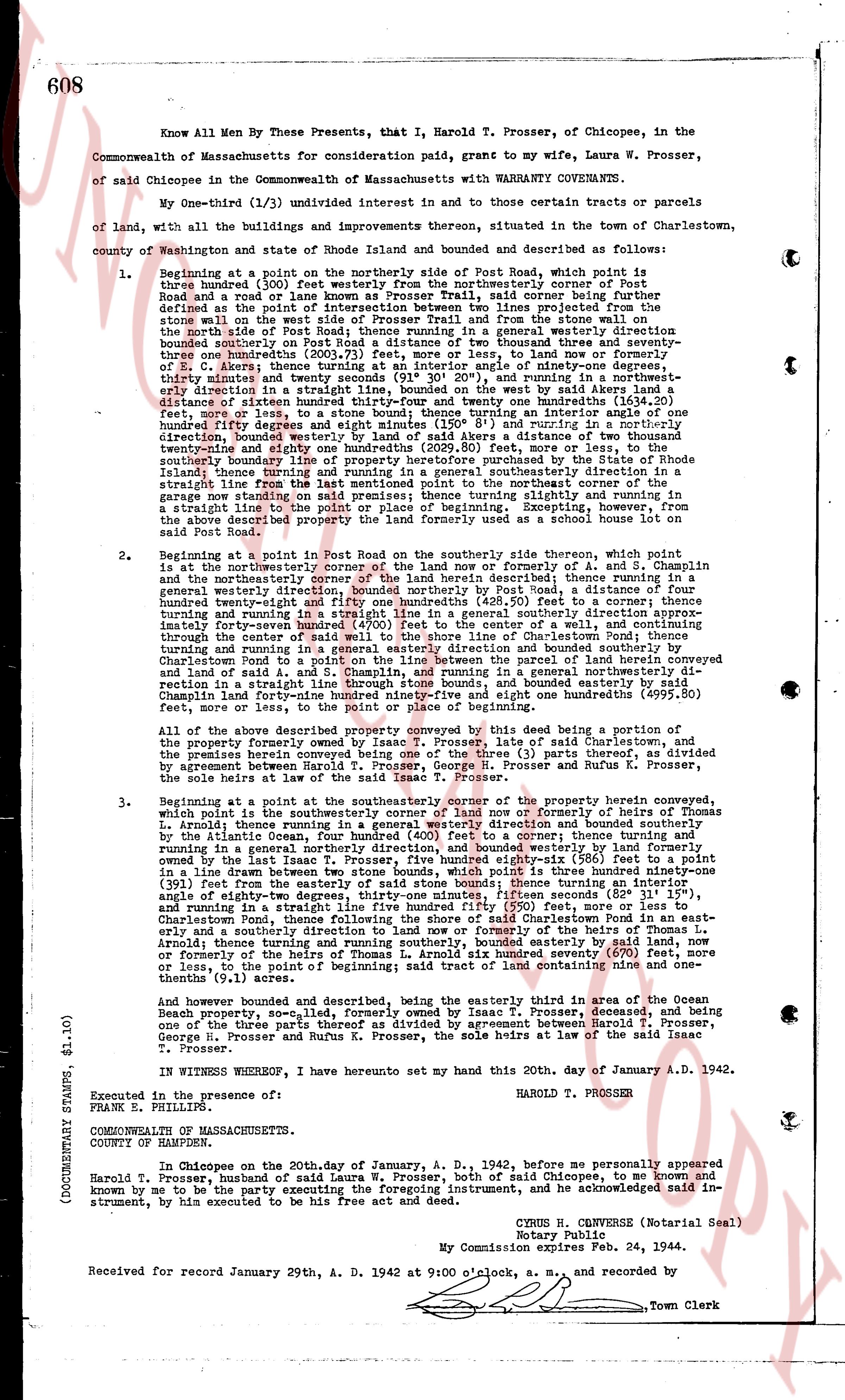
Know All Men By These Presents, that I, Harold T. Prosser, of Chicopee, in the Commonwealth of Massachusetts for consideration paid, grant to my wife, Laura W. Prosser, of said Chicopee in the Commonwealth of Massachusetts with WARRANTY COVENANTS.
My One-third (1/3) undivided interest in and to those certain tracts or parcels of land, with all the buildings and improvements thereon, situated in the town of Charlestown, county of Washington and state of Rhode Island and bounded and described as follows:
1. Beginning at a point on the northerly side of Post Road, which point is three hundred fifty feet east of the intersection of the northeasterly corner of said Post Road and a road or lane known as Prosser Trail, said trail corner being further defined as the point at which the Prosser Trail, as now shown projected from the stone wall on the west side of Prosser Trail and from the stone wall on the northeasterly side of Post Road, runs in a general westerly direction starting bounded southerly on Post Road a distance of two thousand three hundred and seventy-three feet; thence turning and running in a general westerly direction to the end of E. C. Akers' land; thence turning at an angle of interior ninety-one degrees, twenty-two minutes and running in a general westerly direction a distance of one hundred eighty-one feet, more or less, to a stone bound; thence turning an interior angle of one hundred eighty-three degrees and twenty-one minutes and running in a general northeasterly direction, bounded westerly by land of said Akers a distance of two thousand twenty-one and eighty-nine feet (2021.89 feet), more or less, to the southeasterly corner of a wall; thence turning and running in a general southeasterly direction in a straight line turning and running in a general southeasterly direction in a straight line to the northeasterly corner of a garage now standing on said premises; thence turning slightly and running in a straight line to the point of beginning; Excepting, however, from the above described property the land formerly used as a school house lot on said Post Road.
2. Beginning at a point in Post Road on the southerly side thereon, which point is at the northeasterly corner of the land now or formerly of A. and S. Chaplin and the northeasterly corner of the land now or formerly of said Akers; thence turning in a general westerly direction, bounded northerly by Post Road, a distance of four hundred seventy-four feet (474 feet) to a stone bound; thence turning in a general westerly direction turning and running in a straight line in a general southeasterly direction approximately forty-seven feet, bounded northerly by a wall, thence turning and running through the center of said wall to the shore line of Charlestown Pond; thence turning and running in a general easterly direction and bounded southerly by Charlestown pond; thence turning and running in a general northeasterly direction over a parcel of land conveyed by Charlestown pond to A. and S. Chaplin, and running in a general northeasterly direction to its boundary line; thence turning and running in a general easterly direction and bounded southerly by Charlestown pond forty-one hundred ninety-five and eight one hundredths yards (4995.80 feet), more or less, to the point of beginning.
All of the above described property conveyed by this deed being a portion of the property formerly owned by Isaac T. Prosser, late of said Charlestown, the premises herein described being the one-third (1/3) part thereof as divided by agreement between Harold T. Prosser, George H. Prosser and Rufus K. Prosser, the sole heirs at law of said Isaac T. Prosser.
3. Beginning at a point in the southeasterly corner of the property herein conveyed, which point is in the southeasterly corner of the land now or formerly of Thomas L. Arnold; thence running in a general easterly direction, bounded north by a wall and bounded on the Atlantic Ocean, four hundred feet (400 feet), to a center turning and running in a general northerly direction, and bounded westerly by land formerly owned by the last named Arnold, a distance of one thousand five hundred fifty-six feet (1556 feet), to a point in a line drawn between two stone bounds, which point is three hundred ninety-one (391 feet), more or less, from the last named stone bound; thence turning at an interior angle of eighty-two degrees, thirty-one minutes, fifteen seconds (82° 31' 15") and running in a straight line to the point of beginning, a distance of 690 feet; thence turning in a general southeasterly direction, following the shore of said Charlestown Pond, in an easterly direction to the point of beginning; Excepting, however, a part of the land of Thomas L. Arnold; thence turning and running southerly, bounded easterly by said land, now or formerly, of the last named Arnold, a distance of one hundred several seventy (170 feet) or less, to the point of beginning; said tract containing nine rods and one-tenth gunnels (9.1 acres).
And however bounded and described, being the easterly third in area of the Ocean Beach property, so-called, land formerly owned by Isaac T. Prosser, deceased, and being one of the three parts thereof as divided by agreement between Harold T. Prosser, George H. Prosser and Rufus K. Prosser, the sole heirs at law of said Isaac T. Prosser.
IN WITNESS WHEREOF, I hereunto set my hand this 20th, day of January A. D. 1942.
HAROLD T. PROSSER
Executed in the presence of:
FRANK E. PHILLIPS
COMMONWEALTH OF MASSACHUSETTS.
COUNTY OF HAMPDEN.
In Chicopee on the twentieth day of January, A. D. 1942, before me personally appeared Harold T. Prosser, husband of said Laura W. Prosser, both of said Chicopee, to me known and known by me to be the party executing the foregoing instrument, and he acknowledged said instrument, by him to be executed for his free act and deed.
CYRUS H. CONVERSE (Notarial Seal)
Notary Public.
My Commission expires Feb. 24, 1944.
Received for record January 29th, A. D. 1942 at 9:00 o'clock, a. m., and recorded by
Town Clerk
(DOCUMENTARY STAMPS $1.10)
The page as recorded