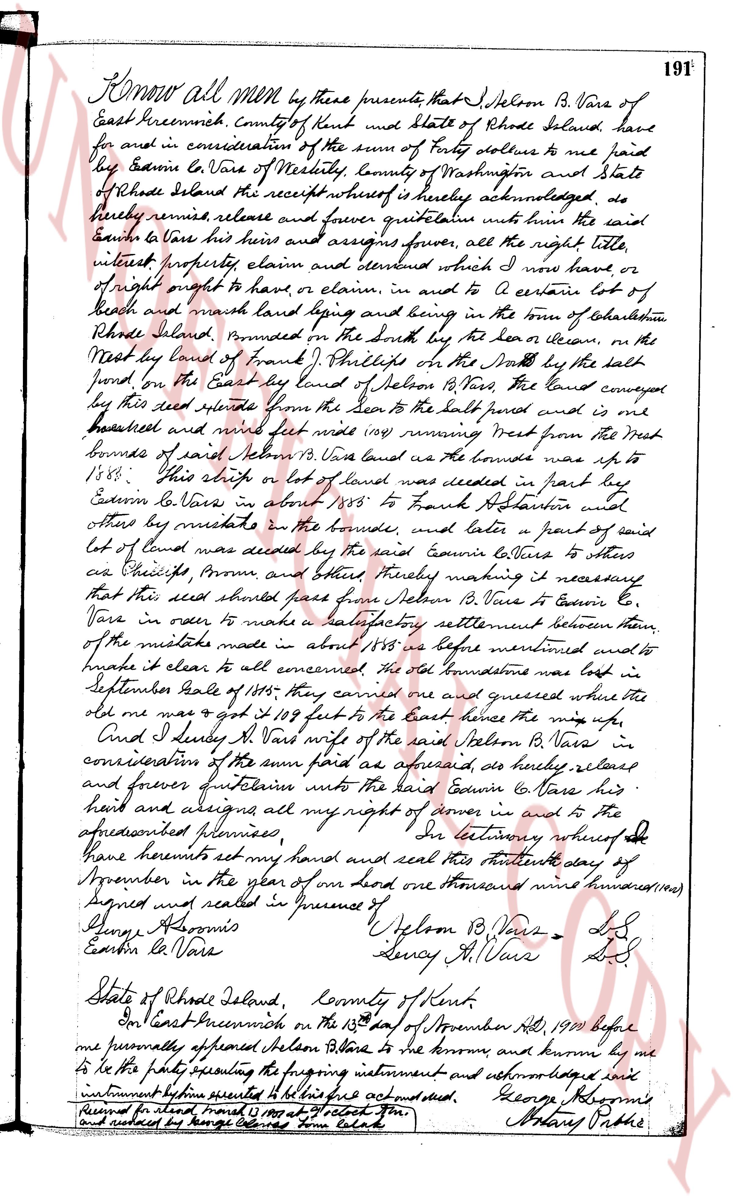
The instrument's own words
page 1
Know all men by these presents, that I, Selbon B. Vars of
East Greenwich, County of Kent and State of Rhode Island, have
for and in consideration of the sum of forty dollars to me paid
by Cousin Le Vars of Westerly, County of Washington and State
of Rhode Island the receipt whereof is hereby acknowledged, do
hereby remise release and forever quitclaim unto the said
Cousin Le Vars his heirs and assigns forever, all the right title,
interest property claim and demand which I now have, or
of right ought to have, or claim, in and to a certain lot of
beach and marsh land lying and being in the town of Charlestown,
Rhode Island, bounded on the North by the beach or ocean, on the
West by land of Israel Phillips on the South by the salt
pond on the East by land of Selbon B. Vars, the Land conveyor
by this deed extends from the sea to the salt pond and is one
hundred and nine feet wide (109) running West from the West
bounds of said Selbon B. Vars land as the bounds was up to
1885. This strip or lot of land was deeded in part by
Cousin Le Vars in about 1885 to Frank Stanton and
others by mistake in the bounds, and later a part of said
lot of land was deeded by the said Cousin Le Vars to others
as Phillips, Brown and others thereby making it necessary
that this said parcel pass from Selbon B. Vars to Cousin Le
Vars in order to make a satisfactory settlement between them
of the mistake made in about 1885 as before mentioned and to
make it clear to all concerned the old stone wall was in lot
in September Scale of 1885 they came and measured where the
old me was got it 109 feet to the East hence the mix ups.
And I Lucy H. Vars wife of the said Selbon B. Vars in
consideration of the sum paid as aforesaid, do hereby release
and forever quitclaim into the hands Cousin Le Vars his
heirs and assigns all my right of owner in and to the
aforementioned premises. In testimony whereof
I have hereunto set my hand and seal this thirteenth day of
September in the year of our Lord one thousand nine hundred(1900)
Signed and sealed in presence of
George Osborne [Signature] Selbon B. Vars [Seal]
Edwin Le Vars [Signature] Lucy H. Vars [Seal]
State of Rhode Island, County of Kent.
In East Greenwich on the 13th day of November AD 1900 before
me personally appeared Selbon B. Vars to me known and known by me
to be the party executing the foregoing instrument and acknowledged had
instrument before executed to be his act and deed. George Osborne
[Signature] Henry Pottle
Received and recorded March 1901 at 4 o'clock PM.
and indexed by George Edward some Clerk
The page as recorded