The instrument's own words
page 1 · read by Gemma vision
383
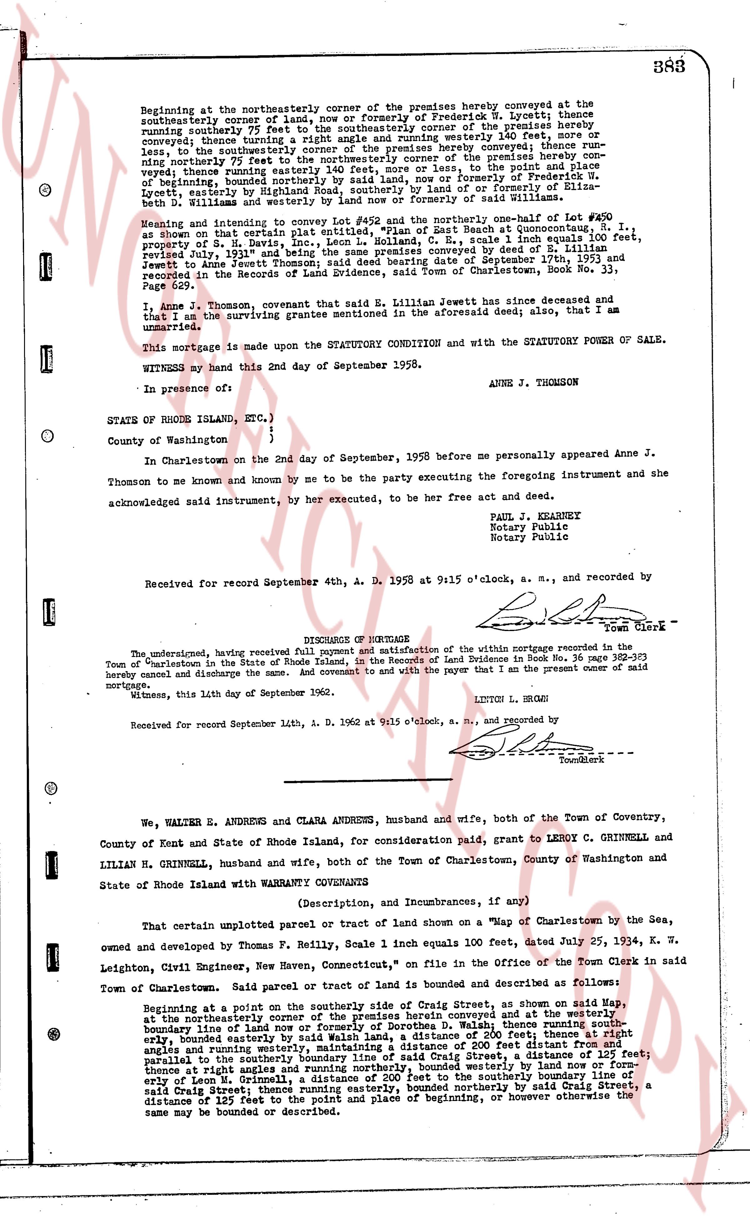
Beginning at the northeasterly corner of the premises hereby conveyed at the southeasterly corner of land, now or Formerly of Frederick W. Lycett; thence southeasterly some 75 feet to the southeasterly corner of the premises hereby running southeasterly 75 feet to the southeasterly corner of the premises hereby conveyed; thence turning a right angle and running northwesterly 140 feet, thence running northwesterly 140 feet to the northwesterly corner of the premises hereby conveyed; thence running northerly 75 feet to the northwesterly corner of the premises hereby conveyed; thence running northwesterly some 75 feet or there or there about, to the point and place of beginning, bounded northerly by said land, now or formerly of Frederick W. Lycett, easterly by land now or formerly of Frederick W. Lycett and land now or formerly of Seth W. Williams and westerly by land now or formerly of said Williams.
Meaning and intending to convey Lot #452 and the northerly one-half of Lot #420 as shown on that certain Plat of the "Beach at Housatonic, R. I." surveyed by S. H. Davis, Inc., LCCN L. Colland, R. E., scale 1 inch equals 100 feet, revised July 31st, 1936 and filed in the Town Clerk's office and conveyed by deed of September 17th, 1953 to Anne J. Thomson; said deed bearing date of September 17th, 1953 and recorded in the Records of Land Evidence, said Town of Charlestown, Book No. 33, Page 549.
I, Anne J. Thomson, covenant that said E. Lillian Jewett has since deceased that and that I am the surviving grantee mentioned in the aforesaid deed; also, that I am unmarried.
This mortgage is made upon the STATUTORY CONDITION and with the STATUTORY POWER OF SALE.
WITNESS my hand this 2nd day of September 1958.
ANNE J. THOMSON
In presence of:
{
STATE OF RHODE ISLAND, ETC.)
{
County of Washington.
{
In Charlestown on the 2nd day of September, 1958 before me personally appeared Anne J. Thomson to me known and by me to be the party executing the foregoing instrument and she acknowledged said instrument, by her executed, to be her free act and deed.
PAUL J. KEANEY
Notary Public
Notary Public
Received for record September 4th, A. D. 1958 at 9:15 o'clock, a. m., and recorded by
[Signature]
Town Clerk
----
DISCHARGE OF MORTGAGE
The undersigned, having received full payment and satisfaction of the within mortgage recorded in the Town of Charlestown in the State of Rhode Island, in the Record of Land Evidence in Book No. 36 page 383 hereby cancel and discharge the same. And covenant and to the party whoever I am the present owner of said mortgage.
Witness, this 14th day of September 1962.
LINTON L. BROWN
Received for record September 14th, A. D. 1962 at 9:15 o'clock, a. m., and recorded by
[Signature]
Town Clerk
----
We, WALTER E. ANDREWS and CLARA ANDREWS, husband and wife, both of the Town of Coventry, County of Kent and State of Rhode Island, for consideration said paid, grant to LEROY C. GRINNELL and LILIAN H. GRINNELL, husband and wife, both of the Town of Charlestown, County of Washington and State of Rhode Island with WARRANTY COVENANTS
(Description, and Incumbrances, if any)
That certain unplotted parcel or tract of land shown on a "Map of Charlestown by the Sea," owned and developed by Thomas P. Reilly, Scale 1 inch equals 100 feet, dated July 25, 1924, E. W. Leighton, Civil Engineer, New Haven, Connecticut," on file in the Office of the Town Clerk in said Town of Charlestown. Said parcel or tract of land is bounded and described as follows:
Beginning at a point on the southerly side of Craig Street, as shown on said Map, at the northeasterly corner of the premises herein conveyed and at the westerly boundary line of land now or formerly of Frederick W. Lycett; thence running southeasterly, bounded northerly by said land, a distance of 200 feet; thence at right angles and running westerly, maintaining a distance of 200 feet; thence at right angles and running northerly, bounded easterly by land now or formerly of Leo M. Grinnell, a distance of 125 feet; thence at right angles and running northerly, bounded easterly by land now or formerly of Leo M. Grinnell, a distance of 125 feet to the southeasterly corner of land now or formerly of said Craig Street; thence running easterly, bounded northerly by said Craig Street, a distance of 125 feet to the point and place of beginning, or however otherwise the same may be bounded or described.
The page as recorded