The instrument's own words
page 1 · read by Gemma vision
335
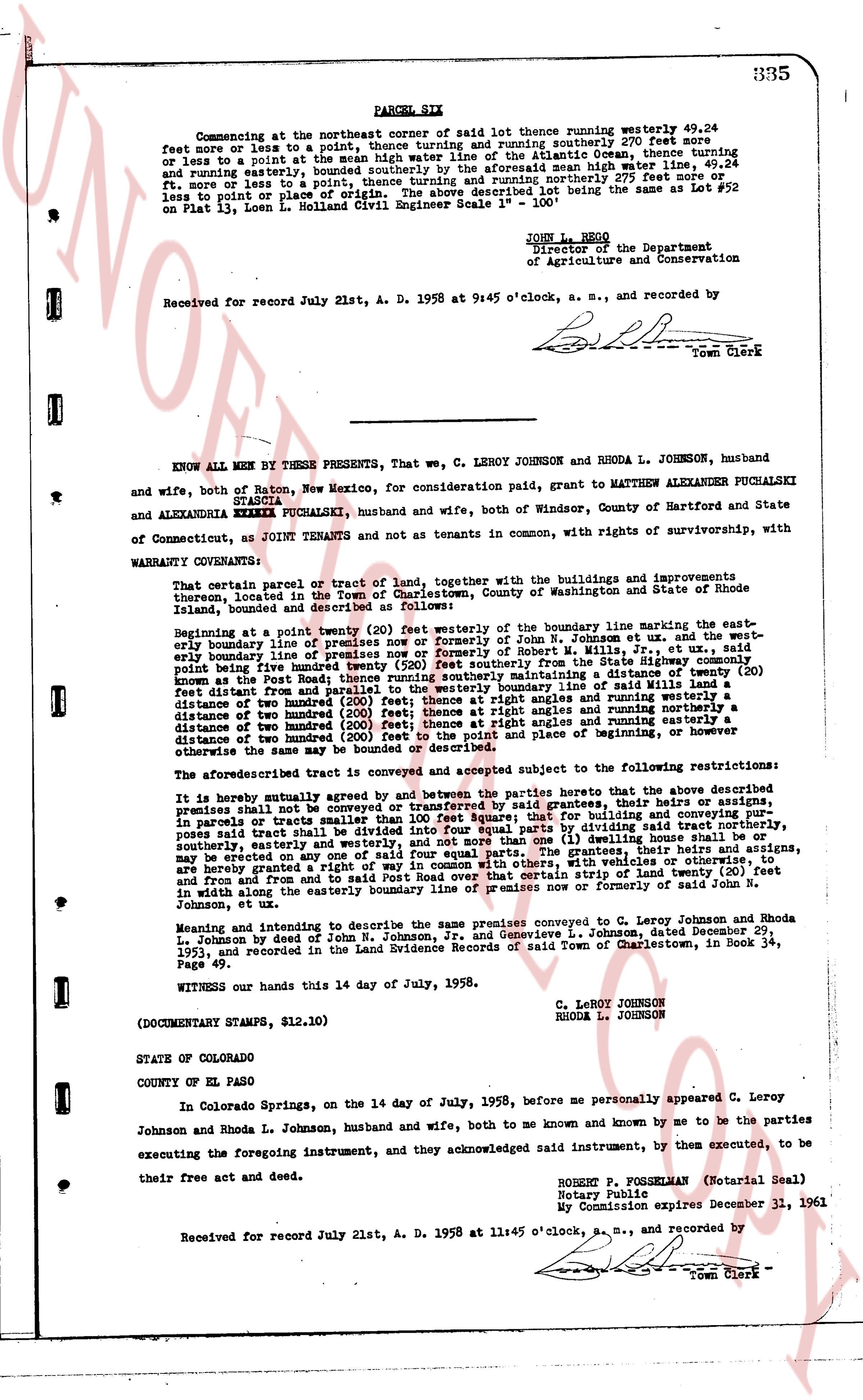
PARCEL SIX
Commencing at the northeast corner of said lot thence running westerly 49.24 feet more or less to a point, thence turning and running southerly 290 feet more or less to a point at the easterly boundary line of the Atlantic Ocean, thence turning and running easterly 49.24 feet, bounded southerly by the aforesaid mean high water line, 49.24 feet, more or less to a point, thence turning and running northerly 290 feet more or less to a point of place of beginning. Said Lot being the same as Lot # 52 on Plat # 13, Locm. in Holland Civil Engineer Scale 1" = 100'.
JOHN L. REGO
Director of the Department
of Agriculture and Conservation
Received for record July 21st, A. D. 1958 at 9:45 o'clock, a. m., and recorded by
L.P.L.
Town Clerk
----
KNOW ALL MEN BY THESE PRESENTS, That we, C LEROY JOHNSON and RHODA L JOHNSON, husband and wife, both of Raton, New Mexico, for consideration paid, CEDIT, grant to MATTHEW ALEXANDER PUCHALSKI and ALEXANDRIA STASCIA PUCHALSKI, husband and wife, both of Windsor, County of Hartford and State of Connecticut, as JOINT TENANTS and not as tenants in common, with rights of survivorship, with WARRANTY CONVEYANCE:
That certain parcel or tract of land, together with the buildings and improvements upon improvements thereon, located in the Town of Charlestown, County of Washington and State of Rhode Island, bounded and described as follows:
Beginning at a point twenty (20) feet westerly of the boundary line marking the easterly boundary line of premises formerly of John N. Johnson et ux and the westerly boundary line of premises now or formerly of said John N. Johnson from the State highway commonly known as the Post Road; thence running southerly maintaining a distance of twenty (20) feet distant from the easterly boundary line of said premises and running parallel with said boundary a distance of two hundred (200) feet; thence at right angles and running easterly a distance of two hundred (200) feet; thence at right angles and running northerly a distance of two hundred (200) feet; thence at right angles and running westerly a distance of two hundred (200) feet to the point and place of beginning, or however otherwise the same may be described.
The aforesaid described tract is conveyed and accepted subject to the following restrictions:
It is hereby mutually agreed by and between the parties hereto that the above described premises shall not be conveyed or transferred by said grantees, or their heirs, assigns, in council or trust unless the entire tract is conveyed. In the event of building and conveying purposes said tract shall be divided into four equal parts by dividing said tract northerly, southerly, easterly and westerly in the center. No dwelling or other building may be erected on any one of said four equal parts. The grantees, their heirs and assigns, are hereby granted a right of way ten (10) feet wide, running easterly and westerly, and running from and from and in from the and to said Post Road over that certain strip of land twenty (20) feet in width along the easterly boundary line of premises now or formerly of John N. Johnson, et ux.
Meaning and intending to describe the same premises conveyed to C. Leroy Johnson and Rhoda L. Johnson by deed of John N. Johnson Jr., and Genevieve L. Johnson, Dated December 29, 1951, and recorded in the Land Evidence Records of said Town of Charlestown, in Book 34, Page 191.
Witness our hands this 14 day of July, 1958.
C. LEROY JOHNSON
RHODA L. JOHNSON
(DOCUMENTARY STAMPS, $12.10)
STATE OF COLORADO
COUNTY OF EL PASO
In Colorado Springs, on the 14 day of July, 1958, before me personally appeared C. Leroy Johnson and Rhoda L. Johnson, husband and wife, both to me known and by me known to be the parties executing the foregoing instrument, and they acknowledged said instrument, by them executed, to be their free act and deed.
ROBERT P. POSSEHLMAN (Notarial Seal)
Notary Public
My Commission expires December 31, 1961
Received for record July 21st, A. D. 1958 at 11:45 o'clock, a. m., and recorded by
L.P.L.
Town Clerk
The page as recorded