The instrument's own words
page 1 · read by Gemma vision
235
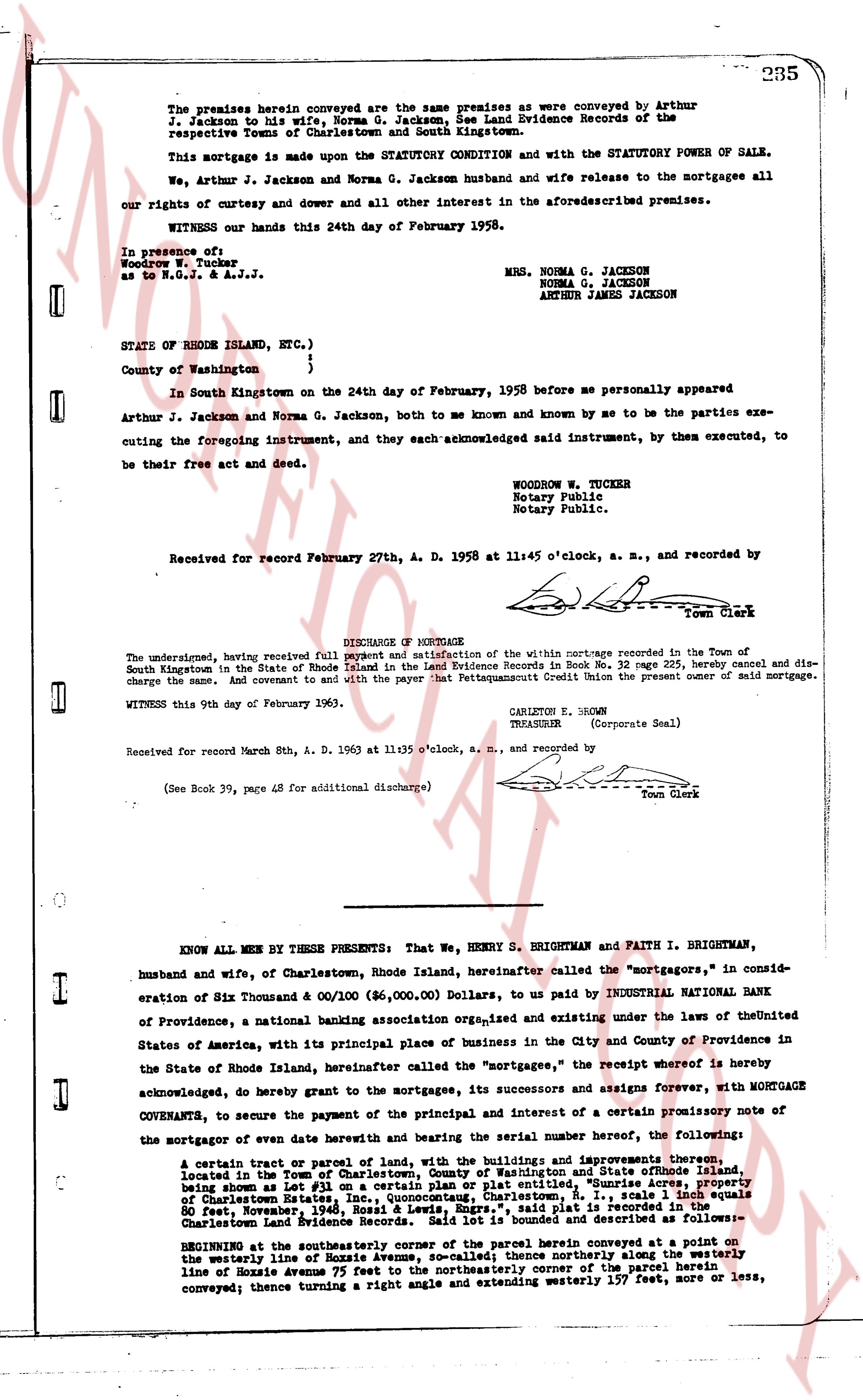
The premises herein conveyed are the same premises as were conveyed by Arthur J. Jackson to his wife, Norma G. Jackson, as appears in the Land Evidence Records of the respective Towns of Charlestown and North Kingstown.
This mortgage is made upon the STATUTORY CONDITION and with the STATUTORY POWER OF SALE.
We, Arthur J. Jackson and Norma G. Jackson husband and wife release to the mortgagee all our rights of curtesy and dower and all other interest in the aforesaid described premises.
WITNESS our hands this 24th day of February 1958.
In presence of:
Woodrow W. Tucker
as to N.G.J. & A.J.J.
MRS. NORMA G. JACKSON
NORMA G. JACKSON
ARTHUR JAMES JACKSON
STATE OF RHODE ISLAND, ETC.)
County of Washington }
}
In South Kingstown on the 24th day of February, 1958 before me personally appeared Arthur J. Jackson and Norma G. Jackson, both to me known and by me to be the parties executing the foregoing instrument, and they each acknowledged said instrument, by them executed, to be their free act and deed.
WOODROW W. TUCKER
Notary Public
Notary Public
Notary Public.
Received for record February 27th, A. D. 1958 at 11:45 o'clock, a. m., and recorded by
[Signature]
Town Clerk
DISCHARGE OF MORTGAGE
The undersigned, having received full payment and satisfaction of the within mortgage recorded in the Town of South Kingstown in the State of Rhode Island in the Land Evidence Records in Book No. 32 page 225, hereby cancel and discharge the same. And covenant to and with the payor that Pettaquamscutt Credit Union the present owner of said mortgage.
WITNESS this 9th day of February 1963.
CARLTON E. BROWN
TREASURER (Corporate Seal)
Received for record March 8th, A. D. 1963 at 11:35 o'clock, a. m., and recorded by
(See Book 39, page 48 for additional discharge)
[Signature]
Town Clerk
----
KNOW ALL MEN BY THESE PRESENTS: That We, HENRY S. BRIGHTMAN and FAITH I. BRIGHTMAN, husband and wife, of Charlestown, Rhode Island, hereinafter called the "mortgagors," in consideration of Six Thousand & 00/100 ($6,000.00) Dollars, to us paid by INDUSTRIAL NATIONAL BANK of Providence, a national banking association org,ised and existing and under the laws of the United States of America, with its principal place of business in the City and County of Providence in the State of Rhode Island, hereinafter called the "mortgagee," the receipt whereof is hereby acknowledged, do hereby grant to the mortgagee, its successors and assigns forever, with MORTGAGE COVENANTS, to secure the payment of the principal and interest of a certain promissory note of the mortgagor of even date and bearing the serial number following, the benefits:
A certain tract or parcel of land and being, with the buildings and improvements thereon, located in the Town of Charlestown, County of Washington in State of Rhode Island, being shown as Lot #1 on a certain plan or plat entitled, "Sunrise Acres, property of Charlestown Station, R.I.," dated January 1, 1955, and signed by Samuel Equals 60 feet, November, 1948, Ross & Lewis, Engrs.," said plat is recorded in the Charlestown Land Evidence records. Said land is described and identified as follows:
BEGINNING at the southeasterly corner of said parcel herein conveyed at a point on the westerly line of Hoxzie Avenue, so-called; thence northerly along the westerly line of Hoxzie Avenue 75 feet to the northeasterly corner of the parcel herein conveyed; thence turning a right angle and extending westerly 157 feet, more or less,
The page as recorded