The instrument's own words
Attribution under review. The portal's file number is shared by more than one instrument, and the words below could not be placed with certainty on this one by their own evidence (page stamp, parties, dates); they may belong to a neighbouring instrument. Read them as the record of the page, not yet as this deed's own.
page 1
385c
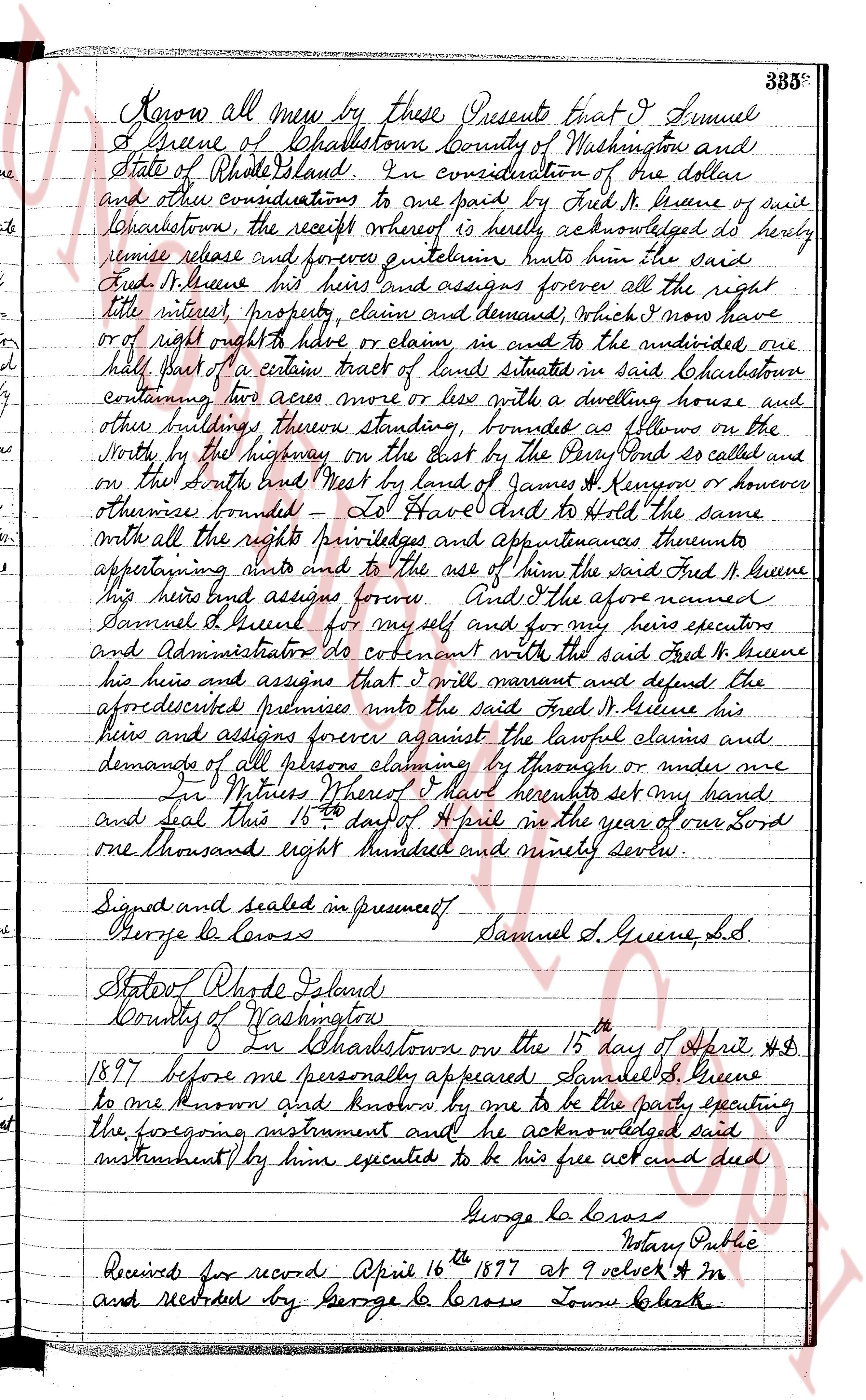
Know all men by these Presents that I Samuel
L Greene of Charlestown County of Washington and
State of Rhode Island In consideration of the dollar
and other considerations to me paid by Fred H Greene of said
Charlestown, the receipt whereof is hereby acknowledged do hereby
remise release and forever quitclaim unto him the said
Fred H Greene his heirs and assigns forever all the right
title interest, property, claim and demand, Which I now have
or of right ought to have or claim in and to the undersigned, one
half part of a certain tract of land situated in said Charlestown
containing two acres more or less with a dwelling house and
other buildings thereon standing, bounded as follows on the
North by the highway on the East by the Perry boundary so called and
on that South end West by land of James H Kenyon or however
otherwise bounded To Have and to Hold the same
with all the rights privileges and appurtenances thereunto
appertaining unto and to the use of him the said Fred H Greene
his heirs and assigns forever And the above named
Samuel L Greene for myself and for my heirs executors
and Administrators do covenant with the said Fred H Greene
his heirs and assigns that i will warrant and defend the
aforedescribed premises unto the said Fred H Greene his
heirs and assigns forever against the lawful claims and
demands of all persons claiming by through or under me
I In Witness Whereof I have hereunto set my hand
and seal this 16th day of April in the year of our Lord
one thousand eight hundred and ninety seven.
Signed and sealed in presence of
George la Crosse Samuel L Greene, L.S.
State of Rhode Island
County of Washington
In Charlestown on the 15th day of April A.D
1897 before me personally appeared Samuel L Greene
to me known and known by me to be the party executing
the foregoing instrument and he acknowledged said
instrument by him executed to be his free act and deed
George la Crosse
Notary Public
Received for record April 16th 1897 at 9 o'clock A.M
and recorded by George la Crosse Town Clerk
page 2
207
THIRD TRACT: Beginning at a stone bound at the southerly corner of the
premises conveyed by Frances King et als to the Westerly Lumber Company;
thence southeasterly in a continuation of the southeasterly line of land
conveyed by this instrument 112 feet to the channels thence land
conveyed this instrument 112 feet to the channels thence
westerly following the line of the channel to the point where it inter-
sect a line 15 feet from and parallel to the first described line; thence
northwesterly on said line 112 feet to a stone bound or formerly of the Westerly
Lumber Company.
Together with a right of way to pass and repass at any and all times with any
and all vehicles and foot passengers over a strip of land 15 feet wide parallel
to the westerly line of the land conveyed by said Frances Currie and els
to the Westerly Lumber Company.
WITNESS my hand this ny day of January 1997.
CHARLES P. ECCLESTON
(DOCUMENTARY STAMPS, 55¢)
STATE OF RHODE ISLAND, ETC.,
}
}
County of Washington }
In Westerly, on the 9th day of January, 1997 before me personally appeared Charles P.
Eccleston, Unmarried widower to me known and known by me to be the party executing the fore-
going instrument, and he acknowledged said instrument, by him executed, to be his free act and
deed.
ARBINDO P. HARDONE
Notary Public.
Received for record December 1st, A. D. 1997 at 11:00 o'clock, a. m., and recorded by
[Signature]
Town Clerk
We, CYRIL G. ROBERTS and HELEN E. ROBERTS, husband and wife, of the Town of Charlestown,
County of Washington and State of Rhode Island for consideration paid, grant to PAUL J. RICHARD
of the Town of Richmond in said county and state with WARRANTY COVENANTS
(Description, and Incumbrances, if any)
Two parcels of land with improvements thereon situated in said Town of Charlestown,
bounded and described as follows, to wit:
First Tract: That certain lot containing buildings and improvements thereon, bounded
and described as Lot No Fourteen (14) as shown and delineated on that map or plat
entitled, "Plot of House Lots on Hill Pasture", in Charlestown, R. I., recorded in the
office of the Recorder of Land Evidence of said Charlestown, and dated October,
1931; scale of said plat, fifty (50) feet to the inch; Earl C. Ward, Platter;
being the same premises conveyed to the grantors herein by deed of John H. Macdonald,
dated December 31, 1943, and recorded in Charlestown Land Evidence Book 29, at page 162.
Second Tract: That certain lot situated within "Hill Pasture", so called, in said Charles-
town, bounded and described as follows: Beginning at a stone bound located on the
side of a Street the northeasterly corner of these premises and the southeasterly
corner of land of Nathaniel S. Lewis, running thence southerly along said boundary
by said Street, a distance of seventy & 85/100 (70.85) feet to another stone bound at
the northeasterly corner of land of Norman S. Snyder; thence running southeasterly
along said boundary by said Snyder, the grantors a distance of one hundred
thence running southeasterly along said boundary by said Lewis, a distance of one hundred
twenty-five (125) feet; more or less.
The page as recorded