The instrument's own words
page 1 · read by Gemma vision
187
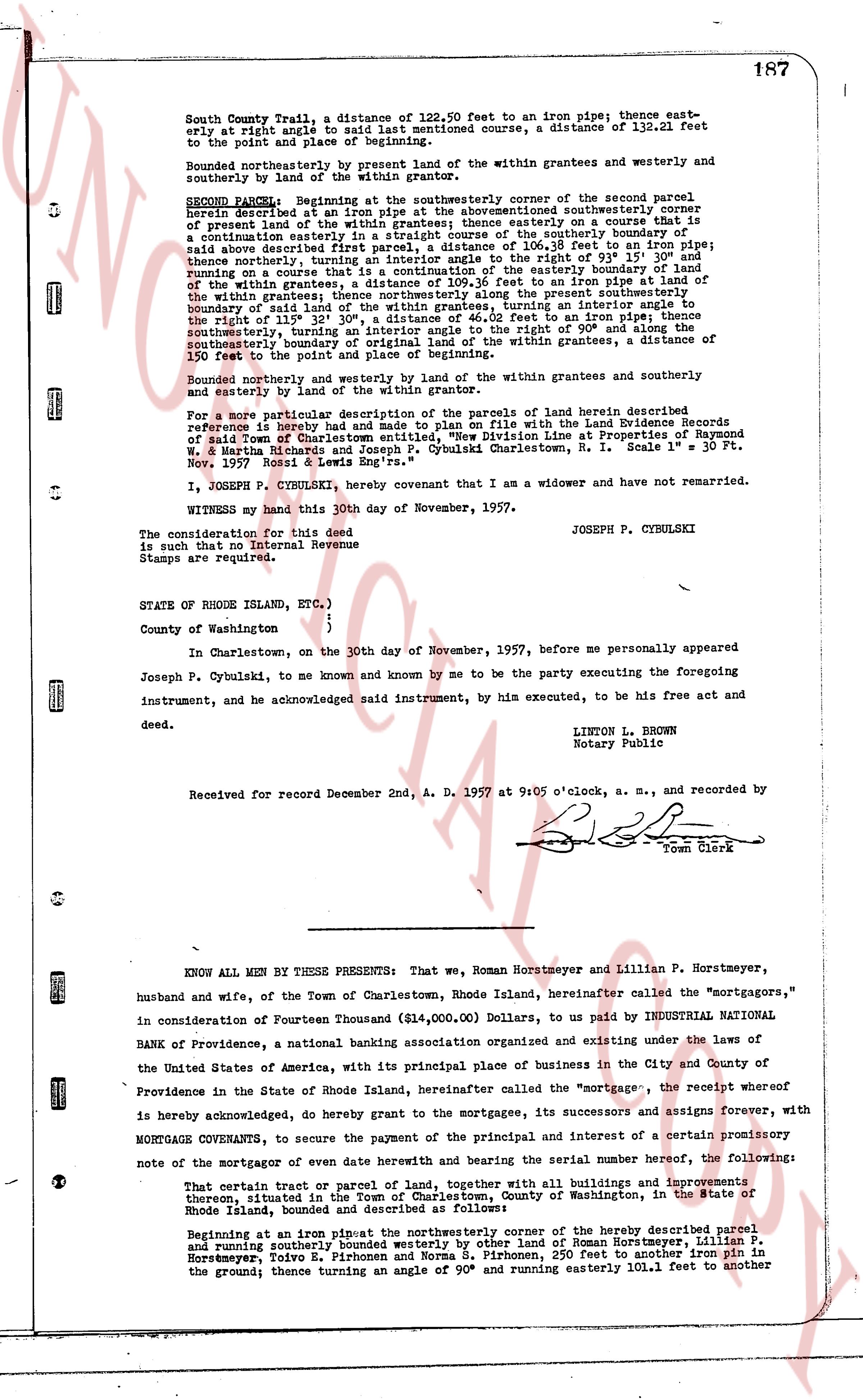
South County Trail, a distance of 122.50 feet to an iron pipe; thence easterly at right angle to said last mentioned course, a distance of 112.21 feet to the point and place of beginning.
Bounded northerly and westerly by present land of the within grantees and westerly and southerly by land of the within grantor.
SECOND PARCEL: Beginning at the southwesterly corner of the second parcel herein described at an iron pipe at the aforementioned southwesterly corner of prevous land of the within grantees; thence running southeasterly on a course of [?] precision continuation easterly in a straight course of the southerly boundary of said above described first parcel, a distance of 106.18 feet to an iron pipe; thence proceeding westerly, turning an interior angle to the right of 93° 15' 30" and running on a course that is a continuation of the easterly boundary of the first parcel, a distance of 112.21 feet to an iron pipe at the right of the lines 112° 35' 32" s, a distance of 46.02 feet to an iron pipe; thence southerly, turning an interior angle to the right of 90° and running on a course that is the southerly boundary of original land of the within grantees, a distance of 150 feet to the point and place of beginning.
Bounded northerly and westerly by present land of the within grantees and southerly and easterly by land of the within grantor.
For a more particular description of the parcels of land herein described reference is hereby had and made to plan filed with the Land Evidence Records of said Town of Charlestown entitled "New Division Line at Properties of Raymond W. & Martha Richards and Joseph P. Cybulski Charlestown, R. I. Scale 1" = 30 ft. Nov. 1 1957 Void & Land Survey Inc."
I, JOSEPH P. CYBULSKI, hereby covenant that I am a widower and have not remarried.
WITNESS my hand this 30th day of November, 1957.
JOSEPH P. CYBULSKI
The consideration for this deed is such that no Internal Revenue Stamps are required.
STATE OF RHODE ISLAND, ETC.)
County of Washington )
In Charlestown, on the 30th day of November, 1957, before me personally appeared Joseph P. Cybulski, in Charlestown, and known by me to be the party executing the foregoing instrument, and he acknowledged said instrument, by his executed statement, to be his free act and deed.
LINTON L. BROWN
Notary Public
Received for record December 2nd, A. D. 1957 at 9:05 o'clock, a. m., and recorded by
[Signature]
Town Clerk
----
KNOW ALL MEN BY THESE PRESENTS: That we, Roman Horstmeyer and Lillian P. Horstmeyer, husband and wife, of the Town of Charlestown, Rhode Island, hereinafter called the "mortgagors," in consideration of Fourteen Thousand ($14,000.00) Dollars, to us paid by INDUSTRIAL NATIONAL BANK OF Providence, a national banking association organized and existing under the laws of the United States of America, with its principal place of business in the City and County of Providence in the State of Rhode Island, hereinafter called the "mortgagee," the receipt whereof is hereby acknowledged, do hereby grant to the mortgagee, its successors and assigns forever, with MORTGAGE COVENANTS, to secure the payment of the principal and of interest of a certain promissory note of the mortgagor of even date herewith and bearing the serial number hereof, the following:
That certain tract or parcel of land, together with all buildings and improvements thereon, situated in the Town of Charlestown, County of Washington in the State of Rhode Island, bounded and described as follows:
Beginning at an iron pipe at the northeasterly corner of the property described parcel and running southerly bounded by land of Roman Horstmeyer, Lillian P. Horstmeyer, Todivo E. Pirborne and Norma S. Pirborne, 250 feet to another iron pin in the ground; thence turning an angle of 90° and running easterly 101.1 feet to another
page 2 · read by Gemma vision
188
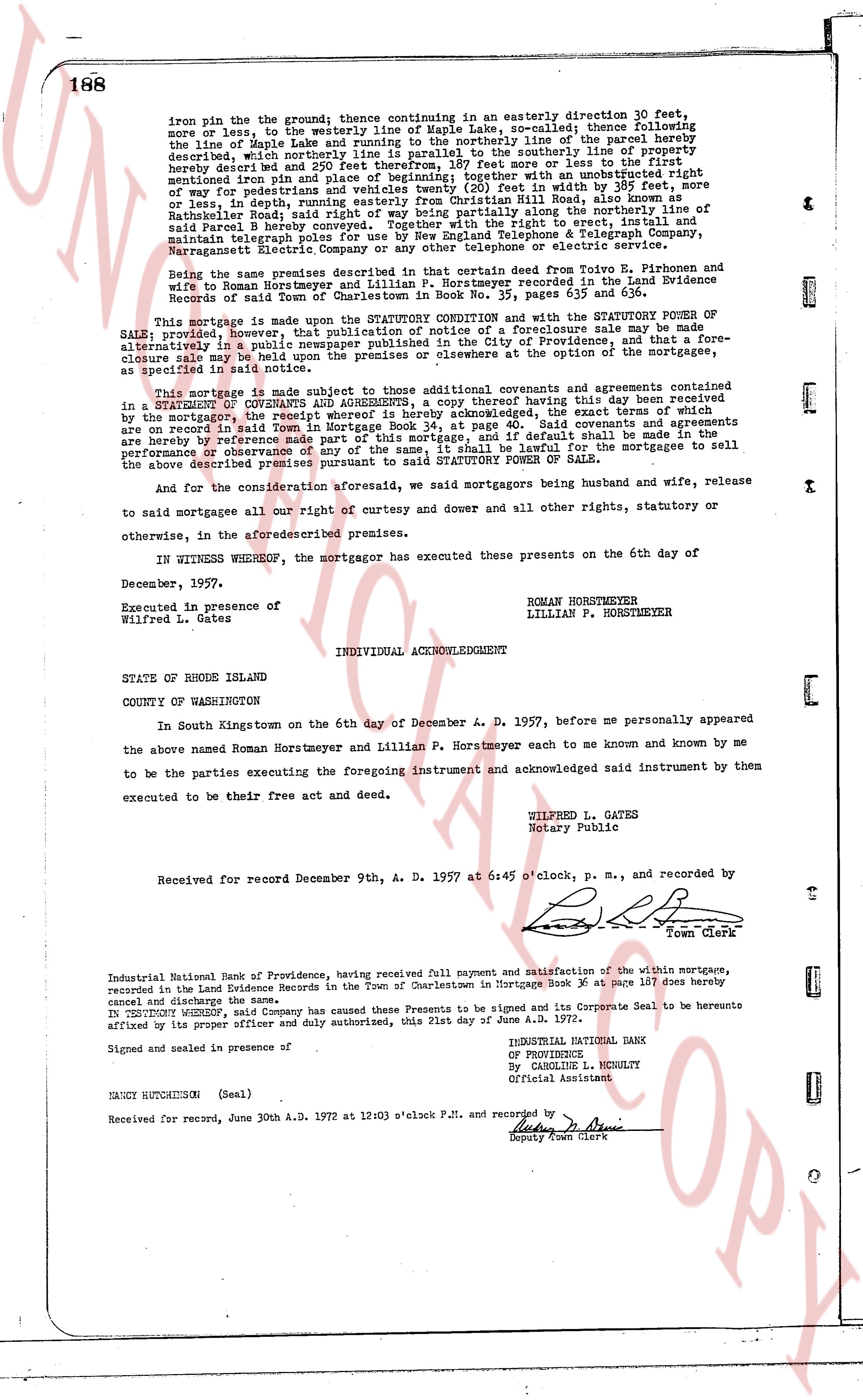
iron pin on the ground; thence continuing in an easterly direction 30 feet,
more or less, to the westerly line of Maple Lake, so called; thence following
the line of Maple Lake and running to the northeasterly line of the parcel
hereby described, which northeasterly line runs parallel to the southerly line of
property hereby described and 250 feet therefore, 187 feet more or less to the first
mentioned iron pin on the ground; subject to an easement with an unrestricted
way of for pedestrians and vehicles twenty (20) feet in width by 385 feet, more
or less, in depth running easterly from the easterly line of Mill Road across said
parcel B hereby conveyed; said right of way being partly approximate along the
northerly line of said Parcel B hereby conveyed. The said right of way is, limited,
maintain, telegraph poles and wires to be used by New England Telephone & Telegraph Company,
Narragansett Electric Company or any other telephone or electric service company.
Being the same premises described in that certain deed from Ezra B. Pithorne and
wife to Roman Horstmeyer and wife, dated November 1, 1957, recorded in the Land Evidence
Records of said Town of Charlestown in Book No. 35, page 635 and following.
This Mortgage is made upon the STATUTORY CONDITION and with the STATUTORY POWER OF
SALE, and provided however, that in the event of a Default sale may be made
alternatively in a public newspaper published in the city of Providence and, that a fore-
closure may be made upon the premises or elsewhere to the extent of the right of the
mortgagee in said note.
This mortgage is made subject to the then existing covenants and agreements contained
in a STATEMENT OF COVENANTS AND AGREEMENTS, a copy thereof having this day been received
by the mortgagee, the terms whereof is hereby acknowledged, the exact terms of which are
on record in said Town in Mortgage Book 34, at page [?]. Said covenants are
binding upon the grantor and his heirs and assigns, and if default shall be made in the
performance or observance of any of the same, it shall be lawful for the mortgagee to sell
the above described premises pursuant to the STATUTORY POWER OF SALE.
And for the consideration aforesaid, we said mortgagors being husband and wife, release
to said mortgagee all our right of curtesy and dower and all other rights, statutory or
otherwise, in the aforesaid premises.
IN WITNESS WHEREOF, the mortgagor has executed these presents on the 6th day of
December, 1957.
Executed in presence of ROMAN HORSTMEYER
Wilfred L. Gates LILLIAN P. HORSTMEYER
STATE OF RHODE ISLAND
INDIVIDUAL ACKNOWLEDGMENT
COUNTY OF WASHINGTON
In South Kingstown on the 6th day of December A. D. 1957, before me personally appeared
the above named Roman Horstmeyer and Lillian P. Horstmeyer each to me known and known by me
to be the parties executing the foregoing instrument and acknowledged said instrument by them
executed to be their free act and deed.
WILFRED L. GATES
Notary Public
Received for record December 9th, A. D. 1957 at 6:45 o'clock, p. m., and recorded by
[Signature]
Town Clerk
Industrial National Bank of Providence, having received full payment and satisfaction of the within mortgage,
recorded in the Land Evidence Records in the Town of Charlestown in Mortgage Book 36 at page 187 does hereby
cancel and discharge the same.
IN TESTIMONY WHEREOF, said Company has caused these Presents to be signed and its Corporate Seal to be hereunto
affixed by its proper officer and duly authorized, this 21st Day of June A. D. 1972.
INDUSTRIAL NATIONAL BANK
OF PROVIDENCE
By CAROLINE L. MCKILTY
Official Assistant
Signed and sealed in presence of
NANCY HUTCHINSON (Seal)
Received for record, June 30th A.D. 1972 at 12:03 o'clock P.M. and recorded by
[Signature]
Deputy Town Clerk
The page as recorded