The instrument's own words
page 1 · read by Gemma vision
186
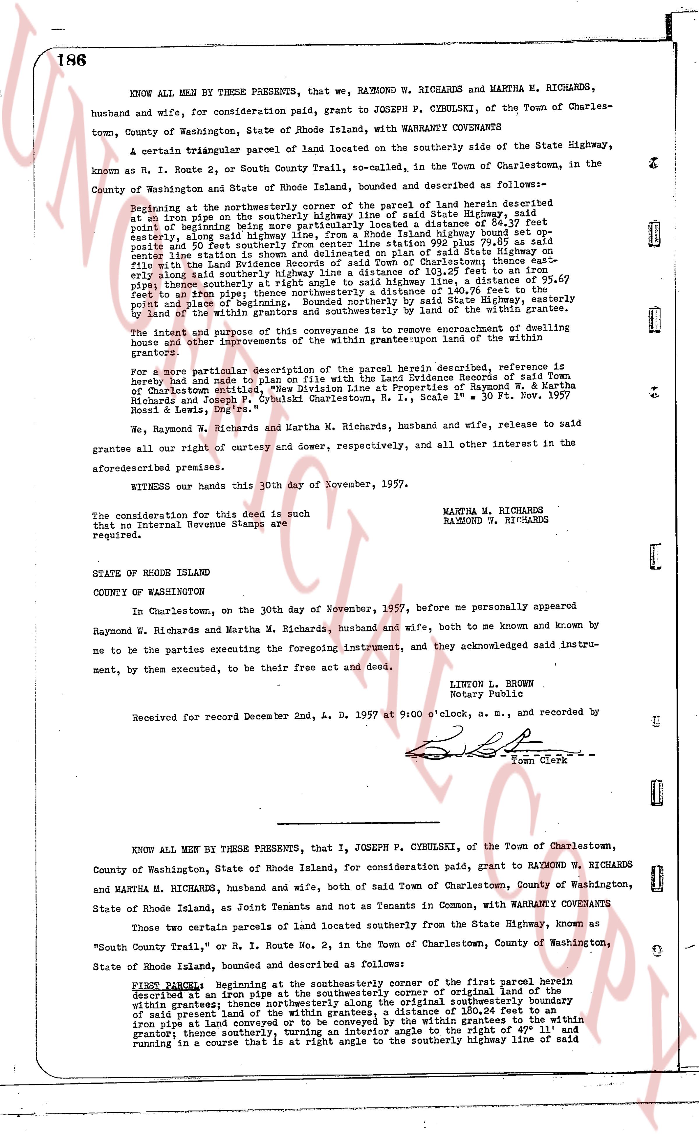
KNOW ALL MEN BY THESE PRESENTS, that we, RAYMOND W. RICHARDS and MARTHA M. RICHARDS, husband and wife, for consideration paid, grant to JOSEPH P. CYBULSKI, of the Town of Charlestown, County of Washington, State of Rhode Island, with WARRANTY COVENANTS
A certain triangular parcel of land located on the southerly side of the State Highway, known as N. R. Route 2, or South County Trail, so-called, in the Town of Charlestown, in the County of Washington and State of Rhode Island, bounded and described as follows:—
Beginning at the northeasterly corner of the parcel of land herein described as written on a map on the Southeast corner of said State Highway, at a point of beginning being more particularly located a distance of 84.57 feet easterly, along said highway line from the intersection of said highway line bounded on the north and south by center line written in State Evidence Records of said Town of Charlestown thence 299.75 poles as well as written on the map on the Southeast corner of said State Highway in a distance of 105.30 feet in a direction easterly along said southerly highway line a distance of 95.67 feet to an iron pipe; thence northeasterly a distance of 140.67 feet to the point of beginning being more particularly located on the southerly side of said State highway easterly by line of the within grantors and southerly by the land of the within grantee.
The intent and purpose of this conveyance is to remove encroachment of dwelling house and other improvements of the within grantors upon the land of the within grantees.
For a more particular description of the parcel herein described, reference is hereby made and made part hereof on File with the Land Evidence Records of said Town of Charlestown entitled, "New Division Line at Properties of Raymond W. & Martha Richards and Joseph P. Cybulski Charlestown, R. I., Scale 1" = 30 ft. Nov. 1957" signed by Ross L. Lewis, Engr.
We, Raymond W. Richards and Martha M. Richards, husband and wife, release to said grantee all our right of curtesy and dower, respectively, and all other interest in the aforementioned premises.
WITNESS our hands this 30th day of November, 1957.
The consideration for this deed is such that no Internal Revenue Stamps are required.
MARTHA M. RICHARDS
RAYMOND W. RICHARDS
STATE OF RHODE ISLAND
COUNTY OF WASHINGTON
In Charlestown, on the 30th day of November, 1957, before me personally appeared Raymond W. Richards and Martha M. Richards, husband and wife, both to me known and known by me to be the parties executing the foregoing instrument, and they acknowledged said instrument, by them executed, to be their free act and deed.
LINTON L. BROWN
Notary Public
Received for record December 2nd, A. D. 1957 at 9:00 o'clock, a. m., and recorded by
[Signature]
Town Clerk
----
KNOW ALL MEN BY THESE PRESENTS, that I, JOSEPH P. CYBULSKI, of the Town of Charlestown, County of Washington, State of Rhode Island, for consideration paid, grant to RAYMOND W. RICHARDS and MARTHA M. RICHARDS, husband and wife, both of said Town of Charlestown, County of Washington, State of Rhode Island, as Joint Tenants and not as Tenants in Common, with WARRANTY COVENANTS
Two certain parcels of land located southerly from the State Highway, known as "South County Trail," or R. I. Route No. 2, in the Town of Charlestown, County of Washington, State of Rhode Island, bounded and described as follows:—
FIRST PARCEL: Beginning at the southeasterly corner of the first parcel herein described at an iron pipe at the southeasterly corner of some original line of the land within the grantee's land; thence running easterly along the original southeasterly boundary of said present land of the within grantees, a distance of 180.24 feet to an iron pipe at corner of the land of the within grantor; thence running westerly to the within iron pipe at corner of the land of the within grantee; thence southerly, turning an interior angle to the right of 47° 11' and running in a course that is at right angle to the southerly highway line of said highway
The page as recorded