The instrument's own words
Attribution under review. The portal's file number is shared by more than one instrument, and the words below could not be placed with certainty on this one by their own evidence (page stamp, parties, dates); they may belong to a neighbouring instrument. Read them as the record of the page, not yet as this deed's own.
page 1
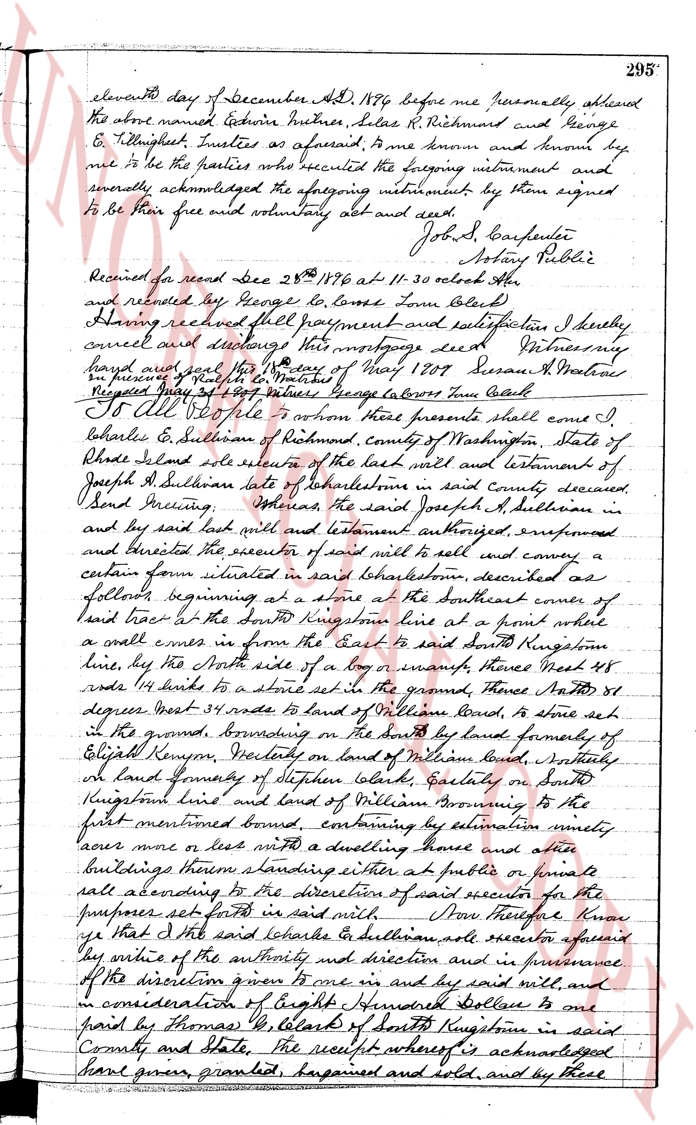
eleventh day of December AD 1796 before me personally appeared the above named Edwin Mutner, Silas R. Richmond and George E. Tillinghast Trustees as aforesaid to me known and known by me to be the parties who executed the foregoing instrument and severally acknowledged the aforegoing instrument by them signed to be their free and voluntary act and deed. John S Carpenter Notary Public Received for record Dec 25th 1796 at 11-30 oclock AM and recorded by George Lo Lome Town Clerk Having received full payment and satisfaction I hereby cancel and discharge this mortgage deed Witness my hand and seal this 4th day of May 1809 Susan A Maxroe in presence Ralph Co Matrose Registered May 3d 1809 witness George lo lomo Town clerk
bounding on the South by land formerly of Elijah Kenyon, Westerly on land of William laund, Northerly on land formerly of Stephen Clark, Easterly on South Kingstown line and land of William Browning to the first mentioned bound, containing by estimation ninety acres more or less with a dwelling house and other buildings thereon standing either at public or private sale according to the direction of said executor for the purposes set forth in said will. Now Therefore know ye that I the said Obadiah Sullivan sole executor aforesaid by virtue of the authority and direction and in pursuance of the discretion given to me via and by said will, and in consideration of Eight Hundred Dollars to one paid by Thomas G. Clark of South Kingstown in said County and State, the receipt whereof is acknowledged have given granted bargained and sold, and by these
page 2
184
northerly side of said Old Post Road at the southeasterly corner of the premises
herein described; thence northerly bounded easterly by other land of the Grants
Grantees aligned with the said Old Post Road, a distance of 131½ feet, more or less; a stone
bound set in the ground at the northerly easterly corner of the premises herein
described; thence westerly bounded northerly by other land of the grantors a
distance of Seventy-One (71) feet, more or less, to a stone bound set in the
ground at the northerly northwestern corner of the premises herein described, said
point being the northerly eastern corner of a strip of land 15 feet wide leading to be
said John Franklin Crandall; thence southerly bounded westerly by said land
to the fence, a distance of 131½ feet, more or less, a distance of One Hundred Fifty
(150) feet, more or less to the point and place of beginning.
Being a portion of the premises conveyed by Lawrence C. Miller and Alice S.
Miller to Colby H. Crandall and Annette C. Crandall, husband and wife, as
Joint Tenants by Warranty Deed dated October 16, 1950, and recorded in the
Land Evidence Records of the Town of Charlestown in Book No. 32, page 311.
The consideration for this deed is such that no United States Internal Revenue
Documentary Stamps are required.
This deed is signed this 21st day of November, 1957.
WITNESS our hands this 21st day of November, 1957.
COLBY H. CRANDALL
C. ANNETTE CRANDALL
STATE OF RHODE ISLAND, ETC.)
County of Washington }
}
In Westerly on the 21st day of November, 1957 before me personally appeared Colby
H. Crandall and C. Annette Crandall to me known and by me known to be the parties exe-
cuting the foregoing instrument, and they acknowledged said instrument, by them executed,
to be their free act and deed.
OLIVER P. CRANDALL (Notarial Seal)
Notary Public
Received for record November 25th, A. D. 1957 at 3:51 o'clock, p. m., and recorded
by
[Signature]
Town Clerk
KNOW ALL MEN BY THESE PRESENTS, that I, DORIS S. PATER, of New York City, State of
New York, for consideration paid, grant to HARRIET M. BLANTON, of Irvington-on-Hudson,
State of New York, with WARRANTY COVENANTS
That certain parcel or tract of land, situate at Quonocutongach Beach, so-called,
in the Town of Charlestown, County of Washington, State of Rhode Island, bounded and
described as follows:
BEGINNING at an iron pin driven in the ground on the easterly side of a
street at the northeasterly corner of premises of Harriet M. Blanton and
at the southeasterly corner of the premises herein conveyed; thence run-
ning northerly, bounded easterly by other land of the Grantor, a distance of 131½
feet, until it comes to an iron pin driven in the ground in the southerly boundary
line of the Town Highway at the northeasterly corner of said Town Highway,
conveyed; thence running easterly along said Town Highway,
a distance of 70 feet to a point; thence running southerly, bounded easterly
by other land of the Grantor, a distance of 131½ feet, more or less,
until it comes to a point on the northerly boundary line of premises of
this Grantee; said boundary line running 70 feet easterly of the point of
beginning; thence running westerly, bounded southerly by other land of
this Grantee, a distance of 131½ feet, to the point and place of beginning.
Being a portion of the premises, that are bounded northerly by said Town
Highway, and shown and delineated as "Doris S. Pater," on that certain plan
or plat entitled, "Survey of Land of Mrs. Doris S. Pater" filed by Harriet M.
Harriet M. Blanton Quonocutongach, Charlestown, R. 1., Scale 1" = 40' Sept.
19, 1953, R. A. Shearson, Civil Engineer," said plat being filed in the Office
of the Town Clerk, said town, Charlestown.
I, DORIS S. PATER, covenant that I am unmarried.
WITNESS my hand this 27 day of November, 1957.
(DOCUMENTARY STAMP, 55¢)
DORIS S. PATER
The page as recorded