The instrument's own words
page 1
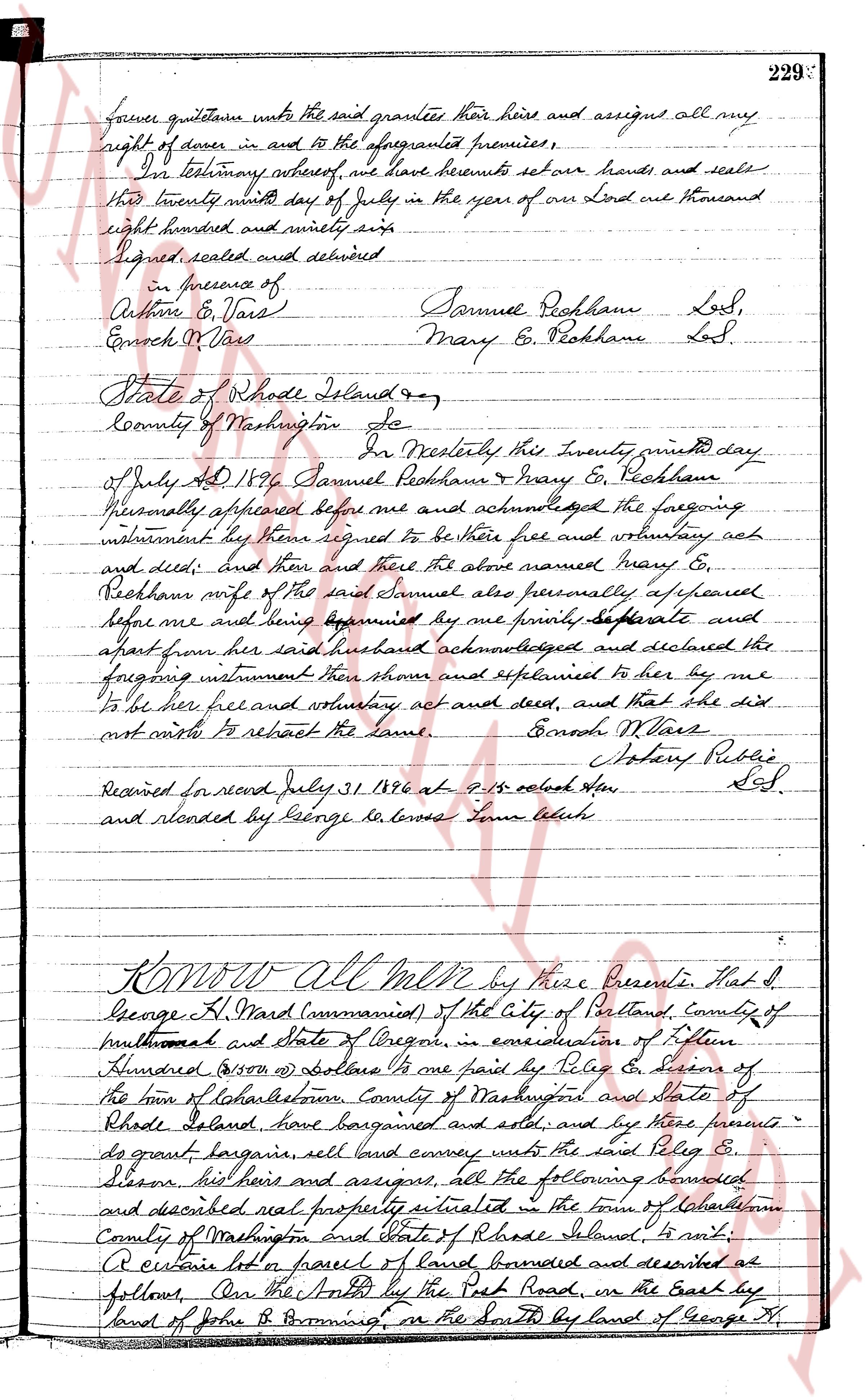
forever quitclaim unto the said grantees their heirs and assigns all my
right of dower in and to the aforementioned premises;
In testimony whereof, we have hereunto set our hands and seals
this twenty ninth day of July in the year of our Lord one thousand
eight hundred and ninety six.
Signed sealed and delivered
In presence of
Arthur E. Vose
Enoch M. Vose
Samuel Peckham Lss,
Mary E. Peckham Lss
State of Rhode Island ss
County of Washington Sc
I, Noel Westlake by these presents this twenty ninth day
of July AD 1896 Samuel Peckham & Mary E. Peckham
personally appeared before me and acknowledged the foregoing
instrument they there signed to be their free and voluntary act
and deed; and then and there the above named Mary E.
Peckham wife of the said Samuel also personally appeared
before me and being examined by me privately separate and
apart from her said husband acknowledged and declared the
foregoing instrument they there signed and explained to her by me
to be her free and voluntary act and deed, and that she did
not wish to retract the same.
Enoch M. Vose
Notary Public Lss.
Received for record July 31 1896 at 9:15 oclock AM
and recorded by George B. Lowe Town Clerk
Know All Men by these Presents, That I
George H. Ward (commissioned) of the City of Portland, County of
multnomah and State of Oregon, in consideration of fifteen
Hundred ($1500) dollars to me paid by Philip E. Stearns of
the town of Charlestown, County of Washington and State of
Rhode Island, have bargained and sold, and by these presents
do grant bargain sell land convey unto the said Philip E.
Stearns his heirs and assigns, all the following bounded
and described real property situated in the town of Charlestown
County of Washington and State of Rhode Island to wit:
A certain lot or parcel of land bounded and described as
follows On the North by the Past Road, on the East by
land of John R. Browning, on the South by land of George H.
page 2
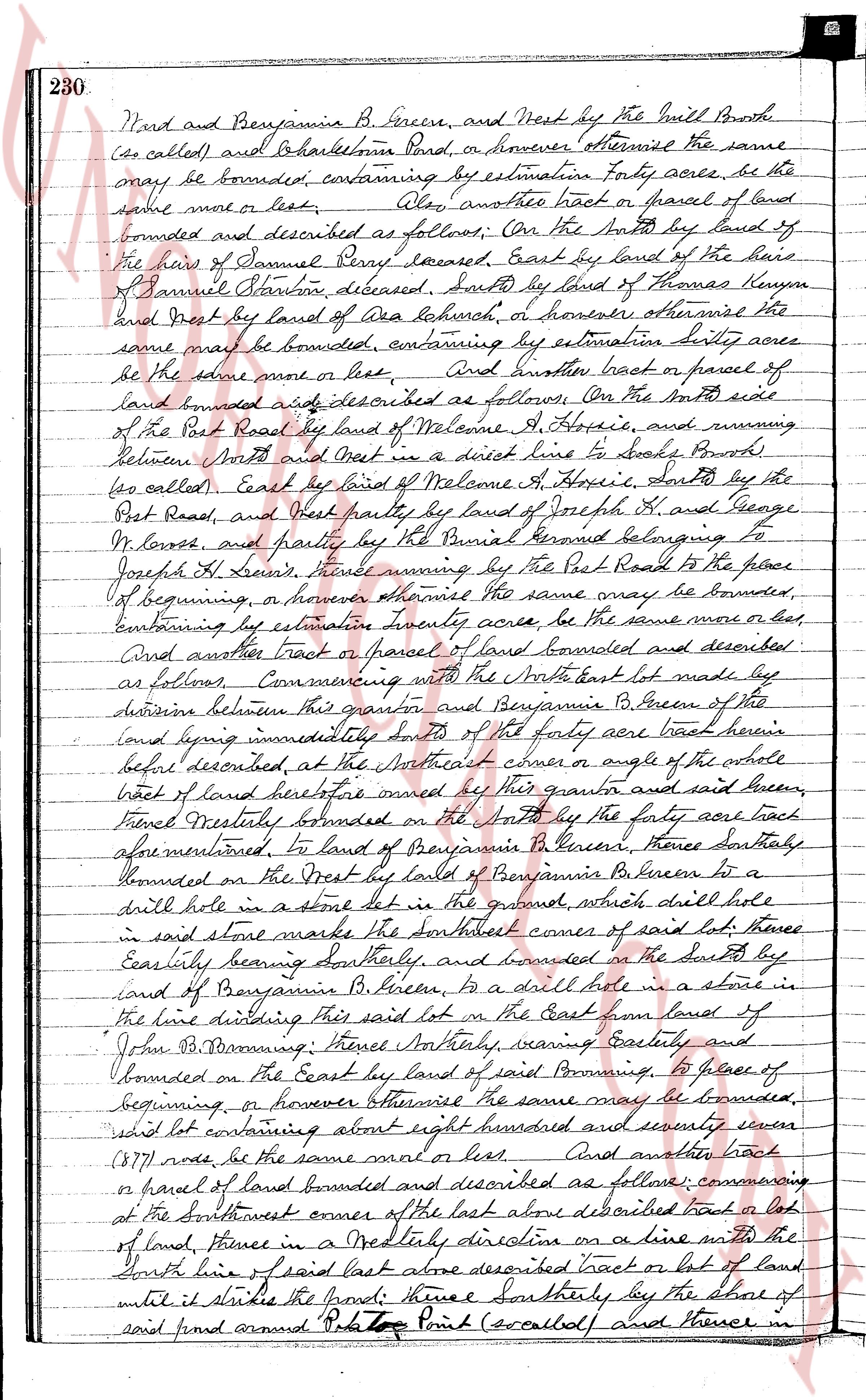
230. Ward and Benjamin B. Greene, and West by the Mill Brook
(so called) and Bartholomews Land, or however otherwise the same
may be bounded, containing by estimation forty acres, be the
same more or less. Also, another tract or parcel of land
bounded and described as follows, On the North by land of
the heirs of Samuel Perry deceased, East by land of the heirs
of Samuel Stanton deceased, South by land of Thomas Benson
and West by land of area beachur, or however otherwise the
same may be bounded, containing by estimation sixty acres
be the above more or less. And another tract or parcel of
land bounded and described as follows, On the North east
of the Post Road by land of Welcome A. Hoxie, and running
between North and West in a direct line to banks Brook
(so called, East by land of Welcome A. Hoxie, South by the
Post Road, and West partly by land of Joseph H. and George
W. Lowe, and partly by the Burial Ground belonging to
Joseph H. Lowe, thence running by the Post Road to the place
of beginning, or however otherwise the same may be bounded,
containing by estimation twenty acres, be the same more or less,
And another tract or parcel of land bounded and described
as follows, Commencing with the North east lot made by
division between this grantor and Benjamin B. Greene of the
land being immediately South of the forty acre tract herein
before described, at the North east corner or angle of the whole
tract of land heretofore owned by this grantor and thence
thence westerly bounded on the North by the forty acre tract
above mentioned, to land of Benjamin B. Greene, thence southerly
bounded on the East by land of Benjamin B. Greene to a
drill hole in a stone lot in the ground, which drill hole
in said stone marks the south east corner of said lot, thence
easterly bearing south westerly, and bounded on the South by
land of Benjamin B. Greene, to a drill hole in a stone in
the line dividing this said lot on the East from land of
John B. Browning, thence southerly, veering easterly and
bounded on the East by land of said Browning, to place of
beginning, or however otherwise the same may be bounded,
said lot containing about eight hundred and seventy seven
(877) rods be the same more or less. And another tract
or parcel of land bounded and described as follows: commencing
at the Southwest corner of the last above described tract a lot
of land, thence in a Northly direction on a line with the
North line of said last above described tract or lot of land
until it strikes the pond, thence southerly by the shore of
said pond around Pt. Top Point (so called) and thence in
page 3
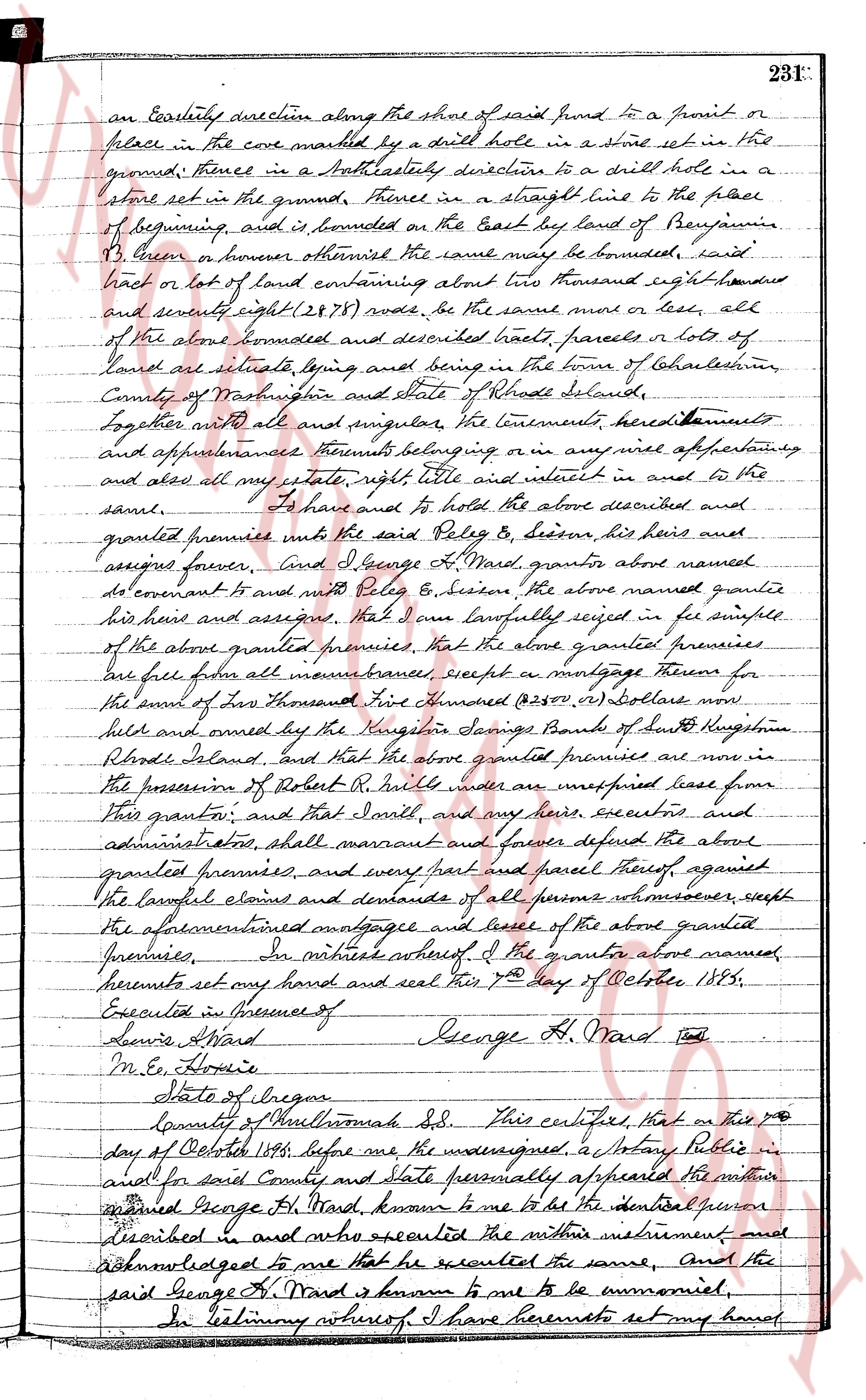
an easterly direction along the shore of said pond to a point or
place in the cove marked by a drill hole in a stone set in the
ground; thence in a southeasterly direction to a drill hole in a
stone set in the ground; thence in a straight line to the place
of beginning, and is bounded on the East by land of Benjamin
Brown or however otherwise the same may be bounded, said
tract or lot of land containing about two thousand eight hundred
and seventy eight (2878) rods, be the same more or less, all
of the above bounded and described tracts, parcels or lots of
land are situated lying and being in the town of Charlestown,
County of Washington and state of Rhode Island,
Together with all and singular the tenements, hereditaments
and appurtenances thereunto belonging or in any wise appertaining,
and also all my estate, right title and interest in and to the
same.
To have and to hold the above described and
granted premises unto the said Foley B. Sescon, his heirs and
assigns forever. And I, George H. Ward, grantor above named
do covenant to and with Foley B. Sescon the above named grantee
his heirs and assigns, that I have lawfully seised in fee simple
of the above granted premises, that the above granted premises
are free from all encumbrances, except a mortgage thereon for
the sum of Two Thousand One Hundred (2100, 00) Dollars now
held and owned by the Kingston Savings Bank of South Kingstown,
Rhode Island. And that the above granted premises are now in
the possession of Robert R. Bell who is undisturbed lease from
this grantor; and that I and my heirs, executors and
administrators, shall warrant and forever defend the above
granted premises, and every part and parcel thereof, against
the lawful claims and demands of all persons whomsoever, except
the aforementioned mortgagee and lessee of the above granted
premises. In witness whereof, I the grantor above named,
hereunto set my hand and seal this 7th day of October 1885.
Executed in presence of
Lewis Ward George H. Ward [seal]
Wm. H. Howie
State of Rhode Island
County of Washington ss. This certifies that on this 7th
day of October 1885, before me, the undersigned, a Notary Public in
and for said County and state personally appeared the witness
named George H. Ward, known to me to be the identical person
described in and who executed the within instrument and
acknowledged to me that he executed the same, And the
said George H. Ward is known to me to be convivial,
In testimony whereof I have hereunto set my hand
page 4
282:
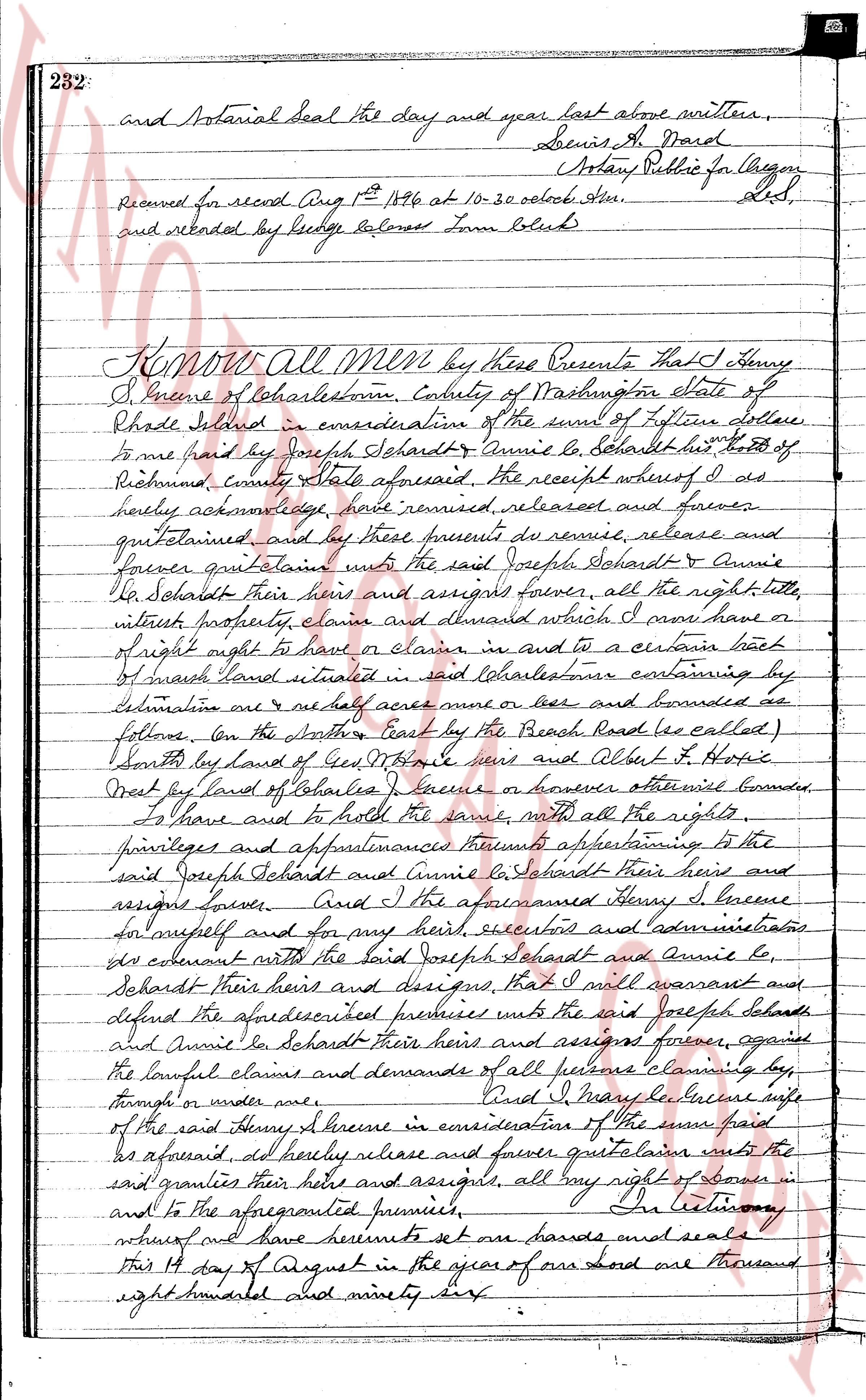
and Notarial seal the day and year last above written,
Louis A. Ward
Notary Public for Oregon
Received for recod Aug 1st 1896 at 10-30 oclock A.M.
and recorded by ledge reference page 282
Lulu Bliss
KNOW All Men by these Presents That I, Henry
I. Greene of Charlestown, County of Washington State of
Rhode Island in consideration of the sum of Fifteen dollars
to me paid by Joseph Schardt & Annie Le Schardt his wife of
Providence, county State aforesaid, The receipt whereof I do
hereby acknowledge, have remised, released and forever
quitclaimed and by these presents do remise, release and
forever quitclaim unto the said Joseph Schardt & Annie Le
Schardt their heirs and assigns forever, all the right title,
interest, property, claim and demand which I now have or
of right ought to have or claim in and to a certain tract
of swamp land situated in said Charlestown containing by
estimation one 1/2 half acre more or less and bounded as
follows. On the North, East by the Beach Road (as called)
South by land of Geo. W. Hale heirs and Albert H. Hopie
West by land of Charles I. [illegible] or however otherwise bounded.
To have and to hold the same, with all the rights,
privileges and appurtenances thereunto appertaining to the
said Joseph Schardt and Annie Le Schardt their heirs and
assigns forever. And I the aforementioned Henry I. Greene
for myself and for my heirs executed and acknowledged
this covenant with the said Joseph Schardt and Annie Le
Schardt their heirs and assigns, that I will warrant and
defend the aforesaid described premises unto the said Joseph Schardt
and Annie Le Schardt their heirs and assigns forever, against
the lawful claims and demands of all persons claiming by,
through or under me. And I Henry I. Greene wife
of the said Henry I. Greene in consideration of the sum paid
as aforesaid do hereby release and forever quitclaim unto the
said granties their heirs and assigns, all my right of dower in
and to the aforementioned premises. In testimony
whereof and have hereunto set our hands and seals
this 14 day of August in the year of our lord one thousand
eight hundred and ninety six.
The page as recorded