The instrument's own words
page 1 · read by Gemma vision
139
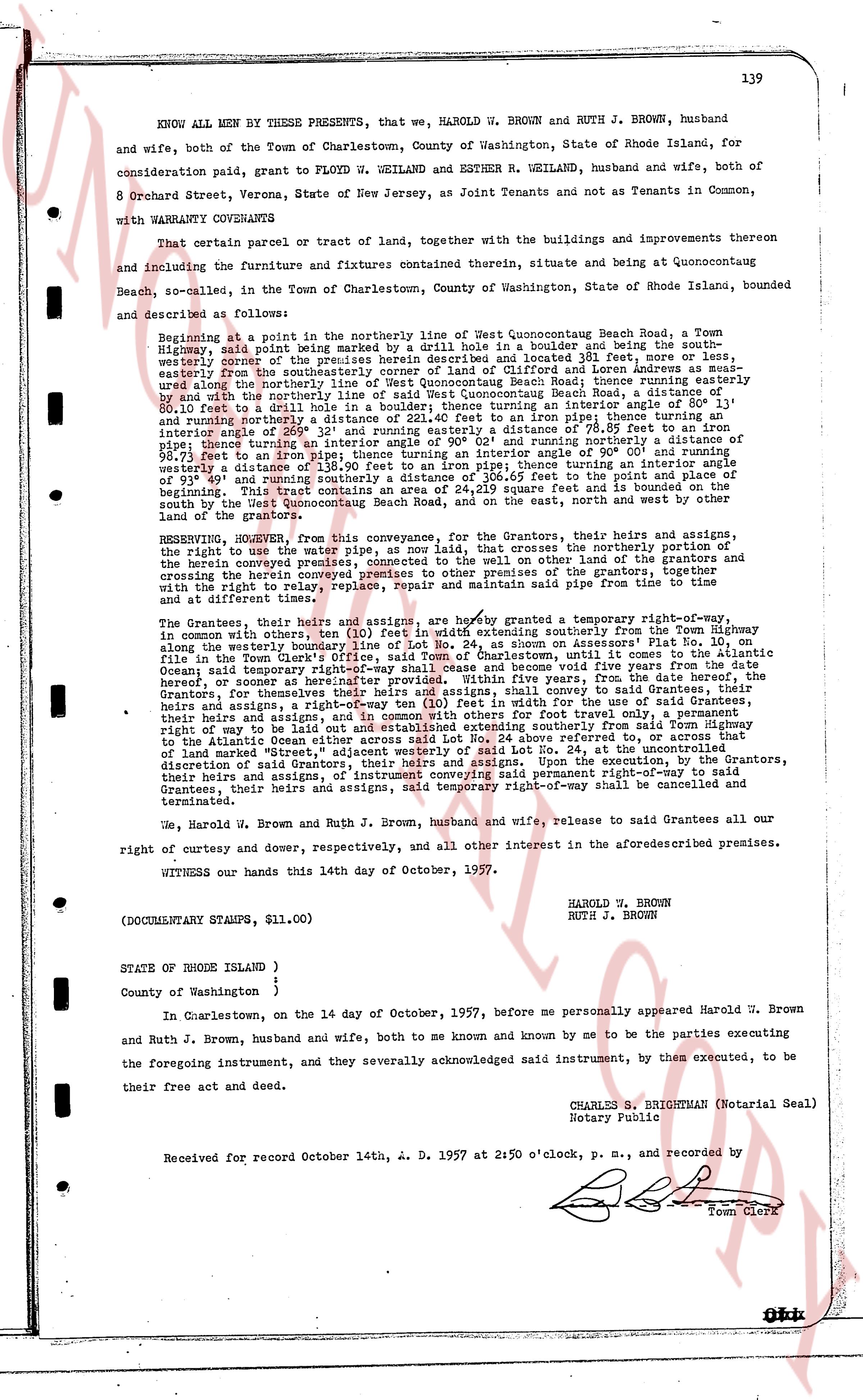
KNOW ALL MEN BY THESE PRESENTS, that we, HAROLD W. BROWN and RUTH J. BROWN, husband and wife, both of the Town of Charlestown, County of Washington, State of Rhode Island, for consideration paid, grant to FLOYD W. WEILAND and ESTHER R. WEILAND, husband and wife, both of 8 Orchard Street, Verona, State of New Jersey, as Joint Tenants and not as Tenants in Common, with WARRANTY CONVEYANCE
That certain parcel or tract of land, together with the buildings and improvements thereon and including the Furniture and fixtures contained therein, situate and being at Quonocutcong Beach, scalloped, in the Town of Charlestown, County of Washington, State of Rhode Island, bounded and described as follows:
Beginning at a point in the northerly line of West Quonocutcong Beach Road, a Town Highway, said point being marked by a drill hole in a boulder and being the southerly corner of the easterly line of the land of [?] and [?] 32 feet, 0 inches east, easterly from the southeasterly corner of land of G. Slocum and Loren Andrews as measured along the northerly line of West Quonocutcong Beach Road; thence northerly 112 feet, 0 inches east, with the northerly line of West Quonocutcong Beach Road as a boundary, to a distance of 80.10 feet to a drill hole in a boulder; thence turning an interior angle of 90° 1' and running northerly 110 feet, 0 inches to a drill hole in a pipe fence; thence turning an interior angle of 89° 59' and running easterly a distance of 78.85 feet to an iron pipe; thence turning an interior angle of 90° 0' and running southerly 110 feet, 0 inches to a drill hole in a pipe fence; thence turning an interior angle of 90° 0' and running easterly 98.73 feet to an iron pipe; thence turning an interior angle of 90° 0' and running southerly 110 feet, 0 inches to a drill hole in a boulder; thence turning an interior angle of 91° 49' and running southerly a distance of 106.45 feet to the point and place of beginning. Said tract contains an area of 15,112 square feet and is elongated on the south and on the east, and north westerly on the west bound of the grantor.
RESERVING, HOWEVER, from this conveyance, for the Grantors, their heirs and assigns, and right to use the water pipe, as now laid, that crosses the northerly portion of the herein conveyed premises, connected to the well of the grantors, and the Grantors crossing the herein conveyed premises to get to the well of the grantors, and the Grantors together with the right to relay, replace, repair and maintain said pipe from time to time and at different times thereafter.
The Grantees, their heirs and assigns, are hereby granted a temporary right-of-way, in common with others, ten (10) feet in width extending southerly from the Town Highway along the westerly boundary of the herein conveyed premises, for five years from the date of Lot No. 10, on file in the Town Clerk's office, said Town of Charlestown, until it comes to the Atlantic Ocean; said temporary right-of-way is hereinafter referred to as "temporary right-of-way". Within five years, from the date hereof, the Grantors, for themselves their heirs and assigns, and in common with others ten (10) feet in width for use of said Grantees, their heirs and assigns, and in common with others ten (10) feet in width for foot traffic only, will construct a right-of-way to be laid out parallel to and east of said temporary right-of-way from the Town Highway to the Atlantic Ocean either across said Lot No. 24 above referred to, or across that of land owned privately in Charlestown, R.I., at the time and place, and in the manner, at the sole discretion of said Grantors, their heirs and assigns. Upon the execution, by the Grantors, their heirs and assigns, of a deed to the said temporary right-of-way, said temporary right-of-way of the Grantees, their heirs and assigns, said temporary right-of-way shall be cancelled and terminated.
We, Harold W. Brown and Ruth J. Brown, husband and wife, release to said Grantees all our right of curtesy and dower, respectively, and all other interest in the aforesaid described premises.
WITNESS our hands this 14th day of October, 1957.
(DOCUMENTARY STAMPS, $11.00)
HAROLD W. BROWN
RUTH J. BROWN
STATE OF RHODE ISLAND )
County of Washington )
In Charlestown, on the 14 day of October, 1957, before me personally appeared Harold W. Brown and Ruth J. Brown, husband and wife, both to me known and known by me to be the parties executing the foregoing instrument, and they severally acknowledged said instrument, by them executed, to be their free act and deed.
CHARLES S. BRIGHTMAN (Notarial Seal)
Notary Public
Received for record October 14th, A. D. 1957 at 2:50 o'clock, p. m., and recorded by [Seal] Town Clerk
The page as recorded