The instrument's own words
page 1 · read by Gemma vision
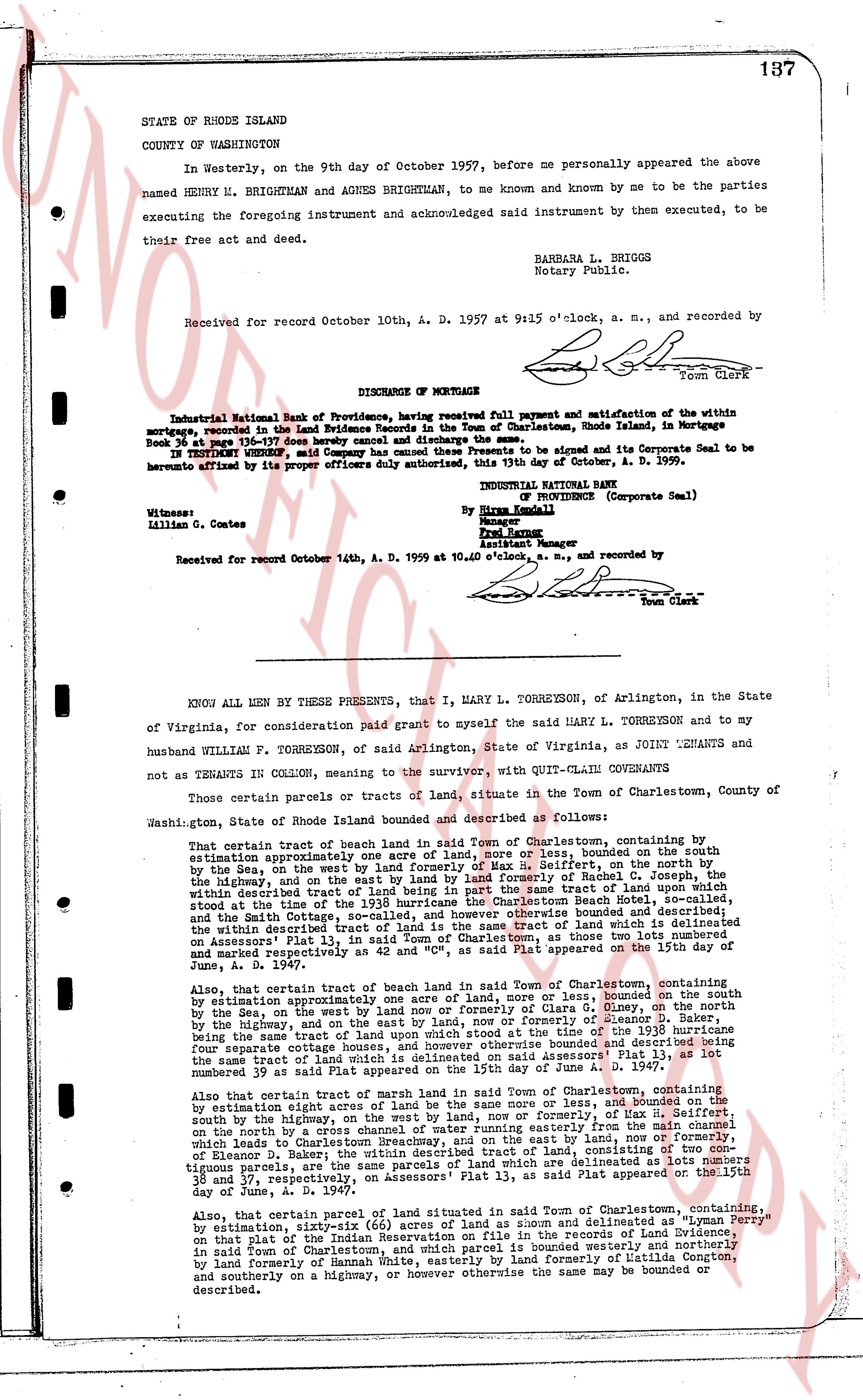
STATE OF RHODE ISLAND
COUNTY OF WASHINGTON
In Westerly, on the 9th day of October 1957, before me personally appeared the above named HENRY H. BRIGHTMAN and AGNES BRIGHTMAN, to me known and known by me to be the parties executing the foregoing instrument and acknowledged said instrument by them executed, to be their free act and deed.
BARBARA L. BRIGGS
Notary Public.
Received for record October 10th, A. D. 1957 at 9:45 o'clock, a. m., and recorded by [Signature]
Town Clerk
----
DISCHARGE OF MORTGAGE
Industrial National Bank of Providence, having received full payment and satisfaction of the within mortgage, recorded in the Land Evidence Records in the Town of Charlestown, Rhode Island, in Mortgage Book 24 page 117 thereof hereby cancels the same.
IN TESTIMONY WHEREOF, said Company has caused these Presents to be signed and its Corporate Seal to be hereunto affixed by its proper officers duly authorized, this 8th day of October, A. D. 1959.
INDUSTRIAL NATIONAL BANK
of Providence (Corporate Seal)
By Hiram Kennedy
Manager
Paul Moore
Assistant Manager
Witnesses:
Lillian G. Cortes
Received for record October 14th, A. D. 1959 at 10.40 o'clock, a. m., and recorded by [Signature]
Town Clerk
----
KNOW ALL MEN by THESE PRESENTS, that I, MARY L. TORREYSON, of Arlington, in the State of Virginia, for consideration paid grant to myself the said MARY L. TORREYSON and to my husband WILLIAM F. TORREYSON, of said Arlington, State of Virginia, as JOINT TENANTS and not TENANTS in COMMON, meaning to the survivor, with QUIT-CLAIM COVENANTS
Those certain parcels or tracts of land, situate in the Town of Charlestown, County of Washington, State of Rhode Island bounded and described as follows:
That certain tract of beach land in said Town of Charlestown, containing by estimation approximately one acre of land, more or less, bounded on the south by the Sea, on the west by the highway, on the north by the Soffrits, on the north by the highway, and on the east by land of formerly Rachel C. Joseph, the whole within described tract of land being a portion of that tract of land, which within described tract of land is a portion of the 1938 hurricane the Charlestown Beach Hotel, so-called, situated at the time of the 1938 hurricane on the beach, and bounded on the north by the Smith and Gotch cove, so-called, and however otherwise the same land may be bounded, within the said described tract of land being a portion of that tract of land which is delineated on Assessors' Plat 13, in said Town of Charlestown, as those two lots numbered and marked respectively as lot number 38 and lot number 39 appearing on said Plat dated June 4, A. D. 1947.
Also, that certain tract of beach land in said Town of Charlestown, containing by estimation approximately one acre of land, more or less, bounded on the south by the Sea, on the west by the land now or formerly of Clara S. Olney, on the north by the highway, and on the east by the land now or formerly of Clara S. Olney, the whole being the same tract of land upon which the situated at the time of the 1938 hurricane were four separate cottage houses which are now demolished and bounded on the north by the same tract of land upon which the situated is one which is delineated on said Assessors' Plat 13, as lot number 39 as said lot appear plated on the 15th day of June A. D. 1947.
Also, that certain tract of marsh land in said Town of Charlestown, containing by estimation eight acres of land, more or less, bounded on the north by the highway, south by the highway, on the west by land, now or formerly, of the State of Rhode Island, and on the east by the sea, and more particularly from the main channel which leads to Charlestown Breachway, and on the east by land, now or formerly, of Eleanor D. Moore, the whole within described tract of land being a portion of those contiguous parcels, are the same parcels of land which are delineated as lots number 35 and 37, respectively, on Assessors' Plat 13, in said Plat appearing on the 15th day of June, A. D. 1947.
Also, that certain parcel of land in said Town of Charlestown, containing, by estimation, sixty-six (66) acres of land as shown and delineated as "Lyman Perry" on that plot of the land of the Former Reservation on file in the records of Land Evidence, in said Town of Charlestown, and which parcel is bounded westerly by the beach and by land formerly of Samuel Unit, easterly of land formerly of Latilda Congdon, and southerly on by a highway, or however otherwise the same land may be bounded or described.
page 2 · read by Gemma vision
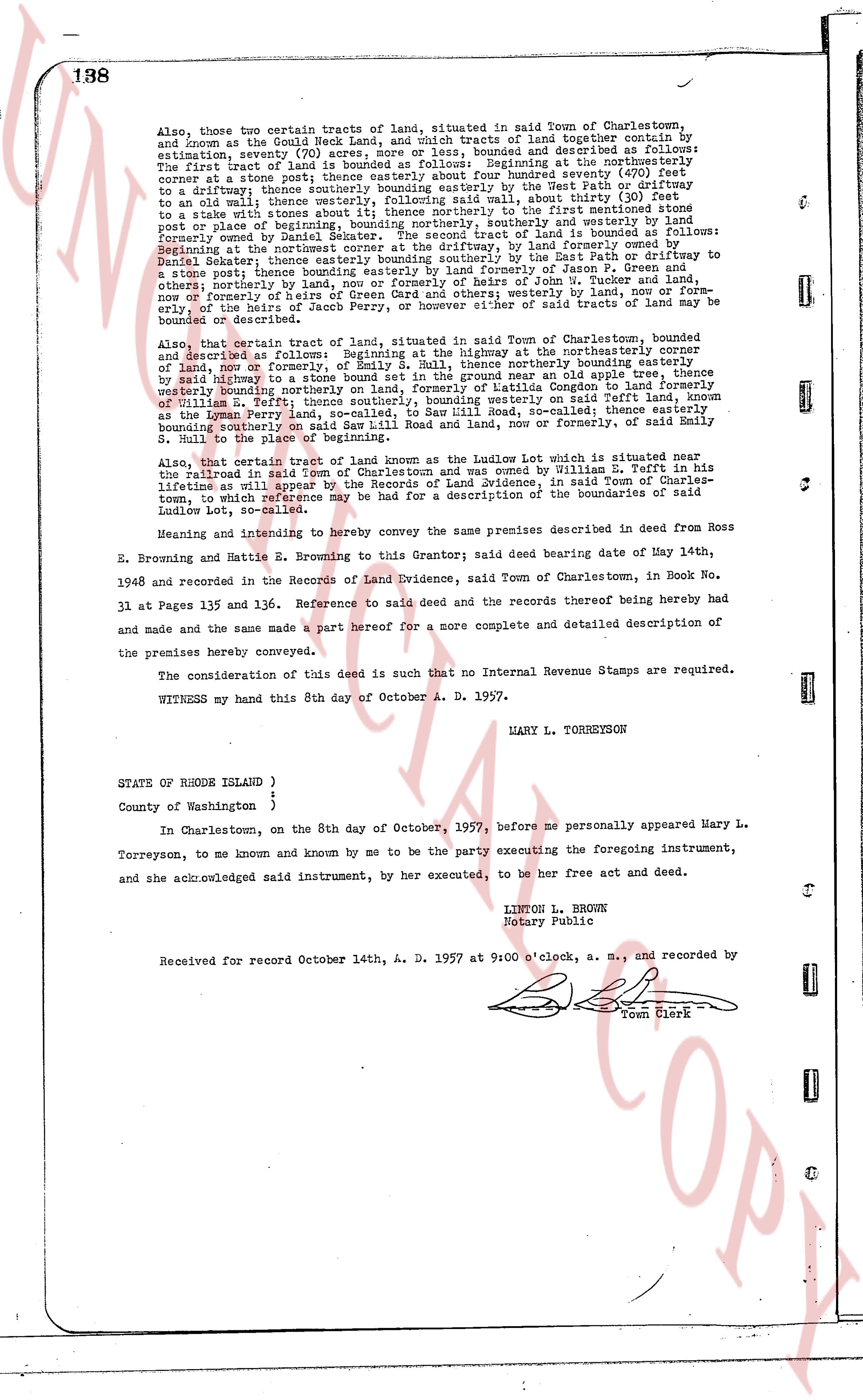
138
Also, those two certain tracts of land, situated in said Town of Charlestown, and known as and the Goud Neck Land, and which tracts of land together contain by estimation seventy (70) acres more or less, bounded and described as follows: The first tract of land is bounded as follows: Beginning at the northeasterly corner at stone post [?] south forty-seven degrees east, twenty-seven feet to a driftway; thence southerly bounding easterly by the West Path or driftway to an old stone wall; thence southerly twenty-one feet, then easterly forty-seven feet to a stake with stones about it; thence northerly to the first mentioned stone post or place of beginning; then bounding southerly and east by land formerly owned by Daniel Seater. The second tract of land is bounded as follows: Beginning at the northeast corner at a stone post, bounding southerly by the East Path or driftway to Daniel Seater; thence bounding southerly and easterly by land formerly owned by Daniel Seater; thence bounding easterly by land formerly of Jason F. Torreysen; then northerly bounding easterly by land formerly of John Torreysen and, now formerly or heirs of the heirs of Smith of Green Orchard and other ways; westerly by, now or formerly, the heirs of the heirs of Smith, bounding northerly by said East Path, or driftway or bounded or described.
Also, that certain tract of land, situated in said Town of Charlestown, bounded and described as follows: Beginning at the highway at the northeasterly corner of land, now or formerly, of Emily S. Dull, thence northerly bounding easterly by said highway to a stone wall; thence easterly twenty-one feet as a stake with stones thence westerly bounding northerly on land, formerly of Katilda Congdon to land formerly of Emily S. Dull; thence southerly bounding easterly by land formerly known as the Lemon Perry land, so-called, to say Sir Lillie Road, so-called; thence easterly bounding southerly on said Sir Lillie Road and wall, now or formerly, of said Emily S. Dull to the place of beginning.
Also, that certain tract of land known as the Ludlow Lot which is situated near the railroad in said Town of Charlestown and was owned by William B. Torreysen in his lifetime as will appear by the deed recorded in said town, in said Town of Charlestown, to which reference may be had for a description of the boundaries of said Ludlow Lot, so-called.
Meaning and intending to hereby convey the same premises described in deed from Ross E. Browning and Beattie E. Browning to this Grantor said deed bearing date my May 14th, 1948 and recorded in the Records of Land Evidence, said Town of Charlestown, in Book No. 31 and Pages 135 and 136. Reference to said deed and the records thereof being hereby made and the same made a part hereof for a more complete and detailed description of the premises hereby conveyed.
The consideration of this deed is such that no Internal Revenue Stamps are required.
WITNESS my hand this 8th day of October A. D. 1957.
MARY L. TORREYSON
STATE OF RHODE ISLAND )
County of Washington )
In Charlestown, on the 8th day of October, 1957, before me personally appeared Mary L. Torreyson, to me known and known by me to be the party executing the foregoing instrument, and she acknowledged said instrument, by her executed, to be her free act and deed.
LINTON L. BROWN
Notary Public
Received for record October 14th, A. D. 1957 at 9:00 o'clock, a. m., and recorded by
[Signature]
Town Clerk
The page as recorded