The instrument's own words
page 1 · read by Gemma vision
130
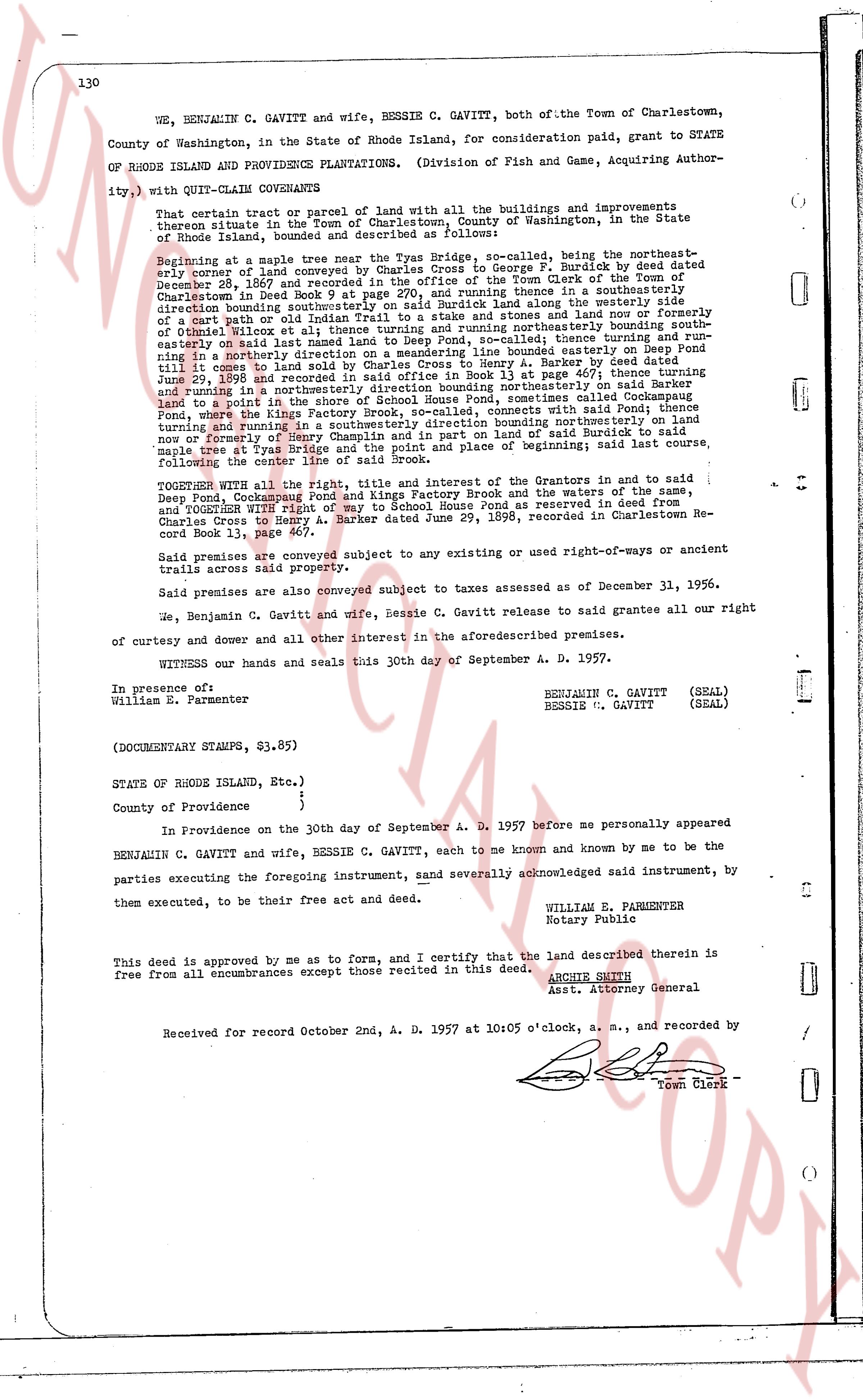
WE, BENJAMIN C. GAVITT and wife, BESSIE C. GAVITT, both of the Town of Charlestown, County of Washington, in the State of Rhode Island, for consideration paid, grant to STATE OF RHODE ISLAND AND PROVIDENCE PLANTATIONS. (Division of Fish and Game, Acquiring Authority), with QUIT-CLAIM COVENANTS
That certain tract of land with all the buildings and improvements thereon situate in the Town of Charlestown, County of Washington, in the State of Rhode Island, bounded and described as follows:
Beginning at a maple tree near the Tyas Bridge, so-called, being the northeast boundary corner of land conveyed by Benjamin C. Gavitt to George F. Burdick by deed dated December 24, 1947 and recorded in the office of the Town Clerk of the Town of Charlestown in Deed book 24, page 110; thence turning north and running along the westerly side of Newood Deed book 9 page 97 at 290 pole; and turning north easterly bounding southerly direction boundaries of land of George F. Burdick, then running along the westerly side of a cart path or old Indian Trail to a stake and stones and thence running north easterly to a stake and stones at the boundary of land of George F. Burdick, thence running northerly bounding southerly easterly on said land named land to Deep Pond, so-called; thence turning and running north easterly on said land to the north westerly boundary of land of George F. Burdick until it comes to land sold by Charles Cross to Henry A. Barker by deed dated June 29, 1898 and recorded in the Town Clerk's office at page 460 of Deed book 11; thence turning and running in a northwesterly direction bounding northeasterly on said Barker land to a point in the north westerly boundary of land of George F. Burdick, then running north, where the Kings Factory Brook, so-called, connects with said Pond; thence running north and running in a north easterly direction bounding north easterly on said land now or formerly of George F. Chaplin and on part of land of Barker said to begin at maple tree at Tyas Bridge and the point of balance and place of beginning; said last course, following the course of the brook to the place of beginning.
TOGETHER WITH all the right, title and interest of the Grantors in and to said Deep Pond, Cockapoose Pond and Kings Factory Brook and the waters of said ponds, and Together With right of way for ingress and egress as reserved by deed from Charles Cross to Henry A. Barker dated June 29, 1898, recorded in Charlestown Record book 11, page 460.
Said premises are conveyed subject to any existing use or use-rights-of-way or ancient trails across said property.
Said premises are also conveyed subject to taxes assessed as of December 31, 1956.
We, Benjamin C. Gavitt and wife, Bessie C. Gavitt release to said grantee all our right of curtesy and dower and all other interest in the aforesaid described premises.
WITNESS our hands and seals this 30th day of September A. D. 1957.
In presence of:
William E. Parmenter
BENJAMIN C. GAVITT (SEAL)
BESSIE C. GAVITT (SEAL)
(DOCUMENTARY STAMPS, $3.85)
STATE OF RHODE ISLAND, Etc. }
County of Providence { }
In Providence on the 30th day of September A. D. 1957 before me personally appeared BENJAMIN C. GAVITT and wife, BESSIE C. GAVITT, each to me known and known by me to be the parties executing the foregoing instrument, sand severally acknowledged said instrument, by them executed, to be their free act and deed.
WILLIAM E. PARMENTER
Notary Public
This deed is approved by me as to form, and I certify that the land described therein is free from all encumbrances except those recited in this deed.
ARCHIE SMITH
Asst. Attorney General
Received for record October 2nd, A. D. 1957 at 10:05 o'clock, a. m., and recorded by [?] Town Clerk
The page as recorded