The instrument's own words
page 1 · read by Gemma vision
84
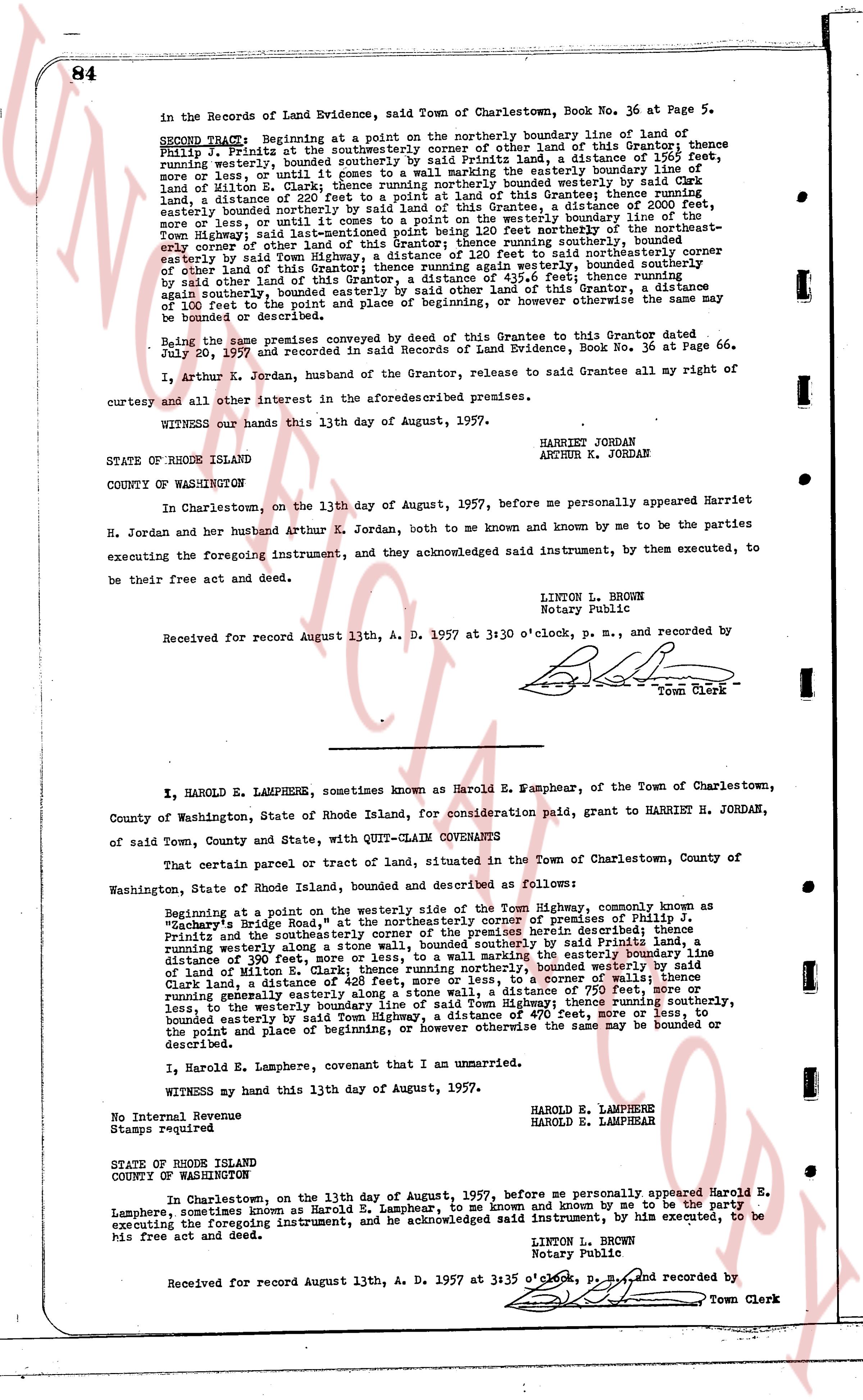
in the Records of Land Evidence, said Town of Charlestown, Book No. 36 at Page 5.
SECOND TRACT: Beginning at a point on the northerly boundary line of land of
Philip J. Pritts at the southwesternly corner of the other land of said Pritts, a distance of 115 feet,
more or less, running westerly, bounded southerly by a stone wall, a distance of 115 feet,
more or less, running northerly to a nail marking the easterly boundary line of
land of Milton E. Clark; thence running northerly bounded westerly by said Clark
land, a distance of 390 feet, more or less; thence running easterly bounded thence running
easterly bounded northerly bounded westerly by said land of this Grantee, a distance of 2000 feet,
more or less, until reaching the easterly boundary line of the northerly boundary line of
Town Highway; said last-mentioned point being 120 feet northeastly from the northeastly-
most corner of other land of this Grantee; thence running southeasterly bounded
easterly by said Town Highway, a distance of 120 feet to said northeasterly corner
of other land of this Grantee; thence running southerly bounded easterly by said
other land of this Grantee, a distance of 435.6 feet thence running
again southerly, bounded easterly by said other land of this Grantee, a distance
of 160 feet to the point of beginning, or however otherwise the same may be
bounded or described.
Being the same premises conveyed by deed of this Grantee to this Grantor dated
July 20, 1954 and recorded in said Records of Land Evidence, Book No. 36 at Page 66.
I, Arthur K. Jordan, husband of the Grantee, release to said Grantee all my right of
curtesy and all other interest in the aforesaid premises.
Witness our hands this 13th day of August, 1957.
HARRIET H JORDAN
ARTHUR K. JORDAN
STATE OF RHODE ISLAND
COUNTY OF WASHINGTON
In Charlestown, on the 13th day of August, 1957, before me personally appeared Harriet
H. Jordan and her husband Arthur K. Jordan, both to me and known by me to be the parties
executing the foregoing instrument, and they acknowledged said instrument, by them executed, to
be their free act and deed.
LINTON L. BROWN
Notary Public
Received for record August 13th, A. D. 1957 at 3:30 o'clock, p. m., and recorded by
[Signature]
Town Clerk
----
I, HAROLD E. LAMPHERE, sometimes known as Harold E. Lamphear, of the Town of Charlestown,
County of Washington, State of Rhode Island, for consideration paid, grant to HARRIET H. JORDAN,
of said Town, County and State, with QUIT-CLAIM COVENANTS
That certain parcel or tract of land, situated in the Town of Charlestown, County of
Washington, State of Rhode Island, bounded and described as follows:
Beginning at a point on the westerly side of the Town Highway, commonly known as
"Dodge's Bridge Road" at the northeasterly corner of premises of Philip J.
Pritts and the southwesternly corner of the other land herein described; thence
running westerly along a stone wall, bounded southerly by said Pritts land, a
distance of 390 feet, more or less; thence running northerly bounding the easterly boundary line of
land of Milton E. Clark; thence running northerly, bounded westerly by said Clark
land, a distance of 420 feet, more or less; thence running to a corner wall running
easterly generally easterly bounded northerly by said land, a distance of 750 feet, more or
less, to the westerly boundary line of said Town Highway; thence running southerly,
bounded easterly by said Town Highway, a distance of 470 feet, more or less, to
the point and place of beginning, or however otherwise the same may be bounded or
described.
I, Harold E. Lamphere, covenant that I am unmarried.
Witness my hand this 13th day of August, 1957.
HAROLD E. LAMPHERE
HAROLD E. LAMPHEAR
No Internal Revenue
Stamps required
STATE OF RHODE ISLAND
COUNTY OF WASHINGTON
In Charlestown, on the 13th day of August, 1957, before me personally appeared Harold E.
Lamphere, sometimes known as Harold E. Lamphear, to me known and known by me to be the party
executing the foregoing instrument, and he acknowledged said instrument, by him executed, to be
his free act and deed.
LINTON L. BROWN
Notary Public
Received for record August 13th, A. D. 1957 at 3:35 o'clock, p. m., and recorded by
[Signature]
Town Clerk
The page as recorded