The instrument's own words
page 1 · read by Gemma vision
69
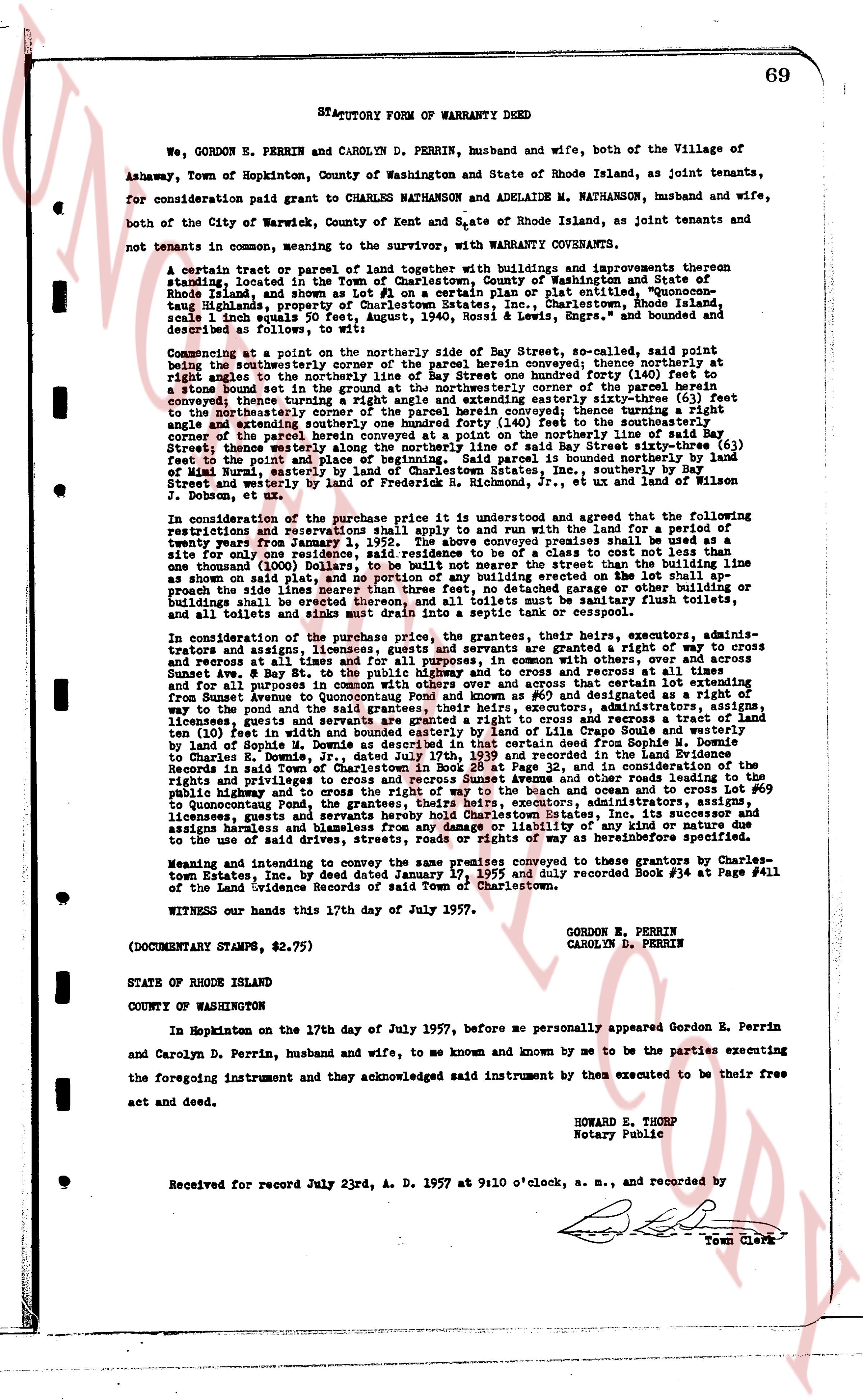
STATUTORY FORM OF WARRANTY DEED
We, GORDON E. PERRIN and CAROLYN D. PERRIN, husband and wife, both of the Village of Ashaway, Town of Hopkinton, County of Washington and State of Rhode Island, as joint tenants, for consideration paid grant to CHARLES NATHANSON and ADELAIDE M. NATHANSON, husband and wife, both of the City of Warwick, County of Kent and State of Rhode Island, as joint tenants and not tenants in common, wanting to sever the warranty, with WARRANTY COVENANTS.
A certain tract or parcel of land together with buildings and improvements thereon situated, located in the Town of Charlestown, County of Washington and State of Rhode Island, as shown and set Lot # 1 on a certain plan or plat entitled "Survey of the 1936-1965 era, typed or in a clerk's hand. The town's index gives the parties as: grantor(s) PERRIN CAROLYN D; PERRIN GORDON E; grantee(s) NATHANSON ADELAIDE M; NATHANSON CHARLES; instrument type DEED. Use those spellings when the text gives them. Transcribe the whole page faithfully in reading order, keeping the paragraph breaks; write names, dates, sums, lot and plat numbers, street names, and every book-and-page citation of an earlier deed exactly as written; mark an unreadable word as [?]. If the page carries the end of the previous instrument or the start of the next, transcribe that too and mark the boundary with a line "----". Output the text only, no commentary.
scale 1 inch equals 50 feet, August, 1940, Rossil & Lewis, Engrs." and bounded as described as follows:
Commencing at a point on the northerly side of Bay Street, so-called, said point being the southeasterly corner of the parcel herein conveyed; thence southeasterly at right angle to the northerly side of Bay Street, south 41° 00' east one hundred forty (140) feet to a stone bound set in the ground at the northeasterly corner of the parcel herein conveyed; thence turning a right angle and running north 49° 00' west one hundred forty (140) feet to the northeasterly corner of the parcel herein conveyed; thence turning a right angle and running northwest north 41° 00' west one hundred forty (140) feet to the northeasterly corner of the parcel herein conveyed at a point on the northerly side of said Bay Street; thence westerly along the northerly side of said Bay Street, north 49° 00' west one hundred forty (140) feet to said bound set in the ground; said parcel is bounded northerly by land of Wimal Nutri, easterly by land of Charlestown State, inc., southerly by Bay Street and westerly by land of [?] [?] [?], as shown on the plan of J. Dobson, et al.
In consideration of the purchase price it is understood and agreed that the following restrictions and reservations shall apply to and run with the land for a period of twenty years from January 1, 1952. The above conveyed premises shall be used as a site for one single family residence, and no other building or a class to construct a residence of one thousand (1000) Dollars to be built neither near the street than the building line as shown on said plat and shall not be more than 30 feet from the street. No other building shall protrude the side lines neither more than three feet, no detached garage either or building or shed shall be built on the premises. All houses shall have sanitary flush toilets and all toilets and sinks shall drain into a septic tank or cesspool.
In consideration of the purchase price, the grantees, their heirs, executors, administrators and assigns, licensees, guests and servants are granted a right of way to cross and recurse at all times, in common with others, and over and across at all times, and for all purposes, a strip of land twenty (20) feet wide, running southeasterly from Sunset Ave. & Bay St. to the public highway and to cross and recurse at all times, in common with others, and over and across at all times, a strip of land twenty (20) feet wide, running southeasterly from Sunset Ave. to Quonnoquont Pond and known as #65 and designated as a right of way to the pond and to the public highway. The grantors, their heirs, executors, administrators, licensees, guests and servants are granted a right to cross and recurse a tract of land lying parallel to the public highway and to cross and recurse at all times, in common with others, by land of Sophie M. Owens as described in that certain deed from Sophie M. Owens to Charles E. Perrin, dated January 17, 1955 and recorded in the land evidence Records in said Town of Charlestown in Book 28 at Page 12, and in consideration of the rights and privileges herein granted, the grantees, their heirs, executors, administrators, licensees, guests and servants are granted a right of way to the beach and ocean and to cross Lot #65 to Quonnoquont Pond, the grantees, their heirs, executors, administrators, licensees, guests and servants shall indemnify Charles-town Estates, Inc. its successor and assigns harmless and blameless from any damage or liability of any kind or nature due to the use of said right of way and the right of way as herein described.
Meaning and intending to convey the same premises conveyed to these grantors by Charles-town Estates, Inc. by deed dated January 17, 1955 and duly recorded Book #36 at Page #411 of the land Evidence Records of said Town of Charlestown.
WITNESS our hands this 17th day of July 1957.
GORDON E. PERRIN
CAROLYN D. PERRIN
(DOCUMENTARY STAMPS, $2.75)
STATE OF RHODE ISLAND
COUNTY OF WASHINGTON
In Hopkinton on the 17th day of July 1957, before me personally appeared Gordon E. Perrin and Carolyn D. Perrin, husband and wife, to me known and known by me to be the parties executing the foregoing instrument and they acknowledged said instrument by them executed to be their free act and deed.
HOWARD E. THORP
Notary Public
Received for record July 23rd A. D. 1957 at 9:10 o'clock, a. m., and recorded by
[Signature]
Town Clerk
The page as recorded