The instrument's own words
page 1 · read by Gemma vision
64
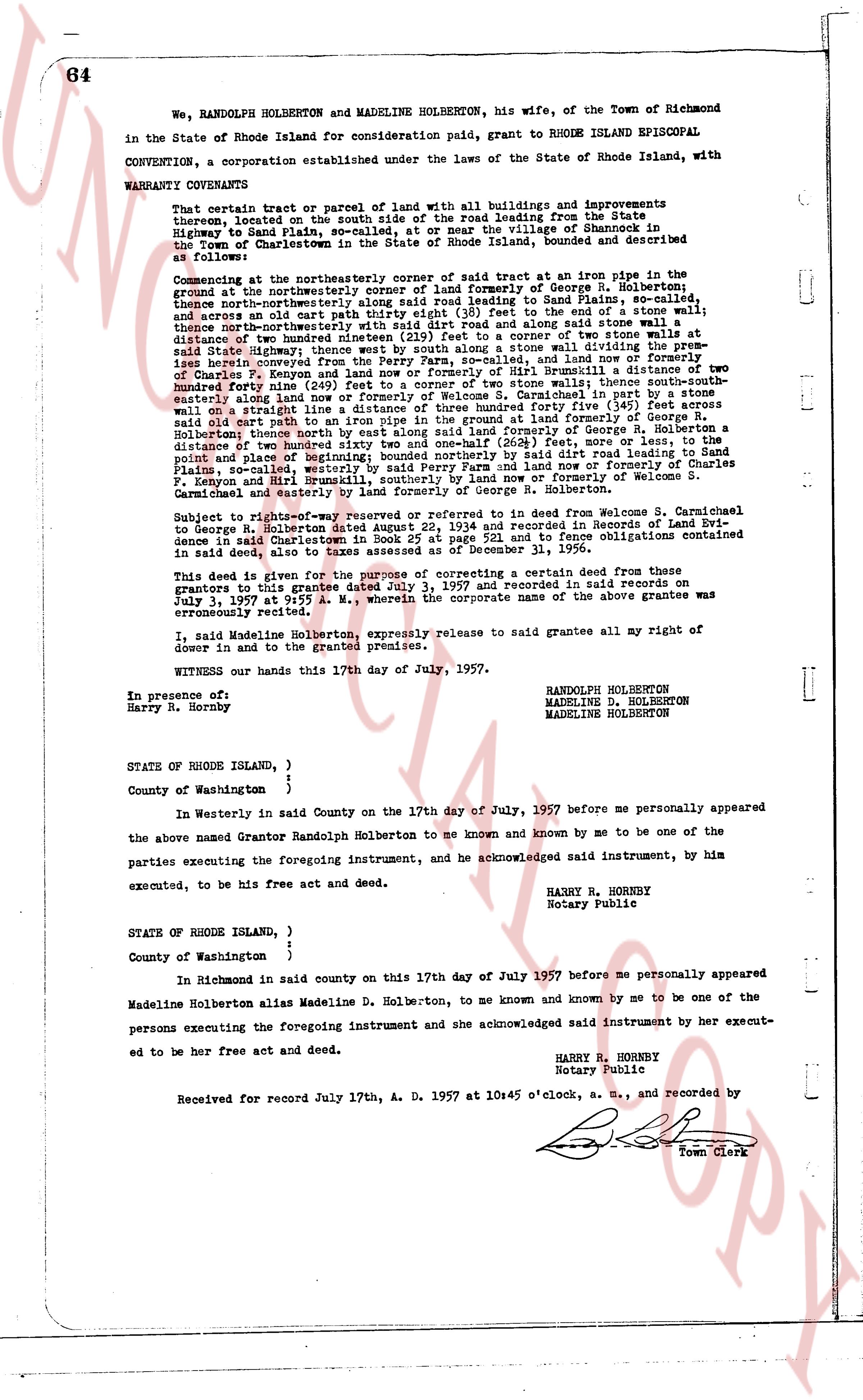
We, RANDOLPH HOLBERTON and MADELINE HOLBERTON, his wife, of the Town of Richmond in the State of Rhode Island for consideration paid, grant to RHODE ISLAND EPISCOPAL CONVENTION, a corporation established under the laws of the State of Rhode Island, with WARRANTY COVENANTS
That certain tract or parcel of land with all buildings and improvements thereon, located on the south side of the road leading from the State Highway to Sand Plain, so-called, or at or near the village of Shannock in the Town of Charlestown, County of Washington, Rhode Island, bounded and described as follows:
Commencing at the northeasterly corner of said tract at an iron pipe in the ground, being the northeasterly corner of land formerly of George R. Holberton, thence north by northeasterly along said road leading to Sand Plains, so-called, thence and across an old cart path to the corner of a stone wall to the east of a stream, thence southeasterly thence subsequently with said dirt road and along said stone wall to a distance of two hundred nineteen (219) feet to a corner of two stone walls to the east of Sand Highway, thence southeasterly with said stone wall dividing the premises herein conveyed from the Perry Farm, so-called, and land of the heirs of Charles T. Rogers and the heirs of George W. Russell a distance of two hundred forty (240) feet to a corner of two stone walls; thence south-southeast a distance of two hundred forty (240) feet to a corner marked "B" in paint, thence south-southeast easterly along land of George R. Holberton a distance of one hundred thirty (130) feet across an old stone wall on a straight line a distance of three hundred forty five (345) feet across said dirt road, then north by northeasterly along land formerly of George R. Holberton thence north by east along said land formerly of George R. Holberton a distance of two hundred forty (240) feet to a point, more or less, at the north easterly point and place of beginning; bounded northerly by said dirt road leading to Sand Plains, and bounded easterly by said dirt road and land now or formerly of Elizabeth J. Keton and Hurl Bumnick, southerly by land now or formerly of Welcome S. Carmichael and easterly by land formerly of George R. Holberton.
Subject to right-of-way reserved or mentioned in certain deed from Welcome S. Carmichael to George H. Holberton dated June 15, 1934 and recorded in Records of Land Evidence in said Charlestown in Book 25 at page 221 and to Fence Obligations contained in said deed, also to a reservation in deed dated July 1, 1956.
This deed is given for the purpose of correcting a certain deed from these donors to grantees this date July 3, 1957 and recorded in said records on July 1, 1957 at 10:55 A. M., wherein the corporate name of the above grantee was erroneously recited.
I, said Madeline Holberton, expressly release to said grantee all my right of dower in and to the granted premises.
WITNESS our hands this 17th day of July, 1957.
RANDOLPH HOLBERTON
MADELINE D. HOLBERTON
MADELINE HOLBERTON
In presence of:
Harry R. Horrby
STATE OF RHODE ISLAND, )
County of Washington }
In Westerly in said County on the 17th day of July, 1957 before me personally appeared the above named Grantor Randolph Holberton to me known and known by me to be one of the parties executing the foregoing instrument, and he acknowledged said instrument, by him executed, to be his free act and deed.
HARRY R. HORRBY
Notary Public
STATE OF RHODE ISLAND, )
County of Washington }
In Richmond in said county on this 17th day of July 1957 before me personally appeared Madeline Holberton alias Madeline D. Holberton, to me known and known by me to be one of the persons executing the foregoing instrument and she acknowledged said instrument by her execution to be her free act and deed.
HARRY R. HORRBY
Notary Public
Received for record July 17th, A. D. 1957 at 10:45 o'clock, a. m., and recorded by [signature]
Town Clerk
The page as recorded