The instrument's own words
page 1 · read by Gemma vision
38
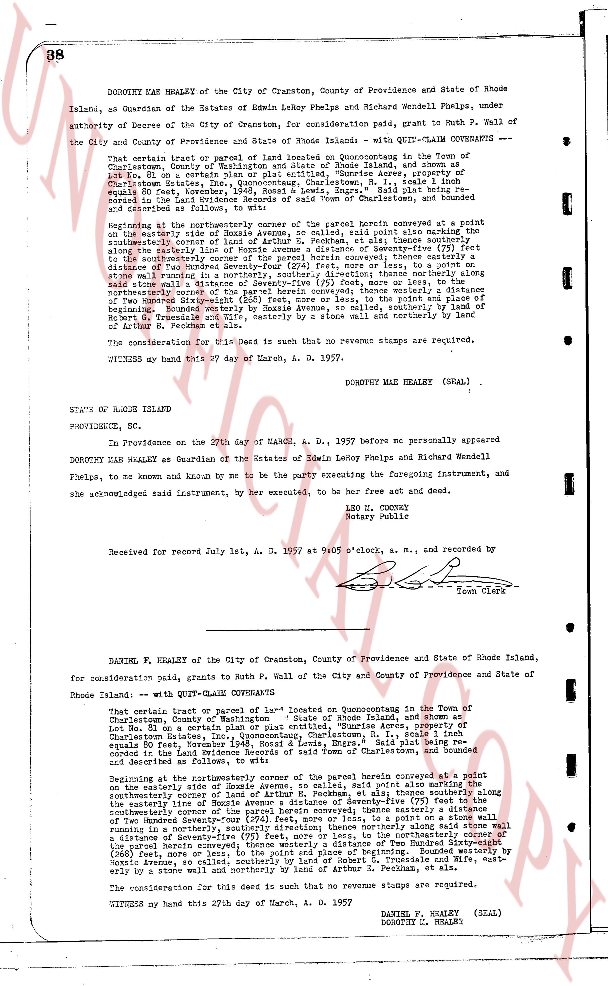
DOROTHY MAE HEALEY of the City of Cranston, County of Providence and State of Rhode Island, as Guardian of the Estates of Edwin LeRoy Phelps and Richard Wendell Phelps, under authority of Decree of the City of Cranston, for consideration paid, grant to Ruth P. Wall of the City and County of Providence and State of Rhode Island - WITH QUIT-CLAIM COVENANTS -
That certain tract or parcel of land located on Quonocutaug in the Town of Charlestown, County of Washington and State of Rhode Island, and shown as Lot No. 81 on a certain plan or plat entitled, "Dunhire Acres, property of Charlestown Estate, Route 1, Quonocutaug, Charlestown, R. I.", scale 1 inch equals 80 feet, November, 1946, Ross & Lewis, Engrs., Said plat being recorded in the Land Evidence Records of the Town of Charlestown and bounded and described as follows, to wit:
Beginning at the northeasterly corner of the parcel herein conveyed at a point on the easterly side of Hoxie Avenue, so called, said point also marking the southeasterly corner of the land of Arthur S. Pecham, et als; thence southerly along the easterly side of Hoxie Avenue, a distance of Seventy-five (75) feet to the southeasterly corner of the parcel herein conveyed; thence easterly a distance of Two Hundred Seventy-four (274) feet, more or less, to a point on some stone wall running in a southerly, northerly direction; thence northerly along said stone wall a distance of Seventy-five (75) feet, more or less, to the northeasterly corner of the parcel herein conveyed; thence westerly a distance of Two Hundred Seventy-four (274) feet, more or less, to the point and place of beginning. Bounded westerly by Hoxie Avenue, so called, southerly by land of Robert G. Trimsdale and wife, easterly by a stone wall and northerly by land of Arthur S. Pecham, et als.
The consideration for this Deed is such that no revenue stamps are required.
WITNESS my hand this 27th day of March, A. D. 1957.
DOROTHY MAE HEALEY (SEAL)
STATE OF RHODE ISLAND
PROVIDENCE, SC.
In Providence on the 27th day of MARCH, A. D., 1957 before me personally appeared DOROTHY MAE HEALEY as Guardian of the Estates of Edwin LeRoy Phelps and Richard Wendell Phelps, to me known and known by me to be the party executing the foregoing instrument, and she acknowledged said instrument, by her execution, to be her free act and deed.
LEO H. CONNEY
Notary Public
Received for record July 1st, A. D. 1957 at 9:05 o'clock, a. m., and recorded by
[Signature]
Town Clerk
----
DANIEL P. HEALEY of the City of Cranston, County of Providence and State of Rhode Island, for consideration paid, grants to Ruth P. Wall of the City and County of Providence and State of Rhode Island: - WITH QUIT-CLAIM COVENANTS
That certain tract or parcel of land located on Quonocutaug in the Town of Charlestown, County of Washington and State of Rhode Island, and shown as Lot No. 81 on a certain plan or plat entitled, "Dunhire Acres, property of Charlestown Estate, Route 1, Quonocutaug, Charlestown, R. I.", scale 1 inch equals 80 feet, November, 1946, Ross & Lewis, Engrs., Said plat being recorded in the Land Evidence Records of the Town of Charlestown and bounded and described as follows, to wit:
Beginning at the northeasterly corner of the parcel herein conveyed at a point on the easterly side of Hoxie Avenue, so called, said point also marking the southeasterly corner of the land of Arthur S. Pecham, et als; thence southerly along the easterly side of Hoxie Avenue, a distance of Seventy-five (75) feet to the southeasterly corner of the parcel herein conveyed; thence easterly a distance of Two Hundred Seventy-four (274) feet, more or less, to a point on some stone wall running in a southerly, northerly direction; thence northerly along said stone wall a distance of Seventy-five (75) feet, more or less, to the northeasterly corner of the parcel herein conveyed; thence westerly a distance of Two Hundred Seventy-four (274) feet, more or less, to the point and place of beginning. Bounded westerly by Hoxie Avenue, so called, southerly by land of Robert G. Trimsdale, and wife, easterly by a stone wall and northerly by land of Arthur S. Pecham, et als.
The consideration for this deed is such that no revenue stamps are required.
WITNESS my hand this 27th day of March, A. D. 1957
DANIEL P. HEALEY (SEAL)
DOROTHY M. HEALEY
The page as recorded