The instrument's own words
page 1 · read by Gemma vision
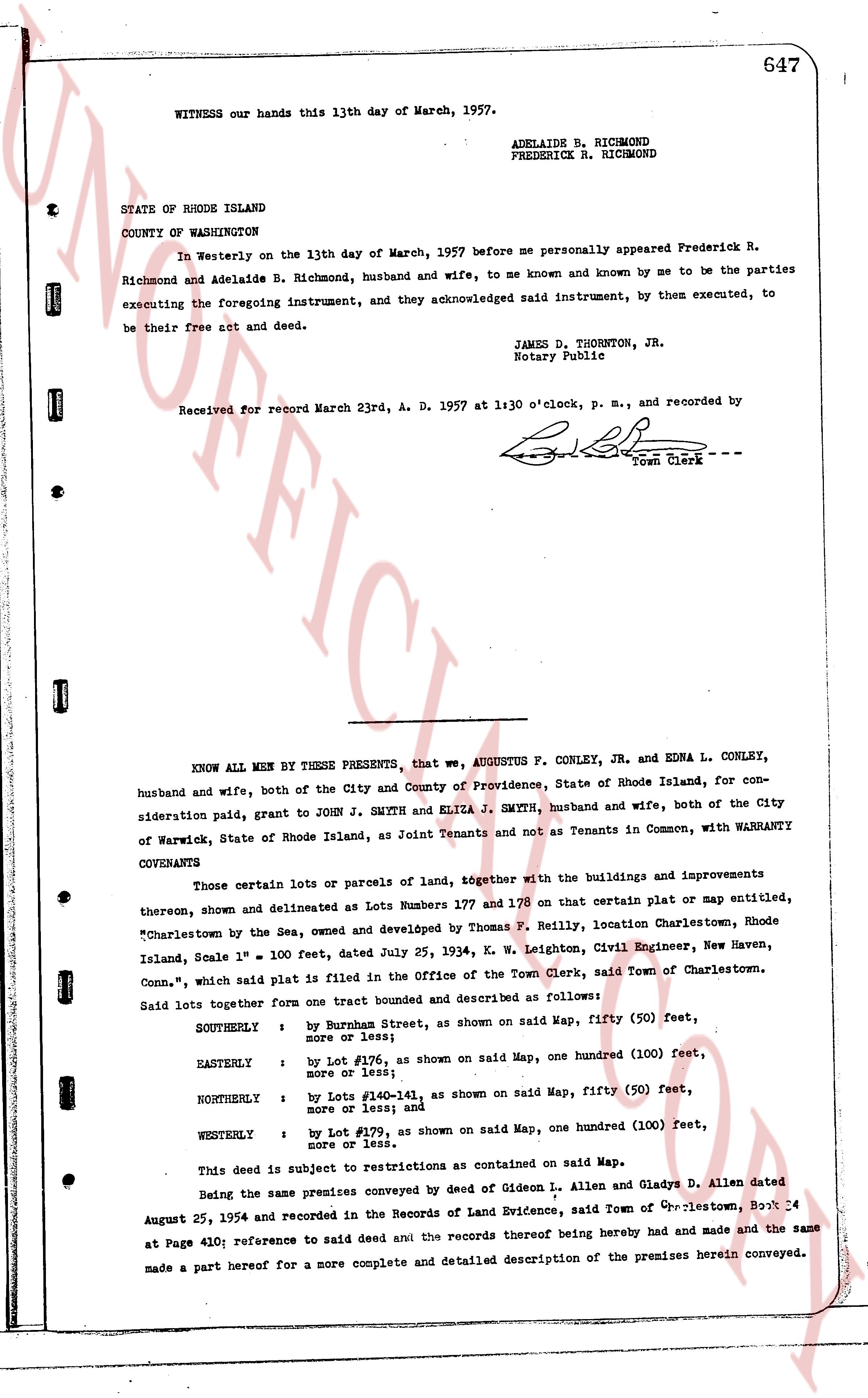
WITNESS our hands this 13th day of March, 1957.
ADELAIDE R. RICHMOND
FREDERICK R. RICHMOND
STATE OF RHODE ISLAND
COUNTY OF WASHINGTON
In Westerly on the 13th day of March, 1957 before me personally appeared Frederick R. Richmond and Adelaide R. Richmond, husband and wife, to me known and known by me to be the parties executing the foregoing instrument, and they acknowledged said instrument, by them executed, to be their free act and deed.
JAMES D. THORNTON, JR.
Notary Public
Received for record March 23rd, A. D. 1957 at 1:30 o'clock, p. m., and recorded by
[Signature]
Town Clerk ---
----
KNOW ALL MEN BY THESE PRESENTS, that we, AUGUSTUS F. CONLEY, JR. and EDNA L. CONLEY, husband and wife, both of the City and County of Providence, State of Rhode Island, for consideration paid, grant to JOHN J. SMYTH and ELIZA J. SMYTH, husband and wife, both of the City of Warwick, State of Rhode Island, as Joint Tenants and not as Tenants in Common, with WARRANTY COVENANTS
Those certain lots or parcels of land, together with the buildings and improvements thereon, shown and delineated as Lots Numbers 178 and 179 on that certain plat or map entitled, "Charlestown by the Sea, owned and developed by Thomas P. Nelly, location Charlestown, Rhode Island, Scale 1" = 100 feet, dated July 25, 1934, by W. H. Leighton, Civil Engineer, New Haven, Conn.", which said plat is filed in the Office of the Town Clerk, said Town of Charlestown. Said lots together form one tract bounded and described as follows:
SOUTHERLY : by Burnham Street, as shown on said Map, fifty (50) feet, more or less; and
EASTERLY : by Lot #176, as shown on said Map, one hundred (100) feet, more or less; and
NORTHERLY : by Lots #140-141, as shown on said Map, fifty (50) feet, more or less; and
WESTERLY : by Lot #179, as shown on said Map, one hundred (100) feet, more or less.
This deed is subject to restrictions as contained on said Map.
Being the same premises conveyed by deed of Gideon L. Allen and Gladys D. Allen dated August 25, 1954 and recorded in the Records of Land Evidence, said Town of Charlestown, Book 34 at Page 410; reference to said deed and the records thereof being hereby made and made the same made a part hereof for a more complete and detailed description of the premises herein conveyed.
page 2 · read by Gemma vision
648
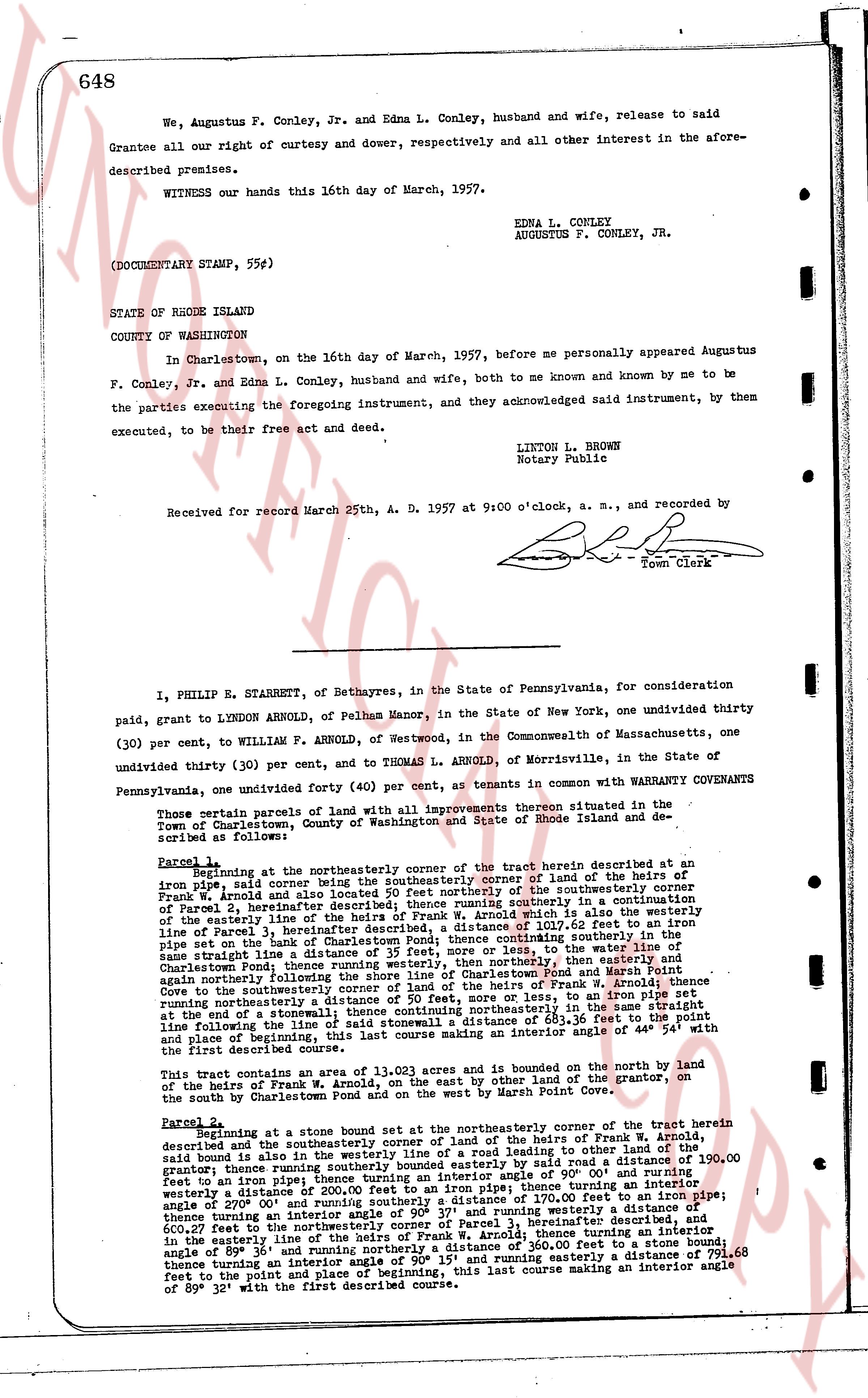
We, Augustus F. Conley, Jr. and Edna L. Conley, husband and wife, release to said Grantee all our right of curtesy and dower, respectively and all other interest in the aforementioned premises.
WITNESS our hands this 16th day of March, 1957.
EDNA L. CONLEY
AUGUSTUS F. CONLEY, JR.
(DOCUMENTARY STAMP, 55¢)
STATE OF RHODE ISLAND
COUNTY OF WASHINGTON
In Charlestown, on the 16th day of March, 1957, before me personally appeared Augustus F. Conley, Jr. and Edna L. Conley, husband and wife, both to me known and known by me to be the parties executing the foregoing instrument, and they acknowledged said instrument, by them executed, to be their free act and deed.
LINTON L. BROWN
Notary Public
Received for record March 25th, A. D. 1957 at 9:00 o'clock, a. m., and recorded by [?] Town Clerk
----
I, PHILIP R. STARBETT, of Bethayes, in the State of Pennsylvania, for consideration paid, grant to LYNDON ARNOLD, of Pelham Manor, in the State of New York, one undivided thirty (30) per cent, to WILLIAM F. ARNOLD, of Westwood, in the Commonwealth of Massachusetts, one undivided thirty (30) per cent, and to THOMAS L. ARNOLD, of Morrisville, in the State of Pennsylvania, one undivided forty (40) per cent, as tenants in common with WARRANTY COVENANTS
Those certain parcels of land with all improvements thereon situated in the Town of Charlestown, County of Washington and State of Rhode Island and described as follows:
Parcel 1, beginning at the northeasterly corner of the tract herein described at an iron pipe, said corner being the southeasterly corner of land of the heirs of the corner of Parcel 2, hereinafter described; thence running easterly along the south line of the heirs of Frank W. Arnold and also some of the heirs of the corner of Parcel 2, hereinafter described; thence running southerly in a continuation of the easterly line of the heirs of Frank W. Arnold which is also the easterly line of Parcel 2, hereinafter described, a distance of 1,100 feet to an iron pipe set on the bank of Charlestown Pond; thence continuing southerly in the same straight line a distance of 100 feet to an iron pipe, then turning to the west along the bank of Charlestown Pond; thence running westerly, then northerly, then easterly and again northerly following the south line of land of the heirs of Frank W. Arnold and also the heirs of Parcel 1, hereinafter described, a distance of 1,100 feet to an iron pipe coming to the southeasterly corner of land of the heirs of Frank W. Arnold; thence turning northerly a distance of 100 feet to an iron pipe, then turning east along the end of a stonewall thence continuing northeasterly in the same straight line following the line of a stonewall said distance of 84.11 feet, to an iron pipe and place of beginning, this last course making an interior angle of 44° 54' with the first described course.
This tract contains an area of 13.003 acres and is bounded on the north by the land of the heirs of Frank W. Arnold, on the east by the other land of the grantor, on the south by Charlestown Pond and on the west by Marsh Point Cove.
Parcel 2, beginning at a stone bound set by the northeasterly corner of the tract herein described and the southeasterly corner of land of the heirs of Frank W. Arnold, said bound also being the intersection of the line of the other land of the grantor; thence running southerly bounded easterly by said road a distance of 190.00 feet to an iron pipe; thence turning northwesterly at an interior angle of 90° 00' and running westerly a distance of 200.00 feet to an iron pipe; thence turning an interior angle of 270° 00' and running southerly a distance of 170.00 feet to an iron pipe; thence turning an interior angle of 89° 37' and running westerly a distance of 170.00 feet to an iron pipe; thence turning an interior angle of 89° 37' and running westerly a distance of 600.27 feet to the northeasterly corner of Parcel 1, hereinafter described; thence turning an interior angle of 89° 37' and running northerly a distance of 360.00 feet to an iron pipe; thence turning an interior angle of 89° 37' and running easterly a distance of 791.68 feet to the point and place of beginning, this last course making an interior angle of 89° 32' with the first described course.
The page as recorded