The instrument's own words
page 1 · read by Gemma vision
635
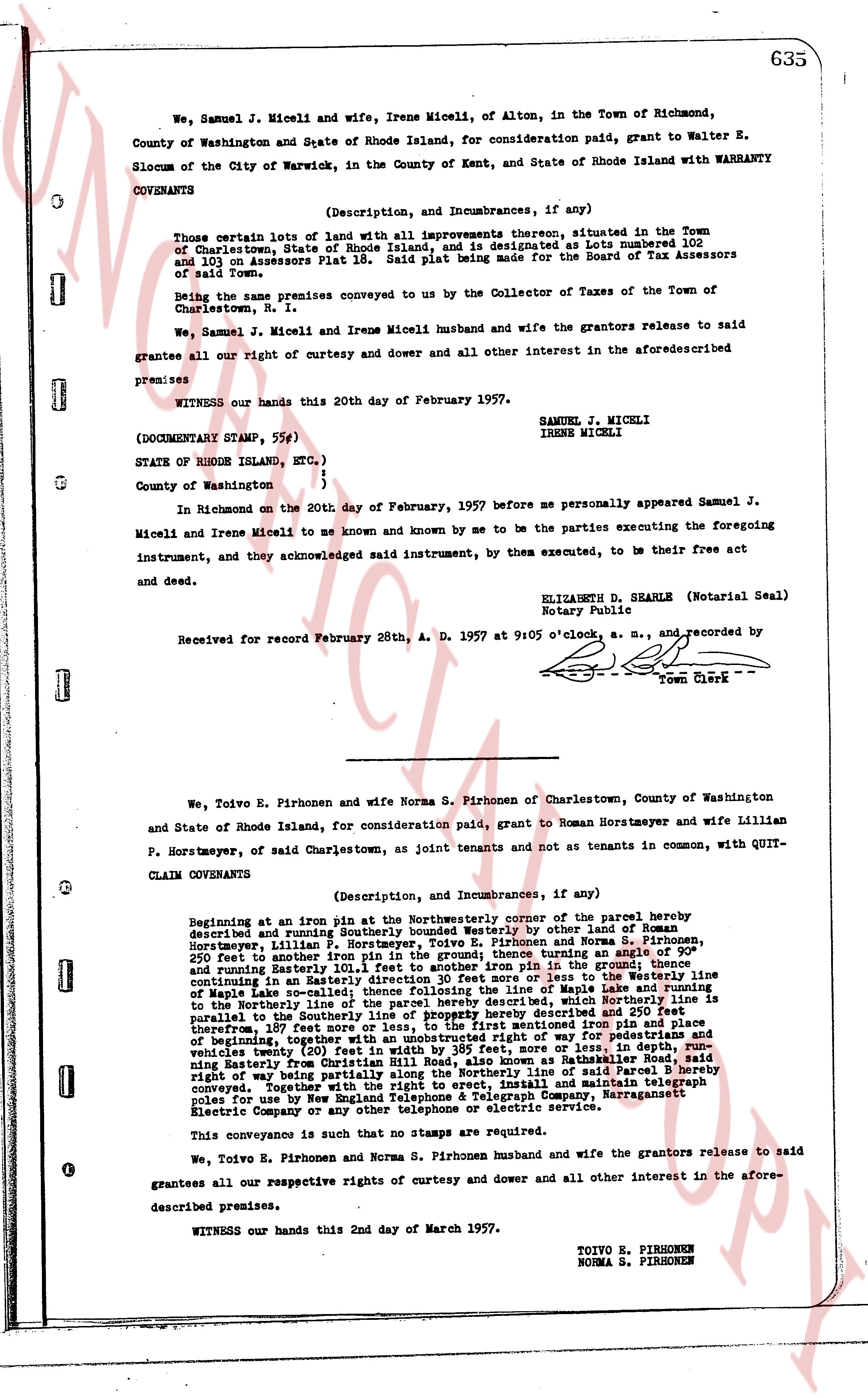
We, Samuel J. Miceli and wife, Irene Miceli, of Alton, in the Town of Richmond, County of Washington and State of Rhode Island, for consideration paid, grant to Walter E. Slocum of the City of Warwick, in the County of Kent, and State of Rhode Island with WARRANTY COVENANTS
(Description, and Incumbrances, if any)
Those certain lots of land with all improvements thereon, situated in the Town of Charlestown, State of Rhode Island, and is designated as Lots numbered 302 and 303 on Assessors Plat 16. Said Plat being made for the Board of Tax Assessors of said Town.
Being the same premises conveyed to you by the Collector of Taxes of the Town of Charlestown, R. I.
We, Samuel J. Miceli and Irene Miceli husband and wife the grantors release to said grantees all our right of curtesy and dower and all other interest in the aforesaid described premises.
WITNESS our hands this 20th day of February 1957.
SAMUEL J. MICELI
IRENE MICELI
(DOCUMENTARY STAMP, 55¢)
STATE OF RHODE ISLAND, ETC. )
County of Washington )
In Richmond on the 20th day of February, 1957 before me personally appeared Samuel J. Miceli and Irene Miceli to me known and known by me to be the parties executing the foregoing instrument, and they acknowledged said instrument, by them executed, to be their free act and deed.
ELIZABETH D. SHEARLE (Notarial Seal)
Notary Public
Received for record February 28th, A. D. 1957 at 9:05 o'clock, a. m., and recorded by [?] Town Clerk
----
We, Toivo E. Pirhonen and wife Norma S. Pirhonen of Charlestown, County of Washington and State of Rhode Island, for consideration paid, grant to Roman Horstmeyer and wife Lillian P. Horstmeyer, of said Charlestown, as joint tenants and not as tenants in common, with QUIT-CLAIM COVENANTS
(Description, and Incumbrances, if any)
Beginning at an iron pin at the Northerly corner of the parcel hereby described and running Southerly bounded Westerly by other land of Roman Horstmeyer, Lillian P. Horstmeyer, Toivo E. Pirhonen and Norma S. Pirhonen, 250 feet to another iron pipe then running Easterly 101.1 feet to another iron pin in the ground; thence continuing in an Easterly direction 101.1 feet to another iron pin; thence to the Westerly line of Maring Lake the southerly line following the line of Maring Lake and running Northerly to the Northerly line of the parcel hereby described then running Westerly as hereby described and 250 feet parallel to the southerly line of this parcel, then to the first mentioned iron pin above described, there being 107 feet more or less, to the first mentioned iron pin above described, there being 107 feet more or less, to the first mentioned iron pin above described, there being a right of way for pedestrians and vehicles twenty (20) feet in the width by the most direct route as established in Parcel B running Easterly from 107 feet from the Northerly line as established in Parcel B to the said right of way being partially along the Northerly line of said Parcel B hereby conveyed together with other rights of way as established in said parcel and existing telephone poles for use by New England Telephone & Telegraph Company, Narragansett Electric Company or any other telephone or electric service.
This conveyance is such that no stamps are required.
We, Toivo E. Pirhonen and Norma S. Pirhonen husband and wife the grantors release to said grantees all our respective rights of curtesy and dower and all other interest in the aforesaid described premises.
WITNESS our hands this 2nd day of March 1957.
TOIVO E. PIRHONEN
NORMA S. PIRHONEN
The page as recorded