The instrument's own words
page 1 · read by Gemma vision
633
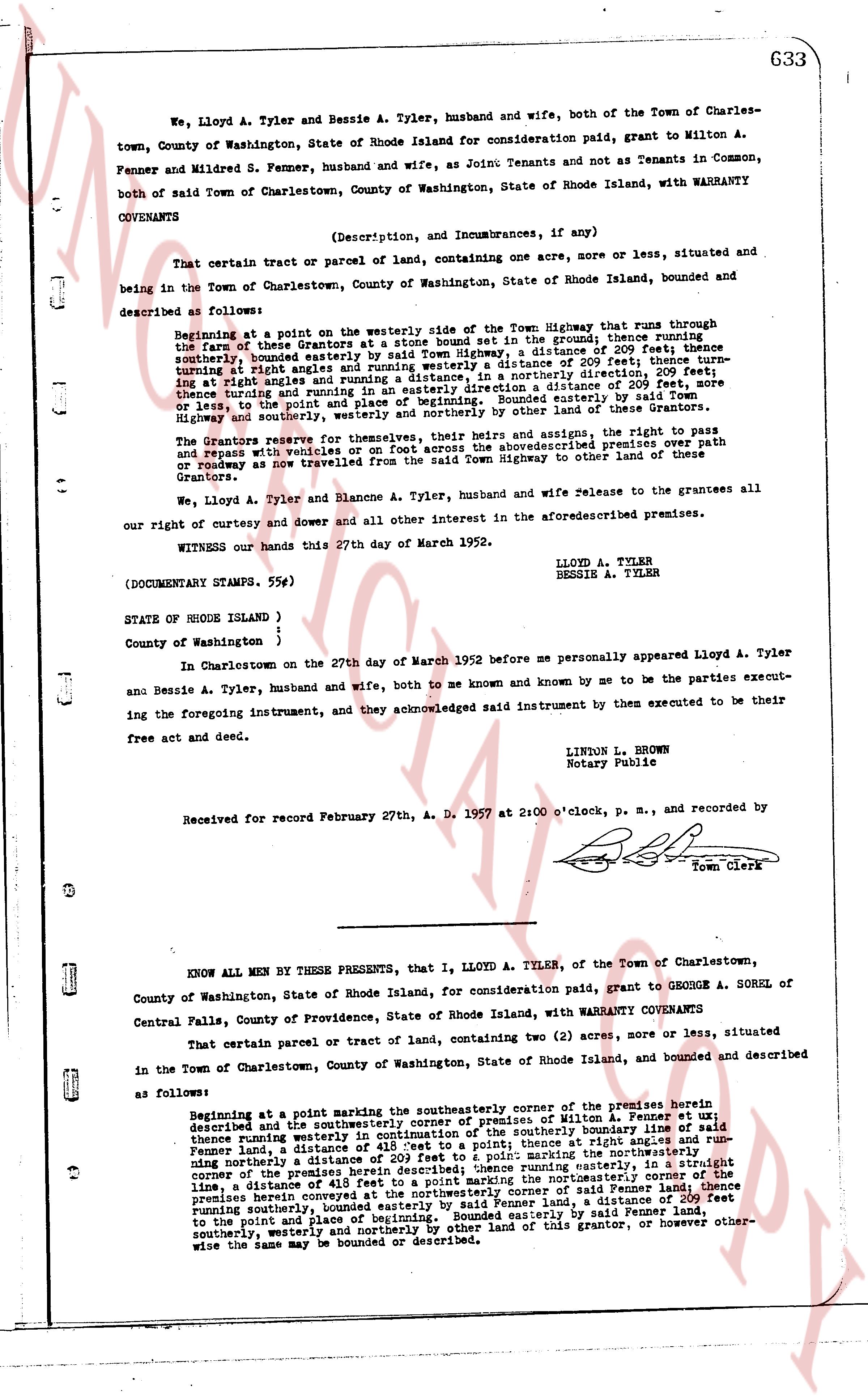
We, Lloyd A. Tyler and Bessie A. Tyler, husband and wife, both of the Town of Charlestown, County of Washington, State of Rhode Island for consideration paid, grant to Milton A. Fenner and Mildred S. Fenner, husband and wife, as Joint Tenants and not as Tenants in Common, both of said Town of Charlestown, County of Washington, State of Rhode Island, with WARRANTY COVENANTS
(Description, and Incumbrances, if any)
That certain tract or parcel of Lands, containing one acre, more or less, situated and being in the Town of Charlestown, County of Washington, State of Rhode Island, bounded and described as follows:
Beginning at a point on the westerly side of East Town Highway that runs through the fare of these Grantors at a distance of 100 feet in the ground thence running southerly, bounded easterly for said Town Highway, a distance of 209 feet; thence turning at right angles and running westerly a distance of 209 feet; thence turning at right angles and running northerly in a easterly direction, a distance 209 feet thence turning at right angles and running in a easterly direction a distance of 209 feet, more or less, to the point and place of beginning, bounded southerly by said Town Highway on the south, and bounded easterly, northerly and westerly by other land of these Grantors.
The Grantors reserve for themselves, their heirs and assigns, the right to pass and repass with vehicles or on foot across the above described premises, with right of roadway as now travelled from the said Town Highway to other land of these Grantors.
We, Lloyd A. Tyler and Blanche A. Tyler, husband and wife release to the grantees all our right of curtesy and dower and all other interest in the aforementioned premises.
WITNESS our hands this 27th day of March 1952.
LLOYD A. TYLER
BESSIE A. TYLER
(DOCUMENTARY STAMPS. 59¢)
STATE OF RHODE ISLAND )
)
County of Washington )
In Charlestown on the 27th day of March 1952 before me personally appeared Lloyd A. Tyler and Bessie A. Tyler, husband and wife, both to me known and known by me to be the parties executing the foregoing instrument, and they acknowledged said instrument by them executed to be their free act and deed.
LINON L. BROWN
Notary Publicle
Received for record February 27th, A. D. 1957 at 2:00 o'clock, p. m., and recorded by
[Signature]
Town Clerk
----
KNOW ALL MEN BY THESE PRESENTS, that I, LLOYD A. TYLER, of the Town of Charlestown, County of Washington, State of Rhode Island, for consideration paid, grant to GEORGE A. SOREL of Central Falls, County of Providence, State of Rhode Island, with WARRANTY COVENANTS
That certain parcel or tract of land, containing two (2) acres, more or less, situated in the Town of Charlestown, County of Washington, State of Rhode Island, bounded and described as follows:
Beginning at a point marking the southeasterly corner of the premises herein described and the southeasterly corner of premises of Milton A. Fenner, bounded easterly thence around westerly side of said premises to the southerly boundary line of said Fenner land, a distance of 418 feet to a point; thence at right angles and running northerly a distance of 209 feet to a point marking the northeasterly corner of the premises herein described and the northeasterly corner of said Fenner land; thence running easterly, in a straight course of 209 feet to a point marking the northeasterly corner of said Fenner land; thence running southerly, bounded easterly by said Fenner land, a distance of 418 feet to a point and place of beginning, bounded easterly by said Fenner land, southerly, westerly and northerly by other land of this grantor, or however otherwise the same may be bounded or described.
The page as recorded