The instrument's own words
page 1 · read by Gemma vision
237
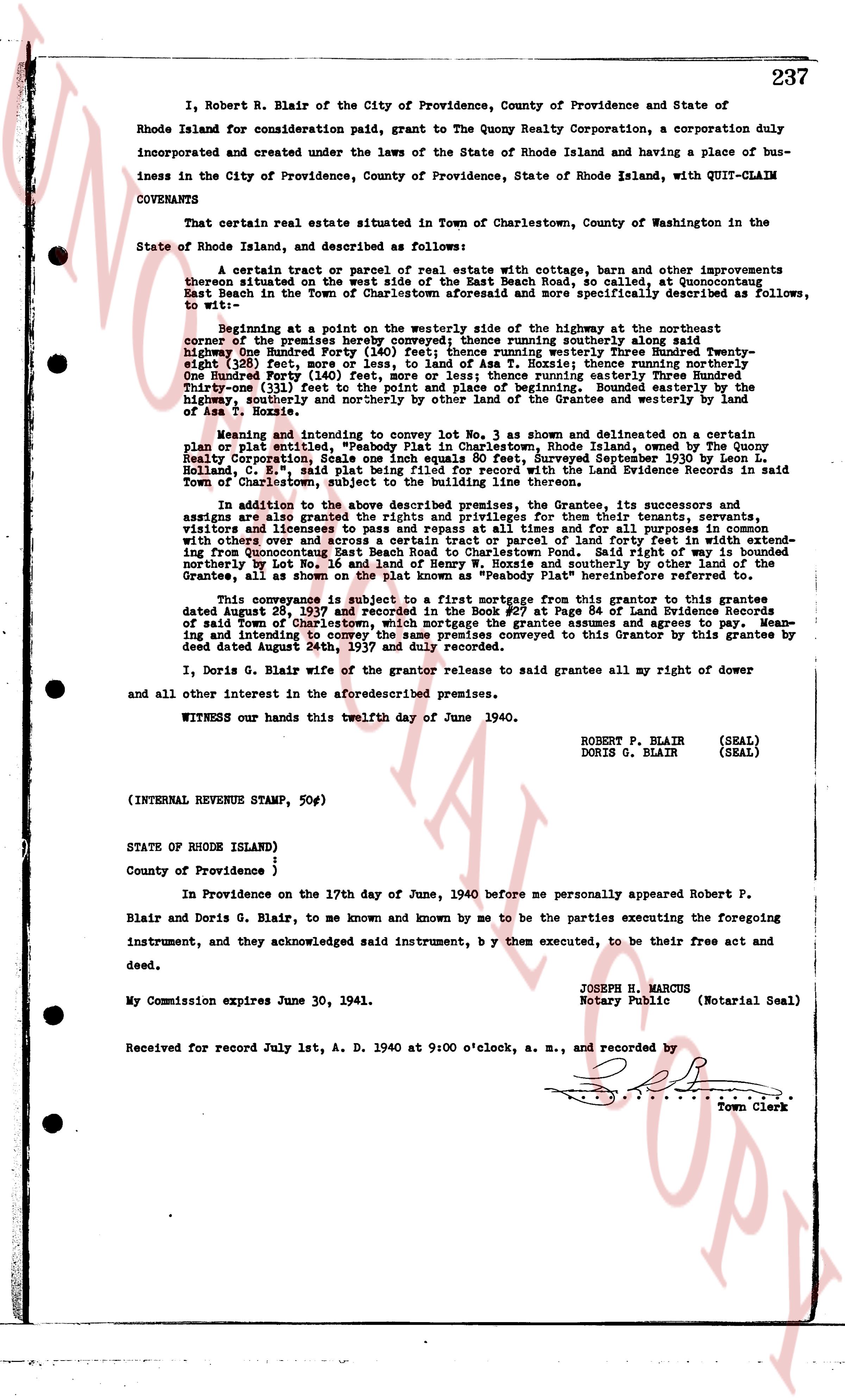
I, Robert R. Blair of the City of Providence, County of Providence and State of Rhode Island for consideration paid, grant to The Quony Realty Corporation, a corporation duly incorporated and created under the laws of the State of Rhode Island and having a place of business in the City of Providence, County of Providence, State of Rhode Island, with QUIT-CLAIM COVENANTS
That certain real estate situated in Town of Charlestown, County of Washington in the State of Rhode Island, and described as follows:
A certain tract or parcel of real estate with cottage, barn and other improvements thereon situated on the west side of the East Beach Road, so called, at Quonochontaug East Beach in the Town of Charlestown aforesaid and more specifically described as follows, To wit:
Beginning at a point on the westerly side of the highway at the northeast corner of the premises hereby conveyed; thence running southerly along said highway One Hundred Forty Five (145) feet; thence running Easterly Three Hundred Twenty-eight (328) feet, more or less, to land of Ass T. Hoxsie; thence running northerly One Hundred Forty One (141) feet to the highway; thence running easterly Three Hundred Twenty-three (323) feet to the point of place and beginning of building. Bounded easterly by the land of the Grantee and westerly and northerly by other lands of the Grantee and westerly by land of Ass T. Hoxsie.
Meaning and intending to convey the entire tract of land shown as subdivided on a certain plan plot entitled "Subdivision Plan in Charlestown, Rhode Island" made for The Quony Realty Corporation, Scale one Inch equals One hundred 80 feet, Surveyed September 1930 by Leon L. Holland, C. E., said plat being filed for record with the Land Evidence Records in said Town of Charlestown, suburb of Westerly, Rhode Island.
In addition to the above described premises the Grantee, its successors and assigns are also granted the rights and privileges for their tenants, servants, visitors and licensees to pass and repass freely along the beach in common with others and over x across a certain tract or parcel of land further to west in extending from Quonochontaug East Beach to the Atlantic Ocean. Said tract of land is bounded northerly by Lot No. 16 and land of Henry W. Boschee and southerly by other land of the Grantees, all at shore. The said right of way is hereinafter termed "the beach road".
This conveyance is subject to a first mortgage from this grantor to this grantee dated August 28, 1937 and recorded in the Book #27 at Page 84 of Land Evidence Records of said Town of Charlestown and to all easements and agreements to agree. Meaning and intending to convey the same premises conveyed to this Grantor by this grantee by deed dated August 24th, 1937 and duly recorded.
I, Doris G. Blair wife of the grantor release to said grantee all my right of dower and all other interest in the aforesaid premises.
WITNESS our hands this twelfth day of June 1940.
ROBERT P. BLAIR (SEAL)
DORIS G. BLAIR (SEAL)
(INTERNAL REVENUE STAMP, 50¢)
STATE OF RHODE ISLAND)
County of Providence ;
In Providence on the 17th day of June, 1940 before me personally appeared Robert P. Blair and Doris G. Blair, to me known and known by me to be the parties executing the foregoing instrument, and they acknowledged said instrument, by them executed, to be their free act and deed.
My Commission expires June 30, 1941.
JOSEPH R. MARCUS
Notary Public (Notarial Seal)
Received for record July 1st, A. D. 1940 at 9:00 o'clock, a. m., and recorded by
[Signature]
Town Clerk
The page as recorded