The instrument's own words
page 1 · read by Gemma vision
531
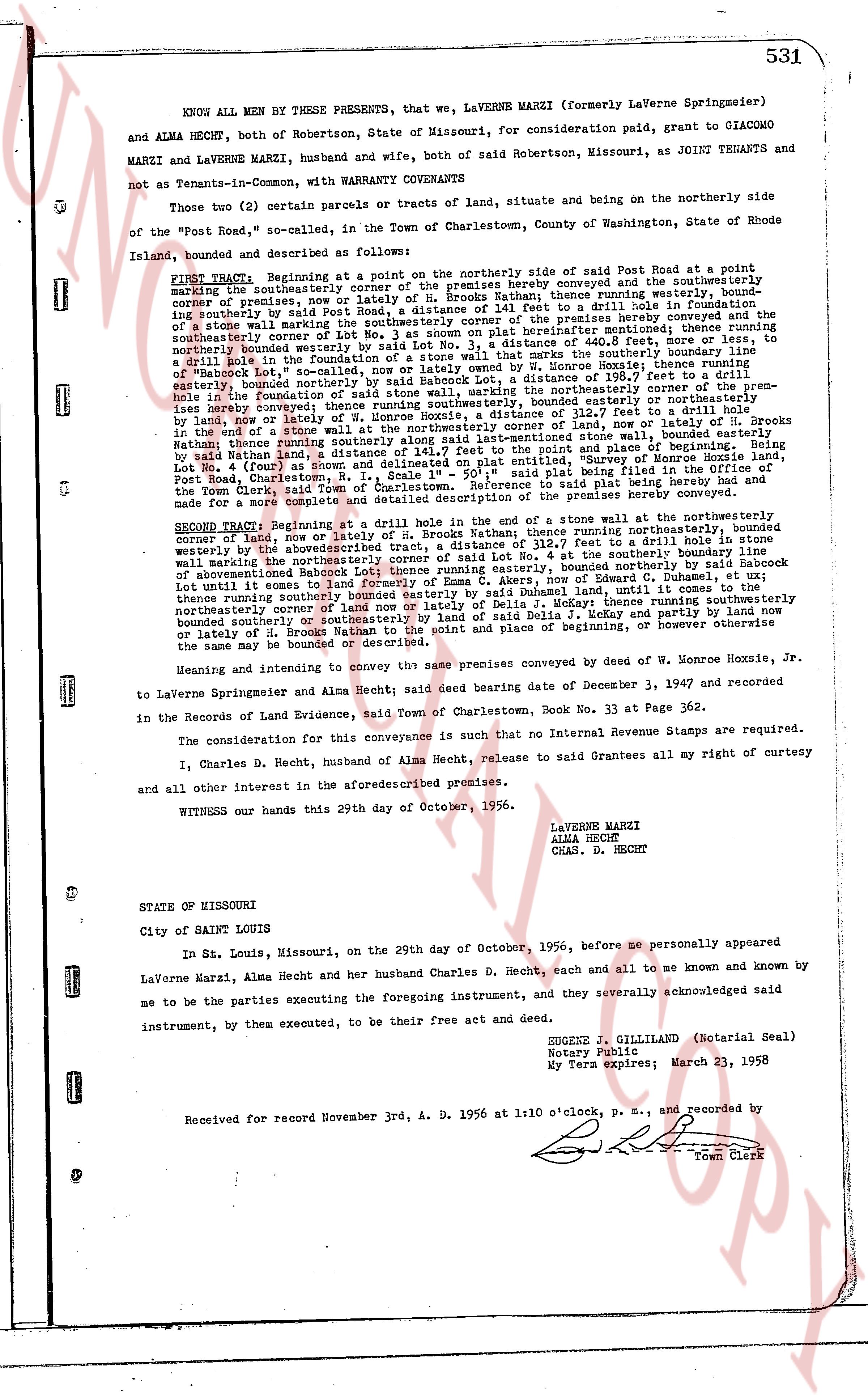
KNOW ALL MEN by THESE PRESENTS, that we, LAVERNE MARZI (formerly Laverne Springmeier) and ALMA HECHT, both of Robertson, State of Missouri, for consideration paid, grant to GIACOMO MARZI and LAVERNE MARZI, husband and wife, both of said Robertson, Missouri, as JOINT TENANTS and not as Tenants-in-Common, with WARRANTY COVENANTS
Those two (2) certain parcels or tracts of land, situate being on the northerly side on the "Post Road," so called, in the Town of Charlestown, County of Washington, State of Rhode Island, bounded and described as follows:
FIRST TRACT Beginning at a point on the northerly side of said Post Road situated at a point marking the northeasterly corner of the premises hereby conveyed and the southeasterly corner of premises, now or lately of H. Brooks Nathan, thence running northerly along the southerly line of said Nathan's land to a drill hole in foundation of a stone wall marking the southwesternly corner of the premises hereby conveyed and the southeasterly boundary marked by said Lot No. 3, a distance of 440.8 feet, more or less, to the southeasterly corner of the premises hereby conveyed, thence running northwesterly along the northeasterly boundary marked by said Lot No. 3, a distance of 117.7 feet measuring along the foundation of a stone wall marking the southwesternly corner of the premises hereby conveyed and the southeasterly corner of premises, now or lately of W. Monroe Hoxzie, thence running easterly, bounded northerly by said Nathan, a distance of 196.7 feet to the point and place of a drill hole in the foundation of a stone wall marking the northeasterly corner of the premises hereby conveyed and the southeasterly corner of premises, now or lately of W. Monroe Hoxzie, thence running easterly, bounded northerly by said Nathan, a distance of 112.7 feet to a drill hole in a stone wall marking the northeasterly corner of the premises hereby conveyed and the southeasterly corner of premises, now or lately of W. Monroe Hoxzie, thence running southerly by said Nathan land, a distance of 141.7 feet to the point and place of a drill hole in the foundation of a stone wall, bounded easterly in the foundation of a stone wall at the northeasterly corner of land, now or lately of W. Monroe Hoxzie, Lot 4 (and 5) as shown on a plat entitled "Survey of the Property of Monroe Hoxzie, Lot Post Road, Charlestown, R. I., Scale 1" = 50'", said plat being filed in the Office of the Town Clerk, Charlestown, R. I., in Book 23, Page 133, said plat being the same plat referred to in the above for a more complete and detailed description of the premises hereby conveyed.
SECOND TRACT Beginning at a drill hole in the end of a stone wall at the northeasterly corner of land, now or lately of W. Monroe Hoxzie, thence running northerly along the boundary of the aforementioned Brooks Nathan tract, a distance of 112.7 feet to a drill hole in stone wall marking the northeasterly corner of the premises hereby conveyed and the southeasterly corner of aforementioned Brooks Nathan tract, thence running easterly, bounded northerly by said Sackbon Lot until it comes to the end of a stone wall, thence running northerly along the boundary of said land until it comes to the thence turning southerly along the boundary of said land to formly of Emma C. Akers, now or lately of Delia J. Nekasi thence running southerly bounded south of the premises hereby conveyed, to a drill hole in a stone wall marking the northeasterly corner of land now or lately of R. Brooks Nathan to the point and place of beginning, or however otherwise the same may be bounded or described.
Meaning and intending to convey that same premises conveyed by deed of W. Monroe Hoxzie, Jr. to Laverne Springmeier and Alma Hecht, said deed bearing date of December 3, 1947 and recorded in the Records of Land Evidence, said Town of Charlestown, Book No. 33 at Page 362.
The consideration for this conveyance is such that no Internal Revenue Stamps are required.
I, Charles D. Hecht, husband of Alma Hecht, release to said Grantees all my right of curtesy and all other interest in the aforementioned premises.
WITNESS our hands this 29th day of October, 1956.
LAVERNE MARZI
ALMA HECHT
CHAS. D. HECHT
STATE OF MISSOURI
City of Saint Louis
In St. Louis, Missouri, on the 29th day of October, 1956, before me personally appeared LaVerna Marzi, Alma Hecht and her husband Charles D. Hecht, each and all to me known and known by me to be the parties executing the foregoing instrument, and they severally acknowledged said instrument, by them executed, to be their free act and deed.
EUGENE J. GILLILAND (Notarial Seal)
Notary Public
My Term expires: March 23, 1958
Received for record November 3rd, A. D. 1956 at 1:10 o'clock, P. M., and recorded by
[Signature]
Town Clerk
The page as recorded