The instrument's own words
page 1 · read by Gemma vision
421
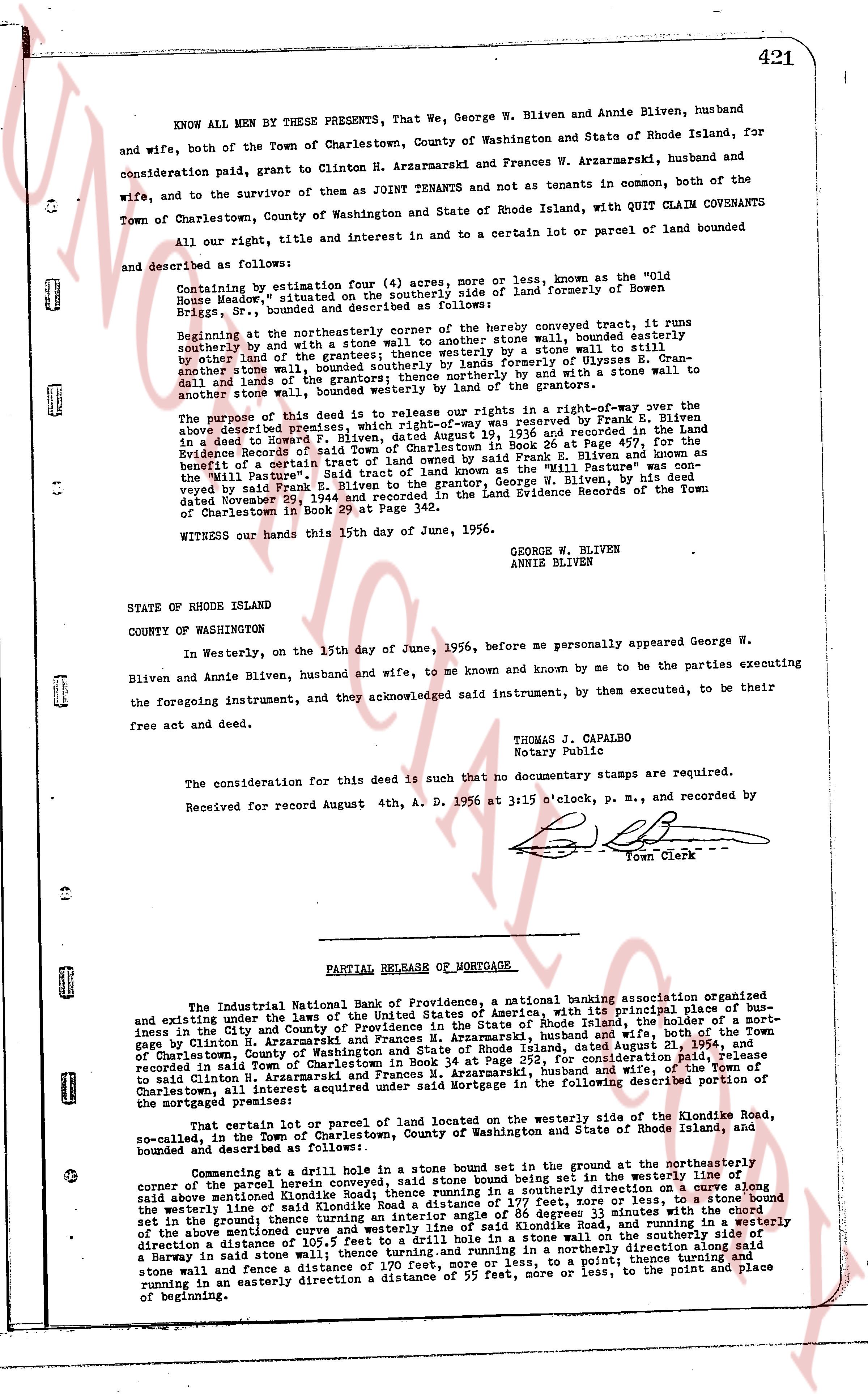
KNOW ALL MEN BY THESE PRESENTS, That We, George W. Bliven and Annie Bliven, husband and wife, both of the Town of Charlestown, County of Washington and State of Rhode Island, for consideration paid, grant to Clinton H. Arzarmarski and Frances W. Arzarmarski, husband and wife, and to the survivor of them as JOINT TENANTS and not as tenants in common, both of the Town of Charlestown, County of Washington and State of Rhode Island, with QUIT CLAIM COVENANTS all, our right, title and interest in and to a certain lot or parcel of land bounded and described as follows:
Containing by estimation Four (4) acres more or less, known as the "Old House Meadow," situated on the southerly side of land formerly of Rowan Bliven Briggs, Sr., bounded and described as follows:
Beginning at the northeasterly corner of the hereby conveyed tract, it runs southerly by and with a stone wall to another stone wall, bounded easterly by other lands of the grantors, then runs southerly by a stone wall to a stone wall, then southerly stone wall, bounded southerly by lands of Ulysses E. Cranston and lands of the grantors, then runs northerly by and with a stone wall to another stone wall, bounded westerly by lands of the grantors.
The purpose of this deed is to release our rights in a right-of-way over the above described premises, which right-of-way was reserved by Frank E. Bliven in a deed to Lowell F. Warren dated August 19, 1936 and recorded in the Land Evidence Records of said Town of Charlestown in Book 26 at Page 497, the benefit of a certain tract of land known as the "Mill Pasture" owned by Frank E. Bliven and known as the "Mill Pasture". Said tract of land known as the "Mill Pasture" was conveyed by Frank E. Bliven to his son, George W. Bliven, by his deed dated November 29, 1944 and recorded in the Land Evidence Records of the Town of Charlestown in Book 29 at Page 342.
WITNESS our hands this 15th day of June, 1956.
GEORGE W. BLIVEN
ANNIE BLIVEN
STATE OF RHODE ISLAND
COUNTY OF WASHINGTON
In Westerly, on the 15th day of June, 1956, before me personally appeared George W. Bliven and Annie Bliven, husband and wife, to me known and by me to be the parties executing the foregoing instrument, and they acknowledged said instrument, by them executed, to be their free act and deed.
THOMAS J. CAPALBO
Notary Public
The consideration for this deed is such that no documentary stamps are required.
Received for record August 4th, A. D. 1956 at 3:15 o'clock, p. m., and recorded by [signature]
Town Clerk
----
PARTIAL RELEASE OF MORTGAGE
The Industrial National Bank of Providence, a national banking association organized and existing under the laws of the United States of America, with its principal place of business in the City and County of Providence, State of Rhode Island, holder of a mortgage in Clinton H. Arzarmarski and Frances W. Arzarmarski, husband and wife, both of the Town of Charlestown, County of Washington and State of Rhode Island, dated August 21, 1954, and recorded in said Town of Charlestown, for a certain consideration paid, does release to said Clinton H. Arzarmarski and Frances W. Arzarmarski, husband and wife, of the Town of Charlestown, all interest acquired under said Mortgage in the following described portion of the mortgaged premises:
That certain lot or parcel of land located on the westerly side of the Klondike Road, so-called, in the Town of Charlestown, County of Washington and State of Rhode Island, bounded and described as follows:
Commencing at a dwell hole in a stone bound set in ground at the northeasterly corner of the parcel herein conveyed, said stone bound being set in the northeasterly line of said above mentioned Klondike road, then runs in a southerly direction on a curve along said above mentioned Klondike road to a point, the chord of said curve being set in the (westerly line of said Klondike Road a distance of 177 feet, sore or there about, then runs in a southerly direction a distance of 175 feet, more or less, 3 minutes with the chord set in ground, then runs easterly a distance of 175 feet, more or less, along the westerly side of the above mentioned curve and westerly line of said Klondike Road, and running in a northerly direction, a distance of 177 feet, more or less, to a point, then runs in a northeasterly direction along said stone wall and fence a distance of 170 feet, more or less, to a point, thence runs in a northerly direction in an easterly direction a distance of 55 feet, more or less, to the point and place of beginning.
The page as recorded