The instrument's own words
page 1
408
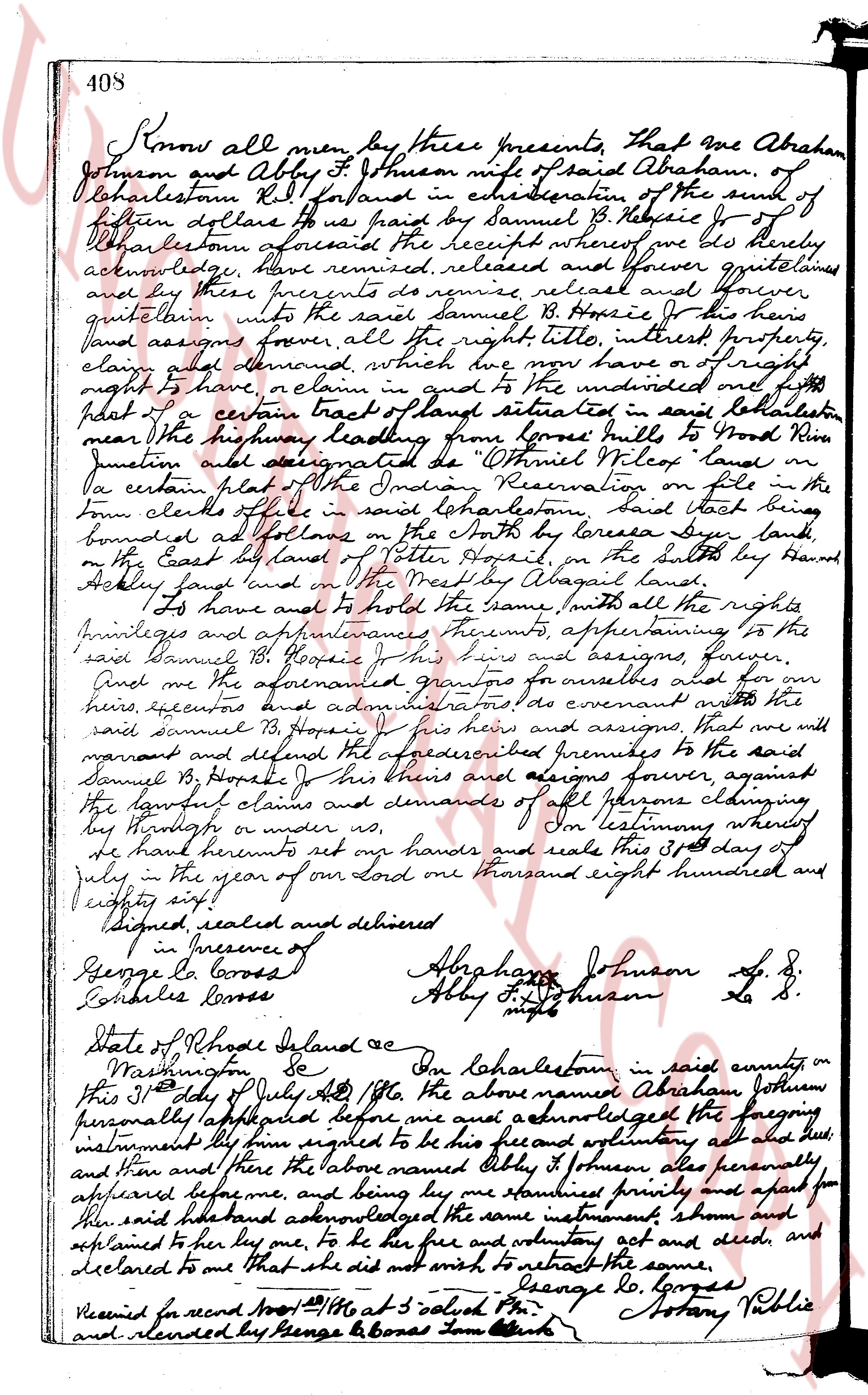
Know all men by these presents, That we Abraham
Johnson and Abby B Johnson wife of said Abraham, of
Charlestown R.I. Island and in consideration of the sum of
fourteen dollars to us paid by Samuel B. Hopson Jr of
Charlestown aforesaid the receipt whereof we do hereby
acknowledge, have remised, released and forever quitclaimed
and by these presents do remise, release and forever
quitclaim unto the said Samuel B. Hopson Jr his heirs
land assigns forever, all the right title, interest property,
claim and demand, which we now have or of right
night to have, or claim in and to the undivided one half
part of a certain tract of land situated in said Charlestown
near the highway leading from Jones hullo to Good Hope Riv
junction and designated as "Whiles Plot" land as
per a certain plat of the Indian Reservation on file in the
town clerks office in said Charlestown said tract being
bounded as follows on the North by Loreesa Sone land,
on the East by land of Peter Hopson, on the South by Hand
Ackley land and on the West by Abigail land.
To have and to hold the same with all the rights
privileges and appurtenances thereunto appertaining to the
said Samuel B. Hopson Jr his heirs and assigns forever,
And we the aforementioned grantors for ourselves and for
our heirs executors and administrators do covenant with the
said Samuel B. Hopson Jr his heirs and assigns, that we will
warrant and defend the above described premises to the said
Samuel B. Hopson Jr his heirs and assigns forever, against
the lawful claims and demands of all persons claiming
by us or under us.
In testimony whereof
we have hereunto set our hands and seals this 15th day of
July in the year of our lord one thousand eight hundred and
eighty six!
Signed sealed and delivered
in presence of
George L Bones
Charles Bones
Abraham Johnson L.S.
Abby B Johnson L.S.
State of Rhode Island &c
County of Washington
On this 15th day of July AD 1886 the above named Abraham Johnson
personally appeared before me and acknowledged the foregoing
instrument to be his free and voluntary act and deed,
and then and there the above named Abby B Johnson also personally
appeared before me, and being her standing privately and apart from
her said husband acknowledged the same instrument shown and
explained to her by me, to be her free and voluntary act and deed, and
declared to me that she did not wish to restrict the same,
George L Bones Notary Public
Received for record Aug 1st 1886 at 5 o'clock PM
and sealed by George L Bones Town Clerk
page 2
401
of said Court, and that in all respects I have at all times conformed to the directions of
said Court and the laws of said State in the premisses.
IN WITNESS WHEREOF I, said Mary F. McKay have hereunto set my hand and seal in my
capacity as administratrix as aforesaid this 12th day of July A. D. 1956.
In Presence of:
C. W. Bubier
MARY F. McKAY
Administratrix as aforesaid
(DOCUMENTARY STAMPS, $71.25)
STATE OF RHODE ISLAND
COUNTY OF PROVIDENCE
In the City of Providence in said County on this 25th day of July A. D. 1956, before me
personally appeared the above named Mary F. McKay to me known and known by me to be the person
personally executing the foregoing instrument in her capacity as administratrix as aforesaid and she acknowl-
edged said instrument by her executed to be her free act and deed as administratrix as aforesaid.
C. WARREN BUBIER
Notary Public
Received for record July 26th, A. D. 1956 at 10:46 o'clock, a. m., and recorded by
[Signature]
Town Clerk
AGREEMENT made this 14th day of July, A. D. 1956 by and between JOSEPH ARRUDA and JANICE
ARRUDA, his wife, of the Town of Charlestown and State of Rhode Island, parties of the first part,
hereinafter sometimes called "ARRUDA", and HAROLD ARTHUR WHITE, unmarried, of said Charlestown,
party of the second part, hereinafter sometimes called "WHITE"
WITNESSETH THAT
WHEREAS the parties hereto are owners of adjoining estate on the northerly side of Post
Road in said Charlestown, and
WHEREAS question has been raised as to the exact location of the common property line
between said estates by reason of the indefiniteness of the description thereof in deeds of said
White's estate from Mary E. Norris and Delia J. Henry Brooks Nathan recorded with the
Records of Land Evidence in said Charlestown in Deed Book 31 at page 421 and in Deed Book 30 at
page 396, respectively;
NOW THEREFORE in order to remove any uncertainty as to the location of said property line
the parties hereto, in consideration of the sum of ONE (1) DOLLAR each to the other paid, receipt
whereof is hereby acknowledged, do mutually agree, each with the other, that said common property
line between their respective estates shall be and is the following described line:
Beginning at a pipe driven in the ground in the northerly line of Post Road, said pipe
being located easterly 100 feet from a stone wall in said easterly, from a point on the
Highway line denoted east in said line of Post Road one hundred (100) feet northerly from a
the center line of said road measured at a right angle to said line, thence north 41° 30' east
0.18 feet to another pipe driven in the ground which forms an angle of 82° 02' with
0.18 feet thence running north 41° 30' east to another pipe driven in the ground located in
the northerly line of Post Road and interior to said Arruda estate, thence deflecting
fifty two (52.00) feet north 41° 30' east to a rock; thence deflecting
48° 42' to the right and running northeasterly, forming an angle of line of 111° 18' for
(45,60) feet described line, then continuing in said direction for 60/100
(45,60) feet to a drill hole in a rock at the southerly line of a stone wall; thence
northerly in the line of said wall 110 1/10 (110.10) feet, angle 90° less to
another stone wall at land now or lately of W. Monroe Roxxie, Jr.; and
In consideration as aforesaid Arruda grants to White with QUITCLAIM COVENANTS all
land lying westerly of and adjacent to the above described line, and White grants
The page as recorded