The instrument's own words
page 1 · read by Gemma vision
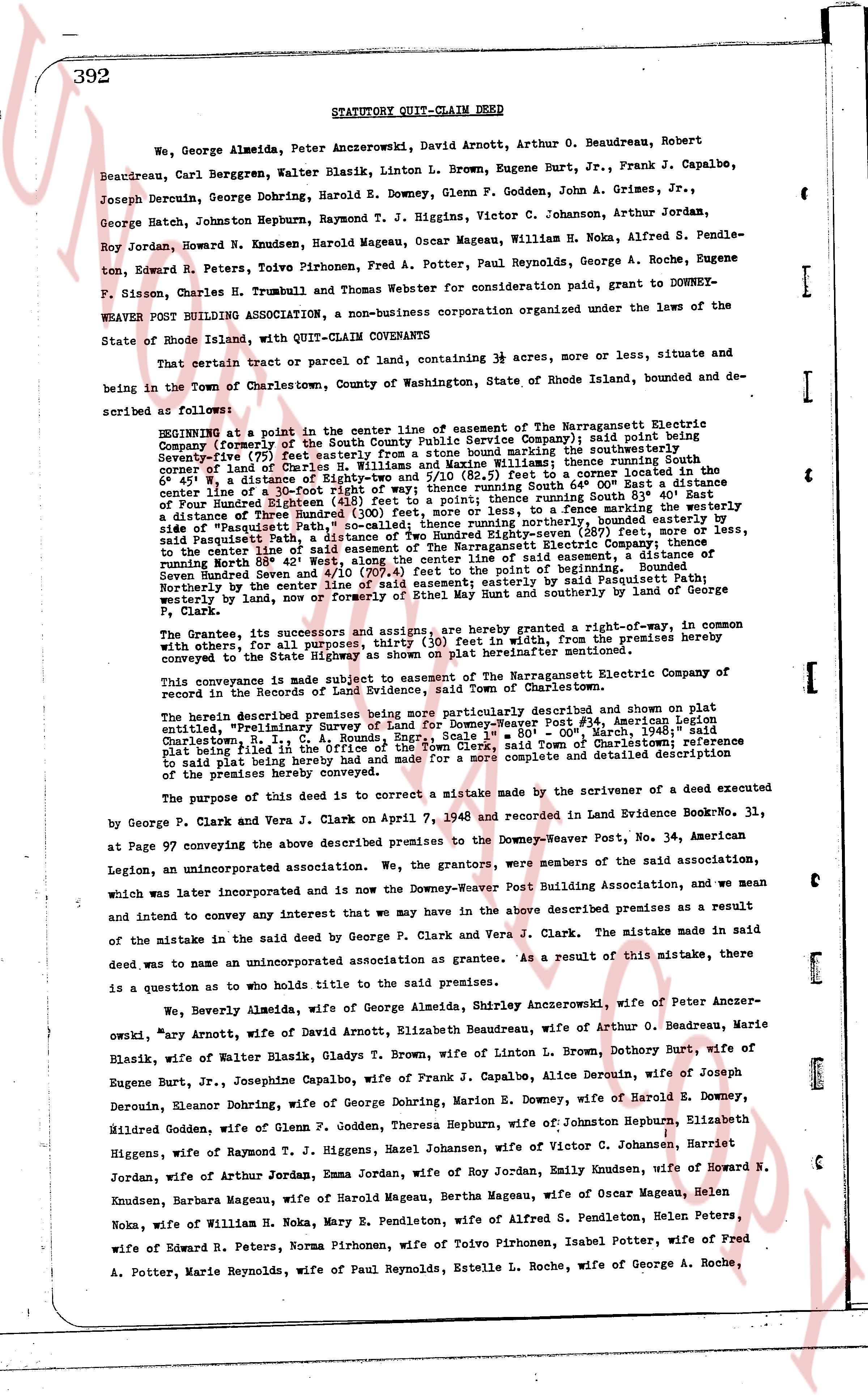
392 STATUTORY QUIT-CLAIM DEED
We, George Almeda, Peter Ancerzkowski, David Arnold, Arthur O. Beaudreau, Robert Beaudreau, Carl Berggren, Walter Blazik, Linton L. Brown, Eugene Burt, Jr., Frank J. Capalbo, Joseph Decruin, George Dohring, Harold E. Downey, Glenn F. Godden, John A. Grimes, Jr., George Hatch, Johnston Hepburn, Raymond T. J. Higgens, Victor C. Johanson, Arthur Jordan, Roy Jordan, Howard N. Knudsen, Harold Magenu, Oscar Magenu, William H. Noka, Alfred S. Pendle-ton, Edward R. Peters, Norma Pirhonen, Fred A. Potter, Paul Reynolds, George A. Roche, Eugene P. Sisson, Charles H. Trumbull and Thomas Webster for consideration paid, grant to DOWNEY-WEAVER POST BUILDING ASSOCIATION, a non-business corporation organized under the laws of the State of Rhode Island, with QUIT-CLAIM CONVEYANCE
That certain tract or parcel of land, containing 3 acres, more or less, situate and being in the Town of Charlestown, County of Washington, State of Rhode Island, bounded and described as follows:
BEGINNING at a point in the center line of the easement of The Narragansett Electric Company (formerly of the South County Public Service Company); said point being Seventy-five (75) feet easterly from a stone boundary line running south easterly; thence running South easterly Seventy-five (75) feet to a stone boundary line; thence running South easterly 60 feet, West a distance of Eighty-two 0/10 (82.0) feet and South (10/10) feet to a point hence running South 80° 43' East a distance of Three Hundred and Eighteen (318) feet to a fence line marking the boundary of Four Hundred Rounded [?] feet; thence running northerly 80° 43' East to a fence marking size of "Tequissett Path" [?] feet; thence running northerly to the center line of said Tequissett Path, a distance of Two Hundred and Thirty-six (236) feet; thence easterly to the center line of the easement of The Narragansett Electric Company; thence a distance of Seven Hundred and 42 West 42° West, along the center line of said easement, to a distance of Seven Hundred and 42 West 42° West, along the center line of said easement, to a distance of Seven Hundred and 42 West 42° West, along the center line of said easement, to a distance of Seven Hundred and 42 West 42° West, along the center line of said easement, to a distance of Seven Hundred and 42 West 42° West, along the center line of said easement, to a distance of Seven Hundred and 42 West 42° West, along the center line of said easement, to a distance of Seven Hundred and 42 West 42° West, along the center line of said easement, to a distance of Seven Hundred and 42 West 42° West, along the center line of said easement, to a distance of Seven Hundred and 42 West 42° West, along the center line of said easement, to a distance of Seven Hundred and 42 West 42° West, along the center line of said easement, to a distance of Seven Hundred and 42 West 42° West, along the center line of said easement, to a distance of Seven Hundred and 42 West 42° West, along the center line of said easement, to a distance of Seven Hundred and 42 West 42° West, along the center line of said easement, to a distance of Seven Hundred and 42 West 42° West, along the center line of said easement, to a distance of Seven Hundred and 42 West 42° West, along the center line of said easement, to a distance of Seven Hundred and 42 West 42° West, along the center line of said easement, to a distance of Seven Hundred and 42 West 42° West, along the center line of said easement, to a distance of Seven Hundred and 42 West 42° West, along the center line of said easement, to a distance of Seven Hundred and 42 West 42° West, along the center line of said easement, to a distance of Seven Hundred and 42 West 42° West, along the center line of said easement, to a distance of Seven Hundred and 42 West 42° West, along the center line of said easement, to a distance of Seven Hundred and 42 West 42° West, along the center line of said easement, to a distance of Seven Hundred and 42 West 42° West, along the center line of said easement, to a distance of Seven Hundred and 42 West 42° West, along the center line of said easement, to a distance of Seven Hundred and 42 West 42° West, along the center line of said easement, to a distance of Seven Hundred and 42 West 42° West, along the center line of said easement, to a distance of Seven Hundred and 42 West 42° West, along the center line of said easement, to a distance of Seven Hundred and 42 West 42° West, along the center line of said easement, to a distance of Seven Hundred and 42 West 42° West, along the center line of said easement, to a distance of Seven Hundred and 42 West 42° West, along the center line of said easement, to a distance of Seven Hundred and 42 West 42° West, along the center line of said easement, to a distance of Seven Hundred and 42 West 42° West, along the center line of said easement, to a distance of Seven Hundred and 42 West 42° West, along the center line of said easement, to a distance of Seven Hundred and 42 West 42° West, along the center line of said easement, to a distance of Seven Hundred and 42 West 42° West, along the center line of said easement, to a distance of Seven Hundred and 42 West 42° West, along the center line of said easement, to a distance of Seven Hundred and 42 West 42° West, along the center line of said easement, to a distance of Seven Hundred and 42 West 42° West, along the center line of said easement, to a distance of Seven Hundred and 42 West 42° West, along the center line of said easement, to a distance of Seven Hundred and 42 West 42° West, along the center line of said easement, to a distance of Seven Hundred and 42 West 42° West, along the center line of said easement, to a distance of Seven Hundred and 42 West 42° West, along the center line of said easement, to a distance of Seven Hundred and 42 West 42° West, along the center line of said easement, to a distance of Seven Hundred and 42 West 42° West, along the center line of said easement, to a distance of Seven Hundred and 42 West 42° West, along the center line of said easement, to a distance of Seven Hundred and 42 West 42° West, along the center line of said easement, to a distance of Seven Hundred and 42 West 42° West, along the center line of said easement, to a distance of Seven Hundred and 42 West 42° West, along the center line of said easement, to a distance of Seven Hundred and 42 West 42° West, along the center line of said easement, to a distance of Seven Hundred and 42 West 42° West, along the center line of said easement, to a distance of Seven Hundred and 42 West 42° West, along the center line of said easement, to a distance of Seven Hundred and 42 West 42° West, along the center line of said easement, to a distance of Seven Hundred and 42 West 42° West, along the center line of said easement, to a distance of Seven Hundred and 42 West 42° West, along the center line of said easement, to a distance of Seven Hundred and 42 West 42° West, along the center line of said easement, to a distance of Seven Hundred and 42 West 42° West, along the center line of said easement, to a distance of Seven Hundred and 42 West 42° West, along the center line of said easement, to a distance of Seven Hundred and 42 West 42° West, along the center line of said easement, to a distance of Seven Hundred and 42 West 42° West, along the center line of said easement, to a distance of Seven Hundred and 42 West 42° West, along the center line of said easement, to a distance of Seven Hundred and 42 West 42° West, along the center line of said easement, to a distance of Seven Hundred and 42 West 42° West, along the center line of said easement, to a distance of Seven Hundred and 42 West 42° West, along the center line of said easement, to a distance of Seven Hundred and 42 West 42° West, along the center line of said easement, to a distance of Seven Hundred and 42 West 42° West, along the center line of said easement, to a distance of Seven Hundred and 42 West 42° West, along the center line of said easement, to a distance of Seven Hundred and 42 West 42° West, along the center line of said easement, to a distance of Seven Hundred and 42 West 42° West, along the center line of said easement, to a distance of Seven Hundred and 42 West 42° West, along the center line of said easement, to a distance of Seven Hundred and 42 West 42° West, along the center line of said easement, to a distance of Seven Hundred and 42 West 42° West, along the center line of said easement, to a distance of Seven Hundred and 42 West 42° West, along the center line of said easement, to a distance of Seven Hundred and 42 West 42° West, along the center line of said easement, to a distance of Seven Hundred and 42 West 42° West, along the center line of said easement, to a distance of Seven Hundred and 42 West 42° West, along the center line of said easement, to a distance of Seven Hundred and 42 West 42° West, along the center line of said easement, to a distance of Seven Hundred and 42 West 42° West, along the center line of said easement, to a distance of Seven Hundred and 42 West 42° West, along the center line of said easement, to a distance of Seven Hundred and 42 West 42° West, along the center line of said easement, to a distance of Seven Hundred and 42 West 42° West, along the center line of said easement, to a distance of Seven Hundred and 42 West 42° West, along the center line of said easement, to a distance of Seven Hundred and 42 West 42° West, along the center line of said easement, to a distance of Seven Hundred and 42 West 42° West, along the center line of said easement, to a distance of Seven Hundred and 42 West 42° West, along the center line of said easement, to a distance of Seven Hundred and 42 West 42° West, along the center line of said easement, to a distance of Seven Hundred and 42 West 42° West, along the center line of said easement, to a distance of Seven Hundred and 42 West 42° West, along the center line of said easement, to a distance of Seven Hundred and 42 West 42° West, along the center line of said easement, to a distance of Seven Hundred and 42 West 42° West, along the center line of said easement, to a distance of Seven Hundred and 42 West 42° West, along the center line of said easement, to a distance of Seven Hundred and 42 West 42° West, along the center line of said easement, to a distance of Seven Hundred and 42 West 42° West, along the center line of said easement, to a distance of Seven Hundred and 42 West 42° West, along the center line of said easement, to a distance of Seven Hundred and 42 West 42° West, along the center line of said easement, to a distance of Seven Hundred and 42 West 42° West, along the center line of said easement, to a distance of Seven Hundred and 42 West 42° West, along the center line of said easement, to a distance of Seven Hundred and 42 West 42° West, along the center line of said easement, to a distance of Seven Hundred and 42 West 42° West, along the center line of said easement, to a distance of Seven Hundred and 42 West 42° West, along the center line of said easement, to a distance of Seven Hundred and 42 West 42° West, along the center line of
page 2 · read by Gemma vision
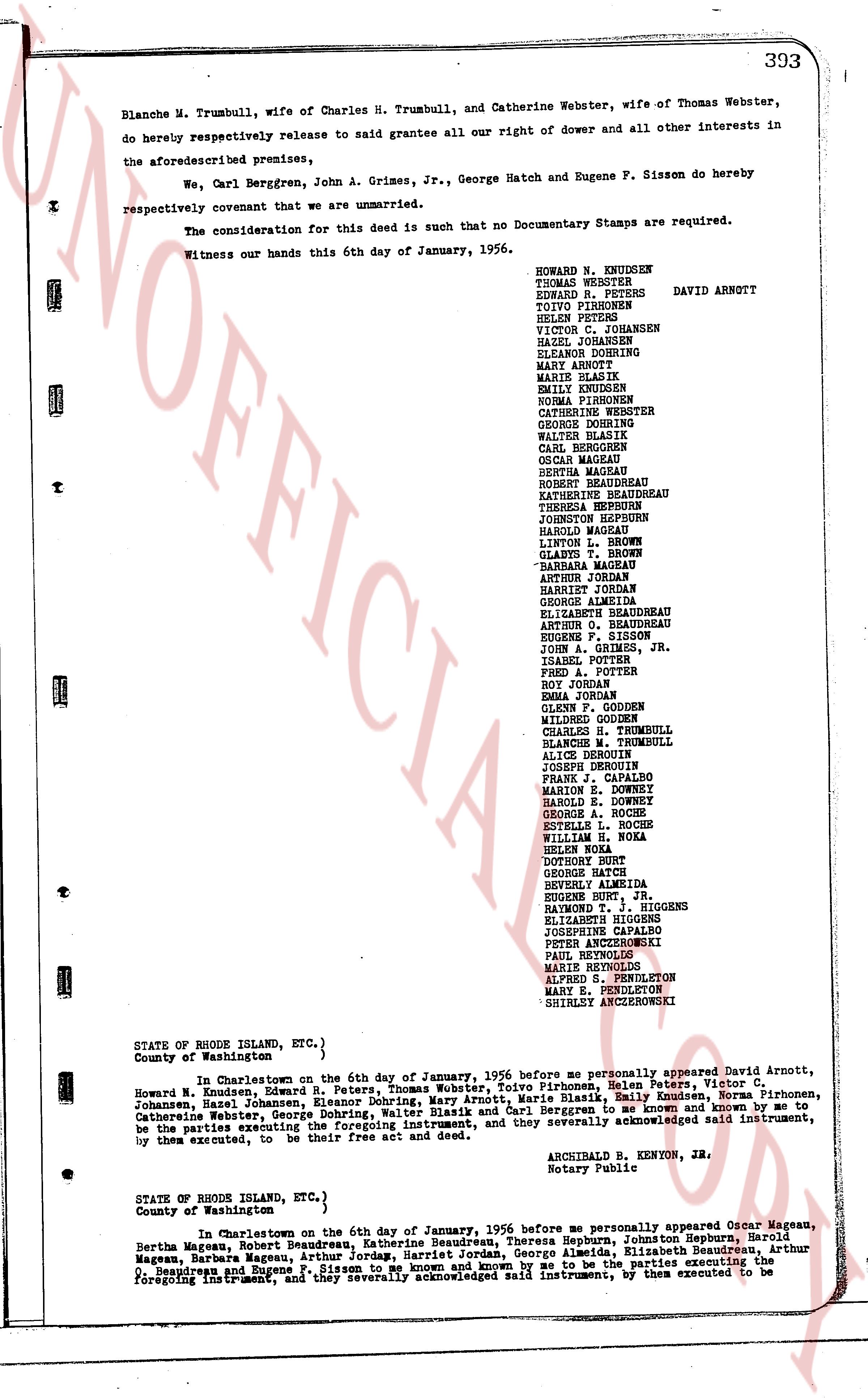
393
Blanche M. Trumbull, wife of Charles H. Trumbull, and Catherine Webster, wife of Thomas Webster, do hereby respectively release to said grantee all our right of dower and all other interests in the aforesaid premises,
We, Carl Berggren, John A. Grimes, Jr., George Hatch and Eugene F. Sisson do hereby respectively covenant that we are unmarried.
The consideration for this deed is such that no Documentary Stamps are required.
Witness our hands this 6th day of January, 1956.
HOWARD N. KNUDSEN
THOMAS WEBSTER
EDWARD R. PETERS
TOTO PIRRONEN
HELEN PETERS
VICTOR C. JOHANSEN
HAZEL JOHANSEN
ELEANOR DOHRNING
MARY ANNOTT
MARIE BLAKY
EMILY KNUDSEN
NORMA KNUDSEN
CATHERINE WEBSTER
GEORGE DORNING
WALTER BLASIK
CARL BERGGREN
OCEAN MAGEEN
BERTHA MAGEEN
ROBERT BEAUDREAU
KATHERINE BEAUDREAU
THERESA HEPBURN
JOHNSTON HEPBURN
HAROLD MAGEEN
LINTON L. BROWN
GLENN F. GODDEN
BARBARA MAGEEN
ARTHUR JORDAN
HARRIET JORDAN
GEORGE ALMEDA
ELIZABETH BEAUDREAU
ARTHUR G. BEAUDREAU
EUGENE F. SISSON
JOHN A. GRIMES, JR.
ISAAC POTTER
FRED A. POTTER
EMMA JORDAN
GLENN F. GODDEN
MILDRED GODDEN
CHARLES H. TRUMBULL
BLANCHE M. TRUMBULL
ALICE DORNING
JOSEPH DERONIN
FRANK C. HARALO
MARION E. DOWNEY
HAROLD E. DOWNEY
ROBERT A. ROCHE
ESTELLE L. ROCHE
WILLIAM E. TUMA
HELEN NOKA
DOROTHY RUHL
GEORGE HATCH
BERTHY LAMRIDA
EUGENE RAYMOND T. J. HIGGENS
ELIZABETH HIGGENS
JOSEPHINE CARAMEL
PETER ANCCERZOWSKI
PAUL ANCCERZOWSKI
MARIE REYOLDS
ALFRED L. SHELTON
MARY E. PENDLETON
SHIRLEY ANCCERZOWSKI
DAVID ARNOTT
STATE OF RHODE ISLAND, ETC.,)
County of Washington )
In Charlestown on the 6th day of January, 1956 before me personally appeared David Arnott, Howard N. Knudsen, Edward R. Peters, Thomas Webster, Tulvo Pirronen, Helen Peters, Victor C. Johansen, Hazel Johansen, Eleanor Dohrning, Walter Dorning, Mary Anrott, Marie Blaky, Emily Knudsen, Norma Pirronen, Catherine Webster, George Dorning, Walter Blasik and Carl Berggren, who being duly sworn to me known and known to me, being the subscribers to the foregoing instrument, and they severally acknowledged said instrument, by them executed, to be their free act and deed.
ARCHIBALD B. KENYON, JR.
Notary Public
STATE OF RHODE ISLAND, ETC.,)
County of Washington )
In Charlestown on the 6th day of January, 1956 before me personally appeared Ocean Mageen, Bertha Mageen, Robert Beaudreau, Katherine Beaudreau, Theresa Hepburn, Johnston Hepburn, Johnston Hepburn, Harold Mageen, George Almeda, Arthur Jordan, Harriet Jordan, George Almeda, Elizabeth Beaudreau, Arthur Beaudreau, Robert Beaudreau and Eugene P. Sisson to me known and known to me, being the subscribers to the foregoing instrument, and they severally acknowledged said instrument, by them executed to be
page 3 · read by Gemma vision
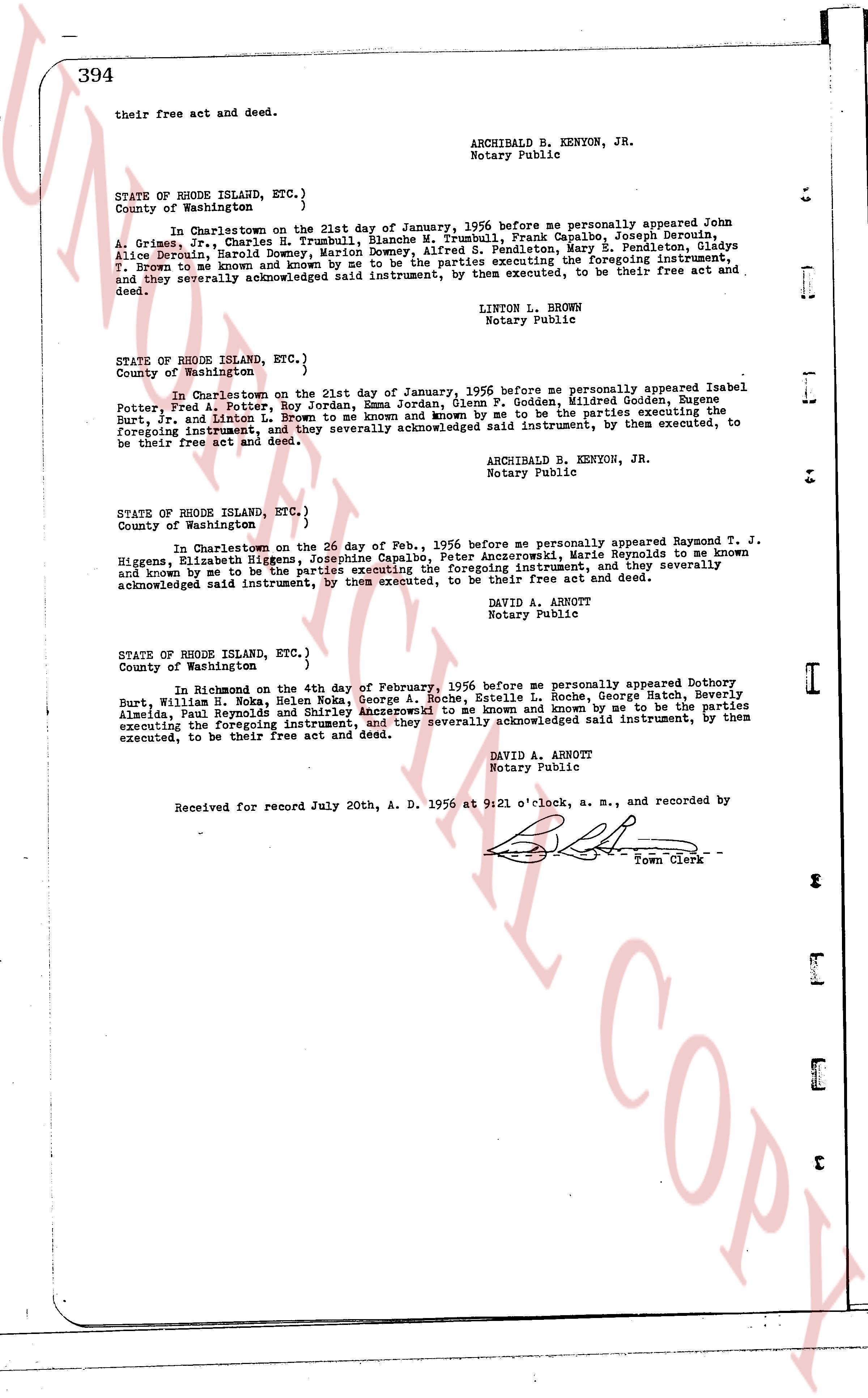
their free act and deed.
ARCHIBALD B. KENYON, JR.
Notary Public
STATE OF RHODE ISLAND, ETC.)
County of Washington )
In Charlestown on the 21st day of January, 1956 before me personally appeared John A. Grimes, T., Charles H. Brumble, Blanche M. Trumbull, Frank Capaldo, Joseph Derouin, Alice Derouin, Harold Downey, Marion Downey, Ida M. Trumbull, Mary L. Trumbull, Gladys Alice Derouin, T. brown to me and known and by me to be the parties executing the foregoing instrument, T. Brown to me and known and by me to be the parties executing the foregoing instrument, and they severally acknowledged said instrument, by them executed, to be their free act and deed.
LINTON L. BROWN
Notary Public
STATE OF RHODE ISLAND, ETC.)
County of Washington )
In Charlestown on the 21st day of January, 1956 before me personally appeared Isabel Potter, Fred A. Potter, Roy Jordan, Jean P. Godden, Mildred Godden, Eugene Burt, R. T. Higgins and Linda T. Higgins to me and known and by me to be the parties executing the foregoing instrument, and they severally acknowledged said instrument, by them executed, to be their free act and deed.
ARCHIBALD B. KENYON, JR.
Notary Public
STATE OF RHODE ISLAND, ETC.)
County of Washington )
In Charlestown on the 20 day of Feb., 1956 before me personally appeared Raymond T. J. Higgens, Elizabeth Higgens, Josephine Capaldo, Peter Amorczewski, Marie Reynolds to me known and known me to be the parties executing the foregoing instrument, and they severally acknowledged said instrument, by them executed, to be their free act and deed.
DAVID A. ARHNOTT
Notary Public
STATE OF RHODE ISLAND, ETC.)
County of Washington )
In Richmond on the 4th day of February, 1956 before me personally appeared Dorothy Burt, William H. Noka, Helen Noka, George A. Roche, Estelle A. Roche, George Hatch, Beverly Burt, William Reynolds and Linda T. Higgins appeared to me and known and by me to be the parties Almeida, Paul Reynolds and Linda T. Higgins appeared to me and known and by me to be the parties executing the foregoing instrument, and they severally acknowledged said instrument, by them executed, to be their free act and deed.
DAVID A. ARHNOTT
Notary Public
Received for record July 20th, A. D. 1956 at 9:21 o'clock, a. m., and recorded by
[Signature]
Town Clerk
The page as recorded